Joan Blaeu’s Map of West Kirkcudbright and Middle Galloway
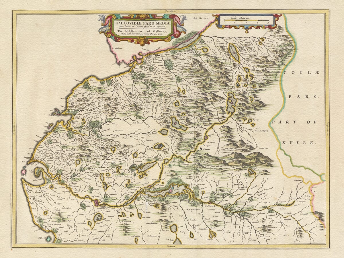
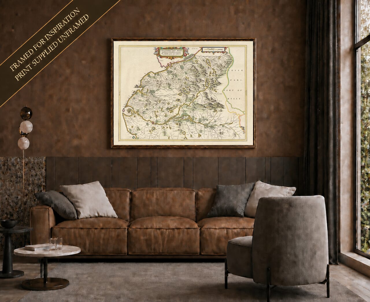
Joan Blaeu’s map of West Kirkcudbright was published in Amsterdam in 1654 as part of the fifth volume of his Theatrum Orbis Terrarum, sive Atlas Novus. This celebrated volume was the first printed atlas devoted to Scotland and presented the country through an exceptionally detailed series of regional engravings.
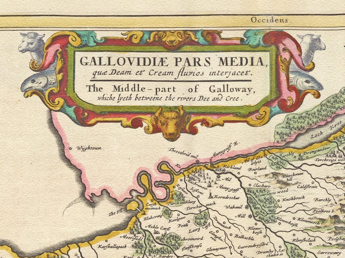
The map’s full title is Gallovidiæ Pars Media, quæ Deam et Cream fluvios interjacet. The accompanying English title describes it as “The Middle-part of Galloway, which lyeth betweene the rivers Dee and Cree.” This is a more precise description than the modern product name West Kirkcudbright, for the engraving follows the broad tract of country lying between two of Galloway’s defining rivers.
Map Details
- Original title: Gallovidiæ Pars Media, quæ Deam et Cream fluvios interjacet
- English title on map: The Middle-part of Galloway, which lyeth betweene the rivers Dee and Cree
- Region shown: Middle Galloway and western Kirkcudbrightshire
- Principal places: Kirkcudbright, New Galloway, Dalry, Balmaclellan, Carsphairn and Minnigaff
- Publisher: Joan Blaeu
- First published: Amsterdam, 1654
- Atlas: Theatrum Orbis Terrarum, sive Atlas Novus
- Orientation: West is at the top
- Cartographic basis: Earlier Scottish field surveys prepared for Blaeu’s atlas
- Format: Engraved copperplate map, with colour added to selected impressions
Between the Dee and the Cree
The River Cree forms the western side of the country represented, while the Dee and its connected waterways shape the eastern side. Between them lies a varied landscape of sheltered farmland, wooded valleys, lochs and increasingly rugged uplands.
Kirkcudbright appears near the southern coast beside the estuary of the Dee. From there, the river system can be followed inland towards Loch Ken, New Galloway and the higher country around Dalry and Carsphairn. To the west, the Cree valley leads towards Minnigaff and the border with Wigtownshire.
The map covers most of historic Kirkcudbrightshire but excludes the country east of the Dee watershed. Dalbeattie and the land extending towards the River Nith consequently belong principally to Blaeu’s adjoining map of eastern Kirkcudbrightshire.
An Unusual View of Galloway
One of the map’s most intriguing characteristics is its orientation. West is placed at the top, north to the right and south to the left. A modern viewer may initially find the coastline and river valleys unfamiliar, even when looking at places they know well.
Once the orientation is understood, the geography begins to unfold. Kirkcudbright Bay lies towards the lower-left portion of the engraving, while the River Dee winds towards the interior. The long waters associated with Loch Ken extend across the middle of the map, surrounded by streams, woodland and rising ground.
This unconventional arrangement allowed the engraver to fit the long tract between the coast and the northern hills comfortably onto the copperplate. It also gives the map an individual character within Blaeu’s Scottish atlas.
Kirkcudbright and the Southern Coast
Kirkcudbright was the principal burgh and administrative centre of the Stewartry. Its position near the mouth of the Dee connected it with the Solway Firth and the wider Irish Sea, while roads and river crossings linked it with the inland communities of Galloway.
The burgh is clearly identified on the map, surrounded by estates, churches and fortified houses. Nearby coastal inlets, islands and headlands are drawn with particular care. The irregular shoreline gives this part of the engraving a strong sense of place and recalls Galloway’s enduring relationship with the sea.
The map predates the modern growth of several settlements associated with this coastline. It instead preserves the older pattern of parishes, estates and scattered communities from which later towns and villages developed.
Loch Ken and the Glenkens
The River Dee and Water of Ken lead the eye northwards into the Glenkens. New Galloway, which had received royal burgh status only a few decades before the map was published, appears near the northern end of Loch Ken. Balmaclellan lies close by on the opposite side of the river valley.
Farther north, Dalry stands beside the Water of Ken, while Carsphairn occupies the more remote upland country. These settlements formed important local centres in a landscape where travel was governed by river valleys, hill passes and the availability of crossings.
The modern reservoirs and hydroelectric works of the Glenkens did not yet exist. Blaeu therefore presents its waters before later engineering altered several lochs and river courses. Natural drainage dominates the engraving, with streams descending from every part of the surrounding hills.
Hills, Lochs and Old Place Names
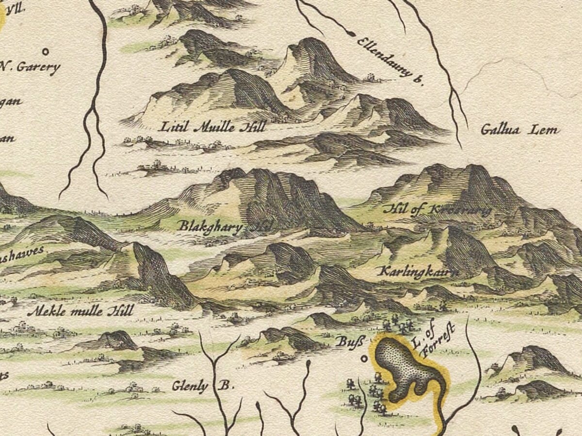
The Galloway uplands are represented by densely grouped pictorial hills. Individual peaks are not shown through measured contours, but the engraver succeeds in conveying the increasingly wild character of the northern interior.
Lochs are strongly outlined and frequently coloured, while woodland is depicted through clusters of individual trees. Farms, mills, churches, castles and estates are recorded by names and conventional symbols. Many familiar place names can still be recognised, although their seventeenth-century spellings often differ from modern usage.
The map also preserves a minor cartographic curiosity. North of Loch Stroan, the engraver began depicting the River Dee along an incorrect course before abandoning the line. Such details reveal the practical process of transferring complex manuscript information onto a copperplate and make close examination especially rewarding.
Decorative Cartography
The elaborate title cartouche occupies the western margin at the top of the original orientation. Animal heads, curling ornament and a central mask surround the Latin and English titles, giving the map a lively theatrical quality.
A separate scale cartouche balances the composition. Coloured boundaries, delicately engraved rivers and the dark outlines of lochs stand out against the softer greens and browns of the landscape.
More than three and a half centuries after its publication, this historic map remains an absorbing portrait of middle Galloway. For anyone with connections to Kirkcudbright, New Galloway, Dalry, Balmaclellan, Carsphairn, Minnigaff or the surrounding glens, it offers a remarkable journey through the landscape between the Dee and Cree.
Explore more regional and island maps in our collection of
old maps of Scotland.





 Verified owner

















