Joan Blaeu’s Seventeenth-Century Map of Kirkcudbrightshire
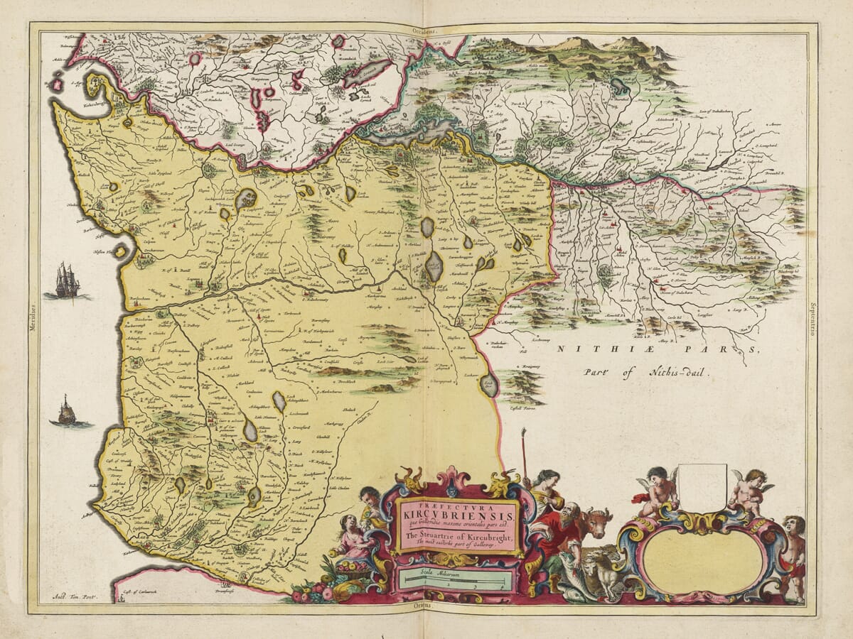
This remarkable map of Kirkcudbrightshire, historically known as the Stewartry of Kirkcudbright, was published in Amsterdam by Joan Blaeu in 1654. Its geographical information derives from the work of Timothy Pont, whose surveys of Scotland during the late sixteenth and early seventeenth centuries provided the foundations for much of Blaeu’s great Atlas of Scotland. The map’s title describes Kirkcudbright as “the most easterlie part of Galloway”, clearly placing the district within the wider historic province of Galloway.
Map Details
Original title: Praefectura Kircubriensis, quae Gallovidiæ maxime orientalis pars est. The Steuartrie of Kircubright, The most easterlie part of Galloway
Original cartographer / surveyor: Timothy Pont
Publisher: Joan Blaeu
Published: Amsterdam, 1654
Area shown: The eastern part of Galloway, corresponding broadly with Kirkcudbrightshire or the historic Stewartry of Kirkcudbright
Orientation: West is at the top
Principal features: Kirkcudbrightshire settlements, rivers, lochs, hills, castles, estates and the Solway coast
Decoration: Large ornamental cartouche with human figures, cherubs, produce, livestock and a conspicuous blank dedication or armorial panel
Source atlas: Theatrum Orbis Terrarum, sive Atlas Novus, Pars Quinta — Atlas of Scotland, 1654
Product type: Reproduction of a seventeenth-century copper-engraved map
Timothy Pont was responsible for one of the most ambitious surveying projects ever attempted in Scotland before the age of scientific national mapping. Travelling extensively through the country, probably during the 1580s and 1590s and into the early seventeenth century, he recorded rivers, lochs, settlements, churches, castles and estates with a degree of geographical detail previously unavailable in printed maps of Scotland.
His work in Galloway was particularly valuable. The region contained an intricate landscape of uplands, river valleys, agricultural estates and coastal settlements, and Pont’s maps preserve evidence of places and names as they existed around the end of the sixteenth century. Modern research into Galloway place-names still uses Blaeu’s 1654 Kirkcudbright map as an important historical source, demonstrating the lasting value of the geographical information Pont collected.
The map is unusual to modern eyes because west is positioned at the top. Early mapmakers were not bound by today’s convention of placing north at the top, and an alternative orientation could allow the shape of a region to fit the engraved sheet more effectively. Once this orientation is understood, the arrangement of Kirkcudbrightshire and the surrounding parts of Galloway becomes much easier to recognise.
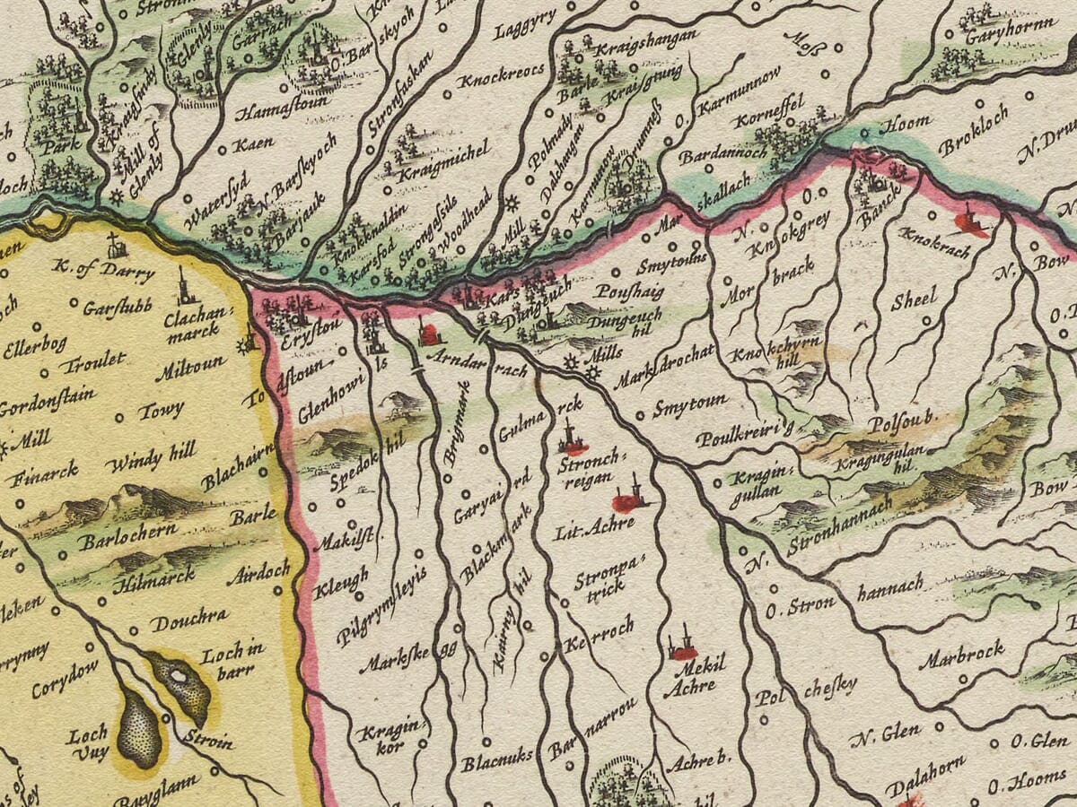
Across the map, rivers and burns thread through a densely recorded landscape of settlements and estates. Places familiar today often appear under markedly different spellings. These early forms are particularly fascinating because many local names were transmitted orally before being written down by surveyors and subsequently interpreted by engravers working hundreds of miles away in Amsterdam.
Historic buildings are also represented. Castles, churches and important houses helped Pont define the inhabited landscape. Kenmure Castle, for example, appears in the cartographic tradition derived from Pont, while archaeological research has used Blaeu’s map when discussing sites such as New Abbey. Such details transform the map from a decorative object into an important documentary record of seventeenth-century Galloway.
The decorative cartouche is among the most striking features of the sheet. Blaeu surrounded the title with figures, cherubs and representations of the agricultural and natural wealth of the district. Alongside it is a conspicuous blank area apparently intended for a dedication and coat of arms. Surviving examples show that this space was left blank as issued, making it a genuine characteristic of the original engraving rather than an omission from this reproduction.
This point is worth preserving because it makes the Kirkcudbrightshire map unusual within Blaeu’s Scottish series. We do not, however, need to speculate that a subscription was sought and failed to materialise: the historical sources confirm the unused dedication space, but not the reason it remained blank.
Joan Blaeu finally published the Scottish maps in 1654 as the fifth part of his Atlas Novus. The volume represented a major milestone in Scottish cartography. Pont had died decades earlier without seeing his projected atlas completed, but his manuscript surveys were preserved, supplemented and eventually transformed into beautifully engraved printed maps by the Blaeu publishing house in Amsterdam.
The result combined practical geographical information with the sophisticated presentation for which the Blaeu family became internationally renowned. Hills were shown pictorially, waterways carefully traced, settlements named and ornamental cartouches used to turn individual regional maps into impressive works of art.
Kirkcudbrightshire itself occupied an important position within historic Galloway, facing the Solway Firth and connected both with neighbouring Dumfriesshire and with the wider maritime world of the Irish Sea. Kirkcudbright developed around an excellent natural harbour on the River Dee, while the surrounding Stewartry contained an extensive network of estates, farms, castles and small communities.
Today Blaeu’s map offers an exceptionally engaging view of this landscape before modern roads, railways and Ordnance Survey mapping transformed its cartographic appearance. The historic spellings, dense settlement detail, unusual orientation and extraordinary blank dedication panel make it one of the most distinctive regional maps in Blaeu’s Atlas of Scotland.
For anyone with a connection to Kirkcudbrightshire, the Stewartry or Galloway, it provides a fascinating record of the area as mapped more than four centuries ago.
Browse our collection of old maps of Scotland →





 Verified owner

















