



 Verified owner
Got there in time and loves it! Cheers David [Gift from US to UK]
 Verified owner
Thanks Lauren. We received it today - it's gorgeous! Thank you, Ellan
 Verified owner
Thank you for your prompt service. I have a gallery and framing business in South Wales. I'm so pleased it is printed in the UK
 Verified owner
My Isles of Scilly map arrived safely and I'm delighted with it!

The print arrived safely and we're delighted with it - a lovely reminder of our honeymoon 15 years ago.
 Verified owner
I have just received them! I'm sure our clients will be pleased with them and there could be more projects off the back of this one where we can use more. [Interior Designers]
 Verified owner
I just received my map of Ireland by Ewart today and, as usual, I am delighted by its quality. The crispness and fineness of detail is excellent and the colour reproduction surpasses my expectations. Please relay my thanks to Steve for another fine effort!
 Verified owner
Many thanks, Lauren. Very pleased with the map and the service: would recommend The Old Map Company to anyone interested in Old Maps.
 Verified owner
Many thanks, the map arrived safely this morning, and I’m really pleased with it. A stunning reproduction, just as I had hoped. I will keep browsing your website, and may yet be tempted by more of your items! Have a great weekend.
 Verified owner
Just arrived, wonderful map! Thanks very much!
 Verified owner
The map – beautiful – arrived safely, very many thanks.
 Verified owner
Thank you, I have already found the map. It’s wonderfull! Good luck! Rasa
 Verified owner
My apologies for the very late reply. I wanted to reach out to thank you so much for rushing my order. My partner absolutely loved it. I am amazed with the service so that is a five-star from me. I wish you all the best.
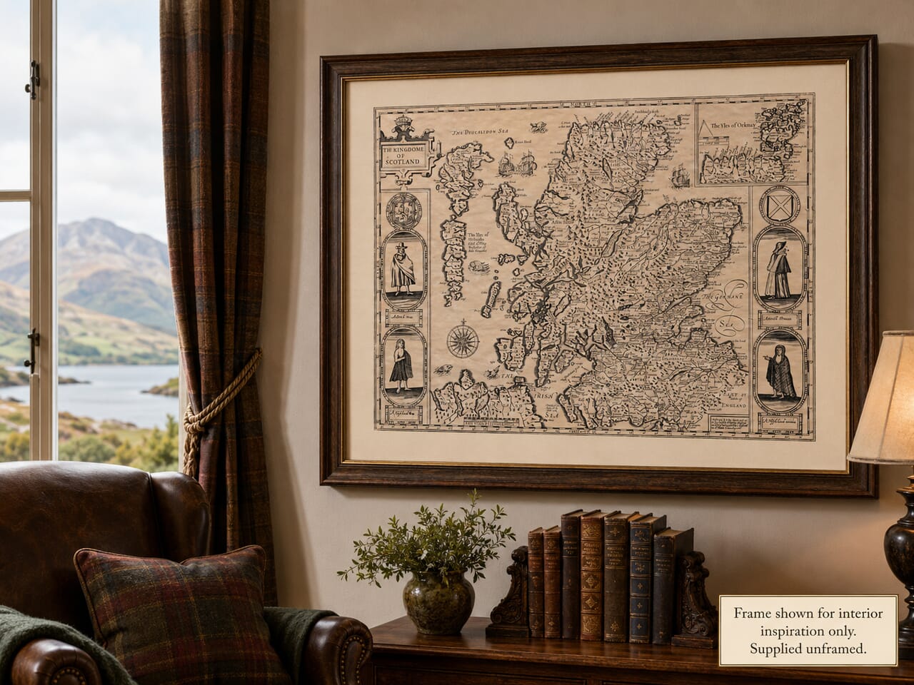
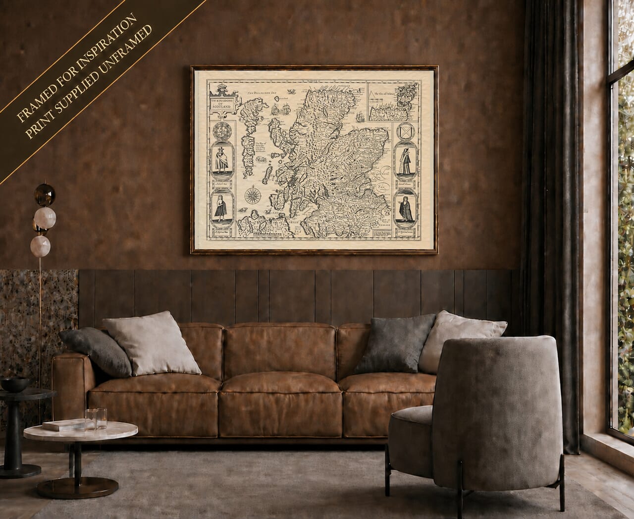
This version of John Speed’s celebrated map of Scotland belongs to the later history of a copper plate first prepared at the beginning of the seventeenth century. The original map was engraved in 1610 by Jodocus Hondius for Speed’s great atlas, The Theatre of the Empire of Great Britaine. The example reproduced here represents the later state commonly associated with the 1676 edition published in London by Thomas Bassett and Richard Chiswell, many years after Speed’s death.
The map had therefore already enjoyed a long publishing life by the time this edition appeared. Speed’s Theatre was first issued in 1611–12 and was repeatedly reprinted, revised and passed between successive owners. The original printing materials had belonged to the publishers John Sudbury and George Humble; over the following decades the plates changed hands until they were acquired by Bassett and Chiswell during the 1670s. Their 1676 publication was the most ambitious later edition of Speed’s work, bringing together the British atlas and the accompanying world atlas in an imposing folio volume.
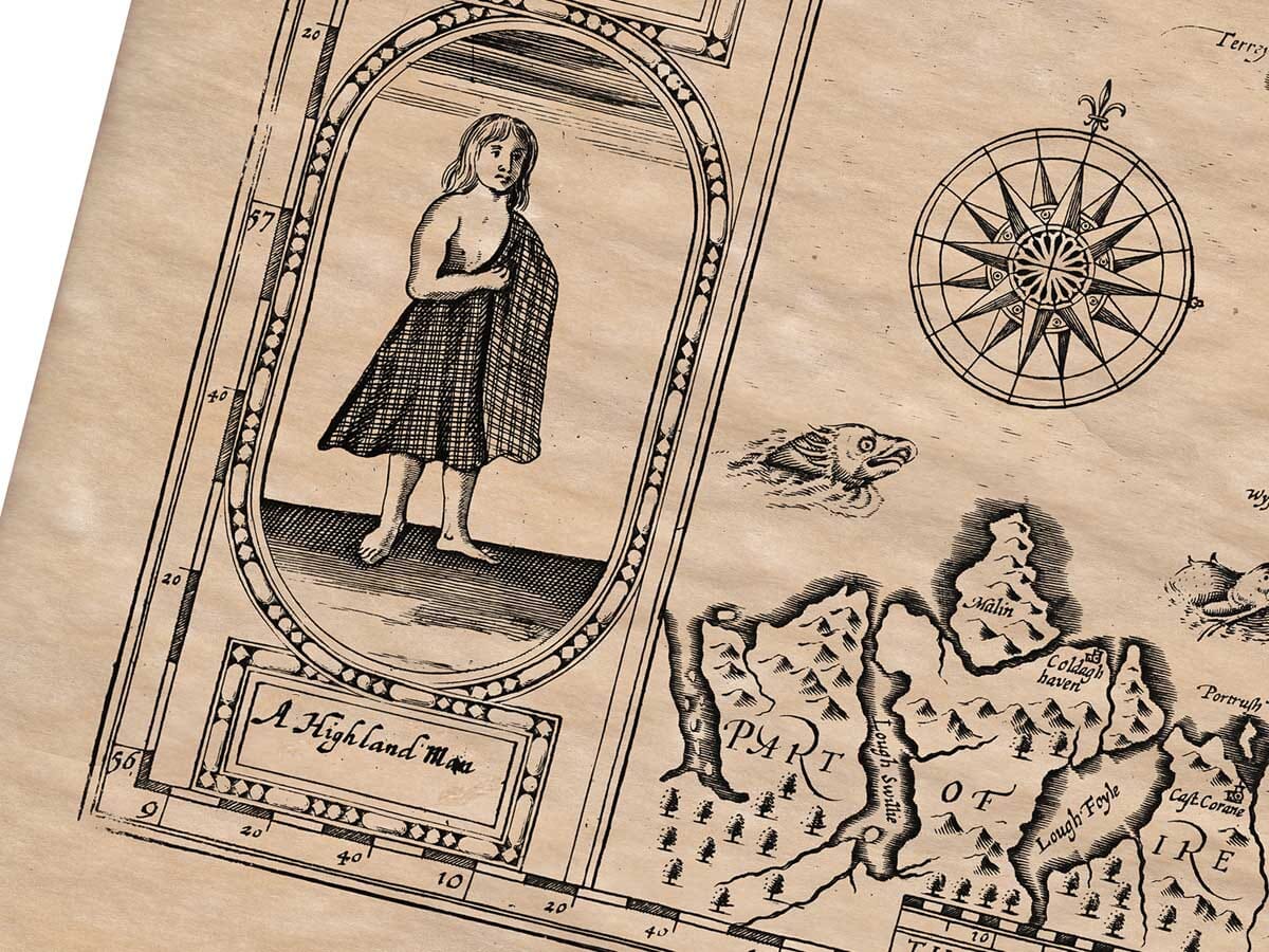
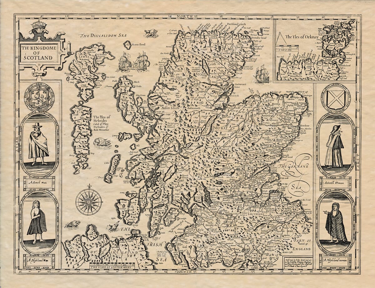
The most immediately noticeable difference between this later map and the first state lies in the decorative figures placed along its sides. The early version had shown King James VI of Scotland and I of England, Queen Anne, Prince Henry and Prince Charles. In the later state, those royal portraits were replaced by four figures labelled as a Scottish man, a Scottish woman, a Highland man and a Highland woman. The plate had been altered by the middle of the century, and the 1676 printing carries the imprint of Bassett and Chiswell.
These costume figures give the later map a markedly different character. Rather than celebrating a particular royal family, the borders present contrasting ideas of Scottish regional identity. The figures on one side represent Lowland or more generally Scottish dress, while those opposite are identified specifically with the Highlands. They should not be treated as exact documentary portraits of ordinary seventeenth-century people, but as stylised representations shaped by contemporary English ideas about Scotland and its inhabitants. Their presence nevertheless makes the map an especially interesting record of how differences within Scotland were pictured for atlas readers in London.
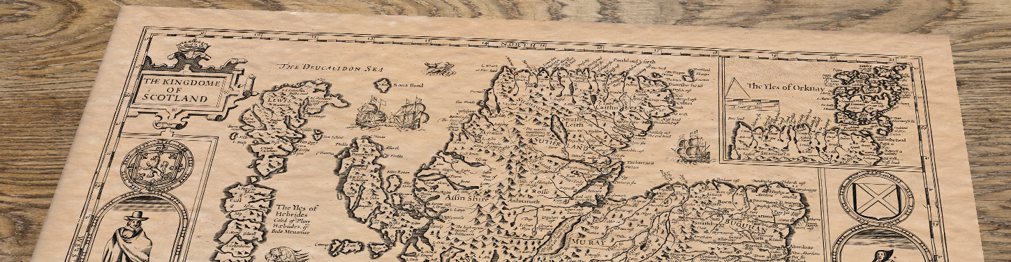
At the centre lies Speed’s densely engraved geographical image of the kingdom. Scotland is divided into its principal regions and covered with towns, settlements, rivers, lochs and pictorial mountains. The Highlands appear heavily textured by repeated mountain symbols, while the more populated Lowlands carry a particularly dense scattering of place-names. Although the map cannot be read as a modern survey, it preserves a remarkable body of early geographical information and shows how Scotland was imagined by readers during the seventeenth century.
Speed did not personally survey the country. The geographical outline was based largely upon Gerard Mercator’s map of Scotland published in 1595, and some of its proportions were already considered imperfect during Speed’s lifetime. The Highlands, islands and northern coastline can consequently appear unfamiliar to modern eyes. Yet those inaccuracies are themselves historically revealing. They show the geographical sources available to Speed before the detailed manuscript surveys of Timothy Pont were published in Joan Blaeu’s atlas of Scotland later in the century.
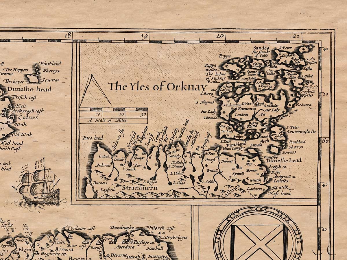
The enlarged inset of “The Yles of Orknay” in the upper-right corner is among the map’s most useful features. By separating Orkney from the main image, the engraver could show the islands at a larger scale and include many more names than would otherwise have been possible. The inset also balances the prominent title cartouche in the opposite corner and contributes to the careful decorative arrangement of the whole plate.
The western islands receive similarly prominent treatment. Lewys is shown separately to the north-west, while the long chain of the Hebrides extends down Scotland’s Atlantic coast. The map labels them as “The Yles of Hebrides” and preserves spellings that belong to an earlier period of English cartography. For modern viewers with family or geographical connections to the islands, these names are often among the most absorbing details to examine.
The surrounding seas are far from empty. Sailing ships cross the waters north and east of Scotland, while a sea creature appears among the western islands. A compass rose occupies the sea to the south-west. Such elements were partly decorative, filling the open spaces around the coastline, but they also suggested navigation, trade, danger and Scotland’s maritime position. They helped transform a geographical diagram into a richly composed image intended to reward prolonged study.
The engraved mountain ranges, curling lettering, heraldic devices and border figures demonstrate the artistic ambition behind Speed’s atlas. Hondius and the other craftsmen involved in the project were not simply copying geographical information; they were producing maps intended to be admired as objects of learning and display. The survival and repeated reuse of the original copper plates allowed Speed’s designs to reach several generations of readers long after both Speed and Hondius had died.
The 1676 edition is particularly important in that history. Bassett and Chiswell retained much of the familiar early-seventeenth-century geography while updating the publisher’s imprint and issuing the map for a Restoration-era audience. The resulting print belongs simultaneously to two periods: its geographical design and original engraving date from the reign of James VI and I, while its later decorative state and publication belong to the reign of Charles II.
Seen today, the map offers more than a view of Scotland’s landscape. It records the long working life of a seventeenth-century copper plate, the changing ownership of Speed’s atlas and the way its imagery was adapted for new audiences. The substitution of Scottish and Highland costume figures for the original royal portraits is particularly telling. It shows how a map initially framed by the new Stuart dynasty was later recast as a broader picture of Scotland and its people.
For anyone with Scottish ancestry, the map provides a fascinating connection with historic place-names and regional identities. For the collector, it combines the distinctive engraving of John Speed’s atlas with the later seventeenth-century costume borders. And as a decorative work, its balance of geographical detail, ships, sea creatures, heraldry and human figures makes it one of the most memorable early maps of Scotland