



Old Map of the World
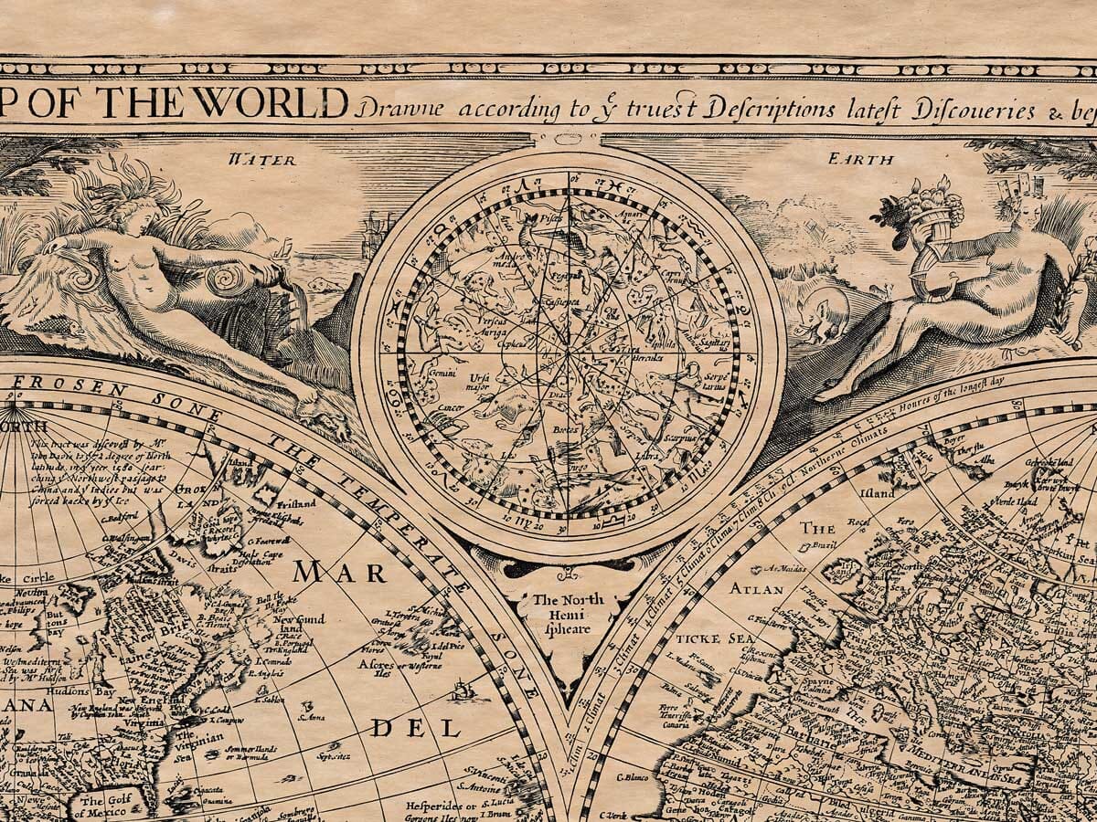
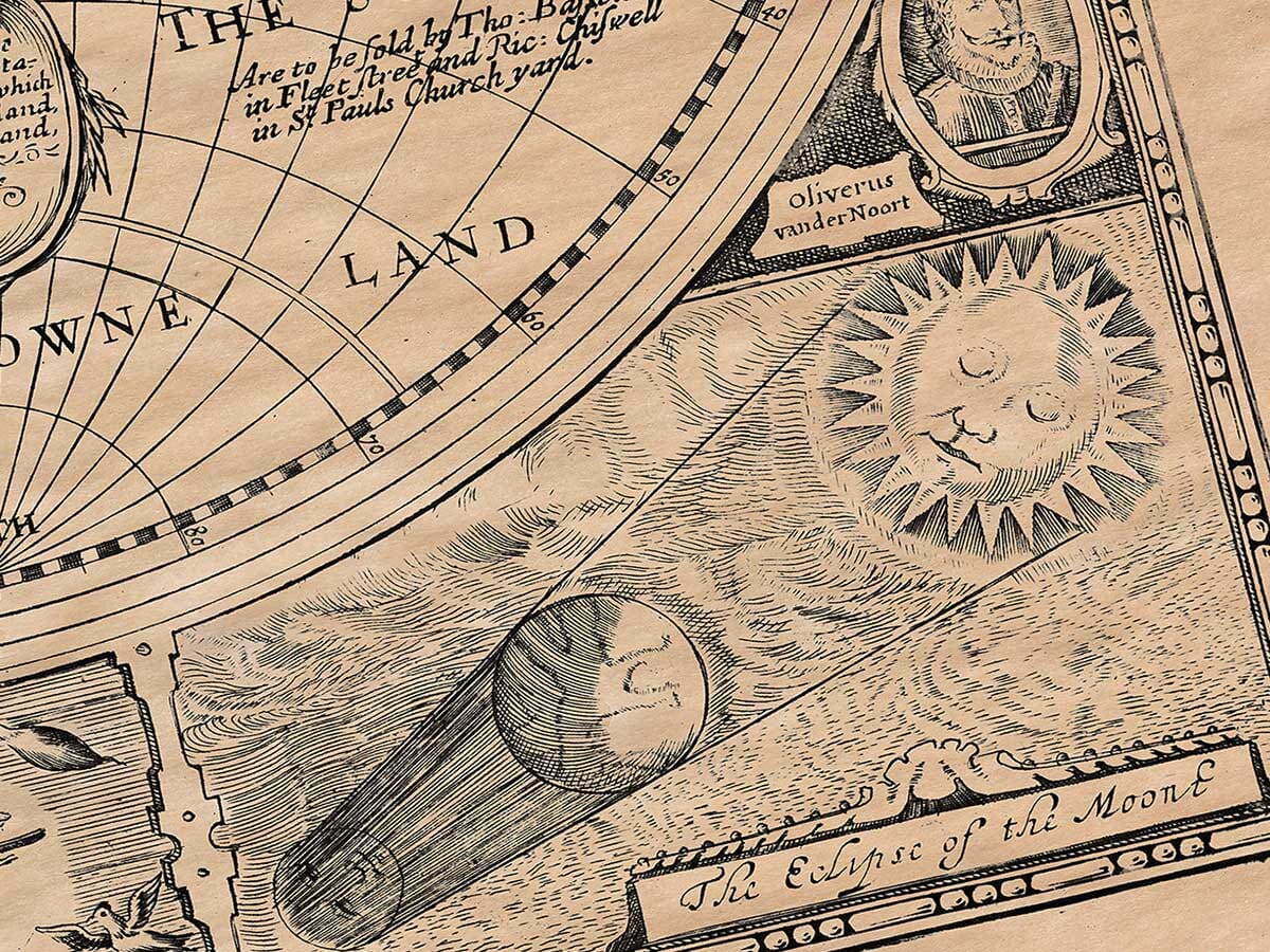
Old Map of the World Detail from an old map of the World Old Eclipse Drawing

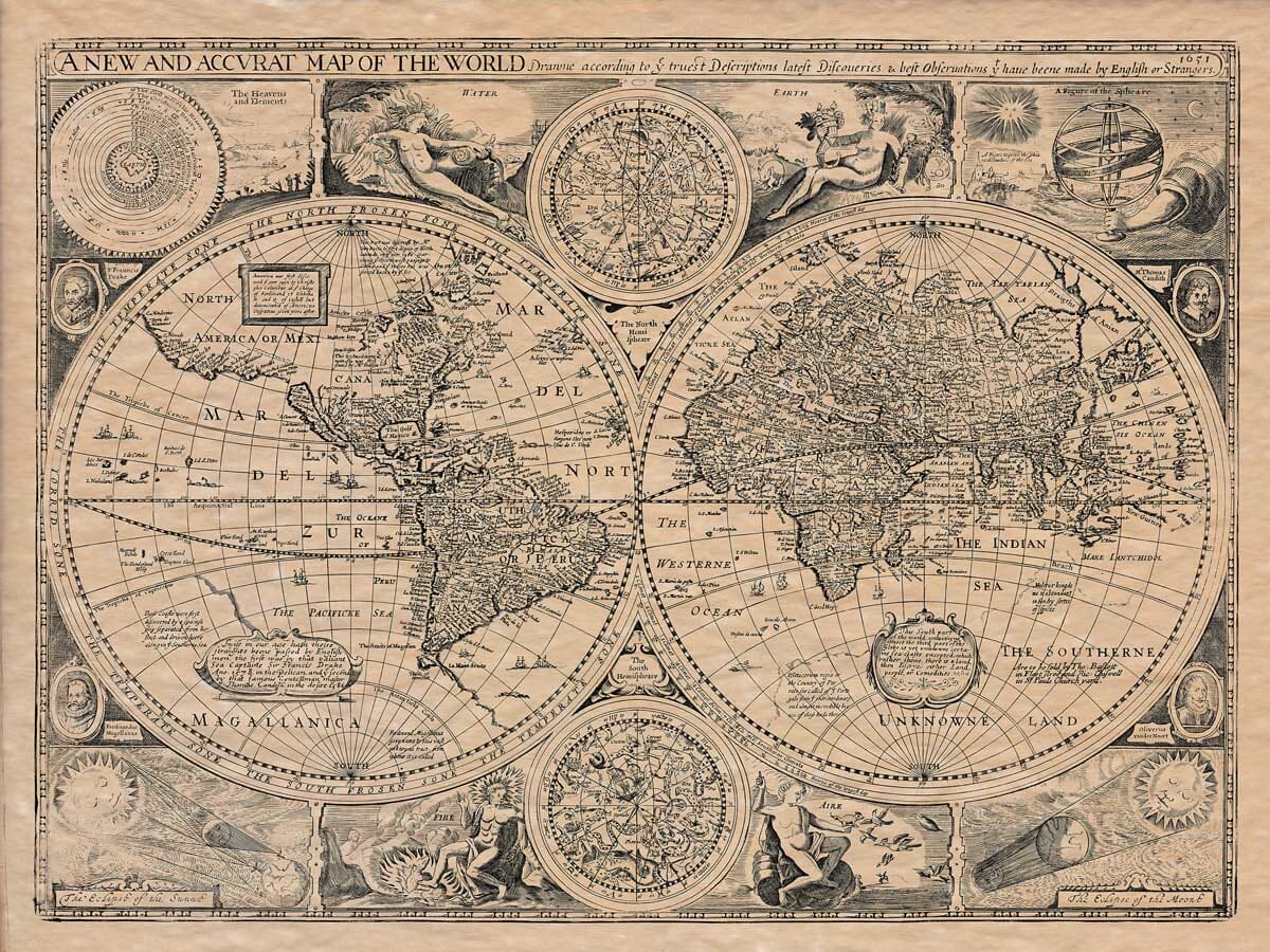
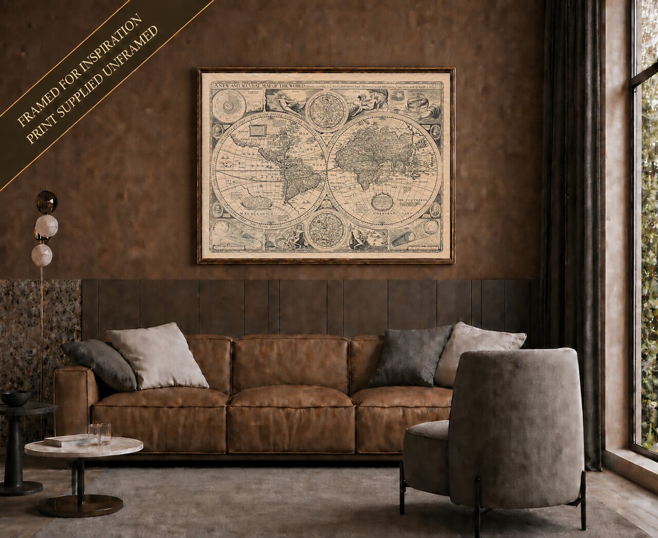
John Speed World Map, 1651 – Historic Double-Hemisphere Print

Price range: £35.95 through £49.95

An Old Map of  the World  by John Speed

An illustratively rich and fascinating Old Map of the World detailing the hemispheres embellished with most unusual representations of the four elements of Water by a figure at the ocean side – Earth by Mother Earth, with fruit and animals – the earth’s bounty, Fire by Apollo and erupting volcanoes, and Aeros, the goddess of Air, with birds. There is an armillary ring style illustration showing ‘The Heavens and Elements’

Fascinating representations of Eclipses of the Sun and Moon adorn the base, whilst portraits of notable explorers including Sir Francis Drake, are placed around the outer circumferences of the spheres. Australia is absent and referenced The Southern Unknown Land. 
+ read more

A stunning certified FINE ART PRINT on heavy textured art paper — not a poster

A richly detailed reproduction of John Speed’s celebrated 1651 world map, presented in two magnificent hemispheres and surrounded by explorers, celestial charts, eclipse diagrams and allegorical figures. Created during the great age of maritime exploration, the map captures a world that was still being discovered. California appears as an island, while the southern oceans are dominated by the mysterious “Southerne Unknowne Land”. Beautifully intricate and full of historical curiosity, this is both a striking piece of wall art and a fascinating record of seventeenth-century cartography.

  • Direct from the publisher — no middlemen
  • Printed in-house in Cornwall
  • Free UK delivery — international shipping available
  • Produced to meet — and often exceed — museum-quality standards

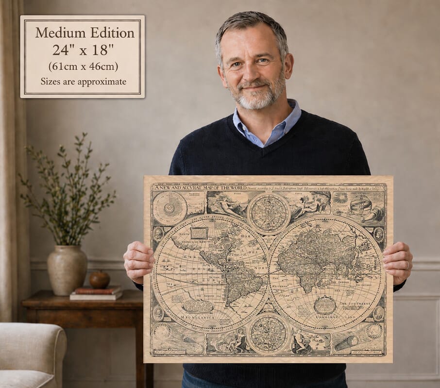
SELECT SIZE

Inspecting Vintage Map Reproduction

Fine Art Map Reproductions – Museum-Quality Printing

Unlike most online offerings, our maps are produced entirely in-house, not outsourced to print-on-demand or drop-shipping services. This allows complete control over quality while offering better value. Each map begins with a high-resolution original, carefully enhanced and printed to order using archival papers and pigment inks for exceptional clarity, depth, and longevity. Every piece is personally overseen — no map leaves our workshop unless it is of a quality we would be proud to display ourselves.

Hand hold a magnifying glass over West Cornwall Map

Authentic Old Map Paper & Accurate Colour Reproduction

Paper choice is essential to the authenticity of our maps. We use specially sourced 190gsm paper made in the UK from pure materials and traditionally pressed with natural woollen felts. This process creates a subtle, randomly textured surface that closely resembles an original antique document. Likewise the use of premium quality ink fully saturates the paper, producing remarkable clarity, depth, and historical character. Colour fastness and sharpness will remain good for in excess of 100 years!

Map in Postal Tube
Buy Old Maps Online in the UK Today Trading online since 1999

The Old Map Company of Great Britain offers a vast and carefully curated collection of the very finest expertly reproduced vintage maps. Our range includes works by renowned cartographers such as John Speed and Willem Blaeu, covering Scotland, England, and beyond. Free UK courier delivery is included, with EU, USA, and worldwide shipping available at cost and calculated at checkout. If you need assistance, our team is always happy to help you choose the perfect map.

RECENT REVIEWS

David H
David H
Verified ownerVerified owner
5/5

Got there in time and loves it! Cheers David [Gift from US to UK]

2 months ago
Ellan C-S
Ellan C-S
Verified ownerVerified owner
5/5

Thanks Lauren. We received it today - it's gorgeous! Thank you, Ellan

2 months ago
Ivano Di Battista
Ivano Di Battista
Verified ownerVerified owner
5/5

Thank you for your prompt service. I have a gallery and framing business in South Wales. I'm so pleased it is printed in the UK

2 months ago
Robert B
Robert B
Verified ownerVerified owner
5/5

My Isles of Scilly map arrived safely and I'm delighted with it!

3 months ago
Andrew T
Andrew T
Reviewer
5/5

The print arrived safely and we're delighted with it - a lovely reminder of our honeymoon 15 years ago.

3 months ago
Hannah J
Hannah J
Verified ownerVerified owner
5/5

I have just received them! I'm sure our clients will be pleased with them and there could be more projects off the back of this one where we can use more. [Interior Designers]

3 months ago
Sean MacManus
Sean MacManus
Verified ownerVerified owner
5/5

I just received my map of Ireland by Ewart today and, as usual, I am delighted by its quality. The crispness and fineness of detail is excellent and the colour reproduction surpasses my expectations. Please relay my thanks to Steve for another fine effort!

3 months ago
John G
John G
Verified ownerVerified owner
5/5

Many thanks, Lauren. Very pleased with the map and the service: would recommend The Old Map Company to anyone interested in Old Maps.

5 months ago
Lois K
Lois K
Verified ownerVerified owner
5/5

Thrilled , Lauren! Thank You

5 months ago
Ed Simpson
Ed Simpson
Verified ownerVerified owner
5/5

Many thanks, the map arrived safely this morning, and I’m really pleased with it. A stunning reproduction, just as I had hoped. I will keep browsing your website, and may yet be tempted by more of your items! Have a great weekend.

5 months ago
Daniel McCade
Daniel McCade
Verified ownerVerified owner
5/5

Just arrived, wonderful map! Thanks very much!

6 months ago
Jonathon R
Jonathon R
Verified ownerVerified owner
5/5

The map – beautiful – arrived safely, very many thanks.

1 year ago
Rasa Terbetiene
Rasa Terbetiene
Verified ownerVerified owner
5/5

Thank you, I have already found the map. It’s wonderfull! Good luck! Rasa

3 years ago
Mina M.
Mina M.
Verified ownerVerified owner
5/5

My apologies for the very late reply. I wanted to reach out to thank you so much for rushing my order. My partner absolutely loved it. I am amazed with the service so that is a five-star from me. I wish you all the best.


4 years ago

A New and Accurat Map of the World

John Speed’s A New and Accurat Map of the World is one of the most recognisable achievements of early English mapmaking. The version reproduced here is dated 1651, although the original design first appeared in Speed’s A Prospect of the Most Famous Parts of the World in 1627—the first world atlas produced by an Englishman.

The world is arranged as a dramatic pair of hemispheres, surrounded by a remarkable mixture of geography, astronomy and classical symbolism. Portraits of the circumnavigators Ferdinand Magellan, Sir Francis Drake, Thomas Cavendish and Olivier van Noort appear around the borders, alongside personifications of Earth, Air, Fire and Water. Celestial hemispheres, an armillary sphere and diagrams explaining solar and lunar eclipses complete the composition.

Perhaps its greatest fascination lies in the way it records the limits of seventeenth-century geographical knowledge. California is depicted as an island, while the coastlines and reported sightings of the far south are absorbed into an enormous imagined continent variously labelled Magallanica and The Southerne Unknowne Land. Australia had not yet emerged in the familiar form recognised today.

More than a decorative antique world map, this is a visual record of an era when navigation, astronomy, exploration and mythology remained closely intertwined. Its dense engraving and balanced double-hemisphere design make it especially suitable for a study, library, office or traditional interior—and an excellent gift for anyone interested in historic cartography, exploration or maritime history.

Carefully reproduced and printed to order in our Cornwall workshop using archival pigment inks and heavy, traditionally textured fine art paper. The finished print retains the warm colour, fine lettering and intricate detail of the historic map and is supplied unframed, ready for you to choose a setting that suits your own interior.

What this historic world map shows

  • Eastern and western double hemispheres
  • California represented as an island
  • The vast “Southerne Unknowne Land”
  • Portraits of four early circumnavigators
  • Northern and southern celestial hemispheres
  • Solar and lunar eclipse diagrams
  • Allegorical figures representing the four elements
  • Seventeenth-century place names, coastlines and geographical theories

You may also like…

×
Product added to cart
No products in the cart.


