The story of the Isles of Scilly 1803 map
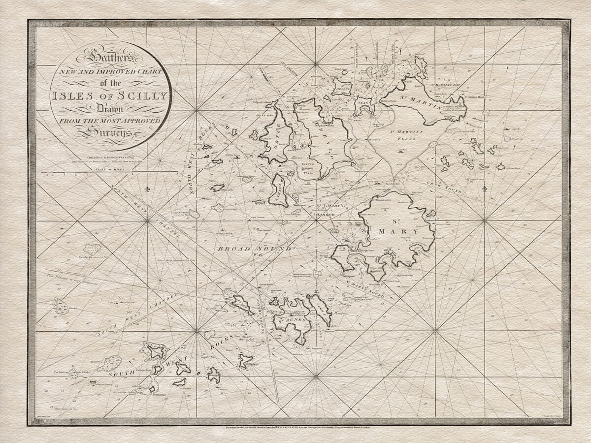
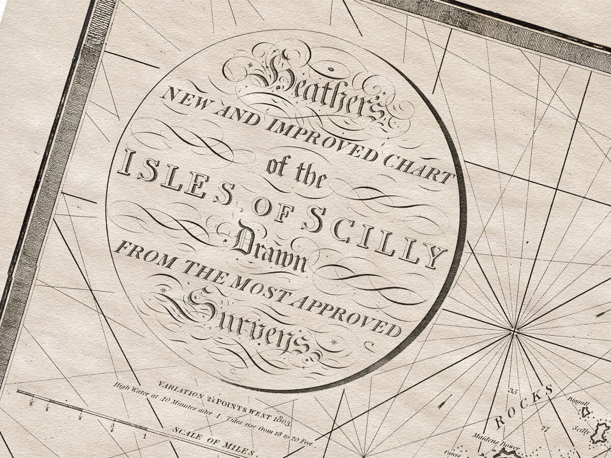
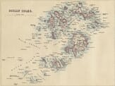
This beautiful map began life as something far more practical than decorative. The Isles of Scilly 1803 is a fine-art reproduction of an early nineteenth-century sea chart, originally catalogued as William Heather’s “New and Improved Chart of the Isles of Scilly”, published in 1803. The original chart was drawn at a scale of around 1:24,300, with a sheet size of approximately 62 × 76 cm.
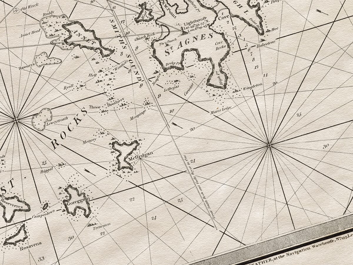
What makes the chart so engaging is that it was made for a real purpose. The Isles of Scilly, lying just off the far south-western tip of Cornwall, are wonderfully beautiful, but for sailors they were also notoriously difficult waters. Rocks, reefs, narrow channels and changing approaches all made navigation hazardous. This chart was created to help mariners make sense of that landscape, marking the islands, rocks, channels, anchorages, sailing lines and coastal outlines that could guide a vessel safely through.
The date, 1803, places the map in a fascinating moment in Britain’s maritime history. Trade, naval movement, fishing, coastal shipping and pilotage all depended on accurate charts. William Heather was part of that world: a London chartmaker, engraver, publisher, and seller of nautical and mathematical instruments. His work belonged to the practical side of mapmaking — charts made not just to be admired in libraries or drawing rooms, but to be used by people at sea.
The Isles of Scilly already carried a serious reputation in the history of navigation. In 1707, four Royal Navy ships were wrecked near the islands, with the loss of roughly 1,400 to 2,000 lives. It became one of Britain’s worst naval disasters, and uncertainty in navigation and position-finding was later seen as part of the tragedy. Charts like Heather’s belong to the long story of trying to make these waters better understood, better recorded, and safer to travel.
When you look at the map, you are not just seeing islands on paper. You are seeing a working maritime landscape. St Mary’s, Tresco, St Martin’s, St Agnes, Bryher, Samson and the surrounding rocks are shown as part of a web of passages, hazards and routes. The radiating lines across the sea are part of the navigational language of the period, helping sailors judge bearings and courses. Every named rock, channel and anchorage hints at local knowledge gathered through experience, care and sometimes hard lessons.
The chart also captures the islands before some of the later improvements that made navigation safer. The famous Bishop Rock Lighthouse, for example, was not completed until 1858, more than fifty years after this chart was published. In Heather’s time, sailors still relied heavily on printed charts, local pilots, soundings, seamanship and close observation. A map like this was not simply helpful; in difficult weather or unfamiliar waters, it could be vital.
Today, the map has a different kind of appeal. It no longer needs to guide ships through Scilly’s channels, but it still tells a powerful story. In 1803, it was a working tool for mariners. Now, it is also a beautiful historical object: a reminder of the islands’ dramatic seascape, the dangers faced by sailors, and the skill of the chartmakers who tried to turn treacherous waters into something that could be read, trusted and safely crossed.