


£35.55 – £59.95Price range: £35.55 through £59.95
The City & Liberties after the Great Fire of London in 1666
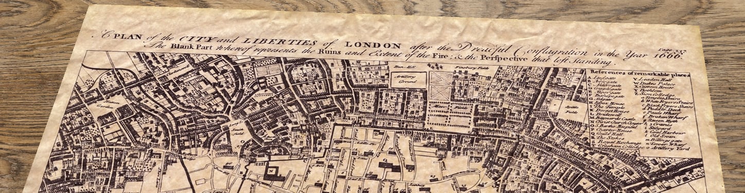
This remarkable Great Fire of London map shows the capital in the aftermath of the catastrophe of September 1666. Engraved by Emanuel Bowen after Wenceslaus Hollar’s near-contemporary survey, it clearly distinguishes the vast ruined district from the streets and buildings that survived.
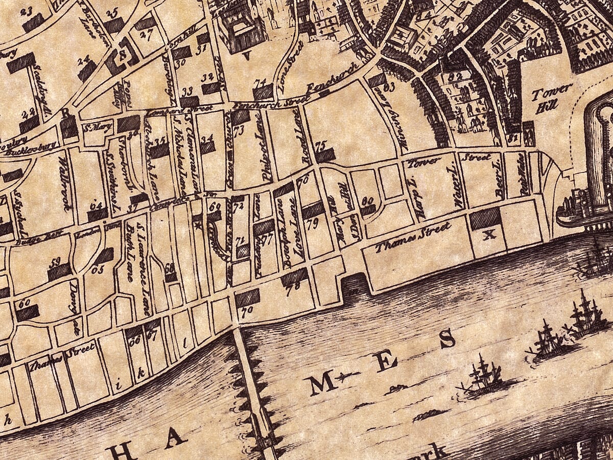
Drawn at an unusually generous scale, the plan extends from Lincoln’s Inn Fields to the Tower and from Finsbury to the Thames and Bankside. Churches, gates, livery halls, markets, wharves and principal streets are identified, while two detailed reference panels help locate notable buildings and places.
An absorbing choice for anyone fascinated by London, family history, architecture or the age of Samuel Pepys, this map reveals both the scale of the disaster and the framework of the city that rose from it. Reproduced as a museum-quality fine-art print, its intricate engraving rewards close inspection and makes a striking historical centrepiece.A stunning certified FINE ART PRINT on heavy textured art paper — not a poster
Unlike most online offerings, our maps are produced entirely in-house, not outsourced to print-on-demand or drop-shipping services. This allows complete control over quality while offering better value. Each map begins with a high-resolution original, carefully enhanced and printed to order using archival papers and pigment inks for exceptional clarity, depth, and longevity. Every piece is personally overseen — no map leaves our workshop unless it is of a quality we would be proud to display ourselves.
Paper choice is essential to the authenticity of our maps. We use specially sourced 190gsm paper made in the UK from pure materials and traditionally pressed with natural woollen felts. This process creates a subtle, randomly textured surface that closely resembles an original antique document. Likewise the use of premium quality ink fully saturates the paper, producing remarkable clarity, depth, and historical character. Colour fastness and sharpness will remain good for in excess of 100 years!
The Old Map Company of Great Britain offers a vast and carefully curated collection of the very finest expertly reproduced vintage maps. Our range includes works by renowned cartographers such as John Speed and Willem Blaeu, covering Scotland, England, and beyond. Free UK courier delivery is included, with EU, USA, and worldwide shipping available at cost and calculated at checkout. If you need assistance, our team is always happy to help you choose the perfect map.
Speedy delivery A beautiful representation
Got there in time and loves it! Cheers David [Gift from US to UK]
Thanks Lauren. We received it today - it's gorgeous! Thank you, Ellan
Thank you for your prompt service. I have a gallery and framing business in South Wales. I'm so pleased it is printed in the UK
My Isles of Scilly map arrived safely and I'm delighted with it!
The print arrived safely and we're delighted with it - a lovely reminder of our honeymoon 15 years ago.
I have just received them! I'm sure our clients will be pleased with them and there could be more projects off the back of this one where we can use more. [Interior Designers]
I just received my map of Ireland by Ewart today and, as usual, I am delighted by its quality. The crispness and fineness of detail is excellent and the colour reproduction surpasses my expectations. Please relay my thanks to Steve for another fine effort!
Many thanks, Lauren. Very pleased with the map and the service: would recommend The Old Map Company to anyone interested in Old Maps.
Many thanks, the map arrived safely this morning, and I’m really pleased with it. A stunning reproduction, just as I had hoped. I will keep browsing your website, and may yet be tempted by more of your items! Have a great weekend.
Just arrived, wonderful map! Thanks very much!
The map – beautiful – arrived safely, very many thanks.
Thank you, I have already found the map. It’s wonderfull! Good luck! Rasa
My apologies for the very late reply. I wanted to reach out to thank you so much for rushing my order. My partner absolutely loved it. I am amazed with the service so that is a five-star from me. I wish you all the best.
London after the Great Fire: Reading Emanuel Bowen’s Map
The map’s full engraved title is A Plan of the City and Liberties of London after the Dreadful Conflagration in the Year 1666. It was produced by Emanuel Bowen, one of the leading British mapmakers of the eighteenth century, using a plan made by the Bohemian-born artist and engraver Wenceslaus Hollar soon after the fire. Surviving examples of Bowen’s map are variously dated to around 1740 and to its appearance in William Maitland’s History of London in 1756.
Hollar was exceptionally well placed to record the disaster. He had already drawn London in remarkable detail, and his 1666 Map or Groundplot of the Citty of London became one of the most important cartographic records of the fire’s extent. Bowen adapted this earlier work into a compact, highly legible historical plan. The engraved explanation states that the blank area represents the ruins and extent of the fire, while the buildings drawn in perspective were left standing.
That simple visual device makes the devastation immediately understandable. The pale, emptied heart of the City stretches westwards from the neighbourhood of Pudding Lane towards the Temple, enclosed by surviving districts to the north and by the busy Thames waterfront to the south. London Bridge, the Tower, the city wall, roads, gates and river stairs provide familiar points of orientation. Two inset keys identify remarkable places and the churches of the City and suburbs, turning the engraving into both a record of destruction and a guide to seventeenth-century London.
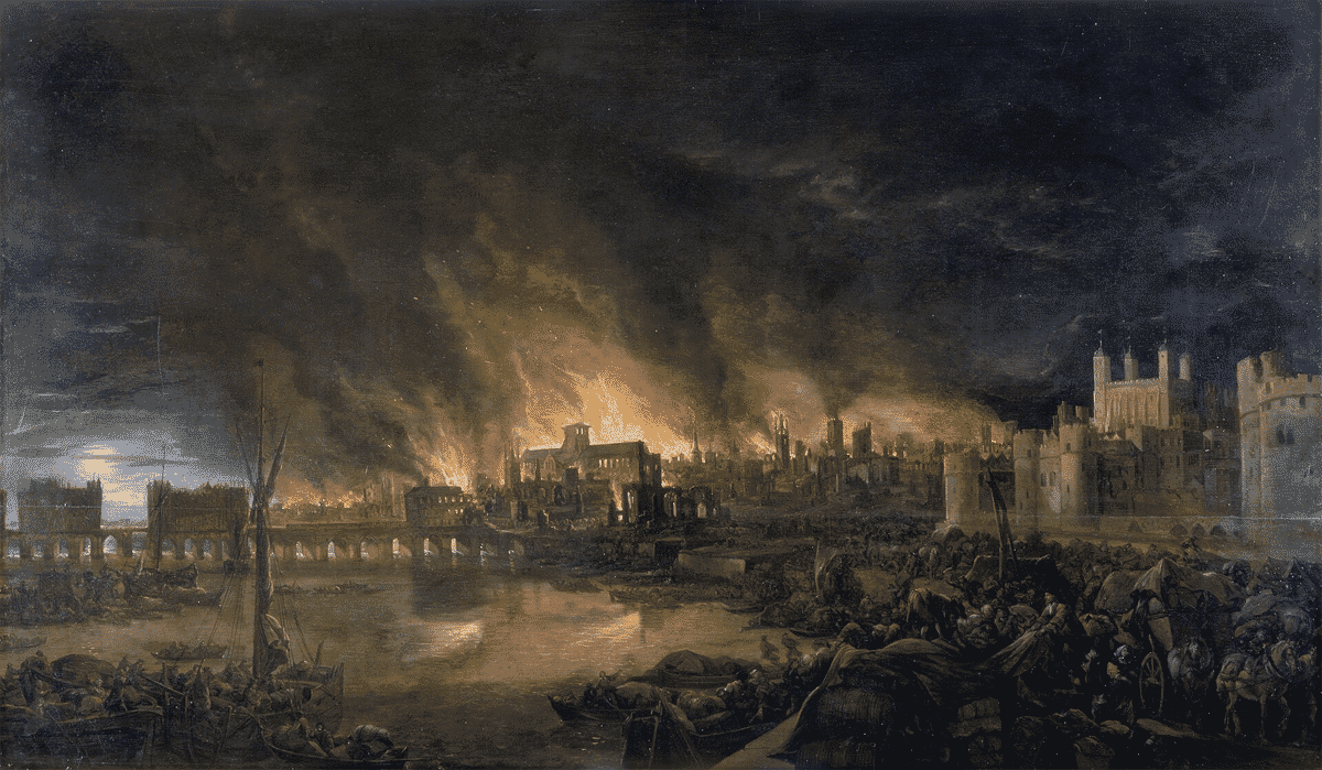
The fire began at about one o’clock on the morning of 2 September 1666 in the Pudding Lane bakery of Thomas Farriner. A dry summer, strong winds and closely packed timber buildings allowed the flames to spread with frightening speed. Firefighting depended on buckets, hooks, primitive squirts and the demolition of buildings to create firebreaks. When the blaze was finally brought under control four days later, it had consumed four-fifths of the City.
Around 13,200 houses and 87 churches were destroyed, together with the old St Paul’s Cathedral, the Royal Exchange, Guildhall and dozens of livery company halls. Approximately 100,000 people were left homeless. The official death toll was small, but the true number remains uncertain, and the loss of homes, goods, workshops, records and livelihoods was immense. Samuel Pepys and John Evelyn left vivid eyewitness accounts, but maps such as Hollar’s and Bowen’s allow the physical scale of the catastrophe to be grasped at a glance.
The ruins also presented an opportunity to redesign the capital. Christopher Wren, John Evelyn and others proposed broad avenues, formal squares and a more regular street plan. These ambitious schemes proved impractical because property boundaries had to be resolved quickly and Londoners needed to rebuild their homes and businesses. Most streets therefore followed their former courses, although some were widened and improved.
The Rebuilding Act of 1667 required new houses to be constructed in brick or stone and regulated their height and form. A special Fire Court helped settle disputes between landlords and tenants, while Wren and his colleagues reshaped the skyline through the rebuilding of St Paul’s and 51 City churches. By 1676, most of the devastated area had been rebuilt, creating a safer but still recognisably medieval street pattern.
Near Pudding Lane, the Monument became the most conspicuous memorial to the disaster and recovery. Designed by Robert Hooke in consultation with Sir Christopher Wren, the Portland-stone column stands 202 feet high and exactly 202 feet west of the traditional site where the fire began. Its 311 spiral steps still lead to a viewing platform above the City.
Bowen’s map captures the pivotal moment between old London and the rebuilt capital. Compare it with the Tudor London Map by John Norden, 1593, and the later Old Map of London after Wenceslaus Hollar, c.1688, to follow the city before the fire, through destruction and into recovery.