Scotia Antiqua: Joan Blaeu’s Map of Ancient Scotland
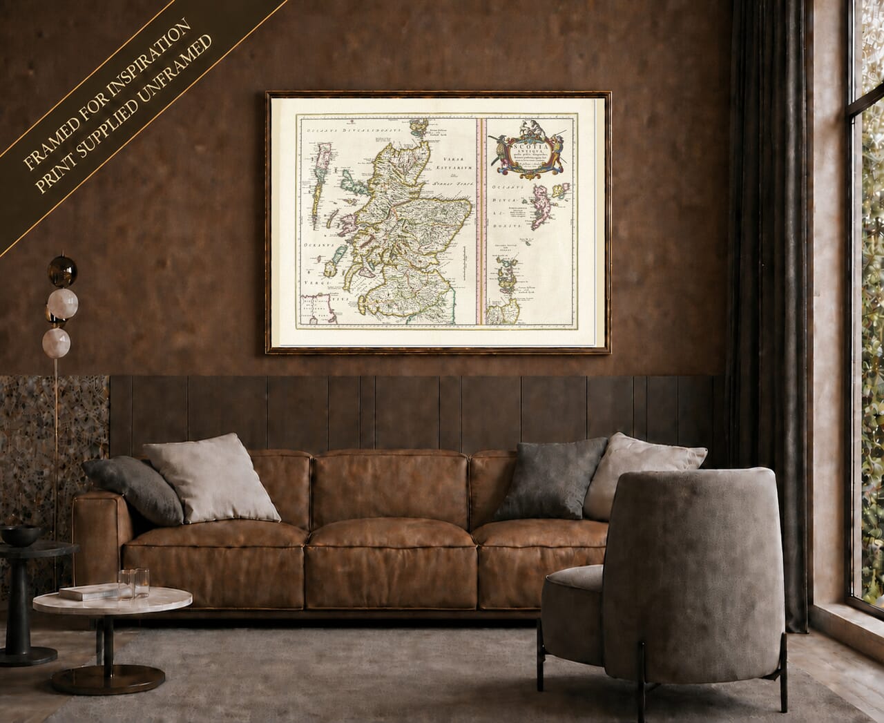
This historic map of Scotland was published by Joan Blaeu in Amsterdam in 1654 as part of the fifth volume of his Theatrum Orbis Terrarum, sive Atlas Novus. Commonly known as the Blaeu Atlas of Scotland, the volume was the culmination of more than seventy years of surveying, scholarship and correspondence involving mapmakers in Scotland and publishers in the Low Countries.
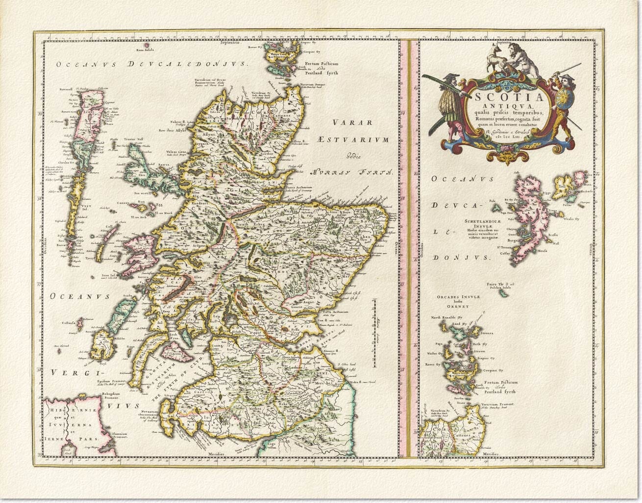
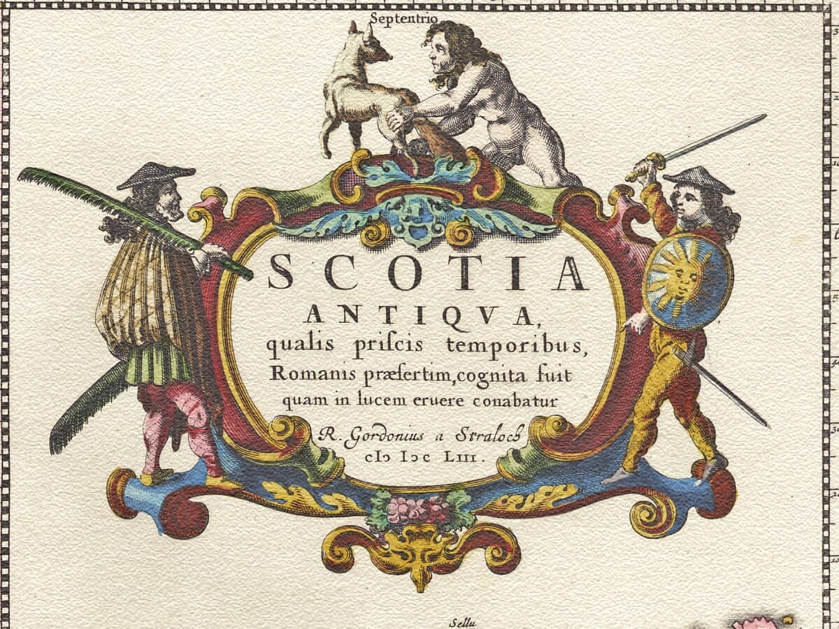
The map’s engraved title is Scotia Antiqua, qualis priscis temporibus, Romanis praesertim, cognita fuit. This may be translated approximately as “Ancient Scotland as it was known in former times, particularly to the Romans.” Unlike a conventional seventeenth-century map, it was intended to reconstruct the geography of Scotland’s distant past.
Robert Gordon of Straloch
Although the finished copperplate was engraved and published by Joan Blaeu’s Amsterdam workshop, the map was prepared by Robert Gordon of Straloch. Born in Aberdeenshire in 1580, Gordon was a mathematician, antiquary, geographer, poet and collector of music.
Gordon became an important contributor to the great Scottish atlas project originally inspired by the surveys of Timothy Pont. Pont had travelled extensively through Scotland during the late sixteenth century, recording coastlines, rivers, settlements and regional boundaries. Much of his work remained unpublished when he died, and Gordon was later asked to help revise and organise the surviving material.
Scotia Antiqua was one of Gordon’s own scholarly contributions. His accompanying notes on ancient Scotland were prepared in 1649, and the map itself was engraved by Blaeu in 1653 before appearing in the completed atlas the following year.
Scotland Through Roman Eyes
The map does not attempt to show Scotland exactly as it appeared in 1654. Instead, Gordon used classical writings, historical interpretation and contemporary geographical knowledge to recreate the country known to Roman authors.
Ancient tribal and territorial names are spread across the landscape, while familiar natural features are given their classical forms. The Firth of Forth, for example, appears as Bodotria, and the northern and western seas carry names such as Oceanus Deucaledonius and Oceanus Vergivus. A line identified on the map as Valli Adriani reflects seventeenth-century thinking about Scotland’s Roman frontiers.
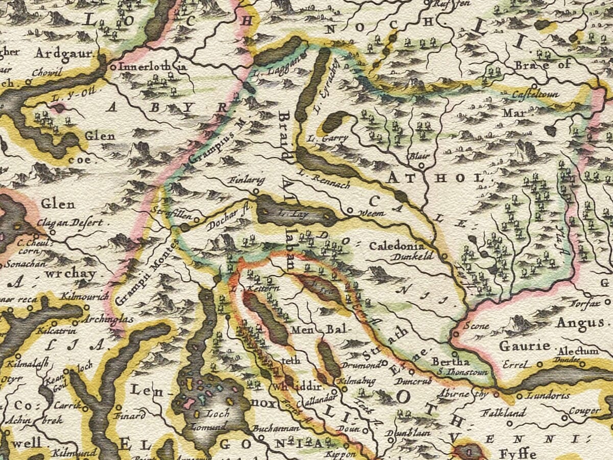
These names give the map much of its mystery and fascination. Recognisable coastlines and islands are transformed into the setting of an older Scotland—a country of Caledonian territories, distant northern seas and places recorded through the imperfect knowledge of classical writers.
From the Borders to the Northern Isles
The principal panel encompasses mainland Scotland from the Borders to Caithness. The long western coast is accompanied by the islands of Arran, Islay, Jura, Mull, Skye and the Outer Hebrides, while the firths and river systems of eastern Scotland lead towards the North Sea.
Orkney and Shetland are placed in a separate vertical panel on the right. This arrangement allowed the islands to be shown clearly without forcing their true geographical positions to create a long and awkwardly shaped sheet. A repeated portion of Scotland’s northern coast helps relate the island groups to the mainland.
Mountains are represented by rows of individually engraved hill symbols, while rivers thread their way towards the coast. The map should not be interpreted as a modern archaeological reconstruction or measured survey. It records the historical scholarship of Gordon’s age, including assumptions that have since been revised.
Art, History and the Blaeu Atlas
A large decorative cartouche occupies the upper part of the island panel. Figures, scrolling ornament and carefully applied colour provide a theatrical introduction to the map’s scholarly subject. The contrast between the densely engraved mainland and the open seas around Orkney and Shetland gives the composition an especially distinctive appearance.
The wider atlas was finally published after years of delay caused by political upheaval, war and the difficulty of transporting maps and written descriptions between Scotland and Amsterdam. When it appeared in 1654, it contained 49 maps of Scotland and represented a landmark in the country’s cartographic history.
More than three and a half centuries later, Scotia Antiqua remains an evocative meeting of geography, history and imagination. Familiar Scottish landscapes emerge beneath ancient names, allowing the viewer to explore not only the physical country but also the way its earliest history was understood during the seventeenth century.
For anyone with a love of Scotland, classical history or antique maps, it is a print that rewards close examination while bringing a wonderfully atmospheric sense of the past into the home.





 Verified owner














