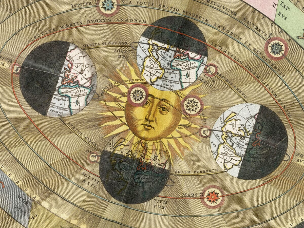
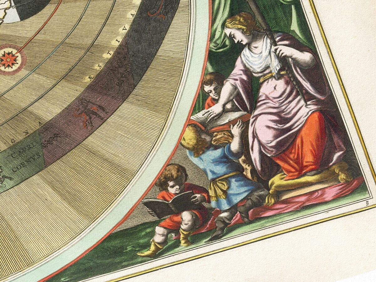
Cellarius Copernican chart with a central Sun, four seasonal Earth globes, a zodiac ring and decorative figures
Cellarius Copernican chart with a central Sun, four seasonal Earth globes, a zodiac ring and decorative figures Star Map 5 detail 1 Star Map 5 detail 2

Vintage Astronomy Chart – The Copernican System

Price range: £29.95 through £59.95

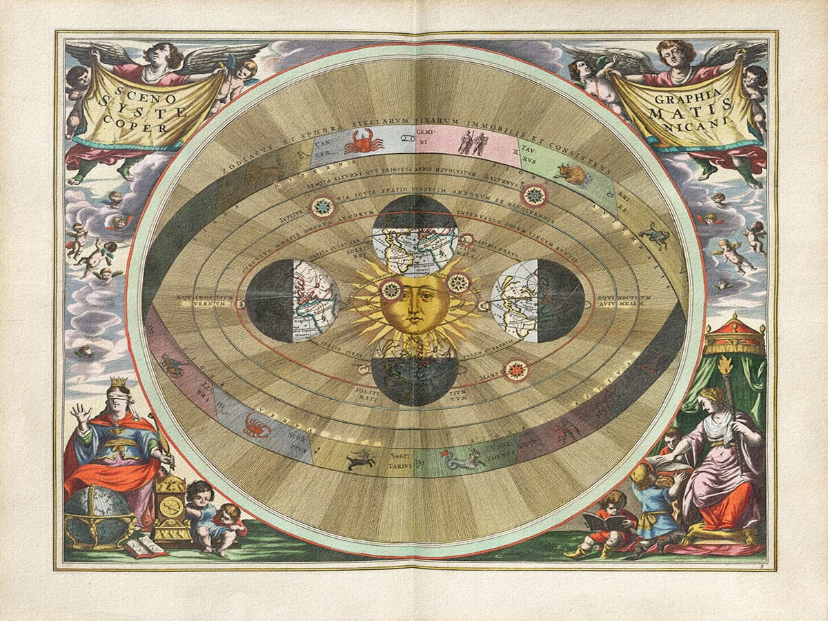
Vintage astronomy chart by Andreas Cellarius, depicting the Copernican system; first published in 1660.

A richly illustrated astronomical chart placing the Sun at the centre, with Earth shown at four seasonal positions around it. A coloured zodiac ring surrounds the planetary paths, while winged figures hold the divided Latin title above.

Globes, books and a clock fill the decorative corner scenes. Reproduced as a giclée fine art print and supplied unframed. The exact original edition of this example is unconfirmed.

With its expressive golden Sun and richly coloured zodiac, this print brings warmth to a study wall—a thoughtful choice for someone fascinated by the ideas that changed our understanding of the heavens.

+ read more

A stunning certified FINE ART PRINT on heavy textured art paper — not a poster

  • Direct from the publisher — no middlemen
  • Printed in-house in Cornwall
  • Free UK delivery — international shipping available
  • Produced to meet — and often exceed — museum-quality standards

SELECT SIZE

Inspecting Mercator's 1623 old map of Great Britain and Ireland

Fine Art Map Reproductions – Museum-Quality Printing

Unlike most online offerings, our maps are produced entirely in-house, not outsourced to print-on-demand or drop-shipping services. This allows complete control over quality while offering better value. Each map begins with a high-resolution original, carefully enhanced and printed to order using archival papers and pigment inks for exceptional clarity, depth, and longevity. Every piece is personally overseen — no map leaves our workshop unless it is of a quality we would be proud to display ourselves.

Hand hold a magnifying glass over West Cornwall Map

Authentic Old Map Paper & Accurate Colour Reproduction

Paper choice is essential to the authenticity of our maps. We use specially sourced 190gsm paper made in the UK from pure materials and traditionally pressed with natural woollen felts. This process creates a subtle, randomly textured surface that closely resembles an original antique document. Likewise the use of premium quality ink fully saturates the paper, producing remarkable clarity, depth, and historical character. Colour fastness and sharpness will remain good for in excess of 100 years!

Map in Postal Tube
Buy Old Maps Online in the UK Today Trading online since 1999

The Old Map Company of Great Britain offers a vast and carefully curated collection of the very finest expertly reproduced vintage maps. Our range includes works by renowned cartographers such as John Speed and Willem Blaeu, covering Scotland, England, and beyond. Free UK courier delivery is included, with EU, USA, and worldwide shipping available at cost and calculated at checkout. If you need assistance, our team is always happy to help you choose the perfect map.

RECENT REVIEWS

Daz
DazGB
Verified ownerVerified owner
5/5

Speedy delivery A beautiful representation

3 months ago
David H
David H
Verified ownerVerified owner
5/5

Got there in time and loves it! Cheers David [Gift from US to UK]

5 months ago
Ellan C-S
Ellan C-S
Verified ownerVerified owner
5/5

Thanks Lauren. We received it today - it's gorgeous! Thank you, Ellan

5 months ago
Ivano Di Battista
Ivano Di Battista
Verified ownerVerified owner
5/5

Thank you for your prompt service. I have a gallery and framing business in South Wales. I'm so pleased it is printed in the UK

5 months ago
Robert B
Robert B
Verified ownerVerified owner
5/5

My Isles of Scilly map arrived safely and I'm delighted with it!

6 months ago
Andrew T
Andrew T
Reviewer
5/5

The print arrived safely and we're delighted with it - a lovely reminder of our honeymoon 15 years ago.

6 months ago
Hannah J
Hannah J
Verified ownerVerified owner
5/5

I have just received them! I'm sure our clients will be pleased with them and there could be more projects off the back of this one where we can use more. [Interior Designers]

6 months ago
Sean MacManus
Sean MacManus
Verified ownerVerified owner
5/5

I just received my map of Ireland by Ewart today and, as usual, I am delighted by its quality. The crispness and fineness of detail is excellent and the colour reproduction surpasses my expectations. Please relay my thanks to Steve for another fine effort!

6 months ago
John G
John G
Verified ownerVerified owner
5/5

Many thanks, Lauren. Very pleased with the map and the service: would recommend The Old Map Company to anyone interested in Old Maps.

8 months ago
Lois K
Lois K
Verified ownerVerified owner
5/5

Thrilled , Lauren! Thank You

8 months ago
Ed Simpson
Ed Simpson
Verified ownerVerified owner
5/5

Many thanks, the map arrived safely this morning, and I’m really pleased with it. A stunning reproduction, just as I had hoped. I will keep browsing your website, and may yet be tempted by more of your items! Have a great weekend.

8 months ago
Daniel McCade
Daniel McCade
Verified ownerVerified owner
5/5

Just arrived, wonderful map! Thanks very much!

9 months ago
Jonathon R
Jonathon R
Verified ownerVerified owner
5/5

The map – beautiful – arrived safely, very many thanks.

1 year ago
Rasa Terbetiene
Rasa Terbetiene
Verified ownerVerified owner
5/5

Thank you, I have already found the map. It’s wonderfull! Good luck! Rasa

4 years ago
Mina M.
Mina M.
Verified ownerVerified owner
5/5

My apologies for the very late reply. I wanted to reach out to thank you so much for rushing my order. My partner absolutely loved it. I am amazed with the service so that is a five-star from me. I wish you all the best.

4 years ago

Historical Background

Andreas Cellarius’s Scenographia Systematis Copernicani presents the Sun-centred world system associated with Nicolaus Copernicus. First published in Amsterdam in 1660 in the Harmonia Macrocosmica, the design combines a perspective diagram of planetary paths with richly coloured allegorical figures. The Sun has a human face, Earth appears at four positions around it, and an outer band carries the signs of the zodiac. The precise edition represented by this reproduction has not been established.

Map Details

  • Original title: Scenographia Systematis Copernicani
  • Meaning: Perspective view of the Copernican world system
  • Chartmaker: Andreas Cellarius
  • Astronomical model: The heliocentric system of Nicolaus Copernicus
  • First publication: Amsterdam, 1660, by Johannes Janssonius
  • Source atlas: Harmonia Macrocosmica, plate 5
  • Later issue: The plate was also published by Gerard Valk and Pieter Schenk in 1708
  • Edition of this example: Unconfirmed
  • Subject: Planetary paths, Earth’s annual journey and the surrounding zodiac
  • Format: Coloured copperplate astronomical engraving

A Sun-centred picture of the heavens

The golden Sun is the immediate focus of the composition. Its rays spread across the inner part of the diagram, while successive paths encircle it. Earth is included among the moving planets rather than occupying the centre. That arrangement communicates the central idea of the Copernican system before the viewer has read any of the Latin lettering.

Copernicus published his account of this system in 1543, more than a century before Cellarius’s atlas appeared. The chart is therefore not an engraving made by Copernicus himself. It is a later presentation of his model, produced when astronomers were comparing competing explanations of the heavens and developing new observational and mathematical evidence.

Why Earth appears four times

The four terrestrial globes represent different positions in Earth’s annual journey around the Sun. They are not four separate worlds. Latin labels identify the equinoxes and solstices, placing the changing seasons within the orbital arrangement. Each globe is divided between light and darkness, giving the otherwise abstract diagram a strongly pictorial character.

The globes also contain geographical outlines. This brings terrestrial cartography into an astronomical image: the world being moved around the Sun is shown as a recognisable mapped sphere. The seasonal positions, small surrounding symbols and closely engraved labels reward inspection at a larger print size, where the chart’s explanatory detail becomes easier to follow.

The zodiac around the outside

A broad coloured band surrounds the planetary paths. Its divisions contain familiar zodiac figures, including the crab, twins, lion, scorpion and archer. These signs mark the celestial framework around the central model. They do not make the sheet a personal horoscope, and the chart does not plot individual stars in the manner of a conventional constellation map.

The ring is drawn in perspective, with its nearer edge lower in the picture and its farther edge rising behind the central arrangement. This gives depth to a system that might otherwise have been presented as flat concentric circles. The large circular surround and finely radiating lines reinforce that effect.

Figures, instruments and the divided title

Winged figures hold yellow draperies in the upper corners. The Latin title is divided between them, so it must be read across the whole composition. Smaller figures emerge from the clouds beside the circular diagram, continuing the decorative surround without interrupting the planetary paths.

At the lower left, a crowned figure sits beside a globe, a clock and an open book. Another seated figure occupies the lower right beneath a canopy, with children and books nearby. These carefully arranged objects connect the image with learned study and the measurement of time. The colours and gestures make the scientific diagram part of an elaborate seventeenth-century visual scene.

A historical model, not a modern scale diagram

Cellarius’s atlas presented several systems, including those associated with Ptolemy and Tycho Brahe as well as Copernicus. This plate belongs to that comparative account of cosmology. Its spacing and decorative forms should not be treated as accurate measurements of planetary sizes or distances.

Modern astronomy also distinguishes the Sun’s role in our Solar System from the idea of a centre of the entire universe. Read as a historical astronomical chart, the engraving records how a major scientific theory was explained through geometry, lettering and illustration. The fine art print preserves the expressive Sun, seasonal Earth globes, coloured zodiac and richly worked corner scenes together.

×
Product added to cart
No products in the cart.