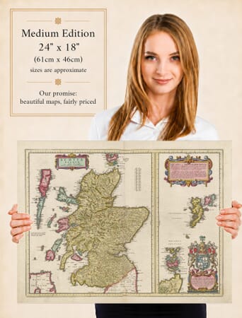
Joan Blaeu’s Old Map of the Uists and Barra
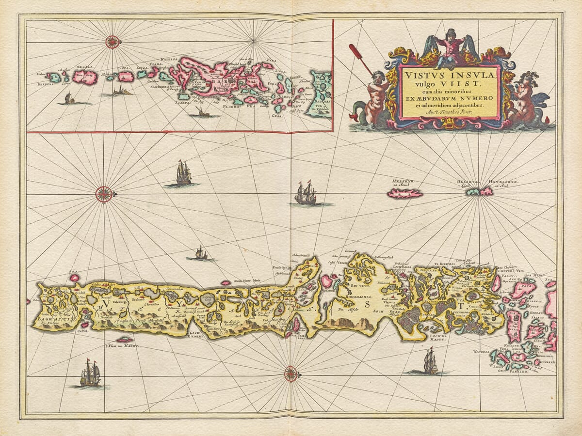
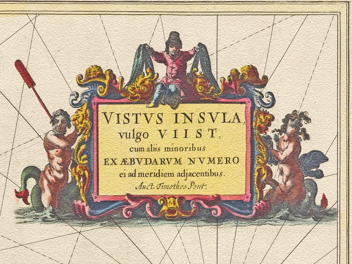
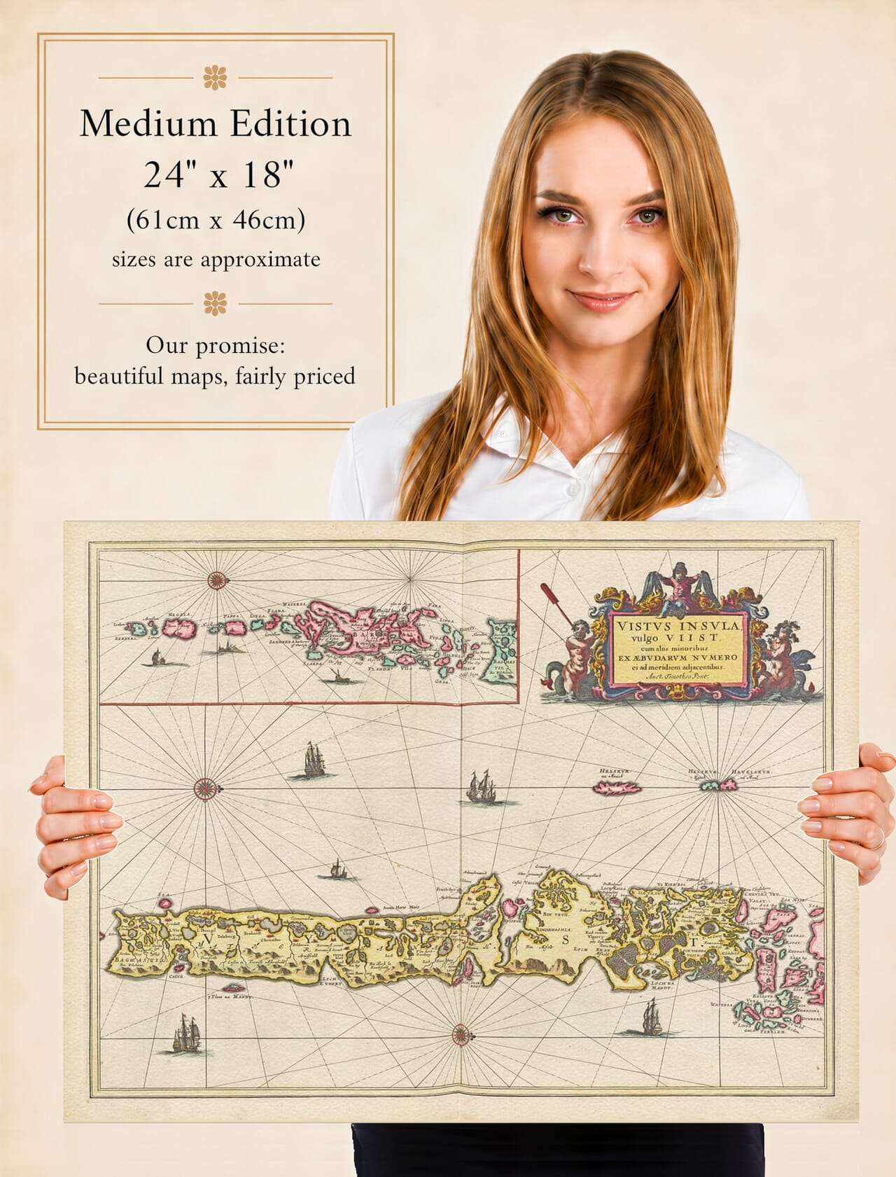
Joan Blaeu’s map of the Uists and Barra was first published in Amsterdam in 1654. Its engraved title begins Vistvs Insula, vulgo Viist—“the island of Uist, commonly called Uist”—and continues by referring to the smaller Hebridean islands adjoining it to the south.
Rather than presenting one simple landmass, the engraving follows a complex island chain of lochs, sounds, headlands and outlying islets. North Uist, Benbecula and South Uist dominate the principal map, while an inset continues the geography southwards through Barra and the islands approaching Barra Head.
Map Details
- Engraved title: Vistvs Insula, vulgo Viist, cum aliis minoribus ex Æbudarum numero ei ad meridiem adjacentibus
- Area shown: North Uist, Benbecula, South Uist, Barra and neighbouring islands
- Cartographic basis: Early Scottish manuscript mapping prepared for Blaeu’s atlas
- Publisher: Joan Blaeu
- First published: Amsterdam, 1654
- Source atlas: Theatrum Orbis Terrarum, sive Atlas Novus—commonly known as the Blaeu Atlas of Scotland
- Orientation: West is placed at the top of the principal map
- Notable features: Sea lochs, tidal channels, settlements, smaller islands, compass lines, sailing vessels, an inset map and a decorative figural cartouche
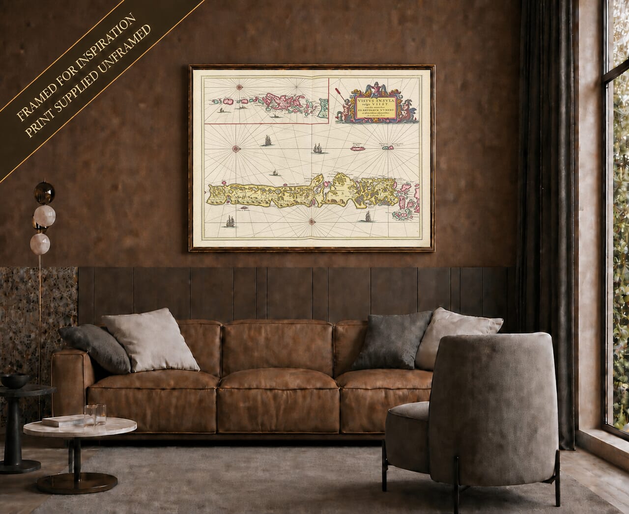
- Product type: Reproduction of a seventeenth-century copper-engraved map, produced as a fine art print
Reading an Unusually Oriented Map
The map can initially seem unfamiliar because west, rather than north, is placed at the top. Consequently, the long island chain appears to stretch across the page instead of running vertically as it does on most modern maps.
This was not an error. Seventeenth-century cartographers could orient a regional map in whichever direction made the best use of the engraved sheet. Turning Uist in this way allowed its intricate coastline to be presented at a larger and more useful scale.
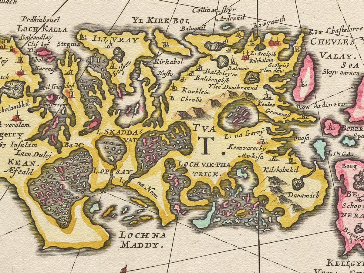
Once the orientation is understood, the principal islands become easier to recognise. North Uist is broken by numerous freshwater lochs and deeply indented sea lochs. Benbecula occupies the low-lying country between North and South Uist, surrounded by channels and smaller islands. South Uist then extends towards Eriskay and the Sound of Barra.
The inset carries the viewer farther south through Barra and the smaller islands beyond. This arrangement avoids compressing the entire chain into one narrow strip and gives individual islands, settlements and coastal features room to breathe.
An Island Landscape Defined by Water
Water occupies much of the engraving. The Atlantic surrounds the exposed western shores, while sounds and tidal channels weave between the islands. Sea lochs reach far into the land, and interior lochs are shown in extraordinary numbers across North and South Uist.
To a modern viewer, these waters can appear to divide communities. In the seventeenth century, however, boats often provided the most practical means of travel. The sea connected settlements, grazing lands, fishing grounds and neighbouring islands in ways that overland routes could not.
Blaeu’s sailing vessels therefore sit naturally within the composition. They are decorative features rather than records of particular ships, but they reinforce the maritime identity of the Uists and Barra. Fine compass lines spread across the surrounding sea, visually linking the islands and giving the sheet something of the character of an early chart.
The coastlines are not measured with modern precision. Tidal islands, narrow channels and irregular shores presented considerable difficulties to early mapmakers. Their forms should therefore be understood as a seventeenth-century interpretation rather than compared too literally with present-day mapping.
Old Names Across the Islands
The engraving contains a wealth of historic place names. Their spellings often differ considerably from modern usage, reflecting a landscape that was overwhelmingly Gaelic-speaking.
Names passed through several stages before reaching the printed plate. Spoken Gaelic forms were recorded in writing, copied into manuscript material and eventually interpreted by engravers working in Amsterdam. Variations and unfamiliar spellings were almost inevitable.
For people exploring Hebridean ancestry, these names are among the map’s greatest attractions. Settlements appear beside lochs and along sheltered coastlines, providing clues to the distribution of communities long before modern roads and causeways connected much of the island chain.
Some settlements have grown or changed their names, while others have diminished or disappeared. The map cannot provide a complete record of every household, but it preserves an early geographical framework within which family and local history can be explored.
Uist and Barra Before Modern Connections
The landscape represented here predates harbours built for modern ferries, surfaced roads, airports and the causeways that now link several islands. Journeys that can today be made by car would once have depended upon tides, weather, boats and knowledge passed between generations.
Life was shaped by the contrast between the fertile machair of the Atlantic coast, extensive areas of peatland, freshwater lochs and the more mountainous eastern side of South Uist. Fishing, livestock and cultivation all depended upon close familiarity with land and sea.
Barra possessed its own strong maritime identity, symbolised by Kisimul Castle in Castlebay. Farther south, Vatersay, Sandray, Pabbay, Mingulay and the islands approaching Barra Head formed the final reaches of the inhabited and travelled chain.
Blaeu’s map freezes this island world at a moment centuries before modern transport altered its connections. Its historical value lies not in scientific precision but in the survival of old names, communities and relationships between land and water.
Decorative Cartography from Amsterdam
The practical geography is framed by decoration characteristic of Blaeu’s workshop. An elaborate cartouche presents the Latin title, while human figures and curling ornament turn the inscription into one of the principal artistic features of the sheet.
Sailing ships and compass lines animate the open water without overwhelming the islands. Colour distinguishes the coastlines and gives clarity to a geographically intricate subject.
For anyone connected with North Uist, Benbecula, South Uist, Barra or the smaller surrounding islands, this historic map offers far more than decoration. It is an absorbing portrait of the Outer Hebrides and a tangible reminder of communities whose lives have always been shaped by the Atlantic.
Explore more
old maps of Scotland or view Blaeu’s wider
map of the Hebrides.





 Verified owner