Northern Scotland Map
Northern Scotland Map Northern Scotland Map from 1600's Northern Scotland Map from 1600's

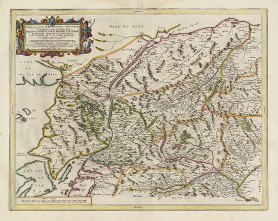
Old Map of Northern Scotland by Joan Blaeu, 1654

Price range: £35.55 through £59.95

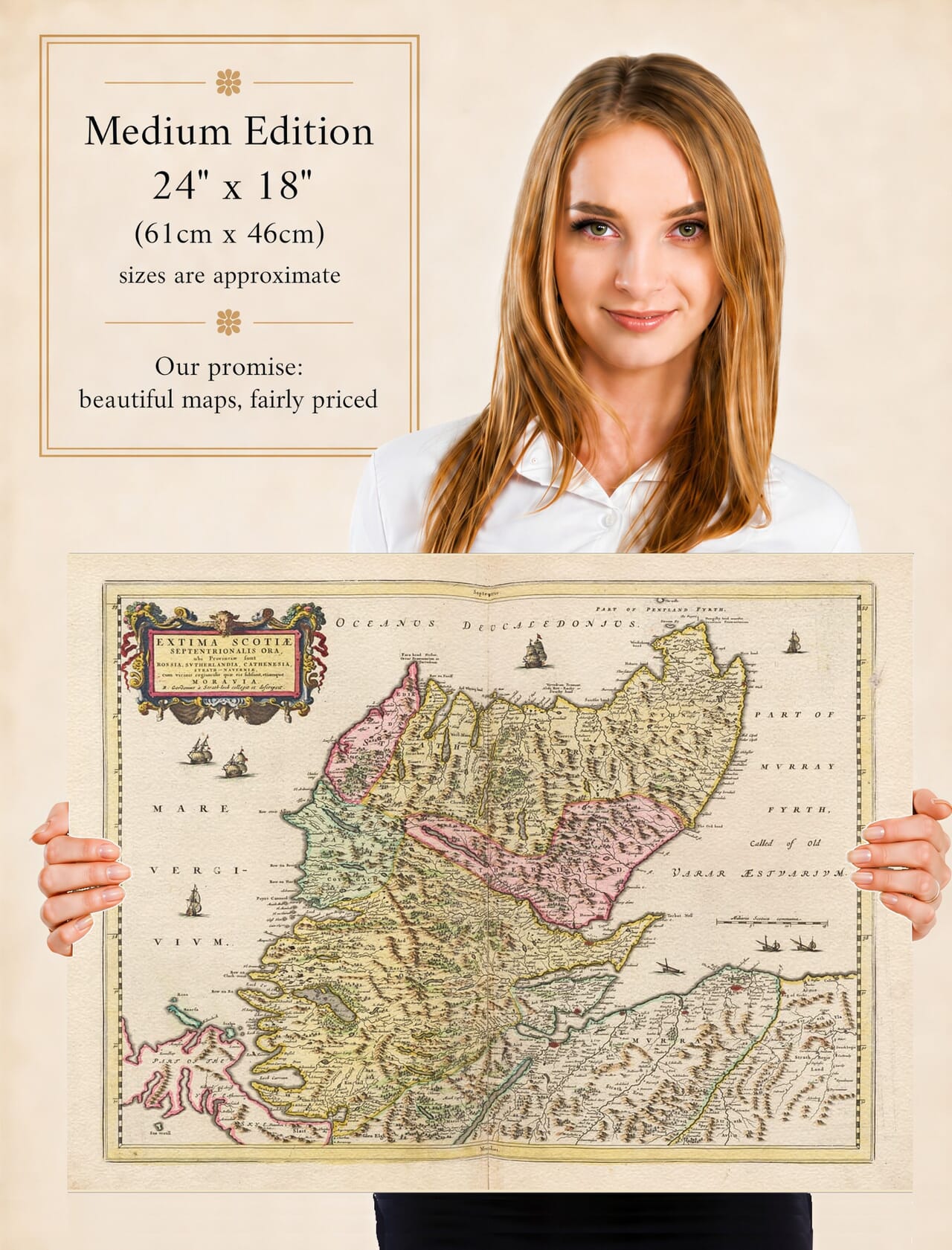
Northern Scotland stretches across this remarkable old map in a sweep of mountains, sea lochs, river valleys and far-reaching coastlines. Published by Joan Blaeu in 1654, it portrays Ross, Sutherland, Caithness and Strathnaver at a time when the Highlands remained beyond the experience of most European travellers.

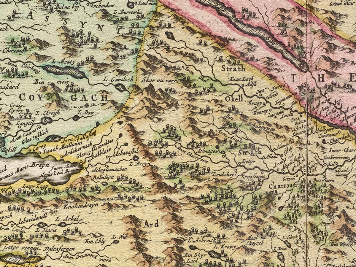
From the sheltered waters around the Beauly and Dornoch firths, the map travels northwards through the lands of Ross and Sutherland to Thurso, Wick and the Pentland Firth. Familiar names emerge among historic spellings, while pictorial hills, winding rivers and scattered settlements convey the scale and solitude of Scotland’s far north.

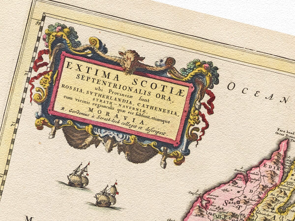
Decorative cartouches, fishermen, measuring instruments and a sailing ship bring warmth and character to the finely engraved landscape. Reproduced as a detailed fine art print on subtly textured paper, this historic map makes a distinctive celebration of the Highlands and the families, journeys and memories connected with them.
+ read more

A stunning certified FINE ART PRINT on heavy textured art paper — not a poster

  • Direct from the publisher — no middlemen
  • Printed in-house in Cornwall
  • Free UK delivery — international shipping available
  • Produced to meet — and often exceed — museum-quality standards

SELECT SIZE

Inspecting Vintage Map Reproduction

Fine Art Map Reproductions – Museum-Quality Printing

Unlike most online offerings, our maps are produced entirely in-house, not outsourced to print-on-demand or drop-shipping services. This allows complete control over quality while offering better value. Each map begins with a high-resolution original, carefully enhanced and printed to order using archival papers and pigment inks for exceptional clarity, depth, and longevity. Every piece is personally overseen — no map leaves our workshop unless it is of a quality we would be proud to display ourselves.

Hand hold a magnifying glass over West Cornwall Map

Authentic Old Map Paper & Accurate Colour Reproduction

Paper choice is essential to the authenticity of our maps. We use specially sourced 190gsm paper made in the UK from pure materials and traditionally pressed with natural woollen felts. This process creates a subtle, randomly textured surface that closely resembles an original antique document. Likewise the use of premium quality ink fully saturates the paper, producing remarkable clarity, depth, and historical character. Colour fastness and sharpness will remain good for in excess of 100 years!

Map in Postal Tube
Buy Old Maps Online in the UK Today Trading online since 1999

The Old Map Company of Great Britain offers a vast and carefully curated collection of the very finest expertly reproduced vintage maps. Our range includes works by renowned cartographers such as John Speed and Willem Blaeu, covering Scotland, England, and beyond. Free UK courier delivery is included, with EU, USA, and worldwide shipping available at cost and calculated at checkout. If you need assistance, our team is always happy to help you choose the perfect map.

RECENT REVIEWS

Daz
DazGB
Verified ownerVerified owner
5/5

Speedy delivery A beautiful representation

2 months ago
David H
David H
Verified ownerVerified owner
5/5

Got there in time and loves it! Cheers David [Gift from US to UK]

4 months ago
Ellan C-S
Ellan C-S
Verified ownerVerified owner
5/5

Thanks Lauren. We received it today - it's gorgeous! Thank you, Ellan

4 months ago
Ivano Di Battista
Ivano Di Battista
Verified ownerVerified owner
5/5

Thank you for your prompt service. I have a gallery and framing business in South Wales. I'm so pleased it is printed in the UK

4 months ago
Robert B
Robert B
Verified ownerVerified owner

5/5

My Isles of Scilly map arrived safely and I'm delighted with it!

5 months ago
Andrew T
Andrew T
Reviewer
5/5

The print arrived safely and we're delighted with it - a lovely reminder of our honeymoon 15 years ago.

5 months ago
Hannah J
Hannah J
Verified ownerVerified owner

5/5

I have just received them! I'm sure our clients will be pleased with them and there could be more projects off the back of this one where we can use more. [Interior Designers]

5 months ago
Sean MacManus
Sean MacManus
Verified ownerVerified owner

5/5

I just received my map of Ireland by Ewart today and, as usual, I am delighted by its quality. The crispness and fineness of detail is excellent and the colour reproduction surpasses my expectations. Please relay my thanks to Steve for another fine effort!

5 months ago
John G
John G
Verified ownerVerified owner
5/5

Many thanks, Lauren. Very pleased with the map and the service: would recommend The Old Map Company to anyone interested in Old Maps.

7 months ago
Lois K
Lois K
Verified ownerVerified owner
5/5

Thrilled , Lauren! Thank You

7 months ago
Ed Simpson
Ed Simpson
Verified ownerVerified owner
5/5

Many thanks, the map arrived safely this morning, and I’m really pleased with it. A stunning reproduction, just as I had hoped. I will keep browsing your website, and may yet be tempted by more of your items! Have a great weekend.

7 months ago
Daniel McCade
Daniel McCade
Verified ownerVerified owner
5/5

Just arrived, wonderful map! Thanks very much!

8 months ago
Jonathon R
Jonathon R
Verified ownerVerified owner
5/5

The map – beautiful – arrived safely, very many thanks.

1 year ago
Rasa Terbetiene
Rasa Terbetiene
Verified ownerVerified owner
5/5

Thank you, I have already found the map. It’s wonderfull! Good luck! Rasa

4 years ago
Mina M.
Mina M.
Verified ownerVerified owner
5/5

My apologies for the very late reply. I wanted to reach out to thank you so much for rushing my order. My partner absolutely loved it. I am amazed with the service so that is a five-star from me. I wish you all the best.

4 years ago

Joan Blaeu and Robert Gordon’s Map of Northern Scotland

Published in Amsterdam in 1654, this remarkable map records the northern mainland of Scotland, principally Ross, Sutherland, Caithness and Strathnaver, together with neighbouring districts and part of Moray. Its full Latin title, Extima Scotiae septentrionalis ora, identifies these northern provinces and, importantly, the map itself credits Robert Gordon of Straloch with compiling and describing the geography: R. Gordonius à Strath-Loch collegit et descripsit. Joan Blaeu was the publisher of the finished map in his great Atlas of Scotland.

Map Details

Original title: Extima Scotiae septentrionalis ora, ubi Provinciae sunt Rossia, Sutherlandia, Cathenesia, Strath-Naverniae, cum vicinis regiunculis quae eis subsunt, etiamque Moravia

Cartographer / compiler: Robert Gordon of Straloch (1580–1661)

Publisher: Joan Blaeu

First published: Amsterdam, 1654

Area shown: Northern mainland Scotland, principally Ross, Sutherland, Caithness and Strathnaver, together with neighbouring districts and part of Moray

Map credit: R. Gordonius à Strath-Loch collegit et descripsit

Source atlas: Theatrum Orbis Terrarum, sive Atlas Novus, Volume V — Scotland, 1654

Product type: Reproduction of a seventeenth-century copper-engraved map

Robert Gordon of Straloch was one of the key figures in bringing Scotland’s first great regional atlas to completion. A scholar, antiquary and accomplished mapmaker, Gordon became closely involved in preparing Scottish geographical material for publication by the Blaeu workshop in Amsterdam. Earlier surveys by Timothy Pont were crucial to the Atlas of Scotland as a whole, but the surviving documentary and cartographic evidence identifies Gordon himself as the compiler of this particular Northern Scotland sheet. The National Library of Scotland likewise catalogues Extima Scotiae septentrionalis ora under Robert Gordon of Straloch.

The full title gives an unusually useful summary of the territory represented. Ross, Sutherland, Caithness and Strathnaver are each named individually, reflecting historic regional identities that do not correspond exactly with modern county or administrative boundaries. Moray is also included towards the southern part of the map. A surviving 1654 copy records a scale of approximately 1:450,000 and describes the relief convention as mountains shown pictorially in profile, together with waterways, woodland, settlements and shaded coastlines.

Ross occupies a large part of the southern and western area. Its varied landscape stretches from the more fertile country adjoining the firths towards the mountainous Atlantic seaboard, where sea lochs penetrate deeply into the land. Further north lies Sutherland, shown as a broad landscape of hills, rivers, lochs and scattered settlements. The relative prominence of waterways and coastlines reminds us how important maritime communication was in northern Scotland before the development of modern roads.

To the north-east is Caithness, reaching towards the Pentland Firth and the sea routes leading to Orkney. The map also gives special prominence to Strathnaver, the historic territory centred upon the valley of the River Naver in the far north. Although the name is less familiar today, in Gordon’s period Strathnaver possessed a strong regional identity and formed an important part of the northern Highland landscape.

The map was produced long before modern scientific surveying. Mountains are therefore represented by individually engraved hill symbols rather than contours, while towns and settlements appear through conventional building signs. Rivers, lochs and coastal features form the geographical framework around which the inhabited landscape is arranged. These conventions give the sheet its unmistakably seventeenth-century character while still allowing many familiar places and physical features to be recognised.

Historic place-names are among the most engaging details. Spellings often differ considerably from modern forms, preserving names as they were recorded and transmitted before standardisation. Research into the Beauly area, for example, notes that Blaeu’s 1654 Northern Scotland map records the settlement as “Beaulie” and points specifically to Gordon manuscript mapping as an important source for this district.

The decorative treatment is equally characteristic of the Blaeu publishing house. Practical geographical information was transformed into an impressive atlas sheet through elaborate lettering, cartouches and finely engraved pictorial detail. The result was intended not merely to communicate geography but to meet the exceptionally high visual standards associated with one of Europe’s leading seventeenth-century map publishers.

The appearance of the map in 1654 marked an important moment in Scottish cartography. Joan Blaeu’s Scottish volume brought together a remarkable collection of detailed regional maps and made Scottish geography available to an international readership on a scale never previously achieved. Contemporary institutional catalogues record the 1654 map under both Joan Blaeu and Robert Gordon, neatly reflecting their different roles as publisher and cartographer.

Today Extima Scotiae septentrionalis ora provides a fascinating record of Northern Scotland before modern roads, railways and systematic Ordnance Survey mapping transformed the way the Highlands were represented. The extensive coastlines, historic settlements, old place-names and pictorial mountain ranges preserve a landscape documented more than three and a half centuries ago.

For anyone with connections to Ross-shire, Sutherland, Caithness, Strathnaver or the Northern Highlands, the map combines Robert Gordon’s important cartographic work with the engraving and publishing craftsmanship of Joan Blaeu’s Amsterdam workshop.

Browse our collection of old maps of Scotland

You may also like…

×
Product added to cart
No products in the cart.