Robert Gordon and Joan Blaeu’s Map of the Kingdom of Scotland
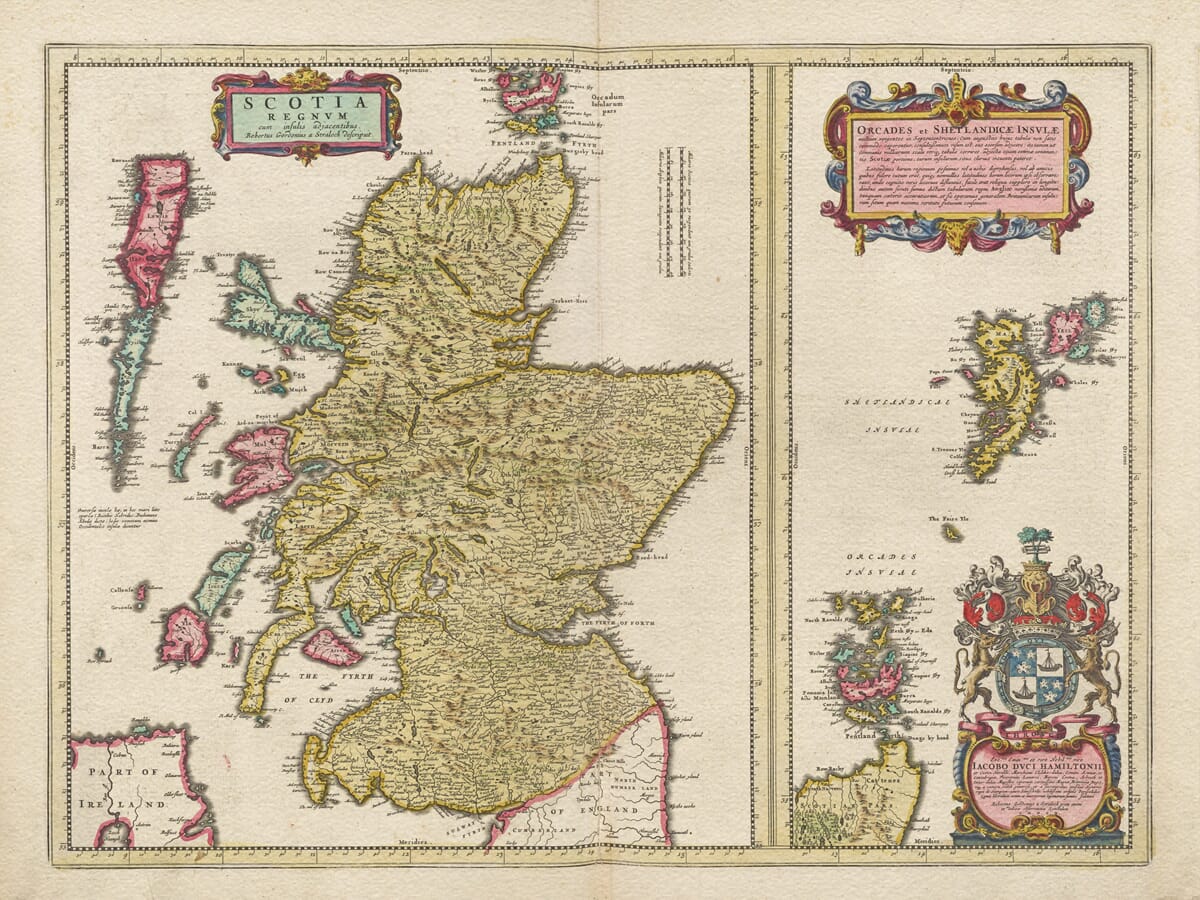
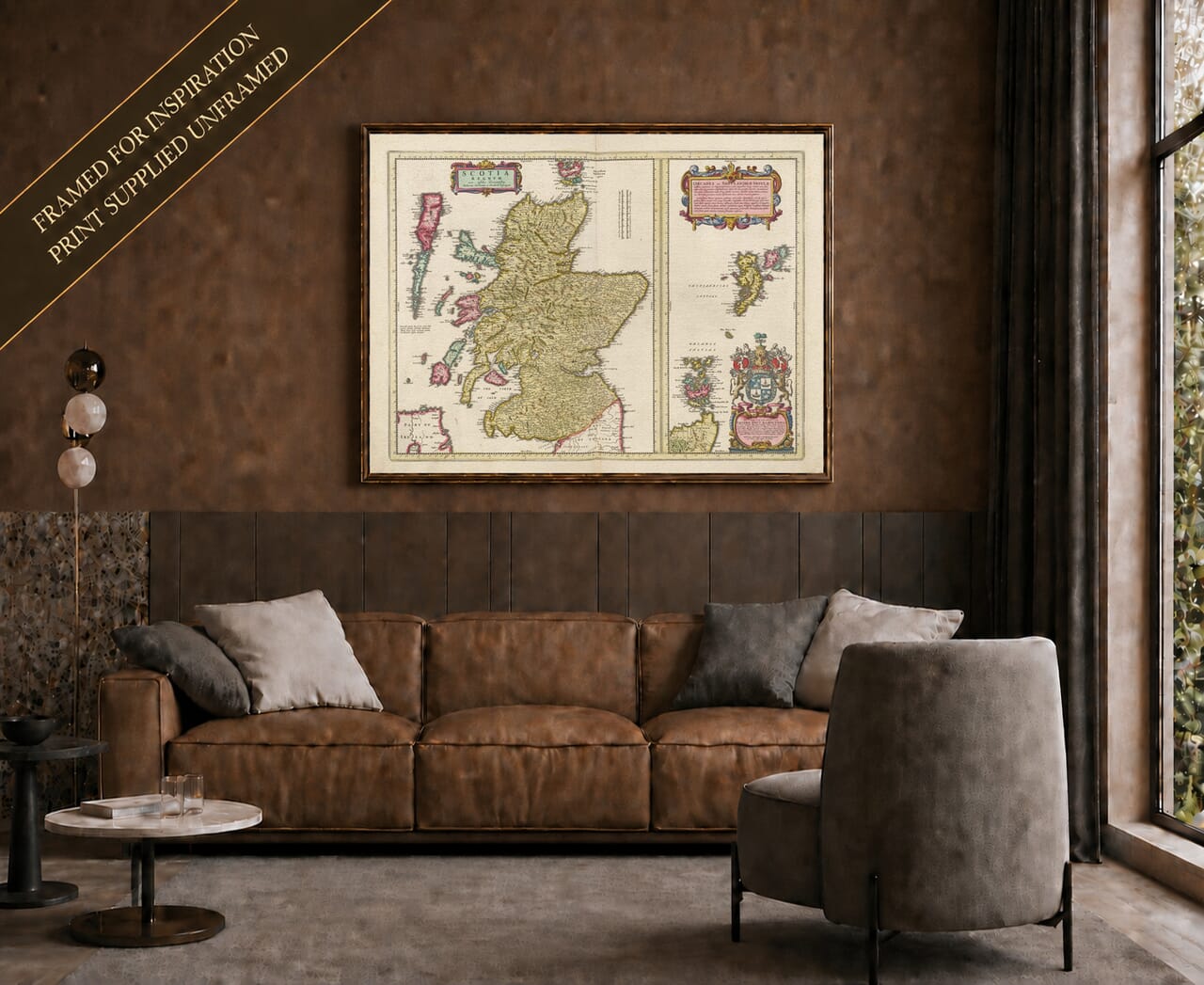
This imposing map of Scotland was drawn by Robert Gordon of Straloch and published by Joan Blaeu in Amsterdam in 1654. Its Latin title, Scotia Regnum cum insulis adjacentibus, may be translated as “The Kingdom of Scotland with its adjacent islands.”
The wording is significant. This is not merely a map of a northern region of Britain, but a portrait of Scotland presented as a complete and recognisable kingdom. Mainland, coast and islands are drawn together within one composition, giving the country a geographical identity that remains immediately familiar more than three and a half centuries later.
Robert Gordon of Straloch
Robert Gordon of Straloch was a Scottish landowner, scholar, antiquary and mapmaker. Born in 1580, he belonged to the cultured world of seventeenth-century Scotland and became an important figure in the long effort to transform manuscript surveys of the country into a published atlas.
That project had begun with Timothy Pont, who travelled extensively through Scotland during the late sixteenth century. Pont recorded coastlines, rivers, settlements and regional boundaries with a level of detail not previously attempted on such a scale. He died before his maps could be published, and the surviving manuscripts eventually came into the hands of those determined to preserve and complete his work.
Gordon was asked to revise and organise the material for Joan Blaeu’s Amsterdam workshop. He corrected earlier information, prepared maps for engraving and contributed eleven maps of his own. Scotia Regnum was one of Gordon’s original contributions: a general map designed to bring the many regions of Scotland together in a single view.
Blaeu supplied the resources of one of Europe’s finest cartographic publishing houses. The resulting atlas, issued in 1654, became the first printed atlas of Scotland and a landmark in the history of Scottish mapping.
Scotland from the Borders to the Northern Isles
The map follows Scotland from the English border northwards to the Pentland Firth. Edinburgh, Glasgow, Stirling, Perth, Aberdeen and Inverness can be found among a dense network of burghs, villages, castles and churches.
The Firths of Forth and Clyde cut deeply into the Lowlands, while the Tay, Dee, Spey and other rivers carry the eye into the interior. Mountain ranges are represented by repeated pictorial hills rather than modern contours, creating a rhythmic landscape across the Highlands and the central country.
Along the western seaboard, the coastline breaks into sea lochs, peninsulas and islands. Skye, Mull, Islay, Jura and the Outer Hebrides appear among the waters of the Atlantic. These islands were not decorative additions: they were essential parts of Scotland’s cultural, political and maritime world.
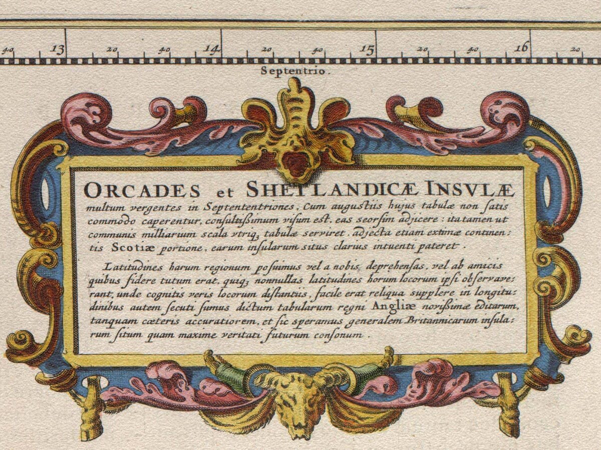
Orkney and Shetland are presented within a large inset extending down the right side of the engraving. This allowed Gordon and Blaeu to include the distant northern archipelagos at a useful scale without distorting the outline of mainland Scotland. A dedication to the Duke of Hamilton appears beneath the inset.
Reading a Seventeenth-Century Map
This historic map should not be interpreted as a modern measured survey. Roads are not systematically shown, distances remain approximate and the varied forms of mountains, woodland and settlements are represented through engraved symbols.
Its information was assembled from surveys and manuscripts prepared over several decades. The map therefore does not portray Scotland at one precise moment in 1654. Instead, it gathers the best geographical knowledge available to Gordon and Blaeu and presents it in a coherent national form.
Historic spellings are among its greatest pleasures. Familiar places appear under names that reflect local usage, Latinised forms or the variable spelling of the period. Examining these names can be particularly rewarding for anyone exploring Scottish ancestry, regional history or a personal connection with a particular town, glen or island.
The map appeared during a turbulent period. The Wars of the Three Kingdoms had brought conflict across Scotland, and by 1654 the country had been drawn into the Cromwellian Commonwealth. Blaeu’s engraving does not depict armies or political boundaries created by these events. Its image of Scotland is more enduring: a country defined by its land, waters, settlements and islands.
A Landmark of Scottish Cartography
The combination of Scottish surveying and Dutch engraving gives Scotia Regnum its distinctive character. Gordon supplied the geographical understanding, while Blaeu’s workshop transformed that knowledge into an elegant copperplate engraving intended for an international audience.
Original impressions were printed in black ink, with colour applied separately to selected copies. Surviving examples consequently vary in their colouring, but retain the same finely engraved coastlines, place names, rivers and decorative cartouches.
For admirers of antique maps,
Scotia Regnum represents a remarkable meeting of scholarship, craftsmanship and national identity. For those with Scottish roots, it offers something still more personal: the opportunity to trace familiar landscapes across a map created when the country was first being presented to Europe in such richness and detail.






 Verified owner
















