Historical Background — The Isle of Islay in Joan Blaeu’s Atlas of Scotland
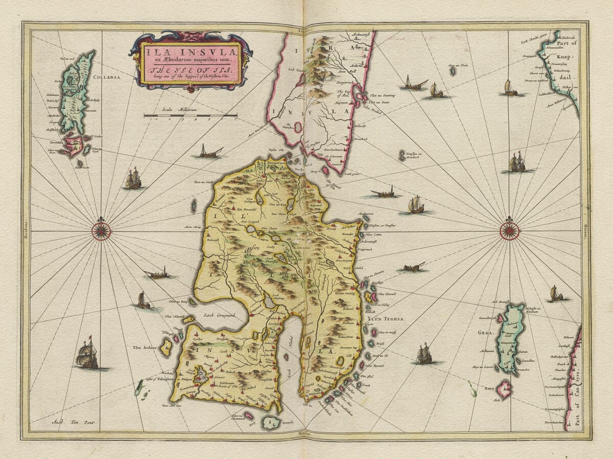
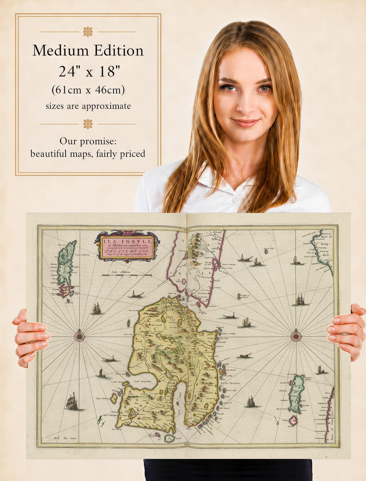
This remarkable seventeenth-century map of the Isle of Islay was published by Joan Blaeu in Amsterdam in 1654 as part of the Scottish volume of his celebrated Atlas Novus. Its original title, Ila Insula, ex Æbudarum majoribus una, is followed by the English description The Yle of Ila, being one of the biggest of the Westerne Yles. The geographical information was derived from the pioneering surveys of Timothy Pont, whose work provided the foundation for many of the maps in Blaeu’s first great printed atlas of Scotland. The National Library of Scotland specifically records the Islay map among the printed maps attributed to Pont.
Map Details
- Original title: Ila Insula, ex Æbudarum majoribus una — The Yle of Ila, being one of the biggest of the Westerne Yles
- Original surveyor: Timothy Pont
- Mapmaker and publisher: Joan Blaeu
- First published: Amsterdam, 1654
- Source atlas: Atlas Novus, Scottish volume
- Area shown: Islay with parts of Jura, Colonsay, Gigha, Knapdale and Kintyre
- Orientation: North at the top
- Format: Engraved atlas map with hand colouring on the original impression
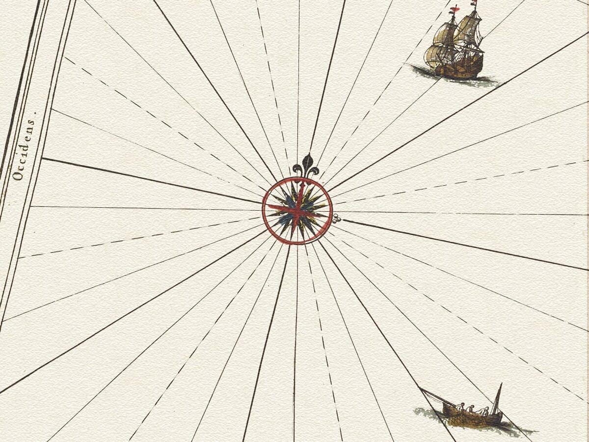
- Visible features: Loch Indaal and Loch Gruinart, pictorial hills, sailing ships and two compass roses with radiating rhumb lines
Pont travelled extensively through Scotland during the later sixteenth century, undertaking an extraordinary programme of first-hand mapping at a time when detailed regional surveys were extremely unusual. His work recorded settlements, rivers, lochs, castles, coastlines and the character of the landscape. Although Pont never succeeded in publishing his proposed Scottish atlas, his surviving surveys were preserved and eventually became central to Joan Blaeu’s ambitious project in Amsterdam.
The Islay sheet is particularly important because no surviving Pont manuscript map of the island is known today. Blaeu’s engraving therefore preserves geographical information originating in a survey made decades before its publication. The finished map belongs to the sophisticated world of seventeenth-century Dutch engraving, yet much of the landscape recorded upon it reflects Scotland as Pont encountered it around the end of the sixteenth century. Specialist cartographic research consequently regards the map as an exceptionally important early representation of Islay.
Islay dominates the composition, accompanied by parts of neighbouring Jura, Colonsay and Gigha, together with a portion of the Kintyre peninsula. Its irregular coastline, numerous bays and inland waters are represented in considerable detail. Hills are shown pictorially rather than by contours, while settlements and other features are indicated through conventional engraved symbols. The resulting image should not be read like a modern Ordnance Survey map, but as a record of the best geographical knowledge available to Pont and subsequently to Blaeu.
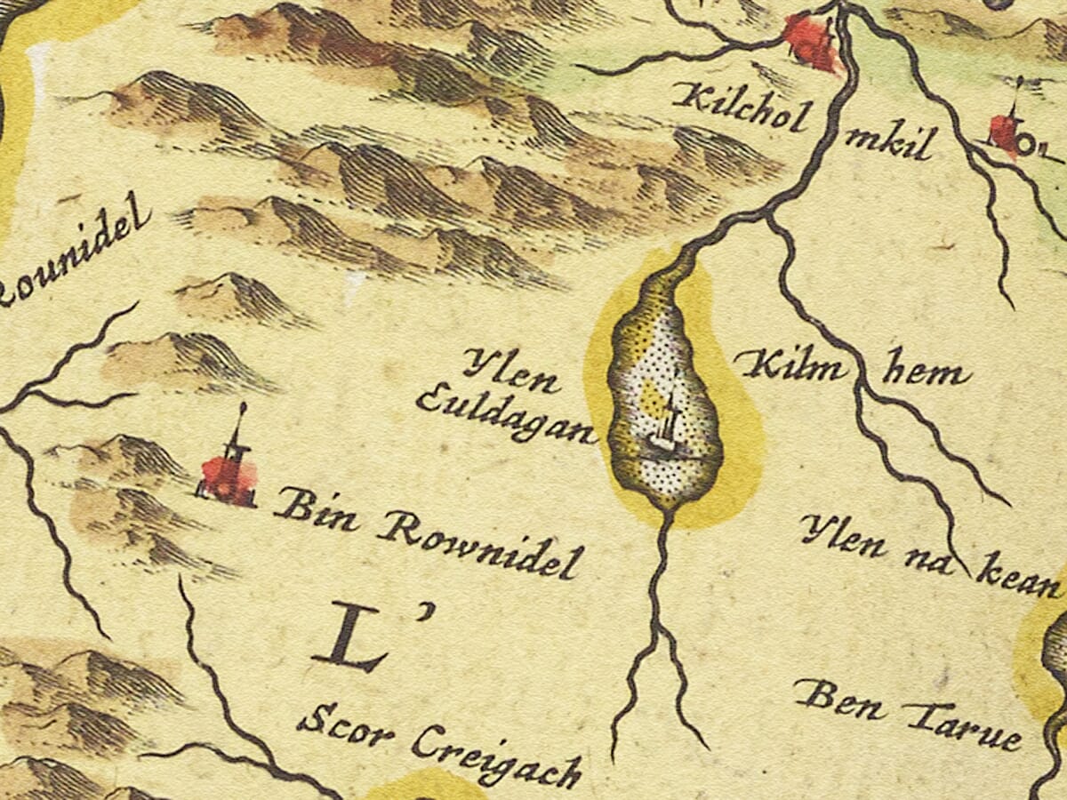
One of the map’s greatest attractions is its wealth of early place-names. Familiar locations appear in spellings reflecting the linguistic world of Pont’s Scotland, when Gaelic remained dominant across Islay and written forms were far from standardised. Names could be recorded phonetically, altered during copying or changed again when Scottish manuscripts were prepared for engraving in Amsterdam. This makes identifying some places a fascinating exercise and gives the map particular interest for anyone researching Islay ancestry or local history.
The map also belongs to a turbulent period in Islay’s history. For centuries the island had been closely associated with the MacDonalds and the Lordship of the Isles, but by the early seventeenth century royal intervention and the growing influence of the Campbells were transforming political control of the region. Dunyvaig Castle, overlooking the approaches to Lagavulin Bay, became a focus of repeated conflict. MacDonald forces captured it from Campbell and government control on several occasions, including in 1614 and 1615, with the castle subsequently retaken after siege. Fighting over Dunyvaig continued later in the century, demonstrating the strategic importance of Islay within western Scotland.
These events are especially interesting when viewed beside Blaeu’s map. The engraving was published in 1654, but Pont’s original geographical observations considerably pre-dated many of the political upheavals of the early seventeenth century. The map therefore preserves an island landscape whose geographical foundations belonged to the closing years of MacDonald dominance, even though the finished atlas appeared after Campbell authority had become firmly established.
Blaeu transformed this practical Scottish survey material into an elaborate work of cartographic art. The map was engraved on copper and embellished with an ornamental title cartouche and scale. Surviving examples were sometimes supplied with hand colouring, enhancing coastlines, decorative details and geographical divisions. The combination of Pont’s detailed observation with the craftsmanship of Blaeu’s Amsterdam workshop produced a map that was both informative and visually impressive.
Islay’s position within the Inner Hebrides also gives the map a strong maritime character. Before modern roads and regular ferry services, sea routes were fundamental to communication between Islay, Jura, Colonsay, Kintyre and the wider western seaboard. Bays and anchorages were consequently of practical importance, while castles and settlements often occupied sites commanding access to the surrounding waters.
Viewed today, Blaeu’s Yle of Ila provides an extraordinary window onto Islay more than four centuries ago. Its historic names, settlements, lochs and pictorial hills preserve a landscape recorded before modern surveying, while the circumstances of its creation link a pioneering Scottish mapmaker with one of Europe’s greatest seventeenth-century publishing houses. For anyone with a connection to Islay, it offers not simply a decorative old map, but an important visual record of the island at a formative period in its history.





 Verified owner