Blaeu’s Map of the Central Highlands: Braid-Allaban
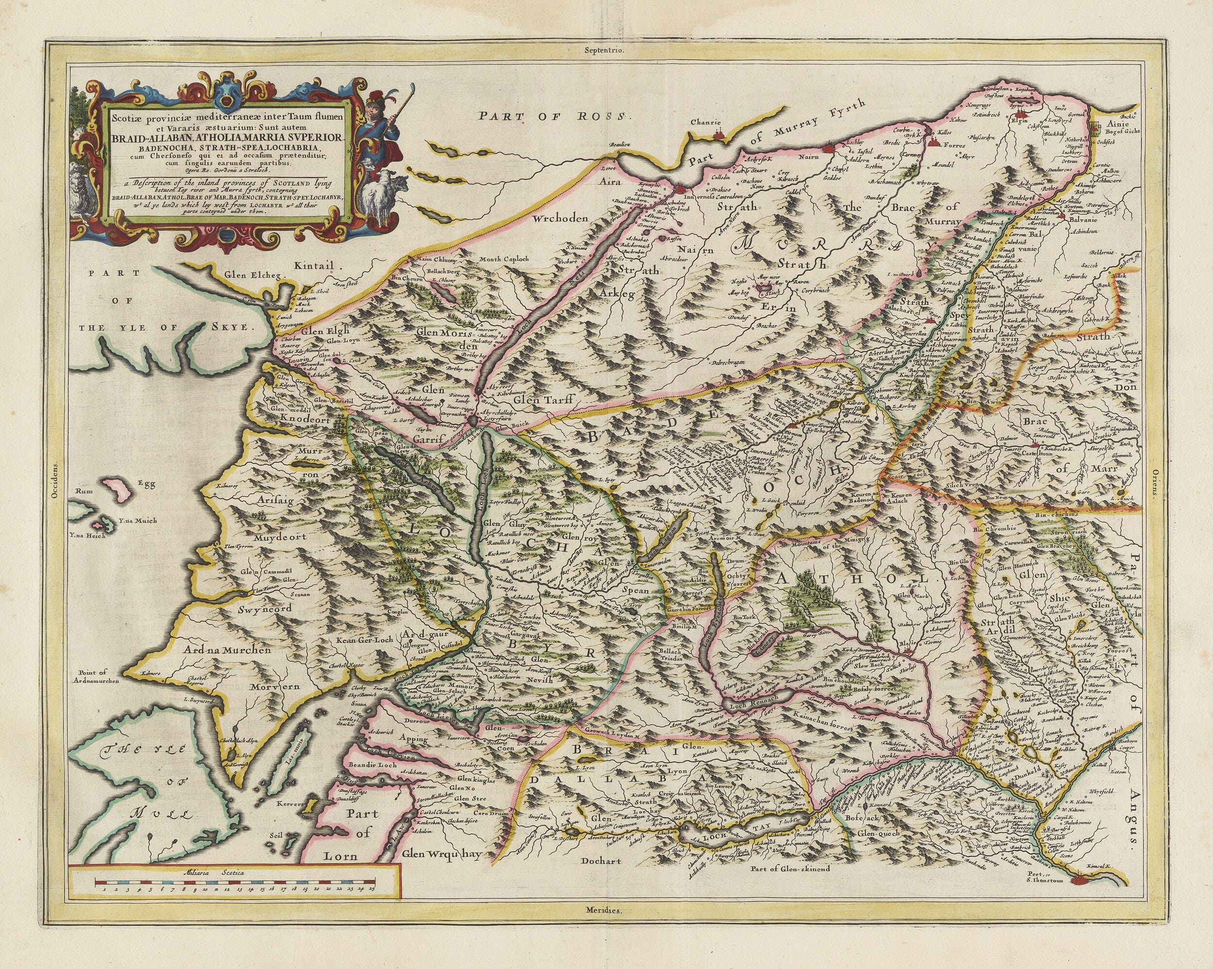
This extraordinary map was designed to describe the inland provinces of Scotland lying between the River Tay and the Moray Firth. Its lengthy title identifies the principal districts as Braid-Allaban, Atholia, Marria Superior, Badenocha, Strath-Spea and Lochabria—Breadalbane, Atholl, the Braes of Mar, Badenoch, Strathspey and Lochaber.
Unlike many of the Scottish maps in Joan Blaeu’s atlas, which were derived principally from the surveys of Timothy Pont, this engraving explicitly credits Robert Gordon of Straloch. Gordon brought together first-hand geographical knowledge, existing manuscript surveys and information supplied by local correspondents to create an ambitious picture of Scotland’s mountainous interior.
Map details
Original title: Scotiæ provinciæ mediterraneæ inter Taum flumen et Vararis æstuarium
Alternative title: A Description of the Inland Provinces of Scotland Lying Between Tay River and Murra Fyrth
Cartographer: Robert Gordon of Straloch
Publisher: Joan Blaeu
First published: Amsterdam, 1654
Area shown: Breadalbane, Atholl, Lochaber, Badenoch, Strathspey, the Braes of Mar and adjoining western districts
Source atlas: Theatrum Orbis Terrarum, sive Atlas Novus, Volume V
Product type: Fine art reproduction print of the historic map
Robert Gordon and the Mapping of Scotland
Robert Gordon of Straloch was a scholar, antiquary and mapmaker with an intimate knowledge of northern and central Scotland. During the 1640s he played an important role in preparing Scottish geographical material for publication by Joan Blaeu in Amsterdam.
Gordon examined and revised surviving work by Timothy Pont while also producing maps of his own. His involvement gave Blaeu access to Scottish knowledge that could not have been obtained from Amsterdam alone. The engraved inscription Opera R. Gordonii a Straloch—“the work of Robert Gordon of Straloch”—ensures that his contribution remains permanently recorded on the plate.
The finished map appeared in 1654 in the fifth volume of Blaeu’s Atlas Novus. This Scottish volume contained 49 maps and is regarded as the first printed atlas devoted to Scotland. Blaeu’s workshop turned Gordon’s geographical information into a finely engraved and visually imposing map intended for an international audience.
Across the Central Highlands
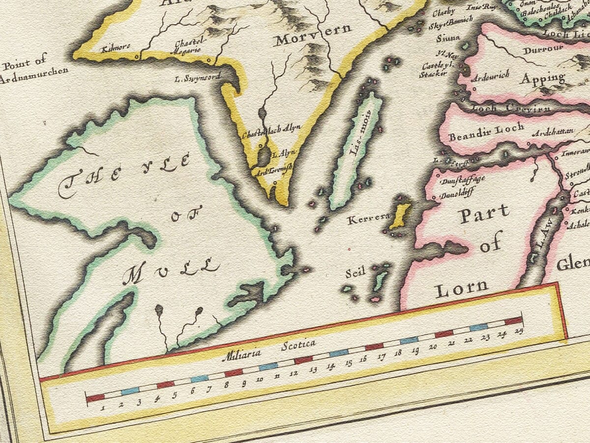
The map extends from the River Tay and Loch Tay in the south to the shores of the Moray Firth in the north. Its western edge reaches the sea lochs facing Skye, Rum and Eigg, while the eastern side takes in Strathspey, Upper Mar and adjoining parts of Angus.
Breadalbane—written as Braid-Allaban—occupies the mountainous country around Loch Tay. Atholl lies farther east, while Badenoch and Strathspey extend northwards through the heart of the Highlands. Lochaber reaches west towards the Atlantic, encompassing a rugged landscape of deep glens and long sea lochs.
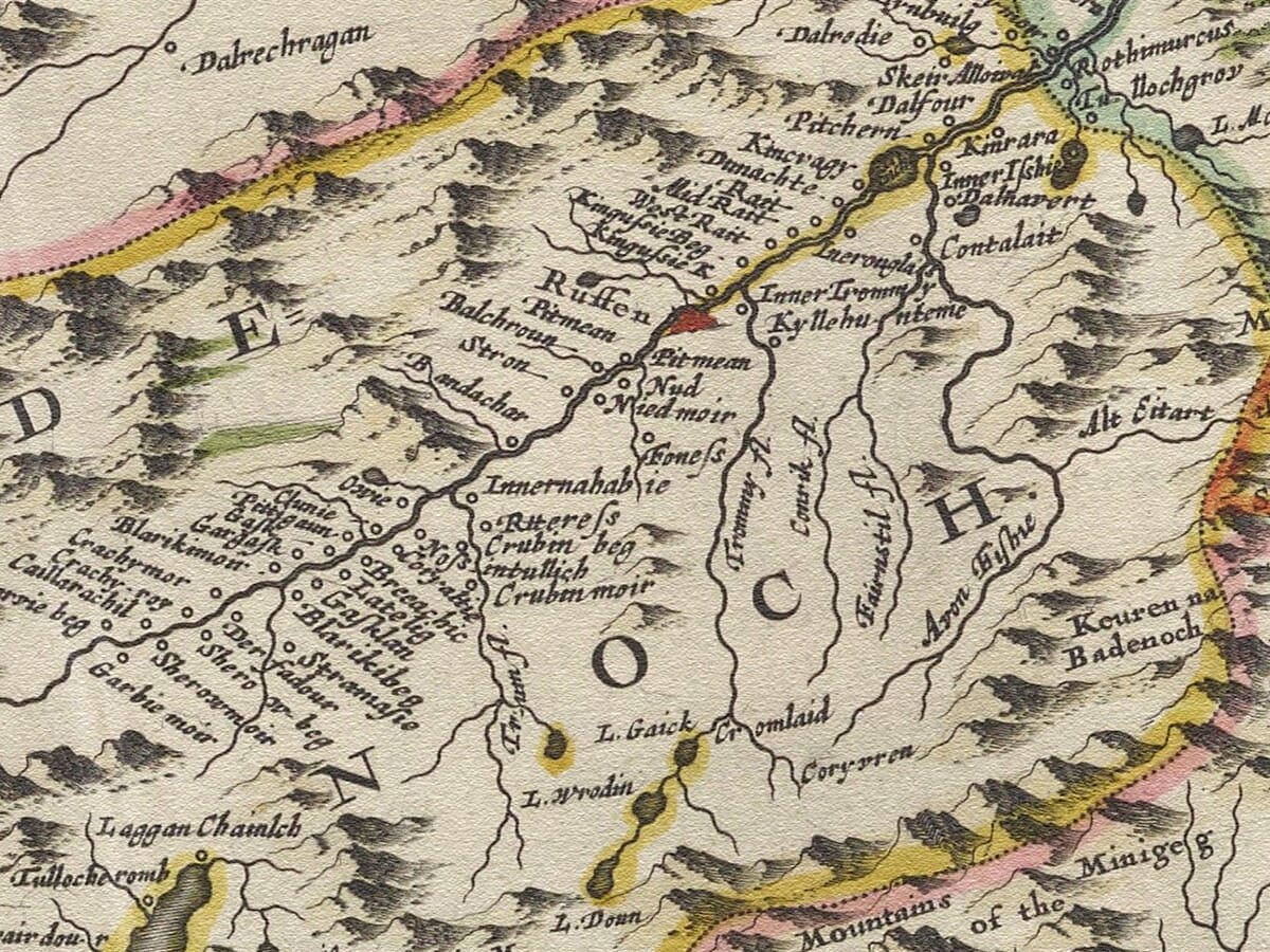
Many familiar Highland names appear in recognisably early forms. Glen Garry, Glen Moriston, Glen Roy, Glen Spean and Glen Coe can be traced among ranges of pictorial mountains. Loch Rannoch and Loch Tay provide strong points of orientation, while the River Spey winds north and east towards Moray.
The map also includes the Braes of Mar, upper Deeside and the mountain country leading towards the Cairngorms. At its margins are parts of Ross, Moray, Angus, Lorn and the western coast opposite the Inner Hebrides.
A Landscape Before Modern Roads
This was not an easy country to survey. Mountains, forests, rivers and long distances separated communities, while travel generally followed glens, passes and waterways. Gordon’s achievement lay in organising a large and complicated landscape into a map that could be understood by readers who might never have visited Scotland.
The engraving should not be interpreted as a modern measured survey. Mountains are shown as individual pictorial forms, and their size is intended to convey the mountainous nature of the country rather than exact elevation. Woodland appears as groups of tiny trees, while settlements, castles and churches are represented by conventional symbols.
Roads are not recorded systematically. Instead, the pattern of glens, rivers and inhabited places suggests the natural routes through the Highlands. This makes the map particularly fascinating: modern roads often follow corridors that were already important when Gordon assembled his geographical information.
The Character of Blaeu’s Engraving
A richly coloured cartouche occupies the upper-left corner. Its Latin title is followed by an English explanation of the territory shown, making the map accessible to both continental and Scottish readers. A figure carrying a bow stands beside the cartouche, accompanied by animals that reinforce the impression of a remote Highland landscape.
The map is densely filled with mountains, forests and watercourses, yet its engraved lettering remains remarkably delicate. A scale of Scottish miles appears at the lower left, while coloured boundary lines distinguish the historic provinces.
More than three and a half centuries later, the map retains a powerful sense of discovery. It allows the eye to travel from Loch Tay through Atholl and Badenoch, along Strathspey and westwards into Lochaber—a sweeping portrait of the Central Highlands before military roads, railways and modern tourism transformed the experience of crossing the country.





 Verified owner