Joan Blaeu’s Map of Lennox and Dunbartonshire
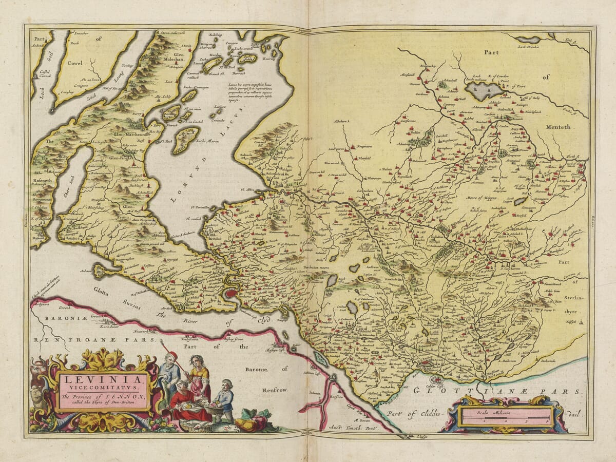
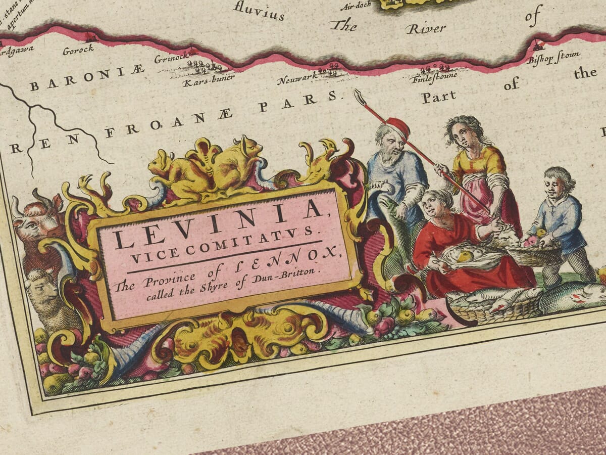
Joan Blaeu published this detailed map in Amsterdam in 1654 as part of the first printed atlas devoted entirely to Scotland. Its principal title is Levinia Vicecomitatus, accompanied by the English description “The Province of Lennox called the Shire of Dun-Briton.”
The wording is significant. Blaeu was not simply presenting the boundaries of a later administrative county. His map preserves the older regional identity of Lennox, a historic territory extending around Loch Lomond, the Vale of Leven and adjoining districts that eventually became divided between Dunbartonshire and Stirlingshire.
Map details
- Original title: Levinia Vicecomitatus: The Province of Lennox called the Shire of Dun-Briton
- Original surveyor: Timothy Pont
- Publisher: Joan Blaeu, Amsterdam
- First published: 1654
- Area shown: Lennox, historic Dunbartonshire, Loch Lomond, the Vale of Leven and adjoining districts
- Principal places: Dumbarton, Luss, Balloch, Cardross, Rosneath and Kilpatrick
- Source atlas: Theatrum Orbis Terrarum, sive Atlas Novus, Scotland volume
- Product type: Fine art reproduction print of the historic map
From Timothy Pont’s Surveys to Blaeu’s Atlas
The geography originated principally with Timothy Pont, the pioneering Scottish cartographer who travelled throughout Scotland during the late sixteenth and early seventeenth centuries. Pont recorded settlements, rivers, lochs, castles and landscape features at a level of detail never previously attempted across the country.
Pont died before his planned atlas could be published. His manuscript maps were subsequently collected and prepared for publication with the assistance of Sir John Scot of Scotstarvet and the Aberdeenshire cartographer Robert Gordon of Straloch. The surviving material eventually reached Joan Blaeu’s workshop in Amsterdam.
Blaeu reorganised and engraved this information for his Scottish atlas, giving Pont’s field observations the refined typography, colour and decorative treatment associated with Dutch Golden Age mapmaking. The resulting volume appeared in 1654 and transformed Scotland into one of the most extensively mapped countries of seventeenth-century Europe.
The Ancient Province of Lennox
Lennox was an ancient provincial territory closely associated with Loch Lomond and the valley of the River Leven. Much of it later became Dunbartonshire, although the historic earldom also extended into western parts of Stirlingshire.
This explains why Blaeu’s map reaches beyond boundaries that might be expected from a modern map of Dunbartonshire. It is better understood as a portrait of Lennox and its neighbouring lands—a region connected by waterways, glens, estates and long-established relationships rather than by modern administrative lines.
Loch Lomond dominates the upper portion of the engraving. Its elongated form, numerous islands and surrounding mountains create one of the map’s most memorable features. The loch is presented not as an isolated scenic landmark but as the heart of an inhabited landscape, with settlements and estates recorded along its shores.
To the west, parts of Loch Long and the mountainous country towards Argyll appear around the edge of the map. To the east lie territories associated with Menteith and Stirlingshire, while the Clyde and lands of Renfrew define much of its southern setting.
From Loch Lomond to Dumbarton Rock
The River Leven provides a natural route from the southern end of Loch Lomond to the Clyde. Along this short but important river corridor, Blaeu records communities, residences and cultivated land stretching towards Dumbarton.
Dumbarton occupies a commanding position where the Leven enters the Clyde. Its famous rock and fortress guarded a strategically important meeting of river and firth. The site had been known in earlier centuries as Alt Clut, the Rock of the Clyde, and later as Dùn Breatainn, the fortress of the Britons—the origin of the name Dumbarton.
The spelling found on historic maps varies. Blaeu’s English title uses “Dun-Briton”, while the historic county became commonly known as Dunbartonshire and the town as Dumbarton. These differences are not errors but part of the changing written history of Scottish place names.
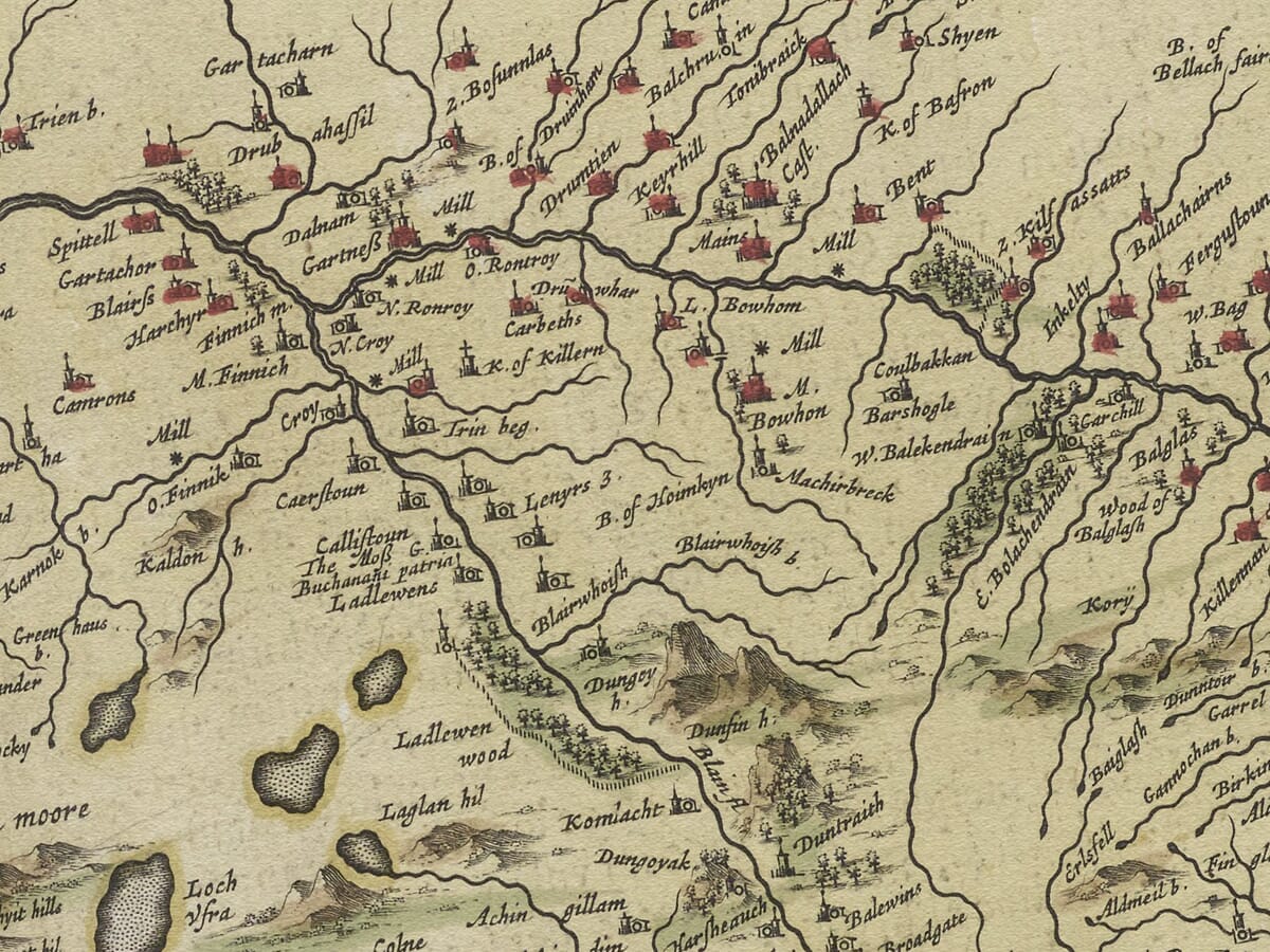
Cardross, Rosneath, Luss and numerous smaller communities can be found among the dense network of names. Many are shown through small building or tower symbols, while more important houses and strongholds receive distinctive pictorial treatment.
Reading the Seventeenth-Century Landscape
This antique map predates scientifically measured contours and modern road mapping. Mountains rise as individually engraved profiles, woodland is suggested pictorially, and settlements vary in prominence according to their perceived importance.
Rivers, burns, lochs and coastal inlets receive exceptional attention. In a landscape where overland travel could be slow and difficult, waterways were essential geographical guides. The concentration of names around Loch Lomond and along the Leven and Clyde reveals how closely settlement followed the natural shape of the land.
The map is especially valuable for family and local history because it preserves early forms of place names and identifies estates, castles and communities that may subsequently have changed, disappeared or become absorbed into larger towns.
Decorative Cartography
Blaeu framed this wealth of geographical information with two finely coloured cartouches. The title is surrounded by figures and elaborate scrolling ornament, while a separate scale cartouche balances the composition. Their warmth and colour provide an attractive contrast to the mountainous country, dark waterways and intricate network of settlements.
The result is more than a geographical record. It is an expressive portrait of Lennox and Dunbartonshire at the threshold between Highland and Lowland Scotland—a place of sheltered lochs, steep glens, ancient strongholds and routes leading south towards the Clyde.
For anyone whose family, memories or affections are tied to Loch Lomond and Dunbartonshire, this old map offers a distinctive way to bring that landscape and its history into the home.





 Verified owner

















