Joan Blaeu’s Seventeenth-Century Map of Renfrewshire
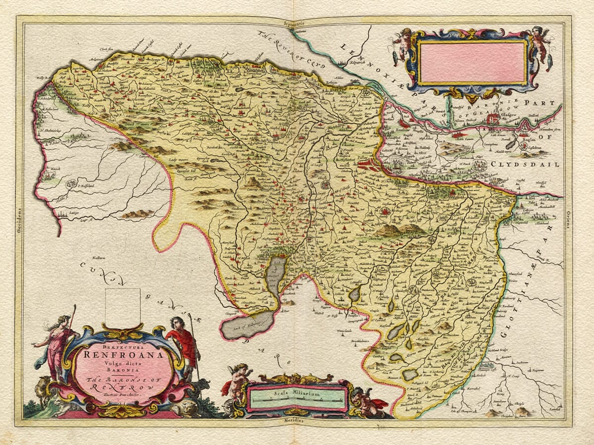
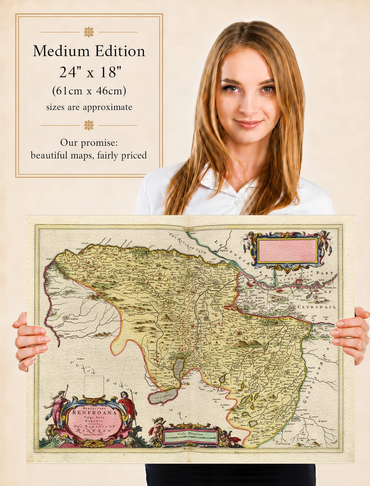
Published in Amsterdam in 1654, Praefectura Renfroana, vulgo dicta Baronia – The Baronie of Renfrow is one of the earliest detailed printed maps devoted to Renfrewshire. The sheet formed part of Joan Blaeu’s great Atlas of Scotland and was based upon the pioneering survey work of Timothy Pont, whose name appears directly in the title as Timotheus Pont Auctor. Pont’s observations were made decades before the map was finally engraved and published, meaning that much of the landscape depicted reflects Renfrewshire around the end of the sixteenth century.
Map Details
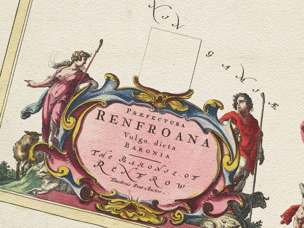
Original title: Praefectura Renfroana, vulgo dicta Baronia. The Baronie of Renfrow. Timotheus Pont Auctor
Original cartographer / surveyor: Timothy Pont
Publisher: Joan Blaeu
First published: Amsterdam, 1654
Area shown: Historic Renfrewshire and the Barony of Renfrew, including the lower Clyde and the valleys of the White and Black Cart
Principal places and features: Renfrew, Paisley, Govan, the River Clyde, White Cart and Black Cart waters, settlements, estates, castles and the Renfrewshire uplands
Decoration: Shepherd and shepherdess flanking the title, putti decorating the scale, and an unused heraldic/dedication panel
Source atlas: Theatrum Orbis Terrarum, sive Atlas Novus, Pars Quinta — Atlas of Scotland, 1654
Product type: Reproduction of a seventeenth-century copper-engraved map
Timothy Pont’s surveys are among the most remarkable achievements of early Scottish cartography. During the closing decades of the sixteenth century he travelled through much of Scotland recording rivers, settlements, castles, estates, churches and geographical features. His maps were never published during his lifetime, but his manuscripts survived and ultimately became the foundation for many of the regional maps included in Blaeu’s Scottish atlas.
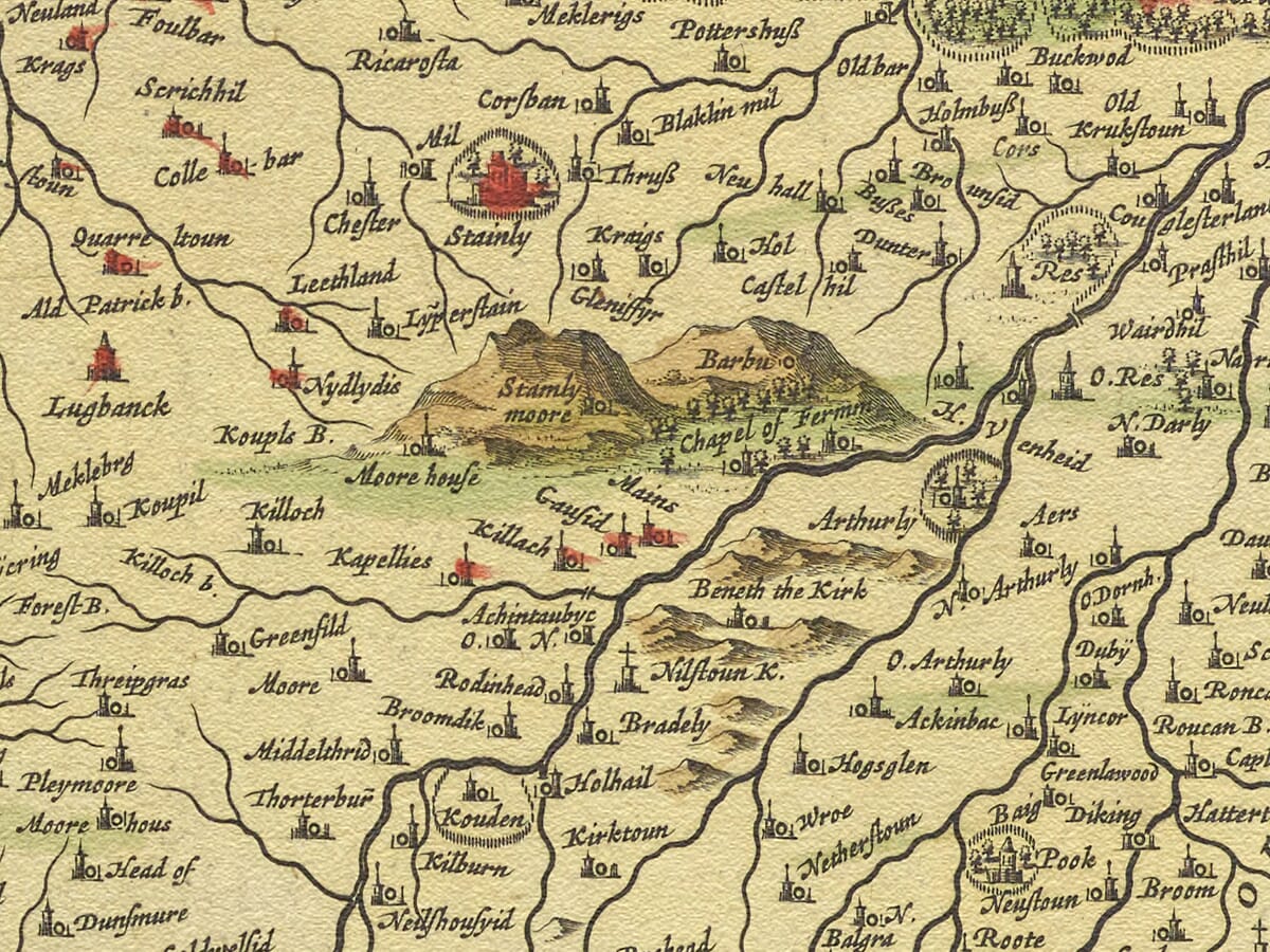
Renfrewshire was particularly well suited to Pont’s detailed style of mapping. The county contained both an increasingly important Clyde-side landscape and extensive rural territory stretching south and west from the river. The academic history of Renfrewshire’s early cartography notes that settlement on Pont’s map is especially concentrated around the lower reaches of the two Cart Waters, while the Renfrewshire Heights are also clearly represented.
Renfrew, the historic county town, occupies an appropriately important place on the sheet. Its location close to the confluence of the Clyde and Cart waterways made the district significant for communications and settlement long before the industrial transformation of the Clyde.
Nearby Paisley is also readily identifiable. In Blaeu’s period it was already an important community centred upon its medieval abbey, though the textile industries that would later make the town internationally famous still lay far in the future. The map therefore records Paisley within an overwhelmingly pre-industrial landscape of estates, farms, rivers and small settlements.
One particularly interesting part of the map is the district around Govan. Archaeological research by the University of Glasgow has compared Pont’s manuscript mapping with Blaeu’s published sheet and notes that Govan was represented as an unusually prominent settlement. On the Blaeu map it appears as “Meckle Govan”, while nearby Gorbals is represented as “Little Govan”. Such details provide a fascinating picture of communities on the Clyde centuries before Glasgow’s later expansion absorbed much of the surrounding landscape.
Further west, the map records estates and fortified houses along the lower Clyde. Easter Greenock, for example, is represented as a substantial castle on Blaeu’s 1654 map, providing evidence for the settlement pattern that existed long before Greenock developed into a major port and shipbuilding centre.
The waterways themselves are fundamental to understanding the map. The River Clyde, White Cart, Black Cart and Gryffe formed natural routes through the region. At Inchinnan, the Cart rivers and Gryffe converge close to the Clyde, a location whose geographical importance is reflected both in early settlement and in Pont’s detailed mapping.
Blaeu transformed this wealth of practical geographical information into an exceptionally decorative atlas sheet. The title cartouche is flanked by a shepherd and shepherdess, while cherubs decorate the scale bar, one holding a pair of dividers associated with the art of surveying. Above the title is a blank shield intended for a coat of arms, and another unused decorative space appears elsewhere on the sheet. The specialist history of the map records these as spaces apparently intended for a dedication that was never supplied.
These blank areas are particularly intriguing. As we found with Kirkcudbrightshire, spaces for heraldry or dedications were sometimes prepared before a patron or final inscription had been settled. In Renfrew’s case the unused areas are part of the original printed design; they are not missing material from the reproduction.
The map also contains imperfections that make it especially interesting as a historical document. Research into Renfrewshire cartography notes an incorrect alignment between parts of the coastline and the north-western boundary. Such discrepancies are reminders that this was produced long before triangulation, modern surveying instruments or the Ordnance Survey.
When Joan Blaeu finally issued the Atlas of Scotland in 1654, Pont had been dead for decades. Yet the resulting maps preserved an extraordinary amount of his geographical information. The Renfrewshire sheet was subsequently reprinted in later Blaeu editions, but specialist catalogues identify 1654 as the date of the first edition.
Today The Baronie of Renfrow gives us a remarkable view of Renfrewshire before the great industrial expansion of Glasgow, Paisley, Greenock and the Clyde corridor. Familiar rivers and place-names remain recognisable, while castles, small communities and old spellings reveal a landscape profoundly different from that of modern west-central Scotland.
For anyone with connections to Renfrew, Paisley, Govan, Greenock or Renfrewshire, Blaeu’s map provides both an impressive work of seventeenth-century cartography and a detailed visual record of the region more than four centuries ago.
Browse our collection of old maps of Scotland.





 Verified owner