Old Map Yorkshire West
Old Map Yorkshire West Yorkshire West Old Yorkshire West Map detail

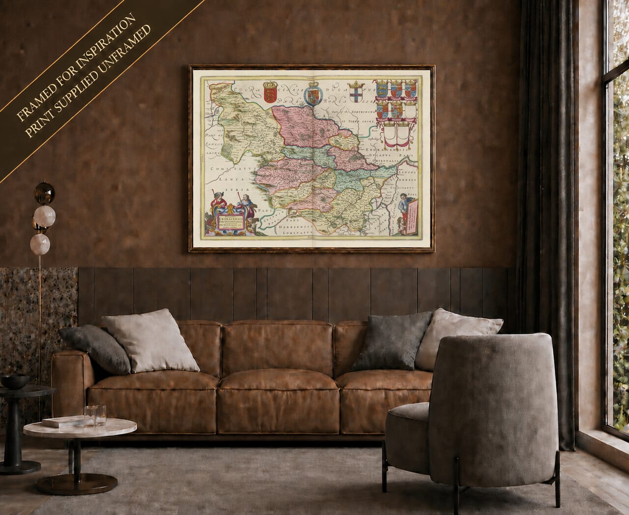
Vintage Map of West Yorkshire by Joan Blaeu, 1645

Price range: £35.55 through £59.95

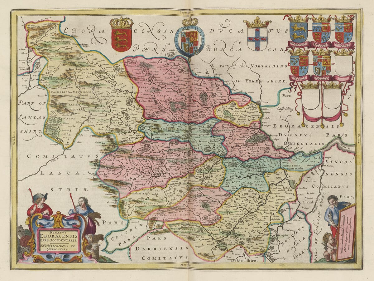
This richly detailed vintage map of West Yorkshire was created by Joan Blaeu and first published in Amsterdam in 1645. Entitled Ducatus Eboracensis Pars Occidentalis; The Westriding of Yorke Shire, it depicts the historic West Riding, a much larger region than the modern county of West Yorkshire.

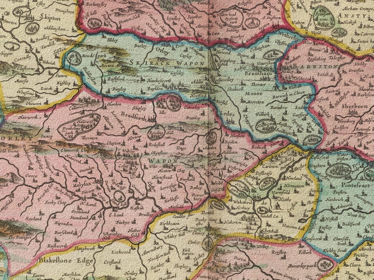
Leeds, Bradford, Halifax, Wakefield, Huddersfield, Sheffield, Doncaster and numerous smaller communities appear among the Pennine hills, river valleys and agricultural country. The map captures these familiar places before industrial expansion transformed them into major centres of textile production, engineering and manufacturing.

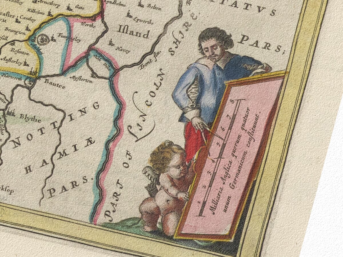
Two decorative figure cartouches and an impressive display of heraldic arms complement the finely engraved geography. Our reproduction preserves the colour, intricate linework and historic character of the original copperplate map and is produced as a fine art print on subtly textured paper.
+ read more

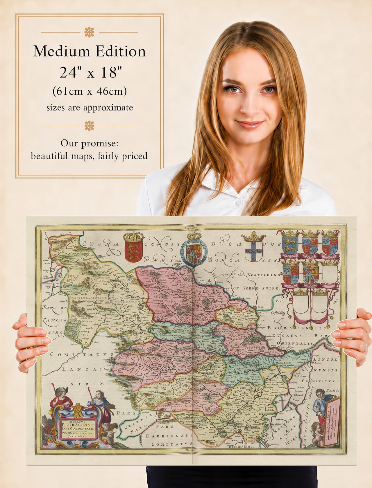
A stunning certified FINE ART PRINT on heavy textured art paper — not a poster

  • Direct from the publisher — no middlemen
  • Printed in-house in Cornwall
  • Free UK delivery — international shipping available
  • Produced to meet — and often exceed — museum-quality standards

SELECT SIZE

Inspecting Vintage Map Reproduction

Fine Art Map Reproductions – Museum-Quality Printing

Unlike most online offerings, our maps are produced entirely in-house, not outsourced to print-on-demand or drop-shipping services. This allows complete control over quality while offering better value. Each map begins with a high-resolution original, carefully enhanced and printed to order using archival papers and pigment inks for exceptional clarity, depth, and longevity. Every piece is personally overseen — no map leaves our workshop unless it is of a quality we would be proud to display ourselves.

Hand hold a magnifying glass over West Cornwall Map

Authentic Old Map Paper & Accurate Colour Reproduction

Paper choice is essential to the authenticity of our maps. We use specially sourced 190gsm paper made in the UK from pure materials and traditionally pressed with natural woollen felts. This process creates a subtle, randomly textured surface that closely resembles an original antique document. Likewise the use of premium quality ink fully saturates the paper, producing remarkable clarity, depth, and historical character. Colour fastness and sharpness will remain good for in excess of 100 years!

Map in Postal Tube
Buy Old Maps Online in the UK Today Trading online since 1999

The Old Map Company of Great Britain offers a vast and carefully curated collection of the very finest expertly reproduced vintage maps. Our range includes works by renowned cartographers such as John Speed and Willem Blaeu, covering Scotland, England, and beyond. Free UK courier delivery is included, with EU, USA, and worldwide shipping available at cost and calculated at checkout. If you need assistance, our team is always happy to help you choose the perfect map.

RECENT REVIEWS

Daz
DazGB
Verified ownerVerified owner
5/5

Speedy delivery A beautiful representation

2 months ago
David H
David H
Verified ownerVerified owner
5/5

Got there in time and loves it! Cheers David [Gift from US to UK]

4 months ago
Ellan C-S
Ellan C-S
Verified ownerVerified owner
5/5

Thanks Lauren. We received it today - it's gorgeous! Thank you, Ellan

4 months ago
Ivano Di Battista
Ivano Di Battista
Verified ownerVerified owner
5/5

Thank you for your prompt service. I have a gallery and framing business in South Wales. I'm so pleased it is printed in the UK

4 months ago
Robert B
Robert B
Verified ownerVerified owner
5/5

My Isles of Scilly map arrived safely and I'm delighted with it!

5 months ago
Andrew T
Andrew T
Reviewer
5/5

The print arrived safely and we're delighted with it - a lovely reminder of our honeymoon 15 years ago.

5 months ago
Hannah J
Hannah J
Verified ownerVerified owner
5/5

I have just received them! I'm sure our clients will be pleased with them and there could be more projects off the back of this one where we can use more. [Interior Designers]

5 months ago
Sean MacManus
Sean MacManus
Verified ownerVerified owner
5/5

I just received my map of Ireland by Ewart today and, as usual, I am delighted by its quality. The crispness and fineness of detail is excellent and the colour reproduction surpasses my expectations. Please relay my thanks to Steve for another fine effort!

5 months ago
John G
John G
Verified ownerVerified owner
5/5

Many thanks, Lauren. Very pleased with the map and the service: would recommend The Old Map Company to anyone interested in Old Maps.

7 months ago
Lois K
Lois K
Verified ownerVerified owner
5/5

Thrilled , Lauren! Thank You

7 months ago
Ed Simpson
Ed Simpson
Verified ownerVerified owner
5/5

Many thanks, the map arrived safely this morning, and I’m really pleased with it. A stunning reproduction, just as I had hoped. I will keep browsing your website, and may yet be tempted by more of your items! Have a great weekend.

7 months ago
Daniel McCade
Daniel McCade
Verified ownerVerified owner
5/5

Just arrived, wonderful map! Thanks very much!

8 months ago
Jonathon R
Jonathon R
Verified ownerVerified owner
5/5

The map – beautiful – arrived safely, very many thanks.

1 year ago
Rasa Terbetiene
Rasa Terbetiene
Verified ownerVerified owner
5/5

Thank you, I have already found the map. It’s wonderfull! Good luck! Rasa

4 years ago
Mina M.
Mina M.
Verified ownerVerified owner
5/5

My apologies for the very late reply. I wanted to reach out to thank you so much for rushing my order. My partner absolutely loved it. I am amazed with the service so that is a five-star from me. I wish you all the best.

4 years ago

Joan Blaeu’s Map of Yorkshire’s Historic West Riding

Joan Blaeu’s map of the West Riding of Yorkshire was first published in Amsterdam in 1645. Its engraved title, Ducatus Eboracensis Pars Occidentalis; The Westriding of Yorke Shire, identifies it as the western division of England’s largest historic county.

The map appeared in the fourth volume of Blaeu’s Theatrum Orbis Terrarum, sive Atlas Novus, devoted to England and Wales. Blaeu issued a general Yorkshire map together with separate plates for the North, East and West Ridings, enabling the county’s settlements and varied landscapes to be represented in greater detail.

Joan Blaeu and His Yorkshire Maps

Joan Blaeu inherited the family mapmaking and publishing business following the death of his father, Willem Blaeu, in 1638. The West Riding map was produced during Joan’s management of the Amsterdam workshop and should be attributed to him.

Blaeu did not conduct a new survey of Yorkshire. His geographical information was derived largely from earlier English county mapping, particularly the work of John Speed and the surveying tradition established by Christopher Saxton. Blaeu’s workshop refined and re-engraved this material, combining it with elaborate decoration and typography.

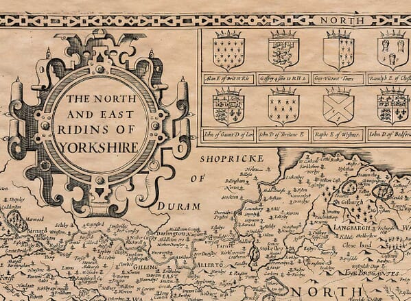
The map can be compared with our old map of Yorkshire’s West Riding by John Speed. Although both maps draw upon the same broad cartographic tradition, their engraving, arrangement and decorative treatment are distinct.

A Region Larger Than Modern West Yorkshire

The historic West Riding covered a considerably greater area than the present ceremonial county of West Yorkshire. It extended from parts of the Yorkshire Dales and the Pennines in the northwest to Sheffield and Doncaster in the south and eastwards towards York and the River Ouse.

The region included places now associated with South Yorkshire and parts of North Yorkshire, as well as Leeds, Bradford, Wakefield, Halifax and Huddersfield. The term “Riding” developed from an Old Norse word meaning a third part, reflecting Yorkshire’s long history of Scandinavian settlement and administration.

Blaeu represents the Pennines and other higher ground through conventional pictorial hills. Woodland appears as groups of trees, while towns and villages are distinguished by engraved building and church symbols. Roads are not shown systematically, and the map was not intended to provide the measured accuracy of a modern survey.

Its rivers are particularly prominent. The Aire and Calder flow eastwards through some of the settlements that later became central to the woollen industry. The Don connects Sheffield, Rotherham and Doncaster, while the Wharfe runs through the northern part of the Riding towards the Ouse.

Towns Before the Industrial Revolution

Leeds, Bradford, Halifax, Wakefield, Huddersfield and Sheffield are all identifiable, but none yet possessed the extensive urban landscape created during the Industrial Revolution. On Blaeu’s map they remain individual towns surrounded by villages, fields, moorland and wooded valleys.

The woollen textile trade was already important. Cloth production frequently took place in domestic workshops, with spinning, weaving and finishing distributed among families and small communities. Market towns provided places where raw wool, yarn and finished cloth could be exchanged.

Leeds and Halifax were developing as important textile centres, while Wakefield benefited from its position beside the River Calder and established regional routes. Sheffield already had a strong reputation for metalworking and cutlery; the Company of Cutlers in Hallamshire had been incorporated in 1624.

Elsewhere, farming, livestock, coal working, quarrying and lead mining contributed to the economy. These activities would expand dramatically during later centuries, assisted by canals, turnpike roads and railways that did not yet exist when Blaeu’s antique map was published.

The West Riding During the Civil War

The map appeared after several years of serious conflict in Yorkshire. Leeds and Bradford were contested by Royalist and Parliamentarian forces, and the Battle of Adwalton Moor was fought near Bradford in June 1643. The Royalist victory forced Parliamentarian troops to withdraw from much of the district.

The balance of power changed following the Parliamentarian victory at Marston Moor in July 1644. Pontefract Castle nevertheless remained an important Royalist stronghold and endured repeated sieges before finally surrendering in 1649.

Blaeu’s map does not depict these events. It was created as a geographical and decorative work rather than a military record, presenting a calm image of a region that had recently experienced considerable disruption.

Cartouches and Heraldic Display

The map contains two finely engraved figure cartouches. One encloses the title, while the other presents the scale in English miles. Royal and English coats of arms appear alongside the traditional arms of Yorkshire.

Eight further family shields form part of the heraldic decoration, although three were left blank. Such unfilled shields occur on several of Blaeu’s English county maps and should not be mistaken for damage or incomplete colouring.

Original examples were printed in black ink from an engraved copperplate, with colour applied separately to selected impressions. The plate was reused in later editions, which may carry Latin, French, Dutch, German or Spanish text on the reverse.

Today, Blaeu’s historic county map provides a striking view of the West Riding before factories, canals, railways and rapid urban growth altered its character. It preserves the earlier geography beneath modern West and South Yorkshire while demonstrating the decorative quality associated with the finest seventeenth-century Dutch atlases.


You may also like…

×
Product added to cart
No products in the cart.