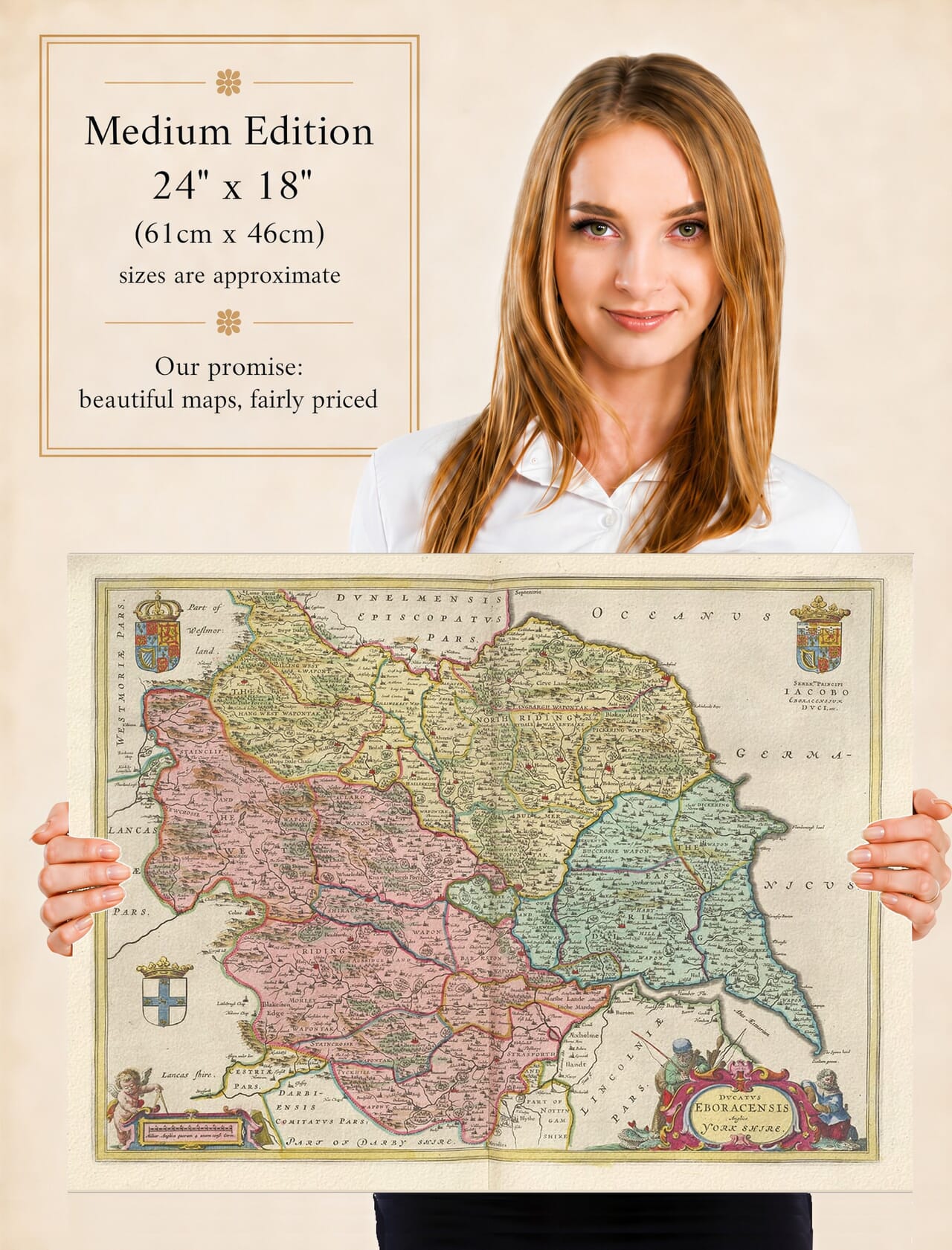
Joan Blaeu’s Map of Historic Yorkshire
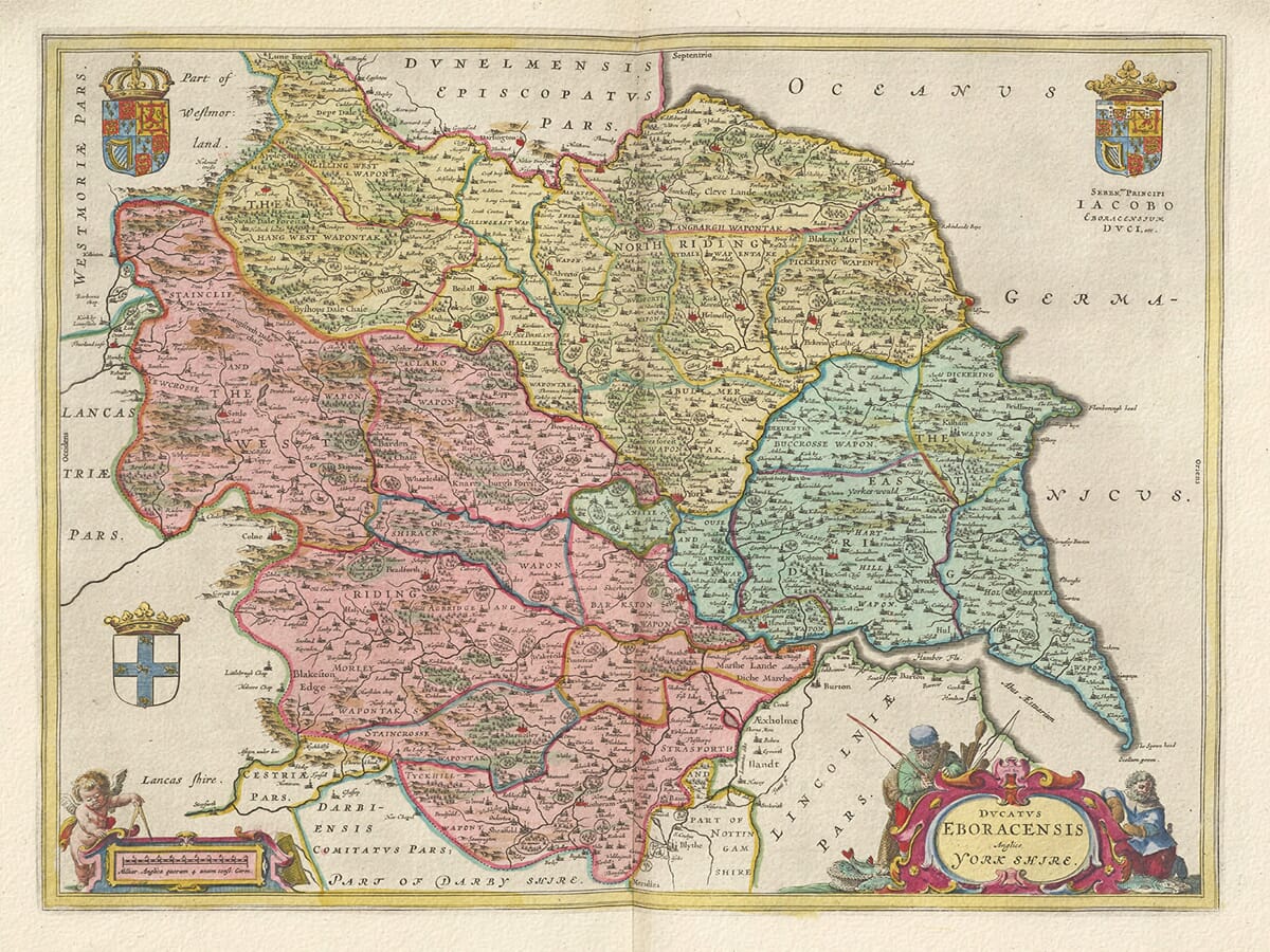
Joan Blaeu’s map of Yorkshire, Ducatus Eboracensis Anglice Yorkshire, was first published in Amsterdam in 1645. It appeared in the fourth volume of his Theatrum Orbis Terrarum, sive Atlas Novus, which was devoted to England and Wales.
This is Blaeu’s general map of the whole historic county. He also published individual maps of the North, East and West Ridings, allowing atlas owners to examine Yorkshire in considerably greater detail. The complete county map nevertheless provides the clearest impression of Yorkshire’s exceptional size, varied geography and distinctive regional identity.
Joan Blaeu and the Amsterdam Atlas Trade
Joan Blaeu assumed control of the family mapmaking business following the death of his father, Willem Blaeu, in 1638. He subsequently expanded the firm’s collection of maps and atlases, culminating in the monumental Atlas Maior during the 1660s.
The Yorkshire map belongs to Joan’s period of leadership and should therefore be attributed to him rather than to Willem. Its 1645 publication formed part of Joan’s effort to create a comprehensive and visually impressive atlas of the English and Welsh counties.
Blaeu did not conduct a new survey of Yorkshire. The geographical information was derived largely from earlier English county mapping, particularly the work of John Speed and the surveying tradition established by Christopher Saxton. Blaeu’s workshop re-engraved and refined this inherited material, combining it with the typography, colour and decorative ornament for which the Amsterdam publishing house became renowned.
You can compare Blaeu’s treatment with our old map of Yorkshire by John Speed, whose influential county map was first published earlier in the seventeenth century.
England’s Largest Historic County
Yorkshire was by far the largest of England’s historic counties. Its landscape extended from the Pennines in the west to the North Sea coast and from the River Tees in the north to the Humber and the southern Pennine districts.
The county was traditionally divided into three Ridings: the North Riding, East Riding and West Riding. The term derives from an Old Norse word meaning a third part and reflects the Scandinavian influence upon Yorkshire’s language and administration. The Ridings met near York, which served as the county’s principal city and historic centre.
Blaeu’s antique map presents all three divisions within one composition. In the west are the Pennines, Yorkshire Dales and river valleys leading towards the Vale of York. The North York Moors and northern uplands occupy much of the northeast, while the Yorkshire Wolds and the lower country of Holderness shape the East Riding.
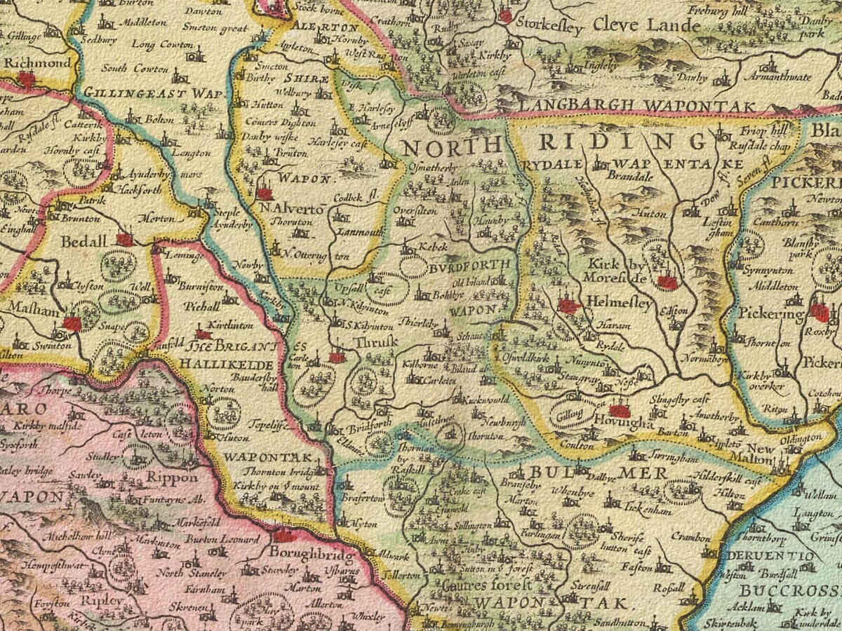
Rivers give the map much of its structure. The Swale, Ure, Nidd and Wharfe flow towards the Ouse, while the Aire, Calder, Don and Derwent connect other parts of the county with York, the Humber and the surrounding regions. The Humber Estuary forms one of the most prominent geographical features along the southeastern edge.
Towns, Trade and the Rural Landscape
York is prominently represented, reflecting its importance as an ecclesiastical, administrative and commercial centre. Other recognisable places include Hull, Beverley, Scarborough, Richmond, Northallerton, Ripon, Wakefield, Leeds, Bradford, Halifax, Sheffield and Doncaster.
Their appearance on the map predates the enormous urban and industrial expansion of later centuries. Leeds, Bradford, Sheffield and many surrounding settlements were already active centres of trade and manufacture, but they had not yet developed into the extensive industrial towns familiar from the eighteenth and nineteenth centuries.
Woollen cloth production was particularly important in parts of the West Riding, while farming, livestock, mining, fishing and coastal trade supported communities elsewhere. Hull provided access to the North Sea and continental markets, and ports such as Scarborough combined maritime trade with fishing.
The map does not show this economic activity systematically. Roads are largely absent, hills are represented pictorially and the size of settlement symbols does not provide a reliable guide to population. Its rivers, place names and conventional landscape signs instead reveal how seventeenth-century mapmakers organised and communicated geographical information.
Yorkshire and the Civil War
Blaeu’s map was published shortly after Yorkshire became one of the principal theatres of the First Civil War. York was besieged by Parliamentary and Scottish forces in 1644, leading to the Battle of Marston Moor on 2 July.
The Parliamentarian victory at Marston Moor severely weakened Royalist power across northern England. These events would still have been recent when Blaeu’s atlas appeared in 1645, although the map itself was not intended as a record of battles, armies or fortifications.
Its orderly presentation instead offered atlas owners an enduring image of the county’s geography. The contrast between its peaceful, decorative landscape and the disruption experienced during the 1640s gives the publication date particular historical interest.
Cartouches and Heraldic Decoration
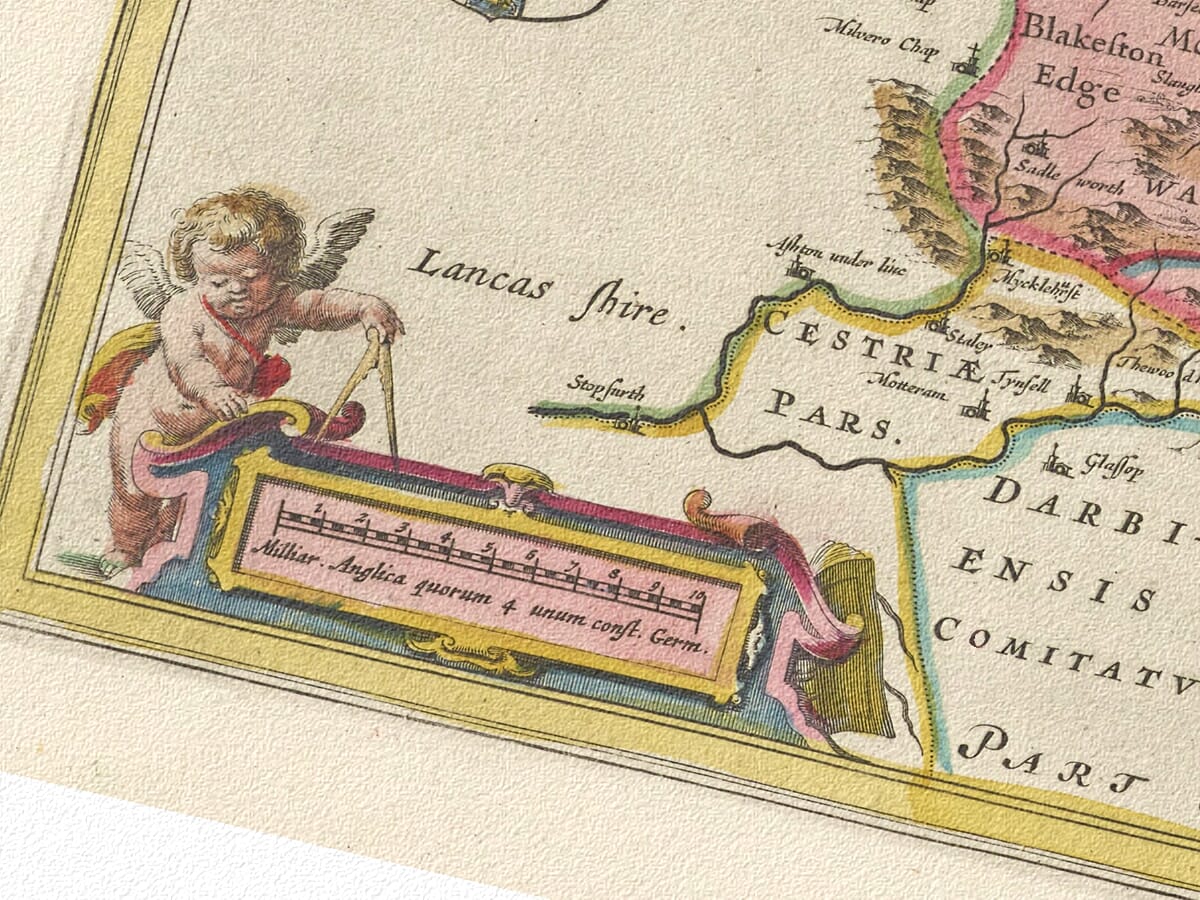
Blaeu surrounded the geography with carefully arranged ornament. The title is enclosed within a figure cartouche, while a separate scale cartouche is accompanied by a cherub. Two royal coats of arms and the traditional arms of Yorkshire give the composition a strong heraldic character.
Original examples were printed in black ink from an engraved copperplate, with colour applied separately to some impressions. The map later appeared in different editions of Blaeu’s atlases, sometimes accompanied by Latin, Dutch, French or German text on the reverse.
Today,
Ducatus Eboracensis Anglice Yorkshire offers a compelling view of the complete historic county before industrialisation, railways and urban growth altered its landscape. It remains both an important old map of Yorkshire and an outstanding example of Dutch Golden Age cartography.





 Verified owner