Blaeu’s Map of Worcestershire and Warwickshire
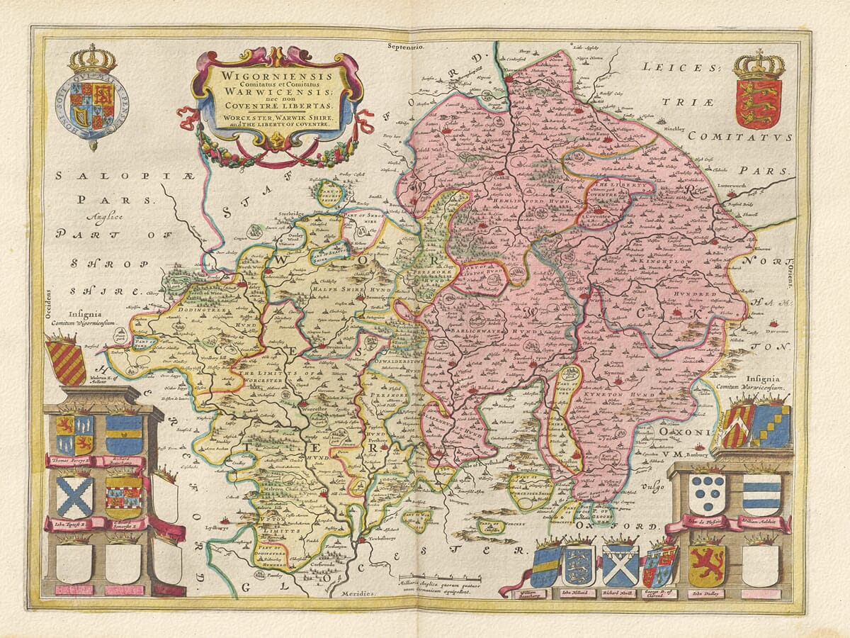
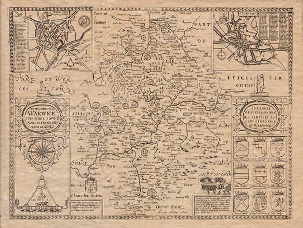
Joan Blaeu’s combined map of Worcestershire and Warwickshire was first published in Amsterdam in 1645. It appeared in the fourth volume of his Theatrum Orbis Terrarum, sive Atlas Novus, devoted to England and Wales.
Map Details
- Original title: Wigorniensis Comitatus et Comitatus Warwicensis; nec non Coventrae Libertas
- Mapmaker and publisher: Joan Blaeu
- First published: Amsterdam, 1645
- Area shown: Worcestershire, Warwickshire and the Liberty of Coventry
- Visible details: The Severn and Avon, Worcester, Stratford-upon-Avon, Coventry and heraldic shields
- Source publication: Theatrum Orbis Terrarum, sive Atlas Novus, England and Wales volume
- Original printing method: Copperplate engraving
Its full engraved title is Wigorniensis Comitatus et Comitatus Warwicensis; nec non Coventrae Libertas, followed by the English wording “Worcester, Warwik Shire and the Liberty of Coventre.” The title establishes that this is not simply a Warwickshire map: it depicts two counties and gives particular recognition to Coventry’s unusual administrative position.
The map was produced during the period when Joan Blaeu directed and expanded the family publishing house.
Two Counties on a Single Plate
Unlike most of Blaeu’s English county maps, this engraving presents two counties together. Worcestershire occupies the western side, structured by the River Severn and its tributaries. Warwickshire extends eastwards around the River Avon, Warwick and Coventry.
The geographical information was not based upon a new survey conducted by Blaeu. It was derived largely from earlier English mapping, particularly John Speed and the county-surveying tradition established by Christopher Saxton. Blaeu’s Amsterdam workshop refined and re-engraved this inherited material, adding the typography, cartouches and heraldry that gave the map its distinctive appearance.
For comparison, the two counties can be explored separately in our old map of Worcestershire by John Speed and old map of Warwickshire by John Speed.
The first edition appeared in 1645, but the plate remained in use for later editions. Surviving original examples may therefore carry Latin, French, Dutch, German or Spanish text on the reverse. The map was subsequently incorporated into Blaeu’s much larger Atlas Maior during the 1660s.
Worcestershire and the Severn
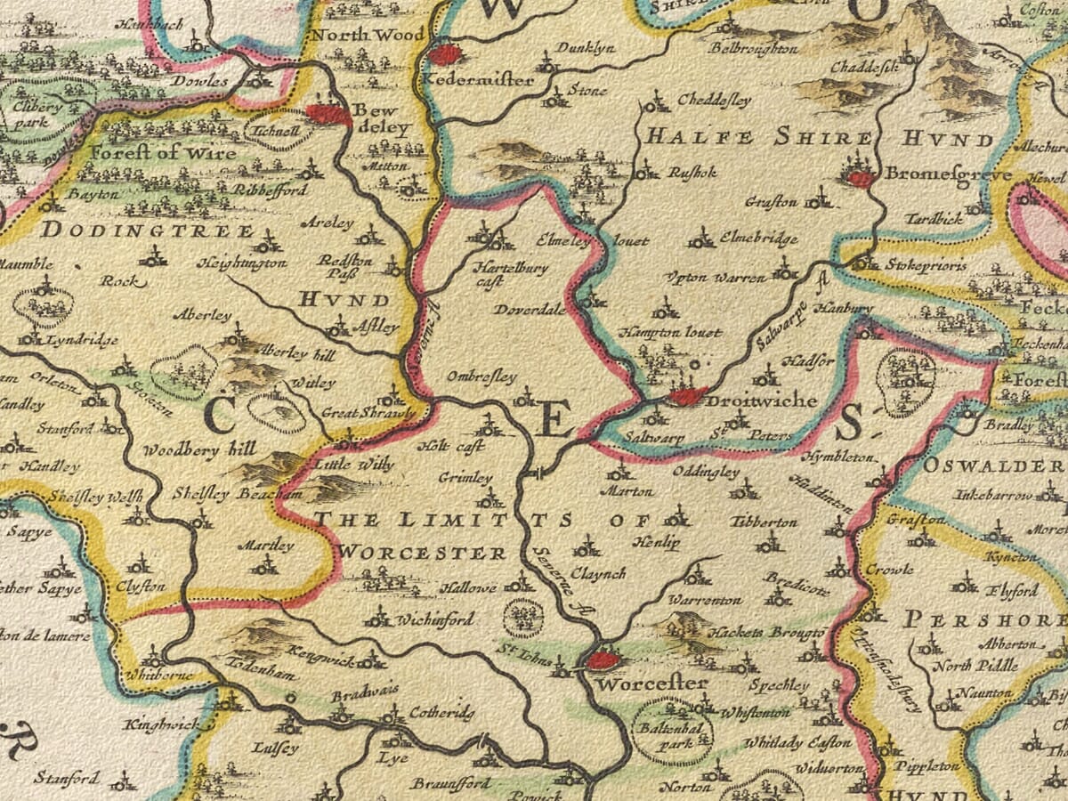
Worcester occupies a prominent position beside the River Severn. Other recognisable settlements include Kidderminster, Bewdley, Droitwich, Bromsgrove, Pershore, Evesham and Upton-upon-Severn.
The Severn forms the geographical backbone of the county, connecting Worcester with communities and trading centres farther north and south. The rivers Teme and Avon join the Severn within Worcestershire, while numerous smaller waterways cross the surrounding countryside.
To the west rise the Malvern Hills, represented pictorially rather than through measured contours. The fertile Vale of Evesham appears in the southeast, an area long associated with productive farmland and orchards.
Droitwich was particularly noted for its salt springs and salt-making industry. Worcester supported cloth-making, glove-making and regional trade, while the rivers and market towns served a predominantly agricultural landscape.
Warwickshire, Coventry and the Avon
Warwickshire spreads across the eastern half of the map. Warwick appears near the centre, while Stratford-upon-Avon, Coventry, Rugby, Kenilworth, Alcester and Birmingham can also be identified.
Birmingham was still a relatively small market settlement in 1645. Its dramatic expansion as a centre of manufacturing and metalworking belonged largely to later centuries. Coventry, by contrast, was already an important walled city with established textile trades and considerable regional influence.
The map’s reference to the “Liberty of Coventry” is historically significant. Coventry had been granted county corporate status in 1451, placing the city and an extensive surrounding district under a separate civic jurisdiction. Blaeu’s title acknowledges this distinction rather than treating Coventry simply as another Warwickshire town.
The River Avon passes through Stratford and Warwick before eventually entering Worcestershire and joining the Severn at Tewkesbury. Northern Warwickshire contained much of the historic Forest of Arden, while the more open southern landscape was traditionally known as the Feldon.
Blaeu represents woodland through groups of individual trees and higher ground through pictorial hill symbols. Roads are not systematically shown, and the map should not be interpreted as a modern measured survey.
The Counties During the Civil War
The publication date places the map during the First English Civil War. Worcestershire and Warwickshire both experienced military activity because their towns, river crossings and routes through the Midlands possessed considerable strategic importance.
The Battle of Edgehill, the first major pitched battle of the war, was fought in southern Warwickshire in October 1642. Warwick Castle supported Parliament, while nearby strongholds and communities were divided in their loyalties.
Worcester changed hands during the conflict and was occupied by Royalist forces for much of the war before surrendering to Parliament in 1646. The later Battle of Worcester, which ended the military phase of the wider civil wars, occurred in 1651—six years after the map’s first publication.
Blaeu’s engraving is not a military map and records none of these campaigns. It instead presents the permanent geography of the two counties during a period of considerable political upheaval.
Heraldry and Decorative Design
The title and scale are presented within ornamental cartouches. Separate displays carry the royal arms and the historic arms of England, while two further cartouches contain nineteen positions for family coats of arms. Five shields were left blank.
These heraldic displays connected the counties with prominent families, titles and traditions of landownership. They also gave the map the imposing decorative character expected by the prosperous European audience for Blaeu’s atlases.
Original impressions were printed from a copperplate in black ink, with colour subsequently applied to selected examples. Today, this historic county map offers a fascinating portrait of Worcestershire and Warwickshire before canals, railways, industrial Birmingham and modern urban expansion transformed the Midlands.





 Verified owner