Carl Graf Vasquez’s Map of Vienna’s Inner City
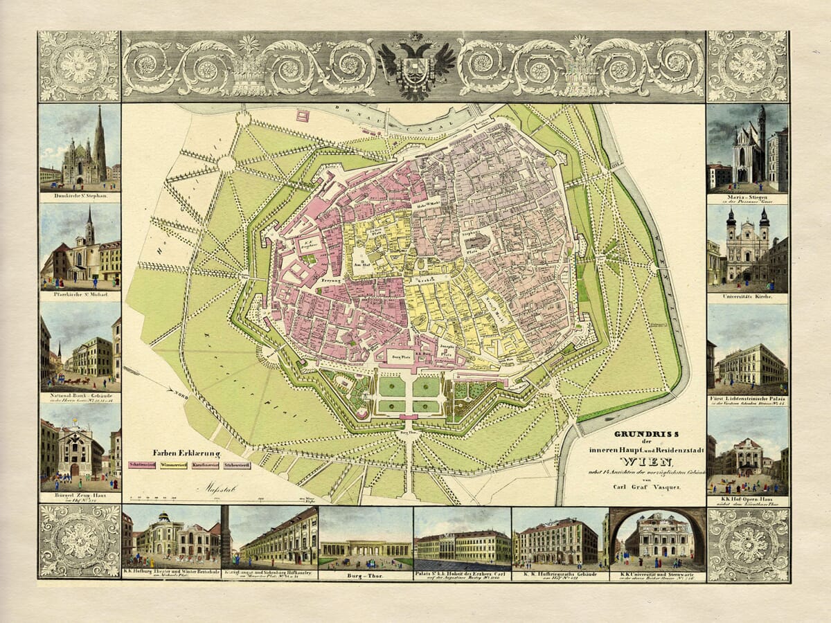
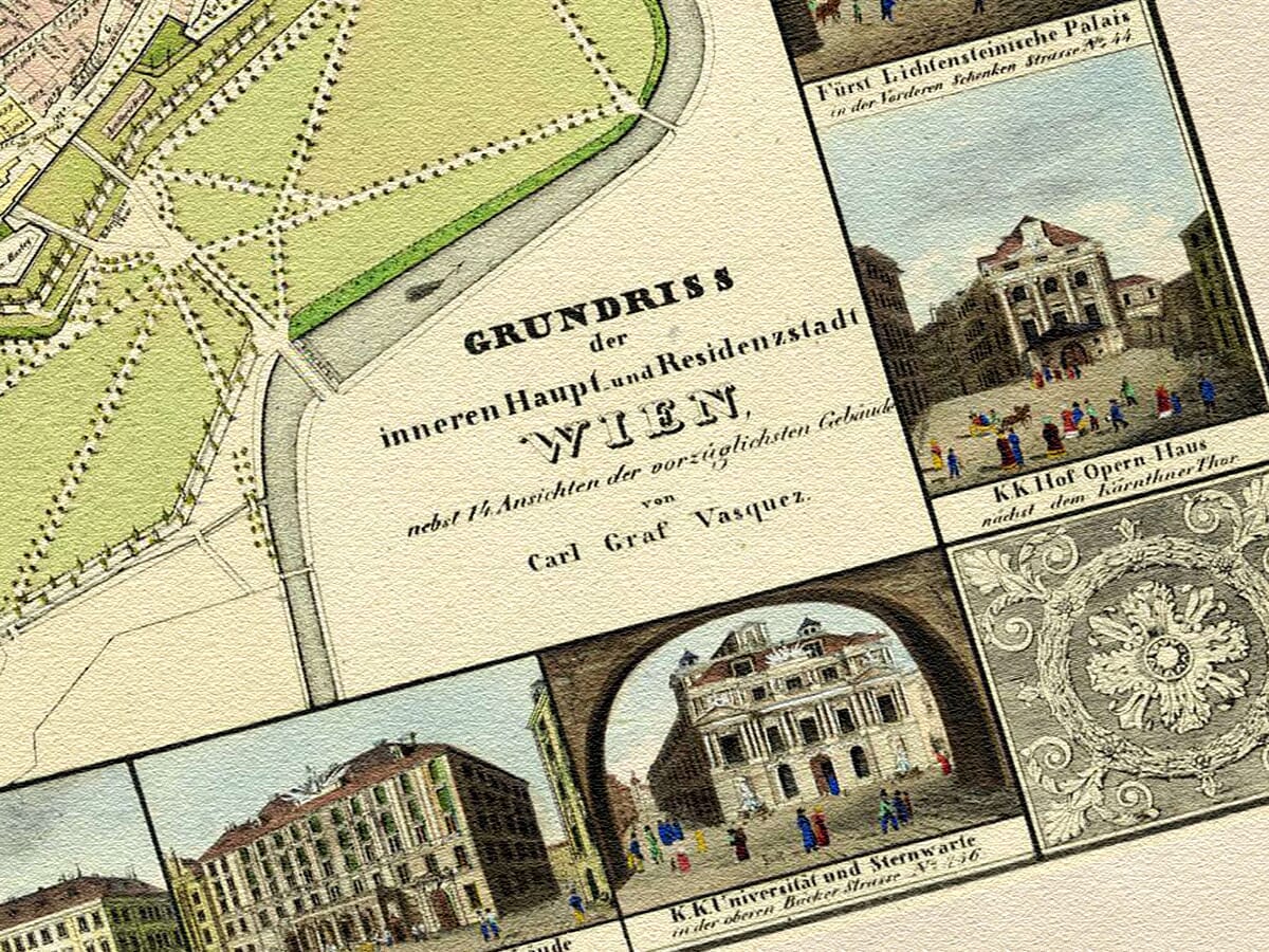
Carl Graf Vasquez created this richly coloured plan of central Vienna around 1835. Its original title, Grundriss der inneren Haupt- und Residenzstadt Wien, nebst 14 Ansichten der vorzüglichsten Gebäude, describes both parts of the composition: a plan of the Inner City accompanied by fourteen views of its most distinguished buildings.
Unlike the broader 1833 plan by W. B. Clarke offered elsewhere in the collection, Vasquez concentrates upon the fortified historic centre. The surrounding suburbs are largely excluded, allowing individual streets, squares, churches, palaces and public buildings to be represented in exceptional detail.
Map Details
- Original title: Grundriss der inneren Haupt- und Residenzstadt Wien, nebst 14 Ansichten der vorzüglichsten Gebäude
- English description: Plan of Vienna’s Inner City with fourteen views of its principal buildings
- Cartographer and publisher: Carl Graf Vasquez
- Date: Circa 1835
- Region shown: Vienna’s fortified Inner City and surrounding glacis
- Historic quarters: Schottenviertel, Widmerviertel, Kärntnerviertel and Stubenviertel
- Decorative features: Fourteen architectural views, imperial eagle, scrollwork and floral corner panels
- Technique: Coloured pen lithograph
- Present-day area: Principally Vienna’s 1st District, Innere Stadt
- Original sheet dimensions: Approximately 58.7 × 73.1 cm
Vienna’s Four Historic Quarters
Colour is used purposefully across the plan. A small key identifies the four traditional quarters of the Inner City: the Schottenviertel, Widmerviertel, Kärntnerviertel and Stubenviertel.
These divisions predated Vienna’s modern numbered districts. Each quarter took its character from prominent gates, churches, religious houses or longstanding neighbourhood names. Their differently coloured streets make the internal organisation of the city immediately apparent without concealing individual buildings and lanes.
St Stephen’s Cathedral stands near the heart of the plan, surrounded by the close street pattern of the old city. The Hofburg and its associated gardens occupy a more spacious position beside the western fortifications, while the university quarter lies towards the east.
The map’s colour therefore does more than enliven the engraving. It preserves an administrative and geographical division of Vienna that has largely disappeared from everyday use.
Inside the City Walls
Vasquez shows Vienna before the medieval and early modern fortifications were removed. Bastions project from the walls at regular intervals, creating a complex angular perimeter around the densely built centre.
Outside the walls lies the glacis: a broad tract of open ground crossed by paths and planted avenues. It had originally been maintained for defensive purposes, preventing buildings from approaching too closely and giving the city’s artillery an unobstructed field of fire.
By the 1830s the glacis also served as an important recreational landscape, with walks and tree-lined routes surrounding the city. Vasquez carefully records this mixture of military geometry and public green space.
The date is particularly significant because Emperor Franz Joseph ordered the demolition of the fortifications in 1857. The Ringstrasse and its monumental buildings subsequently occupied the walls and glacis shown here. The map consequently preserves a cityscape that vanished within a generation.
Fourteen Views of Vienna
The architectural views surrounding the plan transform it from a practical street map into a portrait of the imperial capital. They were not chosen merely as decoration: together they identify the religious, political, educational and military institutions that defined Vienna.
The sequence includes:
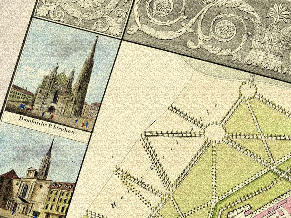
- St Stephen’s Cathedral
- St Michael’s Church
- The National Bank building in Herrengasse
- The Bürgerliches Zeughaus armoury
- The Hofburg Theatre and Winter Riding School
- The Hungarian and Transylvanian Court Chancellery
- The Burgtor
- Archduke Charles’s palace on the Augustinerbastei, now associated with the Albertina
- The Hofkriegsrat military administration building
- The imperial university and observatory
- The Court Opera House beside the Kärntnertor
- The Liechtenstein city palace
- The University Church
- Maria am Gestade
Several of these buildings survive, although their surroundings have changed substantially. Others were demolished or replaced as Vienna was reconstructed during the later nineteenth century.
Buildings That Vienna Lost
The view labelled as the Court Opera House does not depict the present Vienna State Opera. It shows the Kärntnertortheater, which stood close to the city wall and served as an important venue for drama, ballet and opera. It was demolished after the new Court Opera opened on the Ringstrasse.
The old Hofburg Theatre shown beside the Winter Riding School was likewise replaced. These small views therefore preserve buildings that cannot now be encountered in Vienna except through prints, plans and written records.
The university and observatory also belong to an older academic landscape. Their inclusion reflects the importance of learning and science within the imperial capital, while the Hofkriegsrat and chancellery represent the administrative reach of the Habsburg monarchy.
An Illustrated Record of Habsburg Vienna
The ornamental frame is unusually elaborate for a nineteenth-century city plan. Classical scrollwork runs along the upper border, centred upon the Habsburg double-headed eagle. Decorative panels occupy the corners, balancing the architectural views arranged along the sides and lower edge.
Vasquez nevertheless keeps the plan itself exceptionally clear. Streets, building blocks, gardens, bastions and gates remain readable, while the restrained palette distinguishes the four quarters from the green glacis.
Created around 1835, the map records Vienna shortly before profound change. The suburbs would be incorporated into the city in 1850, the fortifications would begin to disappear after 1857 and the Ringstrasse would replace the open defensive landscape with grand public architecture.
Vasquez’s composition therefore offers something more individual than a conventional street plan: a carefully organised portrait of Vienna’s Inner City, its historic quarters and the buildings through which the Habsburg capital represented itself.





 Verified owner












