



£35.55 – £59.95Price range: £35.55 through £59.95
Old Map of Venice, circa 1600
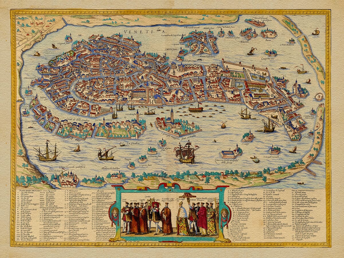
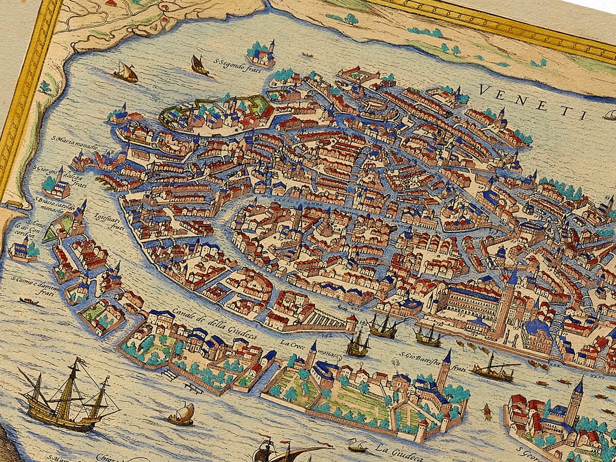
This richly coloured old map of Venice presents the city from an elevated viewpoint, revealing its remarkable position within the Venetian Lagoon. Canals pass through a densely built city of churches, palaces, quays and narrow streets, while boats and sailing ships crowd the surrounding water.
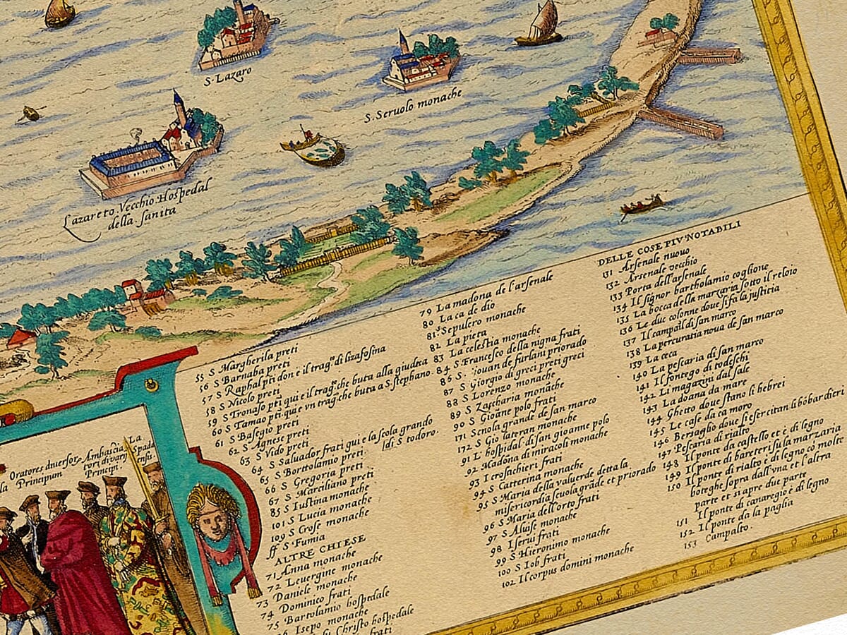
St Mark’s Square, the Doge’s Palace and the tall Campanile can be recognised near the waterfront. The numbered key identifies many of the city’s principal buildings, and a ceremonial group of Venetian figures appears beneath the view.
An absorbing historic map for anyone with a connection to Venice, an interest in Renaissance city plans or a love of Italian history.A stunning certified FINE ART PRINT on heavy textured art paper — not a poster
Unlike most online offerings, our maps are produced entirely in-house, not outsourced to print-on-demand or drop-shipping services. This allows complete control over quality while offering better value. Each map begins with a high-resolution original, carefully enhanced and printed to order using archival papers and pigment inks for exceptional clarity, depth, and longevity. Every piece is personally overseen — no map leaves our workshop unless it is of a quality we would be proud to display ourselves.
Paper choice is essential to the authenticity of our maps. We use specially sourced 190gsm paper made in the UK from pure materials and traditionally pressed with natural woollen felts. This process creates a subtle, randomly textured surface that closely resembles an original antique document. Likewise the use of premium quality ink fully saturates the paper, producing remarkable clarity, depth, and historical character. Colour fastness and sharpness will remain good for in excess of 100 years!
The Old Map Company of Great Britain offers a vast and carefully curated collection of the very finest expertly reproduced vintage maps. Our range includes works by renowned cartographers such as John Speed and Willem Blaeu, covering Scotland, England, and beyond. Free UK courier delivery is included, with EU, USA, and worldwide shipping available at cost and calculated at checkout. If you need assistance, our team is always happy to help you choose the perfect map.
Speedy delivery A beautiful representation
Got there in time and loves it! Cheers David [Gift from US to UK]
Thanks Lauren. We received it today - it's gorgeous! Thank you, Ellan
Thank you for your prompt service. I have a gallery and framing business in South Wales. I'm so pleased it is printed in the UK
My Isles of Scilly map arrived safely and I'm delighted with it!
The print arrived safely and we're delighted with it - a lovely reminder of our honeymoon 15 years ago.
I have just received them! I'm sure our clients will be pleased with them and there could be more projects off the back of this one where we can use more. [Interior Designers]
I just received my map of Ireland by Ewart today and, as usual, I am delighted by its quality. The crispness and fineness of detail is excellent and the colour reproduction surpasses my expectations. Please relay my thanks to Steve for another fine effort!
Many thanks, Lauren. Very pleased with the map and the service: would recommend The Old Map Company to anyone interested in Old Maps.
Many thanks, the map arrived safely this morning, and I’m really pleased with it. A stunning reproduction, just as I had hoped. I will keep browsing your website, and may yet be tempted by more of your items! Have a great weekend.
Just arrived, wonderful map! Thanks very much!
The map – beautiful – arrived safely, very many thanks.
Thank you, I have already found the map. It’s wonderfull! Good luck! Rasa
My apologies for the very late reply. I wanted to reach out to thank you so much for rushing my order. My partner absolutely loved it. I am amazed with the service so that is a five-star from me. I wish you all the best.
This engraved bird’s-eye view presents Venice as a city inseparable from the water around it. The buildings are arranged across the lagoon islands, linked by canals and bridges, while vessels of different sizes move through the channels and open water. The composition allows the viewer to study both the city’s celebrated monuments and its intricate urban structure.
Map Details
The map shows Venice divided by the Grand Canal and the many smaller waterways that served as the city’s principal routes. Churches and towers rise above tightly packed roofs, while the open waterfront around St Mark’s Square forms one of the most recognisable parts of the composition.
The islands and religious foundations surrounding the main city are also carefully distinguished. San Giorgio Maggiore stands across the water from St Mark’s, while other islands, gardens and monastic sites occupy the lagoon. Their inclusion helps explain how Venice developed as a network of inhabited islands rather than as a conventional walled city.
The numerous boats are more than decorative additions. Venice’s wealth and political influence depended upon maritime trade, naval power and control of routes through the Adriatic and eastern Mediterranean. Larger sailing vessels appear beside smaller craft used for movement within the lagoon.
At the bottom of the map, figures in formal Venetian dress provide another layer of historical interest. They evoke the civic hierarchy and ceremonial life of the Venetian Republic, whose government was headed by the Doge.
The numbered keys identify an extensive selection of churches, public buildings and other notable places. They turn the image into both a decorative view and a practical guide to Renaissance Venice.
Although the city has changed over the centuries, the sweep of the Grand Canal, the concentration of buildings around St Mark’s and the close relationship between land and water remain immediately recognisable.



