£35.55 – £59.95Price range: £35.55 through £59.95
Old Map of the Mediterranean by William Berry, after Sanson, circa 1685
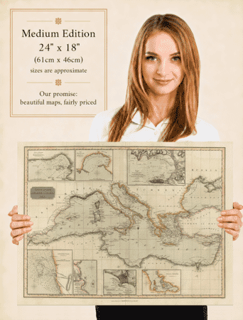
William Berry’s map follows the Mediterranean from the western entrance to the Levant, placing its islands and coastal kingdoms within a broad regional view. The Black Sea appears above the eastern basin, while the Nile and the edge of the Red Sea extend the geography to the south-east. Detailed lettering, engraved mountains and a formal dedication to James II give this fine art reproduction its distinctive late seventeenth-century character.
A stunning certified FINE ART PRINT on heavy textured art paper — not a poster
Size
Unlike most online offerings, our maps are produced entirely in-house, not outsourced to print-on-demand or drop-shipping services. This allows complete control over quality while offering better value. Each map begins with a high-resolution original, carefully enhanced and printed to order using archival papers and pigment inks for exceptional clarity, depth, and longevity. Every piece is personally overseen — no map leaves our workshop unless it is of a quality we would be proud to display ourselves.
Paper choice is essential to the authenticity of our maps. We use specially sourced 190gsm paper made in the UK from pure materials and traditionally pressed with natural woollen felts. This process creates a subtle, randomly textured surface that closely resembles an original antique document. Likewise the use of premium quality ink fully saturates the paper, producing remarkable clarity, depth, and historical character. Colour fastness and sharpness will remain good for in excess of 100 years!
The Old Map Company of Great Britain offers a vast and carefully curated collection of the very finest expertly reproduced vintage maps. Our range includes works by renowned cartographers such as John Speed and Willem Blaeu, covering Scotland, England, and beyond. Free UK courier delivery is included, with EU, USA, and worldwide shipping available at cost and calculated at checkout. If you need assistance, our team is always happy to help you choose the perfect map.
Speedy delivery A beautiful representation
Got there in time and loves it! Cheers David [Gift from US to UK]
Thanks Lauren. We received it today - it's gorgeous! Thank you, Ellan
Thank you for your prompt service. I have a gallery and framing business in South Wales. I'm so pleased it is printed in the UK
My Isles of Scilly map arrived safely and I'm delighted with it!
The print arrived safely and we're delighted with it - a lovely reminder of our honeymoon 15 years ago.
I have just received them! I'm sure our clients will be pleased with them and there could be more projects off the back of this one where we can use more. [Interior Designers]
I just received my map of Ireland by Ewart today and, as usual, I am delighted by its quality. The crispness and fineness of detail is excellent and the colour reproduction surpasses my expectations. Please relay my thanks to Steve for another fine effort!
Many thanks, Lauren. Very pleased with the map and the service: would recommend The Old Map Company to anyone interested in Old Maps.
Many thanks, the map arrived safely this morning, and I’m really pleased with it. A stunning reproduction, just as I had hoped. I will keep browsing your website, and may yet be tempted by more of your items! Have a great weekend.
Just arrived, wonderful map! Thanks very much!
The map – beautiful – arrived safely, very many thanks.
Thank you, I have already found the map. It’s wonderfull! Good luck! Rasa
My apologies for the very late reply. I wanted to reach out to thank you so much for rushing my order. My partner absolutely loved it. I am amazed with the service so that is a five-star from me. I wish you all the best.
Berry divides the Mediterranean into eastern and western seas, then names the smaller seas, gulfs, capes and ports within them. That organisation is stated in the heading and carried through the dense coastal labelling. The map also includes the Black Sea, placing the Mediterranean within a larger connected geography.
Sicily, Sardinia, Corsica, Crete and Cyprus provide recognisable points of reference across the sea. Between them, the carefully named coastal stretches encourage the eye to move from one basin to another. Inland, rows of engraved mountains and branching rivers give the surrounding land a strongly drawn texture. The sea remains relatively open, allowing its subdivisions to stand out.
The map’s northern reach includes the Black Sea, labelled with the classical name Pontus Euxinus. At the south-eastern edge, the Nile and the Red Sea extend the coverage beyond the immediate Mediterranean shore. These additions help explain the breadth of Berry’s subject: the sheet is concerned with the sea’s surrounding regions as well as its islands and harbours.
The English heading credits Sanson and states that Berry corrected and amended the map. His London sales imprint locates the publication, while the dedication to James II places this version in a late Stuart setting. The royal wording is a statement of patronage and loyalty, not a claim that the British monarch governed all the lands pictured.
Unlike a harbour plan, this is a broad regional composition. Its interest lies in the way it brings many coastlines, old place names and political territories onto one sheet. The reproduction preserves that expansive view, with the restrained colouring leaving the engraved lettering and relief particularly prominent.