Joan Blaeu’s Map of Strathnaver and Strathmore
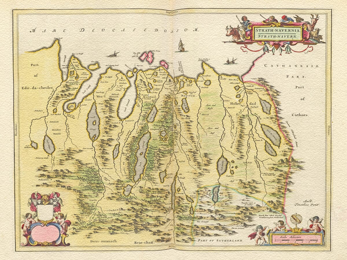
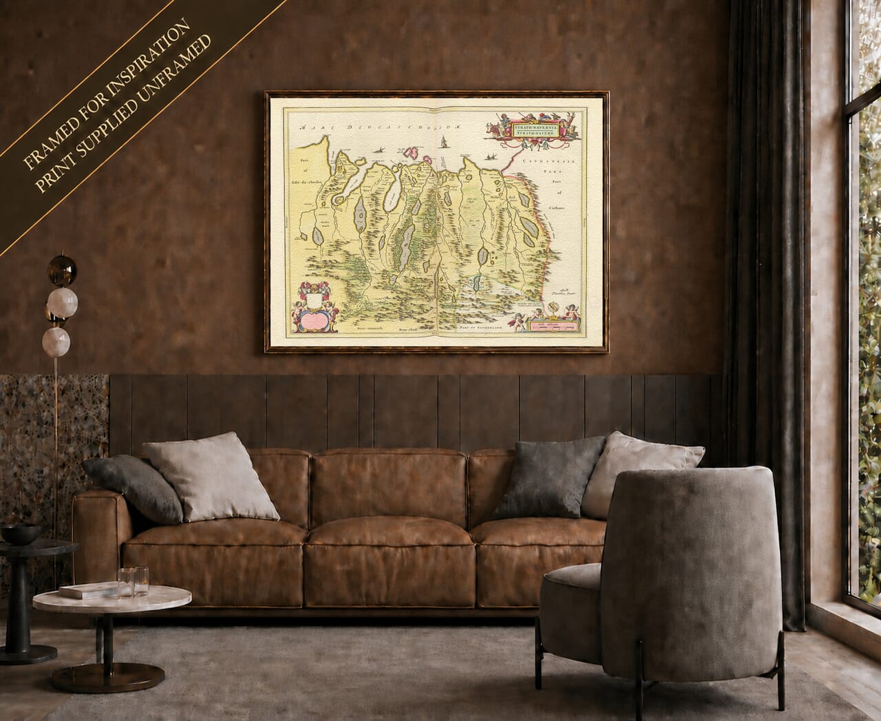
Joan Blaeu’s Strath-Navernia presents one of the most remote and compelling landscapes in his Atlas of Scotland. First published in Amsterdam in 1654, the map follows the northern coast and interior of what is now north and northwest Sutherland.
The Strathmore represented here is the Highland valley southeast of Loch Eriboll, not the better-known Strathmore of central Scotland. It lies beside the River Strathmore, which flows northwards into Loch Hope beneath the slopes of Ben Hope. Together with Strathnaver, it forms part of a landscape defined by water, mountains and long routes through the glens.
Map Details
- Original title: Strath-Navernia
- Area shown: Strathnaver, Strathmore and neighbouring northern Sutherland
- Original survey: Timothy Pont
- Publisher: Joan Blaeu
- First published: Amsterdam, 1654
- Source atlas: Theatrum Orbis Terrarum, sive Atlas Novus—commonly known as the Blaeu Atlas of Scotland
- Notable features: Loch Eriboll, Loch Hope, the Kyle of Tongue, Loch Loyal, Loch Naver, rivers, settlements, pictorial mountains, woodland and decorative cartouches
- Product type: Reproduction historic map printed as a fine art print
A Landscape Shaped by Lochs and Rivers
The northern coastline runs across the upper part of the engraving. Deep sea lochs and inlets reach into the land, forming natural gateways to an interior that would otherwise have been difficult to cross.
Loch Eriboll cuts deeply into the western side of the map. To its east, Loch Hope and the neighbouring Strathmore valley create a north–south passage through the mountains. Farther east are the Kyle of Tongue and the waters around Tongue, followed by the River Naver as it approaches the coast near the present-day settlement of Bettyhill.
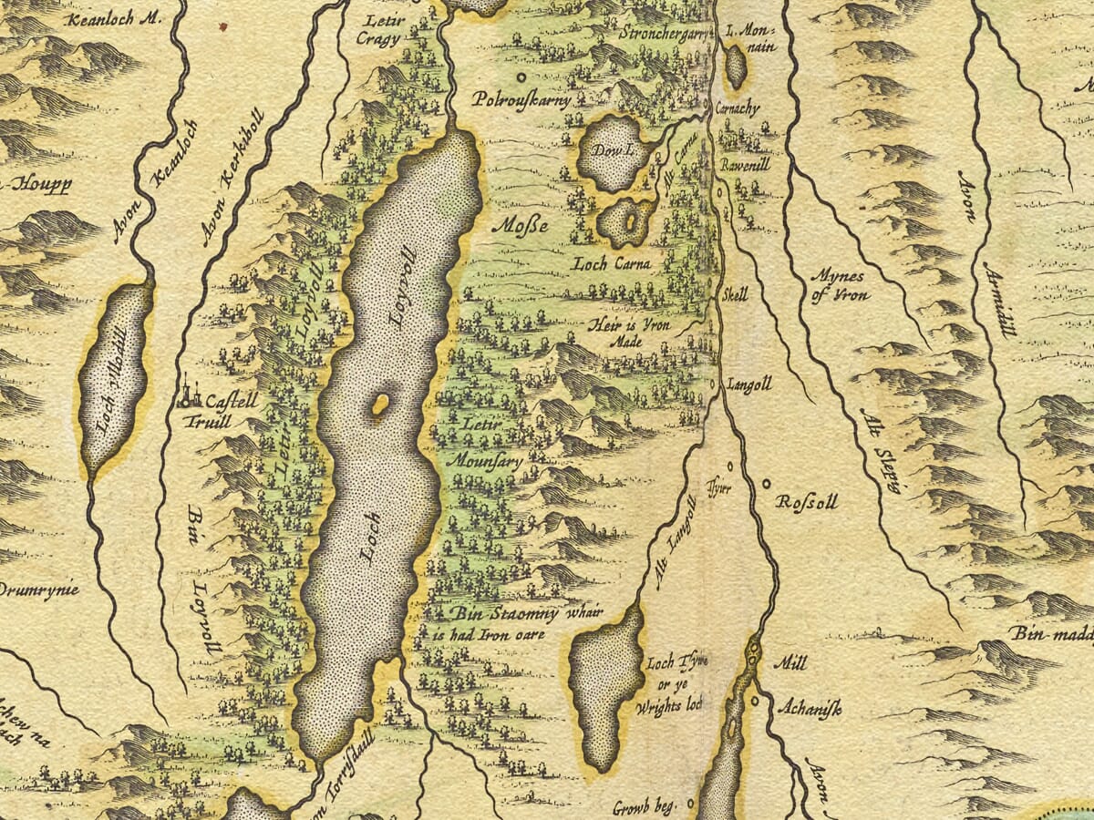
The map draws the eye inland along these waterways. Loch Loyal, Loch Naver and numerous smaller lochs appear between closely packed pictorial hills. Rivers and burns connect the interior with the sea, revealing the natural routes followed by travellers, livestock and communities long before modern Highland roads were constructed.
Mountains are not represented by measured contours. Instead, Blaeu’s engraver used shaded profiles arranged in ranges and clusters. Woodland is shown through groups of individual trees, while settlements are identified by small building symbols. These conventions give the historic map its distinctive character while conveying a clear impression of a sparsely settled and strongly mountainous country.
Strathnaver and Mackay Country
Strathnaver takes its name from the River Naver, which flows northwards from Loch Naver to the sea. The term could also describe a much broader province extending across a large part of northwest Sutherland. This wider territory became closely associated with Clan Mackay and is still remembered as Mackay Country.
The map records the region before the Highland Clearances transformed its pattern of settlement. Small communities and named places appear throughout glens that later became much more thinly populated. Some names survive on modern maps; others belong to townships, estates and localities whose importance has faded or whose spelling has changed.
This makes the engraving particularly valuable for local and family history. It does not provide the precision of a modern survey, but it preserves an early picture of how northern Sutherland was named and understood. Familiar lochs and rivers provide points of orientation, while the density of older place names rewards close examination.
The later history of Strathnaver carries considerable emotional weight. During the early nineteenth century, communities were removed from inland townships as estates reorganised the land for large-scale sheep farming. Blaeu’s map predates those events by more than a century and a half. Its settlements should not be treated as a complete census, but they offer a visual connection with the inhabited landscape that existed before the Clearances.
From a Scottish Survey to an Amsterdam Atlas
The map was based upon the pioneering survey work of Timothy Pont. Pont travelled through Scotland during the late sixteenth and early seventeenth centuries, recording coastlines, rivers, settlements and notable buildings. His manuscript maps eventually reached Joan Blaeu’s workshop in Amsterdam, where the material was prepared for publication.
Blaeu’s Atlas of Scotland appeared in 1654 as part of his expanding Atlas Novus. It was the first atlas devoted extensively to Scotland and brought together maps derived from Pont’s surveys alongside work associated with Robert and James Gordon.
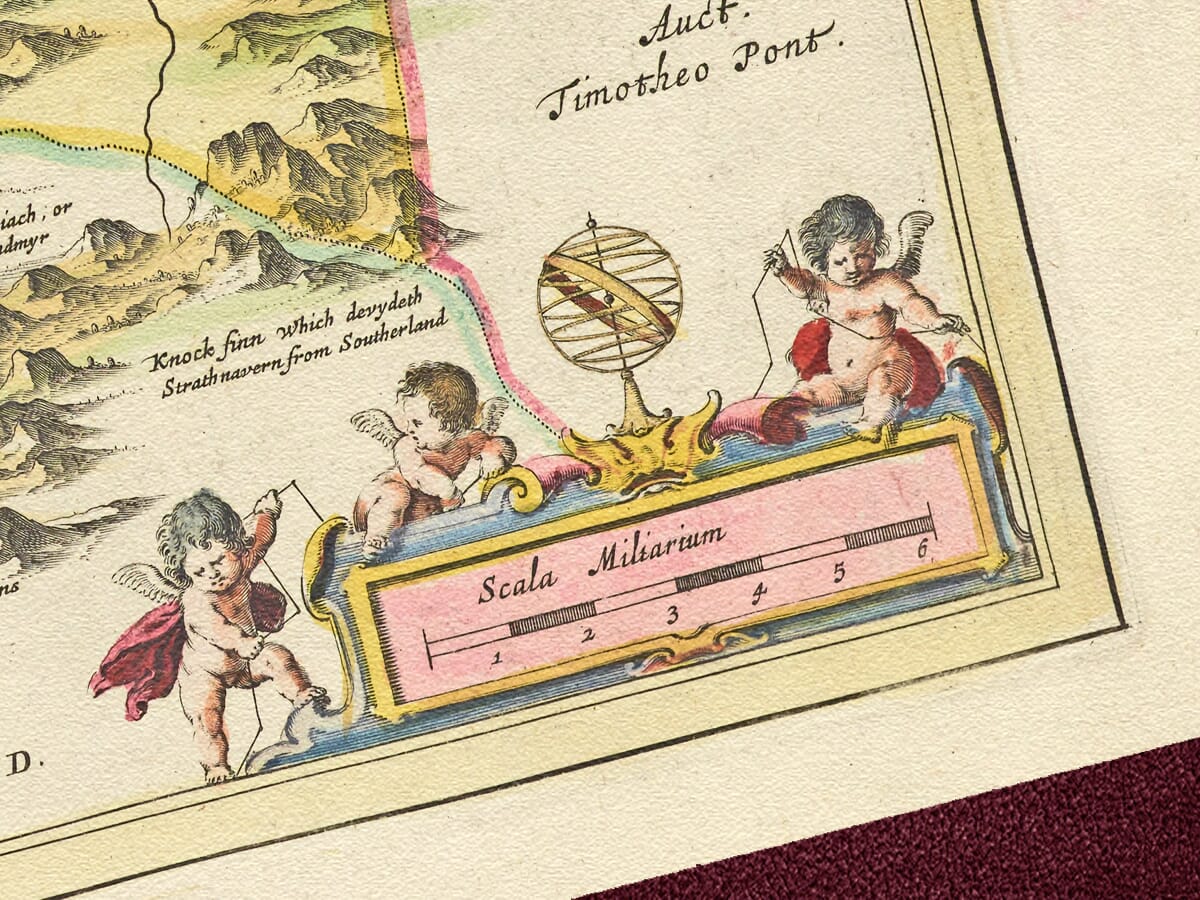
The Strathnaver plate contains an acknowledgement of Pont near the scale. Beyond this concise attribution, the engraving is most rewarding when read through its geographical detail: the sequence of coastal inlets, the long lochs penetrating the mountains and the many small names distributed across the glens.
Cartouches and Blank Heraldic Panels
The title is held within an elaborate cartouche in the upper-right corner. At the foot of the map, a separate scale cartouche is accompanied by figures and surveying imagery characteristic of the Blaeu workshop.
Two conspicuously blank decorative panels appear on the left. The previous product description claimed that these spaces remained empty because nobody paid to have arms inserted. There is no reliable evidence for that explanation, and the spaces should not be interpreted as proof of an abandoned commission. Blank shields and unfinished heraldic arrangements occur elsewhere in Blaeu’s Scottish maps and form part of the published plate.
These unusual open spaces give the composition an immediately recognisable appearance. They contrast with the densely engraved hills, waterways and place names, making Strath-Navernia one of the more distinctive maps in the Scottish series.
More than three and a half centuries after its publication, this antique map design still captures the scale and solitude of Scotland’s northern country. For anyone connected with Strathnaver, Durness, Tongue or the wider Highlands, it offers both a record of place and a striking work of cartographic art.
Explore our wider collection of
old maps of Scotland or compare this detailed regional engraving with Blaeu’s broader
map of Northern Scotland.





 Verified owner
















