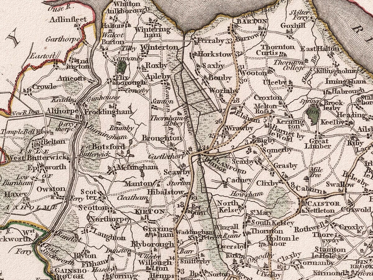
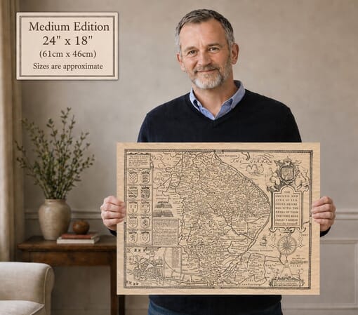
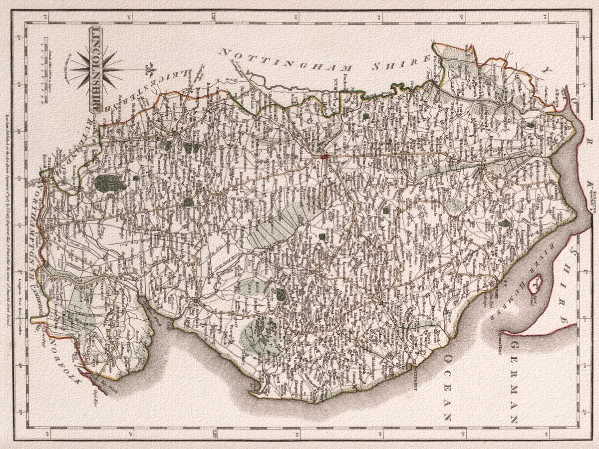
Old map of Lincolnshire by John Cary showing roads, towns and parks, 1787
Old map of Lincolnshire by John Cary showing roads, towns and parks, 1787 Old Framed Map Lincolnshire Old Lincolnshire

Old Map of Lincolnshire, 1787 by John Cary

Price range: £35.55 through £59.95

Old map of Lincolnshire created, engraved and published by John Cary in London in 1787.

Follow the roads of Georgian Lincolnshire through a landscape of market towns, country estates, rivers and open fenland. Lincoln stands near the centre of the county, with routes leading towards Boston, Grantham, Stamford, Sleaford, Louth, Horncastle, Gainsborough and the Humber.

Cary’s clear engraving records principal roads and cross-country routes alongside villages, parks, waterways and coastal settlements. The Wash, River Trent, River Witham and the coastline of the German Ocean provide the natural framework for a county on the threshold of considerable economic and industrial change.

First issued in Cary’s New and Correct English Atlas, this detailed old map of Lincolnshire is reproduced as a fine art print on subtly textured paper.
+ read more

A stunning certified FINE ART PRINT on heavy textured art paper — not a poster

  • Direct from the publisher — no middlemen
  • Printed in-house in Cornwall
  • Free UK delivery — international shipping available
  • Produced to meet — and often exceed — museum-quality standards

SELECT SIZE

Inspecting Vintage Map Reproduction

Fine Art Map Reproductions – Museum-Quality Printing

Unlike most online offerings, our maps are produced entirely in-house, not outsourced to print-on-demand or drop-shipping services. This allows complete control over quality while offering better value. Each map begins with a high-resolution original, carefully enhanced and printed to order using archival papers and pigment inks for exceptional clarity, depth, and longevity. Every piece is personally overseen — no map leaves our workshop unless it is of a quality we would be proud to display ourselves.

Hand hold a magnifying glass over West Cornwall Map

Authentic Old Map Paper & Accurate Colour Reproduction

Paper choice is essential to the authenticity of our maps. We use specially sourced 190gsm paper made in the UK from pure materials and traditionally pressed with natural woollen felts. This process creates a subtle, randomly textured surface that closely resembles an original antique document. Likewise the use of premium quality ink fully saturates the paper, producing remarkable clarity, depth, and historical character. Colour fastness and sharpness will remain good for in excess of 100 years!

Map in Postal Tube
Buy Old Maps Online in the UK Today Trading online since 1999

The Old Map Company of Great Britain offers a vast and carefully curated collection of the very finest expertly reproduced vintage maps. Our range includes works by renowned cartographers such as John Speed and Willem Blaeu, covering Scotland, England, and beyond. Free UK courier delivery is included, with EU, USA, and worldwide shipping available at cost and calculated at checkout. If you need assistance, our team is always happy to help you choose the perfect map.

RECENT REVIEWS

Daz
DazGB
Verified ownerVerified owner
5/5

Speedy delivery A beautiful representation

2 months ago
David H
David H
Verified ownerVerified owner
5/5

Got there in time and loves it! Cheers David [Gift from US to UK]

4 months ago
Ellan C-S
Ellan C-S
Verified ownerVerified owner
5/5

Thanks Lauren. We received it today - it's gorgeous! Thank you, Ellan

4 months ago
Ivano Di Battista
Ivano Di Battista
Verified ownerVerified owner
5/5

Thank you for your prompt service. I have a gallery and framing business in South Wales. I'm so pleased it is printed in the UK

4 months ago
Robert B
Robert B
Verified ownerVerified owner
5/5

My Isles of Scilly map arrived safely and I'm delighted with it!

5 months ago
Andrew T
Andrew T
Reviewer
5/5

The print arrived safely and we're delighted with it - a lovely reminder of our honeymoon 15 years ago.

5 months ago
Hannah J
Hannah J
Verified ownerVerified owner
5/5

I have just received them! I'm sure our clients will be pleased with them and there could be more projects off the back of this one where we can use more. [Interior Designers]

5 months ago
Sean MacManus
Sean MacManus
Verified ownerVerified owner
5/5

I just received my map of Ireland by Ewart today and, as usual, I am delighted by its quality. The crispness and fineness of detail is excellent and the colour reproduction surpasses my expectations. Please relay my thanks to Steve for another fine effort!

5 months ago
John G
John G
Verified ownerVerified owner
5/5

Many thanks, Lauren. Very pleased with the map and the service: would recommend The Old Map Company to anyone interested in Old Maps.

7 months ago
Lois K
Lois K
Verified ownerVerified owner
5/5

Thrilled , Lauren! Thank You

7 months ago
Ed Simpson
Ed Simpson
Verified ownerVerified owner
5/5

Many thanks, the map arrived safely this morning, and I’m really pleased with it. A stunning reproduction, just as I had hoped. I will keep browsing your website, and may yet be tempted by more of your items! Have a great weekend.

7 months ago
Daniel McCade
Daniel McCade
Verified ownerVerified owner
5/5

Just arrived, wonderful map! Thanks very much!

8 months ago
Jonathon R
Jonathon R
Verified ownerVerified owner
5/5

The map – beautiful – arrived safely, very many thanks.

1 year ago
Rasa Terbetiene
Rasa Terbetiene
Verified ownerVerified owner
5/5

Thank you, I have already found the map. It’s wonderfull! Good luck! Rasa

4 years ago
Mina M.
Mina M.
Verified ownerVerified owner
5/5

My apologies for the very late reply. I wanted to reach out to thank you so much for rushing my order. My partner absolutely loved it. I am amazed with the service so that is a five-star from me. I wish you all the best.

4 years ago

John Cary’s Old Map of Lincolnshire

John Cary’s map of Lincolnshire was first issued in 1787 as part of his New and Correct English Atlas. Created from recently available surveys, the atlas represented a new generation of English county mapping in which clarity, practical information and geographical accuracy took precedence over elaborate decoration.

The map is simply titled Lincolnshire. Its clean lettering, carefully traced roads and restrained outline colour are characteristic of Cary’s work as both cartographer and engraver.

Map Details

  • Original title: Lincolnshire
  • County shown: Historic Lincolnshire
  • Cartographer: John Cary
  • Engraver: John Cary
  • Publisher: John Cary
  • First issued: London, 1787
  • Atlas: Cary’s New and Correct English Atlas
  • Approximate scale: 1:488,000
  • Principal places: Lincoln, Boston, Grantham, Stamford, Spalding, Sleaford, Louth, Horncastle and Gainsborough
  • Features shown: Roads, towns, villages, rivers, parks, estates and coastal features
  • Format: Copperplate engraving with outline colour

A New Kind of County Map

Cary’s atlas began appearing in separate parts in 1787 and was completed early in 1789. It brought together 47 maps of the counties of England and Wales, accompanied by descriptive text and information explaining how roads continued from one county sheet to another.

This practical approach reflected the changing needs of travellers. Britain’s turnpike network was expanding rapidly, mail coaches were beginning to offer faster communication and an increasing number of people travelled between towns for business and trade.

Cary consequently gave roads much greater prominence than many earlier county mapmakers. Direct routes and important cross roads can be followed across the engraving, while their continuation beyond Lincolnshire is indicated around the map’s edges.

Lincoln and the County’s Market Towns

Lincoln occupies a commanding position near the centre of the map. Roads radiate from the city towards Gainsborough and the Trent, Market Rasen and the northern Wolds, Horncastle and the coast, and southwards through Sleaford towards Bourne and Stamford.

Grantham appears on the Great North Road near Lincolnshire’s western border. Stamford lies farther south, while Boston stands beside the River Witham close to The Wash. Spalding and Holbeach occupy the rich agricultural country of southern Holland.

In the east, Louth, Alford, Spilsby, Wainfleet and other market towns form a chain between the Wolds and the coast. Grimsby, Caistor, Brigg and Barton-upon-Humber represent the northern part of the county, with the Humber forming its great natural boundary.

Rivers, Fens and the Lincolnshire Coast

The waterways of Lincolnshire are among the map’s strongest geographical features. The Trent defines much of the county’s western side before entering the Humber, while the Witham flows through Lincoln and Boston towards The Wash.

The low-lying Fens spread across the south-east. Drainage schemes had already altered this landscape before Cary’s map was produced, but later engineering and agricultural improvements would transform it still further. The engraving therefore preserves an intermediate stage between the older wetland geography and the intensively managed countryside of the nineteenth century.

Along the eastern edge, the coastline faces the sea labelled on the map as the German Ocean, the name then commonly used for what is now the North Sea. Coastal settlements, river mouths and the broad expanse of The Wash are drawn with the same measured clarity as the inland road network.

Parks, Estates and Country Houses

Cary marks numerous parks and country estates across Lincolnshire. Their shaded grounds stand out among towns, villages and open countryside, revealing the influence of landed estates on the late Georgian landscape.

These features were useful points of reference for travellers, but they also reflected the atlas’s likely readership. Landowners, merchants and professional travellers required maps that could guide journeys while identifying significant properties and settlements along the way.

The result is less theatrical than the richly decorated county maps of John Speed, yet exceptionally rewarding at close quarters. Cary’s disciplined engraving gives even small villages, minor roads and country seats a clear place within the composition.

Finding Present-Day Lincolnshire

Many familiar places can be located easily. In northern Lincolnshire the map records Barton-upon-Humber, Brigg, Caistor, Market Rasen, Grimsby, Gainsborough and Louth. Lincoln, Wragby, Horncastle and Tattershall occupy the central country, while Boston, Sleaford and Grantham lie farther south.

Stamford, Bourne and Market Deeping appear near the county’s southern edge. Spalding, Holbeach, Wainfleet, Alford and Spilsby help modern viewers trace the historic communities of the Fens and eastern coastal plain.

Smaller settlements are recorded alongside roads, rivers and estates, making the map especially interesting for those exploring local or family history. Some names retain their familiar forms; others preserve spellings that have changed since the eighteenth century.

More than two centuries after it was published, Cary’s map remains a remarkably clear portrait of Lincolnshire. It captures the county before railways and industrial towns transformed travel, while revealing the road network, waterways and communities upon which that later development was built.

You may also like…

×
Product added to cart
No products in the cart.