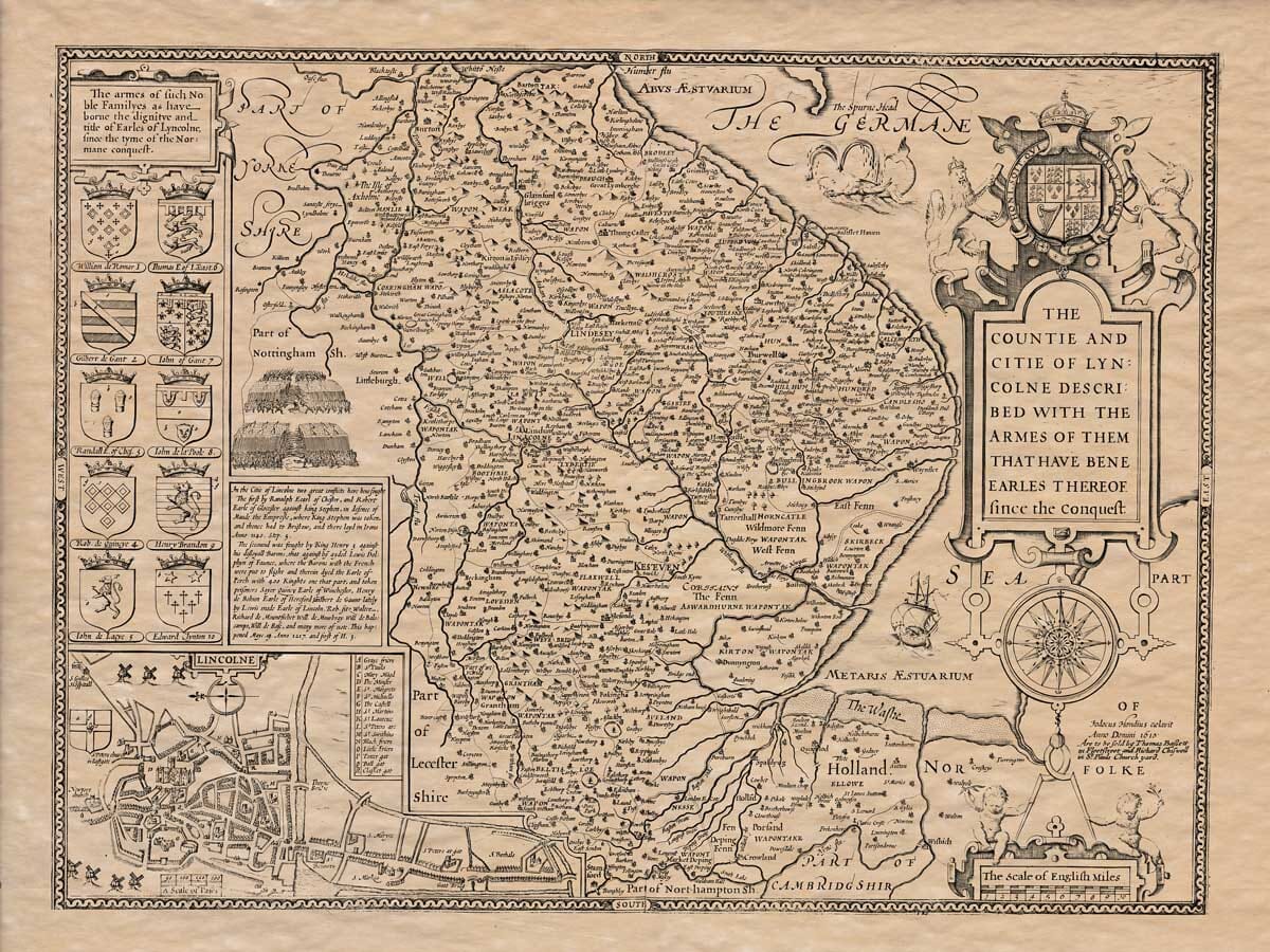
John Speed added a short essay which was published on the rear (the verso) of his Old Map of Lincolnshire which we have translated into modern English . . .
LINCOLNSHIRE
The county of Lincolnshire, known as “Lincoll-rcype” by the Anglo-Saxons and “Nicolfhire” by the Normans, is bordered to the north by the Humber, to the east by the North Sea, to the south by the River Nene which separates it from Cambridgeshire and Northamptonshire, and to the west by the counties of Nottinghamshire and Yorkshire, separated by the rivers Dun and Trent.
The length of this county, from Barton upon Humber in the north to Stamford on the River Nene in the south, is 55 miles, and the width, from Newton in the west to Winthorpe on the east coast, is 35 miles. The total circumference of the county is approximately 180 miles.
The climate on the eastern and southern parts of the county is often thick and foggy due to the fens and marshy land, but it is also very mild and pleasant. The region lies at a latitude of 53 degrees north, and the winds coming from the sea help clear the air of harmful vapors.
The shape of the county resembles a lute, with the eastern coast curving into the North Sea, dotted with saltwater inlets and sandbars that are not safe for travelers. This was proven in the case of King John, who lost all his supplies and equipment when the sea suddenly returned while he was marching north against his rebellious barons.
The soil in the western and northern parts of the county is very fertile, rich, and suitable for grazing, farming, and hay production. The eastern and southern parts are marshy and brackish, making them poor for growing crops, though they are excellent for wildfowl and fish. In some seasons, more than 3,000 mallards and similar birds have been caught in nets in a single catch.
The county’s main products are grain, livestock, fish, fowl, flax, and alabaster. It is also known for a plaster once highly valued by the Romans for use in their statues and artworks, as mentioned by Pliny the Elder. The county is also home to the Asterites, a star-shaped gemstone with five rays, which was believed to bring victory. Near Beverley, on the southwestern part of the county, an ancient bronze vessel containing a golden helmet adorned with precious stones was discovered at Harlaxton, a relic now in the possession of Catherine of Spain, wife and widow of King Henry VIII.
The county takes pride in being the birthplace of King Henry I, born at Selby, and King Henry IV, born at Bolingbroke. However, it also mourns the death of King John, who was poisoned here by Simon, a monk from Swyneshead Abbey, and the death of Queen Eleanor, wife of King Edward I, who died at Hardby near her birthplace of Bolingbroke. Queen Eleanor was known for her exemplary marriage and love for the people.
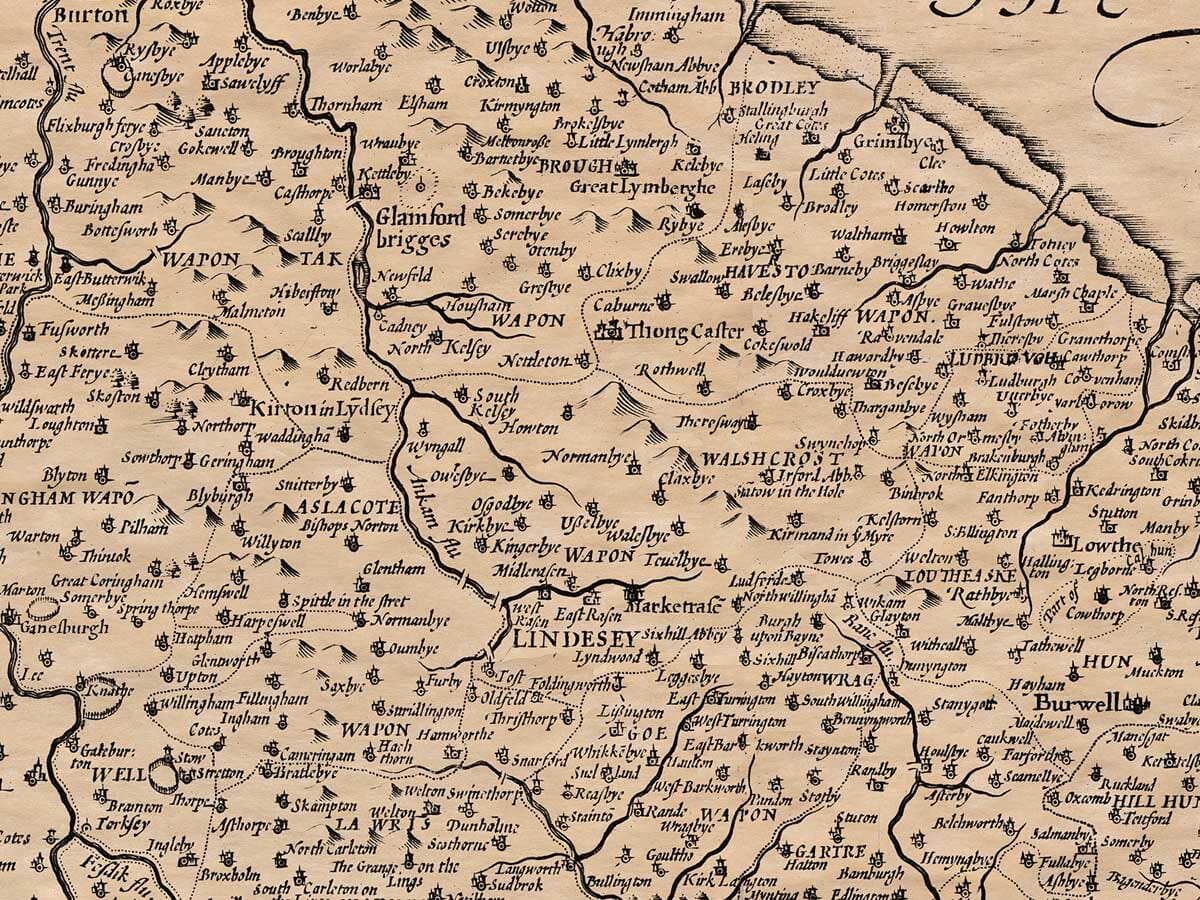
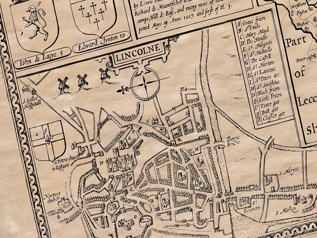
The county’s commerce thrives in 31 market towns, with Lincoln, the county’s namesake, being the most prominent. It was known as Lindum by Ptolemy and Antonine, Linde-collina by Bede, Lyndo-collina by the Saxons, and Nicol by the Normans. It is an ancient city and was once much more splendid, as evidenced by the ruins found there. It was also much more populous, as shown in the Domesday Book, which recorded it having 1,007 homes, 900 burgesses, and 12 large men with legal privileges. In the time of the Normans, according to Malmesbury, it was one of the most populous cities in England and a key center for trade. King Edward III established a staple market for wool, leather, and lead here. The city once boasted 50 parish churches, though only 15 remain today, alongside the cathedral. Though the city has been damaged by war, fire, and earthquakes, it has endured. The city was attacked by the Saxons and Danes, and in Norman times, it was also affected by conflict, with King Stephen being captured there and later King Henry III facing a similar situation. A fire also destroyed many of its buildings, and the foundation of the cathedral was shaken by an earthquake. The city is governed by a mayor, two sheriffs, 12 aldermen in scarlet, a sword bearer, and four sergeants with maces. The city is located at a latitude of 53 degrees, 50 minutes and a longitude of 20 degrees, 10 minutes.
Many religious houses have been built in this county by various kings and princes, including at places like Croyland, Lincoln, Market Deeping, Louth, Alvingham, Grimsby, Newstead, and others.
There have been uprisings in the county, such as in the 28th year of King Henry VIII’s reign, when 20,000 people revolted, swearing violent oaths to certain lords and gentlemen. However, when news of the king’s forces reached them, they quickly scattered and sought forgiveness. Another rebellion took place in the third year of King Edward VI, concerning enclosures, when Lincolnshire rose in revolt along with Cornwall, Devon, Yorkshire, and Norfolk. After some of their leaders were killed, the rebels returned to obedience.
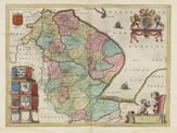
The county is divided into three main regions: Lindsey, Kesteven, and Holland. Lindsey is subdivided into 17 hundreds, Kesteven into 11, and Holland into 3, for a total of 31 hundreds. The county has 34 market towns and 630 parish churches, which are listed alphabetically in the table below.