£35.95 – £59.95Price range: £35.95 through £59.95
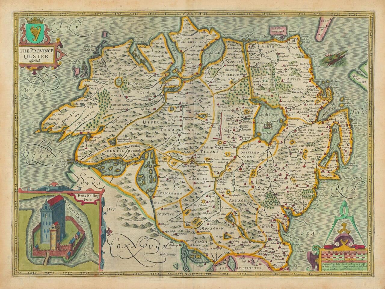
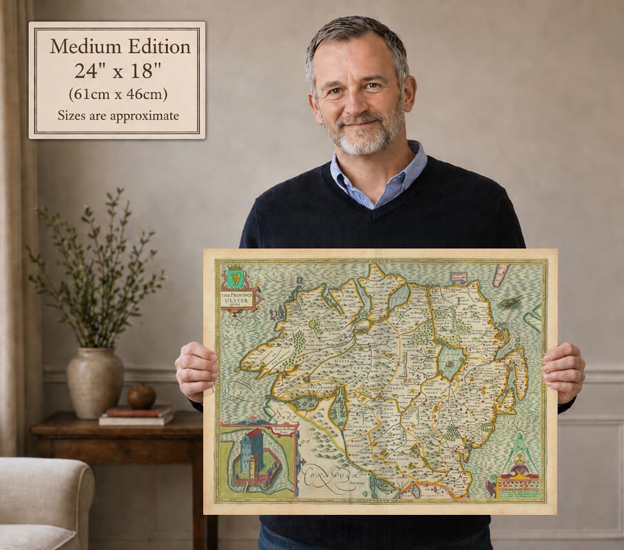
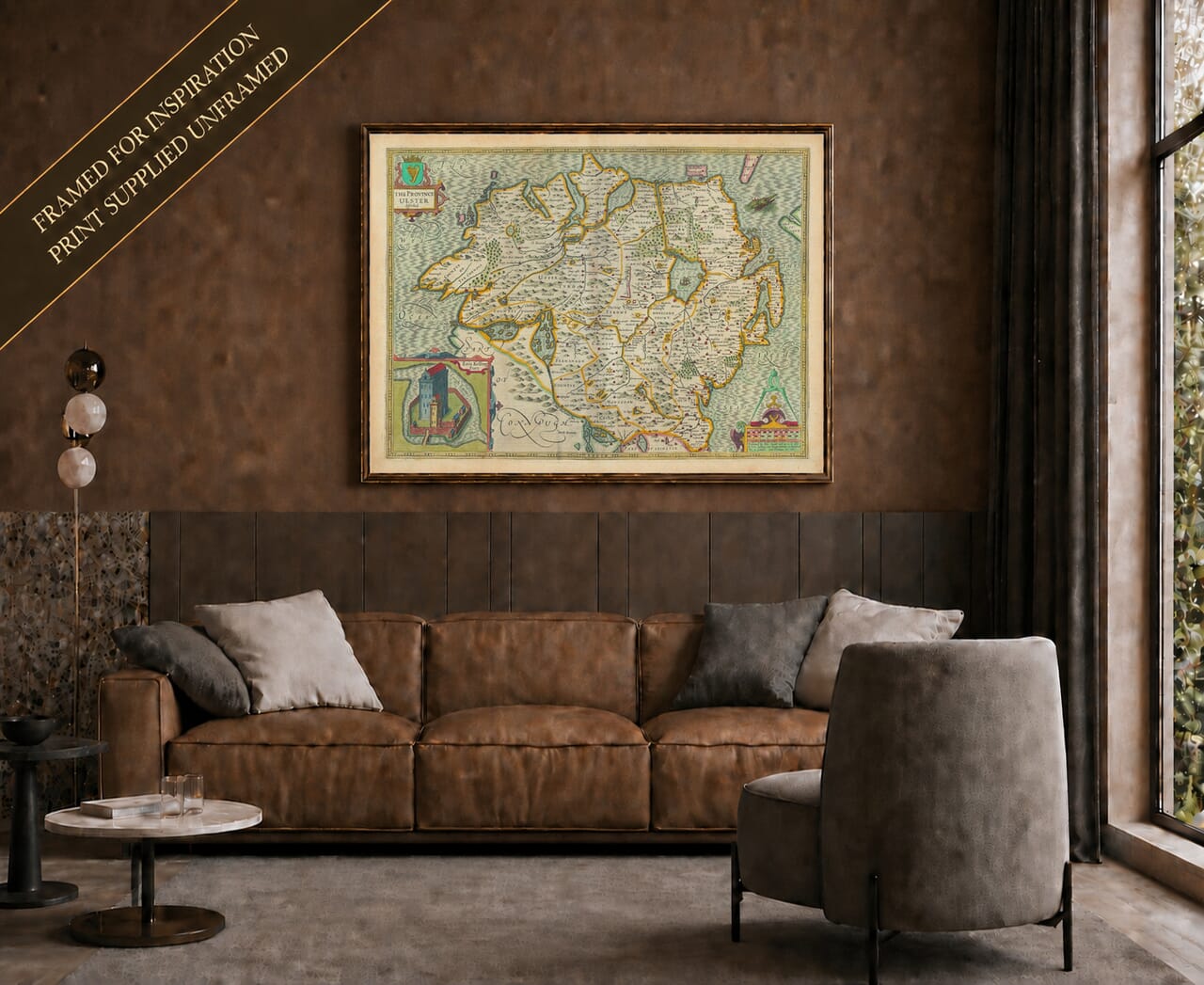
John Speed’s old map of Ulster, first published in 1611–12, is one of the most celebrated early printed maps of Ireland’s northern province. It covers historic Ulster in its entirety—all nine counties now divided between Northern Ireland and the Republic of Ireland—rather than Northern Ireland alone.
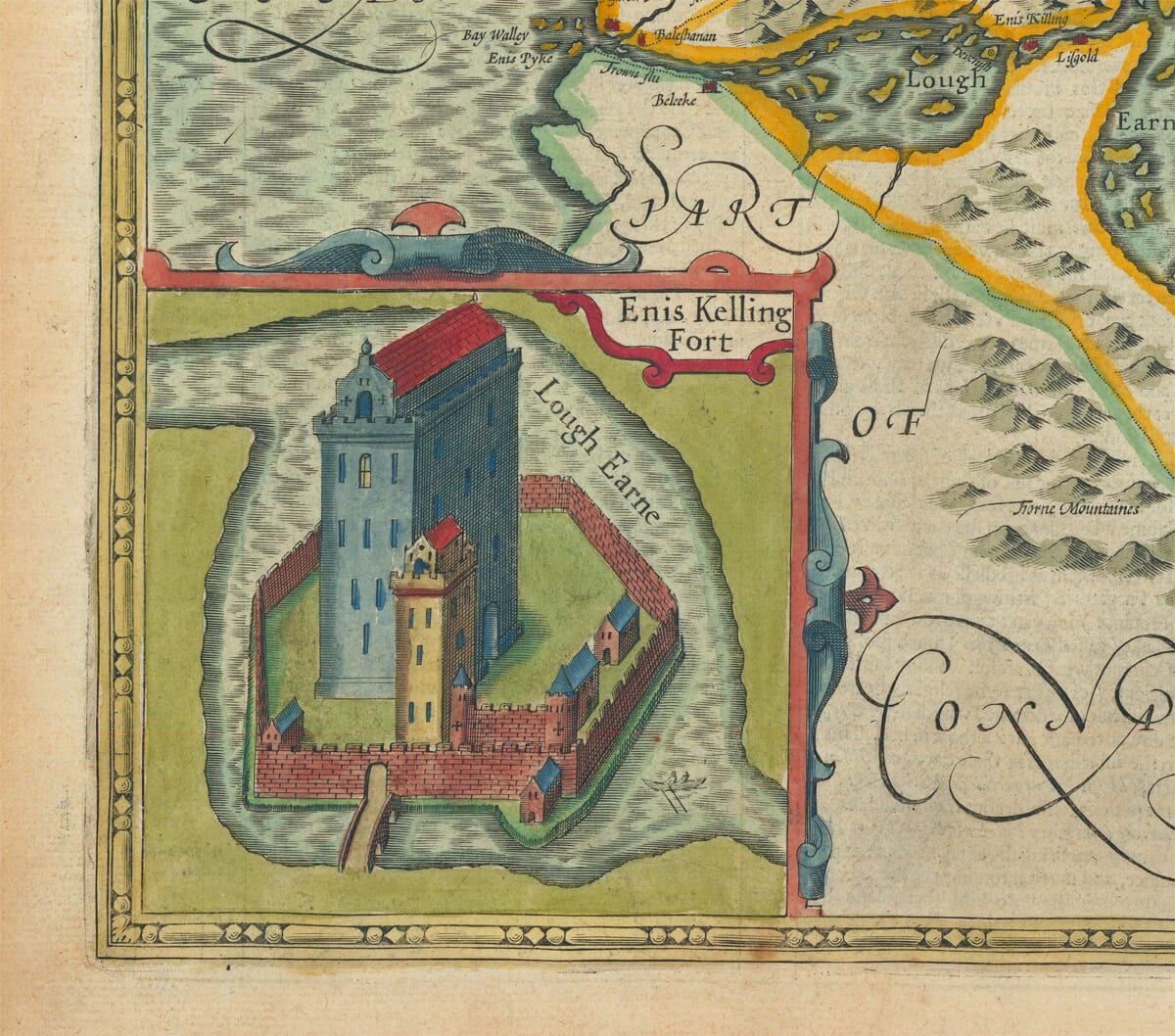
Across the richly engraved landscape are familiar places including Armagh, Belfast, Carrickfergus, Donegal, Derry, Downpatrick and Enniskillen, together with Lough Neagh, Lough Erne and the province’s rivers, mountains and coastlines. A remarkable inset view of “Enis Kelling Fort” records the strategically important stronghold at Enniskillen, while ships, a sea creature, decorative lettering and an Irish harp enrich the surrounding design.
Beautifully coloured and full of historic place names, the map makes a particularly meaningful print for anyone with Ulster ancestry, Irish family connections or an interest in seventeenth-century history and cartography. 6. Historical Significance This old map would have been drawn shortly after the Plantation of Ulster begun in 1609, when the English crown was settling colonists in Ulster after the Nine Years’ War (1594–1603 It reflects the English administration’s new county boundaries and anglicised place names. In summary: Mapmaker John Speed First Published 1611–1612 in The Theatre of the Empire of Great Britaine Region Province of Ulster, Ireland Insets Enis Kelling Fort (Enniskillen) Style Early 17th-century English decorative map, hand-coloured Purpose Display counties and new political divisions after Plantation A beautiful example of a classic old Speed map of Ulster, the remaining originals being prized by collectors of early Irish cartography and a vivid snapshot of Ireland’s northern province just after the major political changes of the early 1600s. <script type=“application/ld+json”> { “@context”: “https://schema.org”, “@type”: “Product”, “name”: “Ulster – an old map by John Speed”, “image”: [ “https://oldmap.co.uk” ], “description”: “Lavishly illustrated historical map of Ulster by John Speed. Certified fine art print on heavy textured art paper.”, “sku”: “SPEED-ULSTER-01”, “brand”: { “@type”: “Brand”, “name”: “The Old Map Company” }, “offers”: { “@type”: “AggregateOffer”, “priceCurrency”: “GBP”, “lowPrice”: “35.55”, “highPrice”: “59.95”, “url”: “https://oldmap.co.uk”, “offers”: [ { “@type”: “Offer”, “availability”: “https://schema.org”, “itemCondition”: “https://schema.org”, “priceSpecification”: [ { “@type”: “PriceSpecification”, “price”: “35.55”, “priceCurrency”: “GBP”, “valueAddedTaxIncluded”: false }, { “@type”: “PriceSpecification”, “price”: “48.45”, “priceCurrency”: “USD”, “valueAddedTaxIncluded”: false }, { “@type”: “PriceSpecification”, “price”: “41.45”, “priceCurrency”: “EUR”, “valueAddedTaxIncluded”: false } ], “shippingDetails”: { “@type”: “OfferShippingDetails”, “shippingRate”: { “@type”: “MonetaryAmount”, “value”: “0.00”, “currency”: “GBP” }, “destinationServiceArea”: { “@type”: “Country”, “name”: “GB” } } } ] } } </script>A stunning certified FINE ART PRINT on heavy textured art paper — not a poster
Unlike most online offerings, our maps are produced entirely in-house, not outsourced to print-on-demand or drop-shipping services. This allows complete control over quality while offering better value. Each map begins with a high-resolution original, carefully enhanced and printed to order using archival papers and pigment inks for exceptional clarity, depth, and longevity. Every piece is personally overseen — no map leaves our workshop unless it is of a quality we would be proud to display ourselves.
Paper choice is essential to the authenticity of our maps. We use specially sourced 190gsm paper made in the UK from pure materials and traditionally pressed with natural woollen felts. This process creates a subtle, randomly textured surface that closely resembles an original antique document. Likewise the use of premium quality ink fully saturates the paper, producing remarkable clarity, depth, and historical character. Colour fastness and sharpness will remain good for in excess of 100 years!
The Old Map Company of Great Britain offers a vast and carefully curated collection of the very finest expertly reproduced vintage maps. Our range includes works by renowned cartographers such as John Speed and Willem Blaeu, covering Scotland, England, and beyond. Free UK courier delivery is included, with EU, USA, and worldwide shipping available at cost and calculated at checkout. If you need assistance, our team is always happy to help you choose the perfect map.
Speedy delivery A beautiful representation
Got there in time and loves it! Cheers David [Gift from US to UK]
Thanks Lauren. We received it today - it's gorgeous! Thank you, Ellan
Thank you for your prompt service. I have a gallery and framing business in South Wales. I'm so pleased it is printed in the UK
My Isles of Scilly map arrived safely and I'm delighted with it!
The print arrived safely and we're delighted with it - a lovely reminder of our honeymoon 15 years ago.
I have just received them! I'm sure our clients will be pleased with them and there could be more projects off the back of this one where we can use more. [Interior Designers]
I just received my map of Ireland by Ewart today and, as usual, I am delighted by its quality. The crispness and fineness of detail is excellent and the colour reproduction surpasses my expectations. Please relay my thanks to Steve for another fine effort!
Many thanks, Lauren. Very pleased with the map and the service: would recommend The Old Map Company to anyone interested in Old Maps.
Many thanks, the map arrived safely this morning, and I’m really pleased with it. A stunning reproduction, just as I had hoped. I will keep browsing your website, and may yet be tempted by more of your items! Have a great weekend.
Just arrived, wonderful map! Thanks very much!
The map – beautiful – arrived safely, very many thanks.
Thank you, I have already found the map. It’s wonderfull! Good luck! Rasa
My apologies for the very late reply. I wanted to reach out to thank you so much for rushing my order. My partner absolutely loved it. I am amazed with the service so that is a five-star from me. I wish you all the best.
John Speed’s Ulster: A Province at a Turning Point
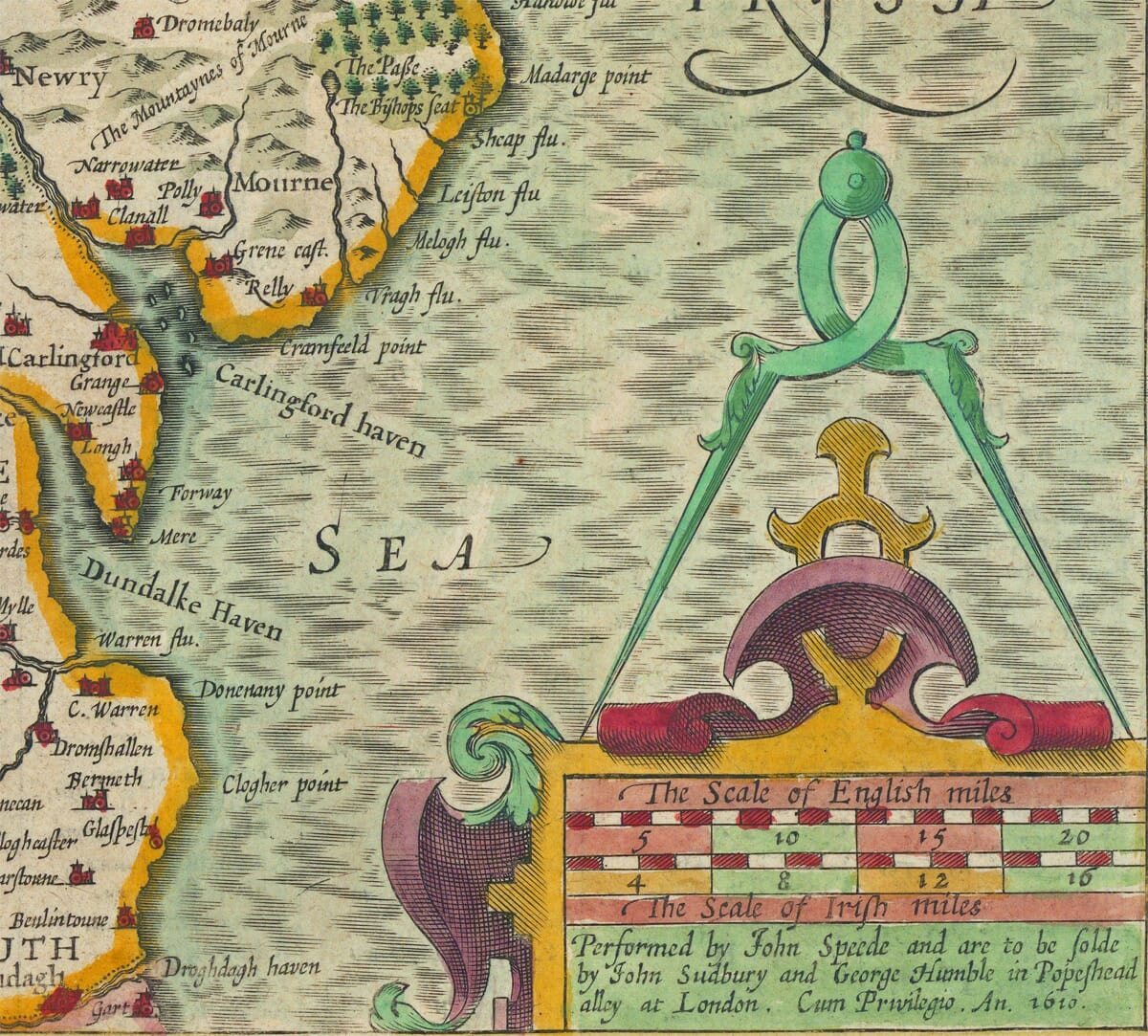
John Speed’s map bears the original title The Province Ulster Described. The copperplate is dated 1610 and the map first appeared in Speed’s Theatre of the Empire of Great Britaine, published in 1611–12. The atlas was the first great printed collection devoted to the individual counties and provinces of Britain and Ireland. Speed compiled its maps from existing surveys and other geographical sources, while much of the engraving was undertaken in Amsterdam by Jodocus Hondius.
The Ulster shown here is the historic Irish province, not the later political territory of Northern Ireland. It comprises nine counties: Antrim, Armagh, Cavan, Donegal, Down, Fermanagh, Monaghan, Tyrone and the county identified on the map as Colrane. Six are now within Northern Ireland, while Cavan, Donegal and Monaghan form part of the Republic of Ireland. The engraving also extends into County Louth along Ulster’s south-eastern approaches.
The use of “County Colrane” is especially revealing. The older county took its name from Coleraine and had not yet been reorganised as County Londonderry under the royal charter of 1613. Elsewhere the map preserves numerous early spellings and anglicised forms of Irish names. These make it rewarding for local and family-history research, although they should not always be interpreted as exact equivalents of modern boundaries or settlements.
Lough Neagh dominates the centre of the province, with the Rivers Bann, Blackwater and other waterways connecting the interior to the coast. To the west lie the two great expanses of Lough Erne, while Donegal’s deeply indented Atlantic shoreline contrasts with the eastern coast around Carrickfergus and Belfast Lough. Mountains are represented pictorially, and towns, castles, woods, rivers and islands are distinguished by carefully engraved symbols.
The map appeared during a decisive period in Ulster’s history. The Nine Years’ War had ended in 1603 with the defeat of the Gaelic alliance led principally by Hugh O’Neill and Hugh Roe O’Donnell. The Flight of the Earls in 1607 was followed by the Crown’s programme for the Plantation of Ulster, which began formally in 1609. Land was redistributed among English and Scottish settlers, London companies and loyal Irish landowners, bringing lasting changes to settlement, government, landholding, religion and culture.
Speed’s map is therefore often associated with the Plantation, but it was not simply a new survey made to document that scheme. Much of its geographical information was inherited from earlier Elizabethan mapping and could already have been several decades old when the plate was engraved. It is best understood as a published English view of Ulster at the moment when the province was entering a profound political transformation.
The inset entitled “Enis Kelling Fort” gives Enniskillen unusual prominence. Its castle occupied a commanding position between Upper and Lower Lough Erne and controlled important routes through Fermanagh. The stronghold changed hands during the conflicts of the 1590s and became a powerful symbol of military control in western Ulster. Rather than presenting a peaceful town prospect, Speed chose a fortified site whose recent strategic importance would have been readily understood by contemporary viewers.
Around the map are the visual features for which Speed became famous. The ornamental title cartouche incorporates an Irish harp, while sailing ships and a sea creature enliven the surrounding waters. Original impressions were printed from the copperplate in black ink. Colour was applied separately by hand, either for an early purchaser or, in many surviving examples, by a later colourist.
Speed’s atlas remained popular throughout the seventeenth century, and the Ulster plate was reissued by successive publishers. English descriptive text normally appeared on the reverse, combining geography, history and contemporary assumptions about the province. Today the map is valued not only for its decorative beauty but for the questions it raises about mapping, power and identity. It records historic Ulster before County Londonderry had received its later name and preserves a landscape poised between the Gaelic world and the new order of the seventeenth century.