JOHN SPEED’S MAP OF HAMPSHIRE
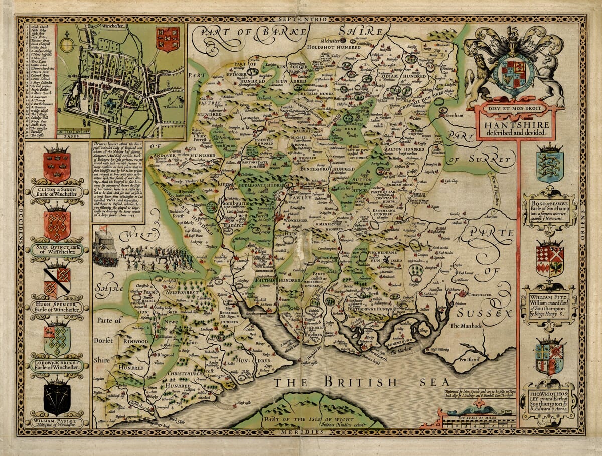
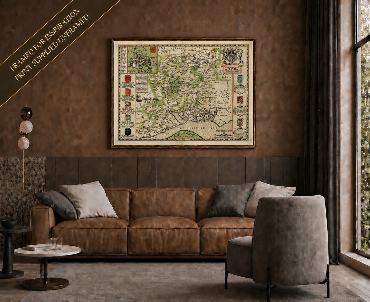
John Speed’s Hantshire described and devided first appeared in 1611 in his celebrated The Theatre of the Empire of Great Britaine. The atlas was one of the landmarks of early English cartography and brought together county maps, town plans, heraldry and historical information in a form that was both practical and highly decorative.
MAP DETAILS
Original title: Hantshire described and devided
Reproduced publisher state: Thomas Bassett and Richard Chiswell; associated with their London atlas edition of 1676
Cartographer: John Speed
Engraver: Jodocus Hondius
First published: London, 1611
Original publishers: John Sudbury and George Humble
Source atlas: The Theatre of the Empire of Great Britaine
Area shown: Hampshire, with adjoining parts of Dorset, Wiltshire, Berkshire, Surrey, Sussex and the Isle of Wight
Inset: Detailed street plan of Winchester
Principal places shown: Winchester, Southampton, Portsmouth, Ringwood, Romsey, Petersfield, Titchfield, Hamble, Basingstoke, Silchester, Andover and Odiham
Notable features: New Forest, Solent coastline, county Hundreds, forests, parks, beacons, rivers, castles, historic coats of arms and the vignette of Empress Matilda’s escape from Winchester
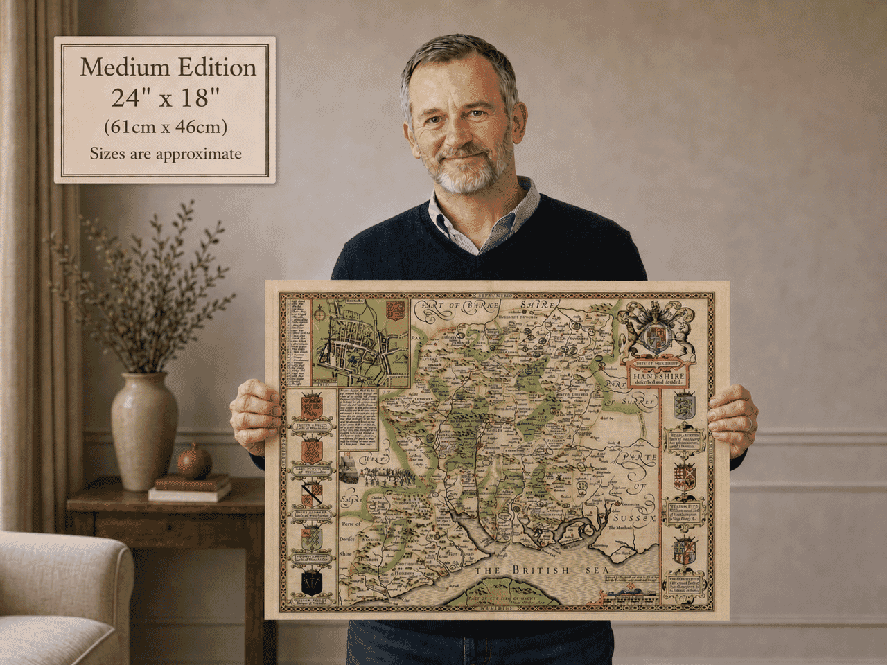
Product edition: Coloured reproduction of John Speed’s seventeenth-century Hampshire map
Speed did not pretend that every element of his county mapping came from his own surveys. The Hampshire sheet drew upon earlier work, particularly that of John Norden and Christopher Saxton, which Speed revised and embellished for his atlas. The finished copperplate was engraved by Jodocus Hondius in Amsterdam, whose exceptionally fine engraving helped give Speed’s maps their distinctive appearance.
WINCHESTER IN REMARKABLE DETAIL
One of the great attractions of this Hampshire map is the inset plan of Winchester.
Speed’s county atlas became famous partly because of its town plans, and the Winchester inset was one that Speed had surveyed himself. It shows streets, houses, gardens, the city walls and gates, bridges over the River Itchen, Winchester Cathedral, churches, mills and Winchester College. A scale measured in paces accompanies the plan.
Winchester was an especially appropriate choice. Long before Speed’s lifetime it had been one of England’s most important cities — a royal centre of the kingdom of Wessex, an ecclesiastical centre and a city whose history reached back through Saxon and Roman Britain.
Speed himself devoted considerable attention to Winchester in the descriptive text printed on the reverse of his Hampshire map, describing its royal associations, cathedral, walls and historic importance. The accompanying historical description also preserves Speed’s description of Hampshire as extending from Berkshire and Surrey in the north to the sea and Isle of Wight in the south.
A HAMPSHIRE OF FORESTS, PARKS AND DEER
Away from its towns, Speed’s Hampshire retains the character of a much more wooded county.
The New Forest is prominently depicted, together with other forests and wooded areas. Among the most delightful small details is a group of deer running among trees and hills while pursued by a hound — the sort of miniature incident that rewards close inspection of Speed’s maps. Parks are individually represented, sometimes enclosed by rings of paling, while woodland is shown through groups of engraved trees.
Speed described Hampshire’s soil as productive for corn and cattle and praised its pasture and woodland. The coloured edition gives these rural features greater visual separation, making the contrast between the county’s forests, settlements and coastal landscape particularly attractive.
HAMPSHIRE AND THE SEA
The southern edge of the map tells another story entirely.
Hampshire’s identity was inseparable from the sea. Southampton, Portsmouth, Titchfield and Hamble were among the important maritime places described by Speed, while the intricate Solent coastline and approaches to Portsmouth were of great strategic importance.
The original map records coastal castles and defences, rivers and bridges, and even hilltop beacons such as those at Selborne and Popham. These were part of a landscape in which warning of invasion could be carried rapidly across the countryside.
Your source text preserves Speed’s enthusiasm for Hampshire’s harbours, which he regarded as valuable both for commerce and for ships employed in other service.
The map therefore captures both sides of seventeenth-century Hampshire: the wooded and agricultural interior and a coastal county whose ports looked outward towards the Channel and continental Europe.
THE ANARCHY — A STORY HIDDEN WITHIN THE MAP
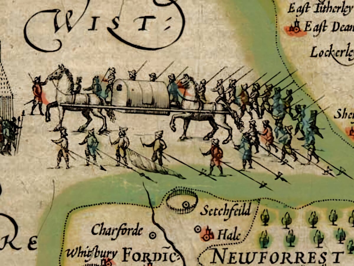
Speed was as interested in history as geography, and one of the most memorable features of the Hampshire sheet is the illustrated panel describing the civil war between King Stephen and the Empress Matilda during the twelfth century.
The engraving depicts Matilda’s dramatic escape from Winchester in 1141. Speed recounts the story that she escaped from Stephen’s forces concealed as though dead and carried away in a litter before eventually reaching safety.
Whether every colourful detail of Speed’s account would satisfy a modern historian is less important than what the vignette tells us about his approach. His maps were intended not simply to show roads, rivers and towns, but to present the history and identity of each county to the reader.
HERALDRY AND THE COLOURED EDITION
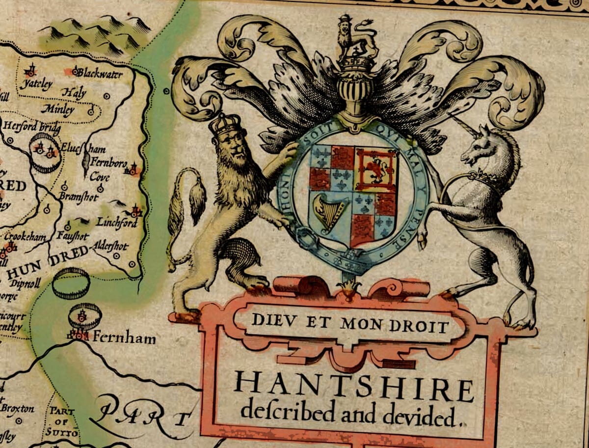
The Hampshire map is surrounded by an impressive sequence of coats of arms associated with the Earls of Winchester and Southampton, while the royal arms of James I appear prominently above the title cartouche.
These heraldic panels are particularly effective in a coloured edition. Speed’s engraver incorporated conventional markings indicating heraldic colours, allowing the shields to be interpreted according to the traditions of armorial design.
Colour also helps reveal the map’s elaborate strapwork, engraved borders and hundreds of tiny geographical details without changing the underlying historical content of the original design.
TOWNS AND PLACES SHOWN ON THE MAP
Among the many places that can be found are Winchester, Southampton, Portsmouth, Ringwood, Romsey, Petersfield, Titchfield, Hamble, Basingstoke, Silchester, Andover and Odiham.
The map also includes the New Forest, the Solent, part of the Isle of Wight and numerous smaller settlements, estates and coastal features. Christchurch appears on the western edge of the sheet in neighbouring Dorset rather than within Hampshire itself.
It is this density of recognisable places that gives Speed’s county maps their enduring appeal. A familiar village or town can often be found amid spellings and boundaries recorded more than four hundred years ago.
A COLOURED VIEW OF SEVENTEENTH-CENTURY HAMPSHIRE
John Speed’s Hampshire is much more than an old county outline. It combines geography, local history, Winchester’s streets, royal and aristocratic heraldry, forests, deer, ports and coastal defences within a single richly engraved sheet.
In this coloured edition, those details gain a new visual presence. The colour draws the eye through the county while the fine linework of the original engraving continues to provide the character and historical authenticity that makes Speed’s maps so distinctive.
For anyone with a connection to Hampshire, Winchester, Southampton, Portsmouth or the New Forest, it offers a wonderfully absorbing portrait of the county at the beginning of the seventeenth century.
Also Available
Prefer the quieter appearance of the original engraving?
Our alternative edition of John Speed’s Hampshire map is also available.





 Verified owner