Verified owner
Got there in time and loves it! Cheers David [Gift from US to UK]
 Verified owner
Thanks Lauren. We received it today - it's gorgeous! Thank you, Ellan
 Verified owner
Thank you for your prompt service. I have a gallery and framing business in South Wales. I'm so pleased it is printed in the UK
 Verified owner
My Isles of Scilly map arrived safely and I'm delighted with it!

The print arrived safely and we're delighted with it - a lovely reminder of our honeymoon 15 years ago.
 Verified owner
I have just received them! I'm sure our clients will be pleased with them and there could be more projects off the back of this one where we can use more. [Interior Designers]
 Verified owner
I just received my map of Ireland by Ewart today and, as usual, I am delighted by its quality. The crispness and fineness of detail is excellent and the colour reproduction surpasses my expectations. Please relay my thanks to Steve for another fine effort!
 Verified owner
Many thanks, Lauren. Very pleased with the map and the service: would recommend The Old Map Company to anyone interested in Old Maps.
 Verified owner
Many thanks, the map arrived safely this morning, and I’m really pleased with it. A stunning reproduction, just as I had hoped. I will keep browsing your website, and may yet be tempted by more of your items! Have a great weekend.
 Verified owner
Just arrived, wonderful map! Thanks very much!
 Verified owner
The map – beautiful – arrived safely, very many thanks.
 Verified owner
Thank you, I have already found the map. It’s wonderfull! Good luck! Rasa
 Verified owner
My apologies for the very late reply. I wanted to reach out to thank you so much for rushing my order. My partner absolutely loved it. I am amazed with the service so that is a five-star from me. I wish you all the best.
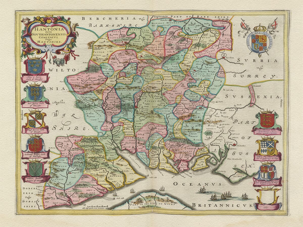
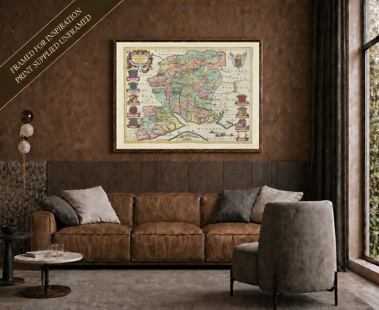
Joan Blaeu published this map in Amsterdam in 1645 as part of the fourth volume of his Theatrum Orbis Terrarum, sive Atlas Novus. Its full engraved title is Hantonia Sive Southantonensis Comitatus Vulgo Hantshire.
The title uses both Latin and an older English form of the county name. “Southamptonshire” was historically used alongside Hampshire, reflecting the county’s association with Southampton.
The first edition was a copperplate engraving measuring approximately 41.5 by 50.5 centimetres within the printed area. A documented 1645 example appeared in the French-language fourth part of Blaeu’s atlas, with descriptive text printed on the reverse.
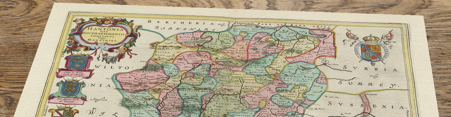
Blaeu was the publisher and engraver of this edition, but he did not personally conduct a new field survey of Hampshire. His English county maps were largely derived from John Speed’s atlas of 1611, which had itself drawn upon the pioneering Elizabethan surveys of Christopher Saxton.
Blaeu acknowledged the importance of Speed’s work in the introductory material to later editions. His contribution was to reinterpret the inherited cartography through refined engraving, lettering, colour, heraldry and decorative presentation.
The result is historically informative, but it should not be treated as a precise modern survey. Churches, towns, forests and parks are represented by conventional symbols rather than individual architectural drawings.
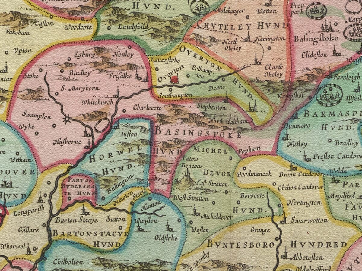
The map divides Hampshire into its traditional hundreds. These were longstanding administrative districts used for local government, justice and taxation.
Names such as Andover, Basingstoke, Bosmere, Christchurch, Fawley, Kingsclere, New Forest, Odiham and Portsdown can be identified among the divisions. Their colours and boundary lines help the viewer understand how seventeenth-century mapmakers organised the historic county.
Winchester is prominently marked near the centre, while Southampton and Portsmouth occupy important positions on the southern coast. Other recognisable places include Romsey, Ringwood, Lymington, Christchurch, Fareham and Petersfield.
These settlements are shown using map symbols. Portsmouth and Southampton are not represented by detailed architectural views, dock plans or fortification surveys.
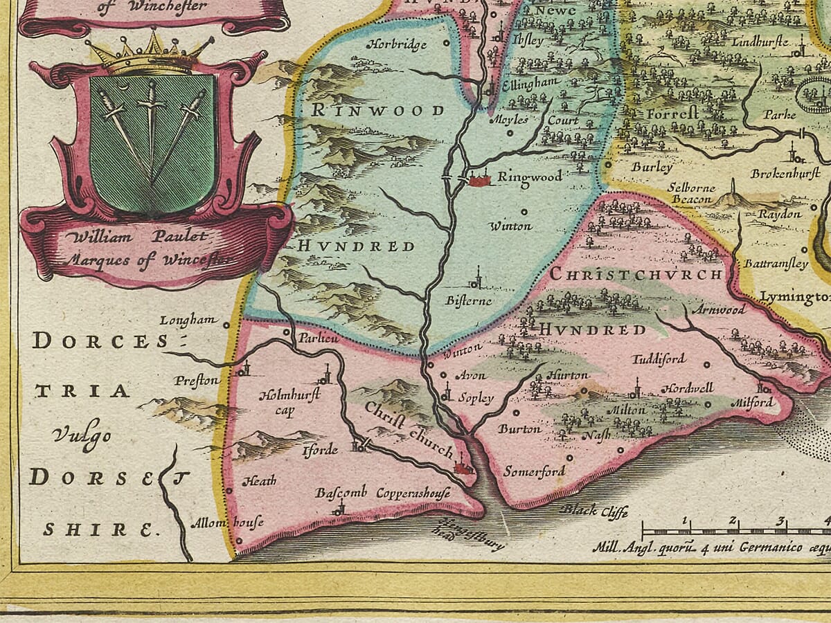
In southwestern Hampshire, groups of engraved trees identify the New Forest. Created as a royal hunting forest by William the Conqueror around 1079, it developed a distinctive system of forest law and customary commoning rights.
The map’s woodland symbols provide a strong visual indication of the forest’s location. They do not, however, distinguish every area of woodland, heath, common land or private enclosure.
Timber from the New Forest became increasingly important to naval shipbuilding, particularly in later centuries. That history is relevant to the region, but Blaeu’s engraving does not identify individual timber enclosures, shipyards or woodland supply routes.
The Rivers Test and Itchen are shown flowing into Southampton Water, while the Hampshire coast is traced from the Christchurch area eastwards towards Portsmouth and the Sussex border.
The northern coastline of the Isle of Wight appears across the Solent, but most of the island falls outside the lower edge of the map. Blaeu produced a separate plate, Vectis Insula Anglice The Isle of Wight, which provides a complete map of the island.
Several sailing ships decorate the coastal waters. They reflect the maritime character of the composition but do not document particular naval movements, transatlantic voyages, cargo routes or commercial services.
No sea monsters appear on the Hampshire map.
The map was published during the First English Civil War. One of Hampshire’s most important wartime sites was Basing House, a major Royalist stronghold that endured repeated siege operations between 1643 and 1645. It was stormed by forces commanded by Oliver Cromwell in October 1645.
This event is closely contemporary with the map’s publication and provides valuable historical context. Nevertheless, Blaeu’s engraving does not depict the sieges, military earthworks or the destruction of Basing House.
The county’s towns, forests, rivers and hundreds reflect established geographical information rather than a specially commissioned wartime survey.
An elaborate cartouche containing the map’s title occupies the upper-left corner. The page also carries the Royal Arms and nine family coats of arms, two of which are represented by blank shields.
The scale of English miles appears near the lower border, while numerous sailing ships decorate the sea. These elements create a carefully balanced composition around the coloured county geography.
The cartouche belongs to the ornate tradition of seventeenth-century Dutch mapmaking. It should not be called neoclassical, and there are no pastoral figures surrounding it that can be interpreted as representing forestry, farming or seafaring.
Blaeu’s map remains an exceptionally attractive record of historic Hampshire, combining the county’s hundreds, settlements, forests and southern coastline within one of the most accomplished atlas designs of the period.