Verified owner
Got there in time and loves it! Cheers David [Gift from US to UK]
 Verified owner
Thanks Lauren. We received it today - it's gorgeous! Thank you, Ellan
 Verified owner
Thank you for your prompt service. I have a gallery and framing business in South Wales. I'm so pleased it is printed in the UK
 Verified owner
My Isles of Scilly map arrived safely and I'm delighted with it!

The print arrived safely and we're delighted with it - a lovely reminder of our honeymoon 15 years ago.
 Verified owner
I have just received them! I'm sure our clients will be pleased with them and there could be more projects off the back of this one where we can use more. [Interior Designers]
 Verified owner
I just received my map of Ireland by Ewart today and, as usual, I am delighted by its quality. The crispness and fineness of detail is excellent and the colour reproduction surpasses my expectations. Please relay my thanks to Steve for another fine effort!
 Verified owner
Many thanks, Lauren. Very pleased with the map and the service: would recommend The Old Map Company to anyone interested in Old Maps.
 Verified owner
Many thanks, the map arrived safely this morning, and I’m really pleased with it. A stunning reproduction, just as I had hoped. I will keep browsing your website, and may yet be tempted by more of your items! Have a great weekend.
 Verified owner
Just arrived, wonderful map! Thanks very much!
 Verified owner
The map – beautiful – arrived safely, very many thanks.
 Verified owner
Thank you, I have already found the map. It’s wonderfull! Good luck! Rasa
 Verified owner
My apologies for the very late reply. I wanted to reach out to thank you so much for rushing my order. My partner absolutely loved it. I am amazed with the service so that is a five-star from me. I wish you all the best.
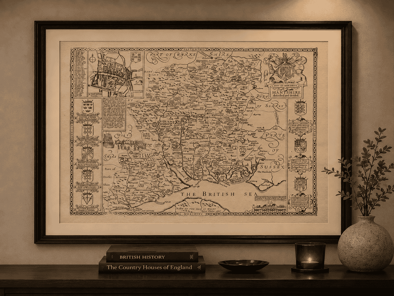
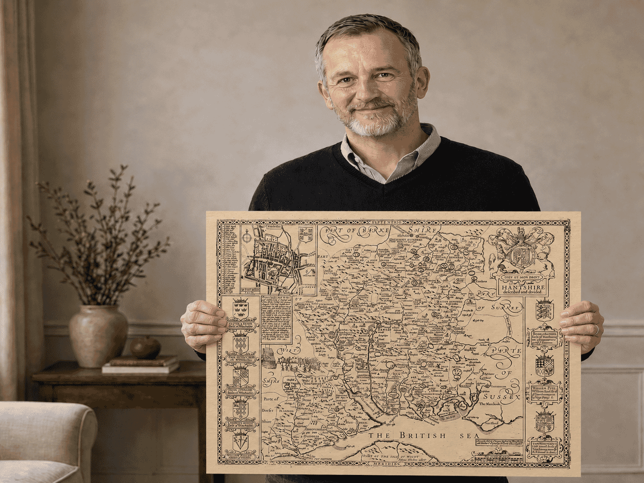
Speed’s Hampshire extends from inland towns such as Andover to Southampton, Portsmouth and the Solent. Winchester receives its own inset plan at the upper left, with a key to streets and important buildings. Woodland symbols give the New Forest a distinct presence, while Christchurch and the coast towards it show the county’s older boundaries. The sheet brings maritime geography, heraldry and historical annotation into the same composition.
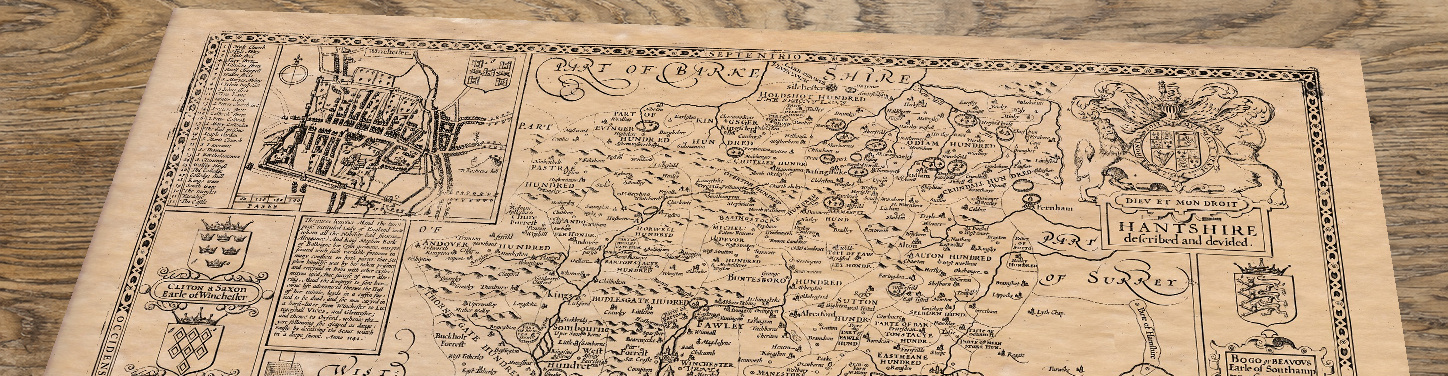
Winchester’s plan shows the compact city, its street pattern and important buildings, with a key for closer study. Southampton and Portsmouth occupy different positions along the southern coast, while the New Forest fills much of the south-western county. Ringwood and Christchurch appear within historic Hampshire, although Christchurch now belongs to Dorset. Part of the Isle of Wight is also visible offshore. The map’s hills, woodland symbols and coastline should be read as features of an early seventeenth-century county design. A later publishing date does not mean that all its geography had been revised to match the landscape of that later year.
The map records many of Hampshire’s principal towns, ports and settlements, including Winchester, Southampton, Portsmouth, Ringwood, Christchurch, Romsey, Petersfield, Titchfield, Hamble, Basingstoke, Silchester, Andover and Odiham. It also depicts the New Forest, the Solent coastline, part of the Isle of Wight, and numerous smaller villages, estates, castles and coastal defences across the county.
Christchurch appears within historic Hampshire on this map. It became part of Dorset much later, following the local government changes of 1974.
John Speed’s published county map was accompanied by a detailed historical description of Hampshire. The following transcription retains much of the account’s period language. It reflects the beliefs and geographical knowledge of its period; historical claims and judgements should be read in that context.
HANTSHIRE [Hampshire]
[Known as Ant-shire], by the Saxons, lying upon the west of England, is bordered upon in the north by Berkshire, upon the East with Surrey and Sussex, upon the south with the British seas, and Isle of Wight, and upon the West with Dorset and Wiltshire.
The length thereof from Blackwater in the North upon Surrey, unto Bascombe in the south upon the sea, extended in a right line, is fifty four English miles: and the breadth drawn from Petersfield in the East: unto Tidworth in the West, and confines of Wiltshire, is little less than thirty miles, the whole circumference about 155 miles.
The air is temperate, though somewhat thick by reason of the seas, and the many rivers that through the shire do fall, whose plenty of fish and fruitful increase, do manifoldly redeem the harms which they make.
The soil is rich for corn and cattle, pleasant for pasturage, and plenteous for woods; in a word, in all commodities either for Sea or land, blessed and happy.
Havens it hath, and those commodious both to let in, and to loose out ships of great burthen in trade of merchandise, or other employments: whereof Portsmouth, Tichfield, Hamble and Southhampton are chief: besides many other creeks that open their bosoms into those seas, and the coast strengthened with many strong castles, such as Hurt, Calbot, Southhampton, St. Andrews, Worth, Porchester, and the South Castle, besides other bulwarks, or blockhouses that secure the county and further inland; as Malwood, Winchester, and Odiam, so strong, that in the time of King John, thirteen Englishmen only defended the Fort for fifteen days against Lewis of France, that assaulted it most hotly.
Anciently it was possessed upon the north by the Segontians, who yielded themselves to Julius Cæsar, and whose chief City was Vindonum, Caer Segonte, now Silchester; and upon the South by the Belge, and Regni, who were subdued by Plaufius and Vefpafian the Romans, where Titus rescuing his father, straitly besieged by the Britains, (as Dio and Forcatulus do report) was grasped about with an adder, but no hurt to his person, and therefore taken for a sign of good luck. Their chief town was [Ringwood], as yet founding the name: and more within land inhabited the Manures, as Beda calls them, whose hundreds also to this day give a relish of their names.
Thirty six parish churches were converted and pulled down by the Conqueror, and thirty miles of circuit in-forested for his game of hunting, wherein his sons, Richard and Rufus, with Henry the son to Duke Robert, his first, felt by hasty death the hand of justice and revenge; for in the same forest, Richard by a pestilent air, Rufus by a shot taken for a beast, and Henry as Absolom hanged by a bough, came to their untimely ends.
The general commodities gotten in this shire, are wools, cloths and iron, whereof store is therein wrought from the mines, and thence transported into all parts of this realm, and their cloths carried into many foreign countries, to that countries great benefit, and to England’s great praise.
The trade whereof, with other provisions for the whole, are vented though eighteen Market Towns in this Shire, whereof Winchester, the Britains Caer Gwent, the Romans Venta Belgarum, and the Saxons Windonearben is chief, ancient enough by our British Historians, as built by King Rudbudibras, nine hundred years before the Nativity of Christ and famous in the Romans times for the weavings and [embroideries] therein wrought, to the peculiar uses of their Emperors own persons. In the Saxons time, after two Calamities of consuming fire, her walls were raised, and the City made the Royal Seat of their Weft Saxons Kings, and the Metropolitan of their Bishops See, wherein Egbert and Elfred their most famous Monarchs were crowned: and Henry the third, the Normans longest reigned first took breath: And here King Athelstane erected six houses for his Mint: but the Danish desola Henry Huntingtion over-running all, this City felt their fury in the days of King Ethelbright, and in the Normans time, twice was defaced by the misfortune of fire, which they
again repaired and graced with the trust of keeping the public Records of the Realm. In the civil Wars The Staple. of Maud and Stephen, this City was fore sacked, but again receiving breath, was by King Edward the third appointed the place for Mart of Wool and Cloth. The Cathedral Church built by Kenwolf King of the Weft Saxons that had been Amphibalus, S.Peters, Swithins, and now holy Trinity, is the Sanctuary for the paths of many English Kings: for herein great Egbert, An. 836. with Kings buried his Son King Ethelwolfe, 857. Here Elfred, Oxfords in Winchester. founder 901. with his Queen Elfwith 904. Here the first Edmund before the Conquest, 924. with his sons Elfred and Elfward Edred 955. and Edwy.956, both Kings of England. Here Emme,1052, with her Danish Lord Canute, 1035. and his son Hardicanute, 1042. And here. lastly the Normans, Richard and Rufus,1100. were interred; their bones by Bishop Fox were gathered and thrined in little guilt coffers fixed upon a wall in the Quire, where still they remain carefully preserved.
This Cities situation is fruitful and pleasant, in a valley under hills, having her River on the East, and Castle on the West, the circuit of whose walls are well near two English miles, containing 1880 paces; throgh which openeth six gates for entrance, and therein are seven Churches for divine service, besides the Minster, and those decayed: such as Callendar, Ruell Chappel, S. Maries Abbey, and the Fryers, without in the Suburbs, and Sooke; in the East is S. Peters, and in the North Hyde- Church and Monastery, whose ruins remaining, show the beauty that formerly it bare. The Graduation of this City by the Mathematics, is placed for Latitude in the degree 51, 10 minutes, and for Longitude 19,3 minutes.
The Situation of Winchester.
More South is Southhampton, a town populous Southhamp rich and beautiful, from whom the whole Shire derives her name, most strongly walled about with square stone, containing in circuit, 1200 paces, having seven gates for entrance, and 29 towers for defence, two very stately [quays] for ships arrivage, and five fair Churches for Gods divine service, besides an hospital called God’s house, wherein the unfortunate Richard, Earl of Cambridge, beheaded for treason, lieth interred. On the West of this Town is mounted a most beautiful Castle, in form Circular, and wall within wall, the foundation upon a hill so topped, that it cannot be ascended but by stairs, carrying a goodly prospect both by Land and Sea, and in the East without the walls a goodly Church sometimes slood, called S. Maries, which was pulled down, for that it gave the French direction of course, who with fire had greatly endangered the Town’s instead thereof, is now newly erected a small and unfinished Chapel. In this place, saith learned Cambden, stood the ancient Claufentium, or fort of the Romans, whose circuit Claufentiume on that fide extended itself to the Sea: this suffered many depredations by the Saxon Pirates, and in An.980 was by the Danes almost quite overthrown. In King Ed ward the thirds time, it was fired by the French, under the Conduct of the King of Sicilssfyn, whom a Country. man encountered and struck down with his Club, He crying Rancon, that is, ransom: but neither understanding his language, nor the Law that Armes doth allow, laid on more soundly, saying, I know thee a Frankon, and therefore shalt thou die: and in Richard the second time it was somewhat removed, and built in the place where now it standeth. In this Claufentium Canute to evict his slatterers, made trial of his Deitie, commanding the Seas to keep back from his feat: but being not obeyed, he acknowledged God to be the only supreme Governor, and in a religious devotion gave up his Crown to the Rood at Winchester. More ancient was Silcefter, built by Constan Silcestertius, great Constantines Son, whose monument(they say) was seen in that City, and where another Constantine put on the purple robe against Honorius, as both Ninius and Niniuss Gernafe of Canterbury do witness. Here by our Historians Ger. Cant record, the warlike Arthur was crowned. whose greatness for circuit contained no less then 80 acres of ground, & the walls of great height, yet standing 2 miles in compass about. This City by the Danish Rovers suffered such wrack, that her mounted tops were never since seen and her hulk (the walls) inmured to their middle in the earth, which the rubbish of her own desolations hath filled.
Finally detailed on the rear of this old map of Hampshire the chief religious houses within this county are [the most reacted and again suppressed] were these, Christ-Church, religious houses Beaulieu, Whorwell, Rumsey, Redbridge, Winchester, Hyde, in this Southhampton and Tichfield. The honour of this Shire is dignified with the high Titles of Marques, and them Earls of Winchester and Southhampton; whose Armes of Families are as thousand, and her division into thirty seven Hundreds, and those again into two hundred fifty three Parishes, as in her table shall appear.