Joan Blaeu’s Old Map of the Firth of Lorn
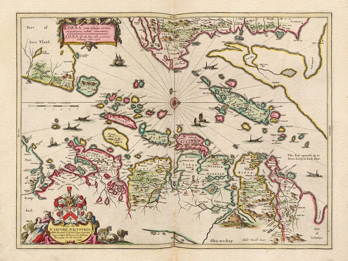
This remarkable old map presents Lorn and its neighbouring islands as they were understood in the seventeenth century. Its original title, Lorna cum insulis vicinis et provinciis eidem conterminis, is followed by the English wording “Lorn with the Isles and provinces bordering thereupon.”
The map was based upon the pioneering surveys of the Scottish cartographer Timothy Pont and published by Joan Blaeu in Amsterdam in 1654. It appeared in the Scottish volume of Blaeu’s Theatrum Orbis Terrarum, sive Atlas Novus—the first atlas devoted entirely to Scotland.
Map details
- Original title: Lorna cum insulis vicinis et provinciis eidem conterminis
- English title: Lorn with the Isles and provinces bordering thereupon
- Area depicted: Lorn, the Firth of Lorn and neighbouring Inner Hebridean islands
- Original surveyor: Timothy Pont
- Publisher: Joan Blaeu
- Published: Amsterdam, 1654
- Original format: Copperplate engraving
- Product type: Fine art reproduction map print
A Maritime Landscape of Mainland and Islands
The Firth of Lorn lies where the deeply indented coast of Argyll meets the islands of the Inner Hebrides. It extends between the mainland and the southeastern coast of Mull, opening southwestwards towards the Atlantic.
Blaeu’s map captures this intricate meeting of land and water. The islands of Kerrera, Seil and Luing appear alongside a mainland coast broken by sea lochs, headlands and sheltered inlets. Parts of Mull lie across the firth, while numerous smaller islands and channels complete a landscape whose character has always been inseparable from the sea.
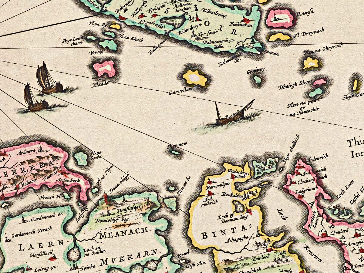
Modern Oban had not yet developed into the harbour town familiar today. The map instead records a region of scattered settlements, castles, estates and old territorial divisions. Historic place names appear in forms that may differ considerably from their modern spellings, preserving traces of Gaelic pronunciation as it was interpreted by Pont and later engravers.
This was a place in which water frequently offered the most practical means of travel. Boats carried people, livestock, messages and goods between the islands and the mainland, while the firth connected local communities with the wider Hebrides and Scotland’s western seaways. The channels that divide the islands were not simply boundaries: they were the routes that held the region together.
Timothy Pont’s Survey of Scotland
Timothy Pont travelled through Scotland during the late sixteenth century, recording its coastlines, rivers, settlements, castles and estates. His surviving manuscript maps constitute the earliest detailed survey of much of the country.
Pont died before his ambitious work could be published. His papers were preserved and eventually made available to Joan Blaeu’s Amsterdam workshop, where Scottish scholars including Sir John Scot of Scotstarvet and Robert Gordon of Straloch helped prepare the material for publication.
The resulting maps combined Pont’s first-hand Scottish observations with the accomplished engraving and typography of the Blaeu publishing house. Although refined for a European atlas, they retained an exceptional wealth of local information that could not have been assembled from Amsterdam alone.
This map was dedicated to Sir James Balfour of Denmilne, the Scottish antiquary and herald who played an important part in preserving Pont’s cartographic legacy. The dedication connects the finished engraving with the network of Scottish scholars whose efforts allowed Pont’s surveys to reach an international audience.
Lorn Before Later Transformation
The landscape shown here predates many of the changes now associated with the district. Oban’s considerable growth as a port and resort came much later, particularly after improved transport connections transformed the town during the eighteenth and nineteenth centuries.
The islands of Seil, Easdale and Luing would subsequently become celebrated for their slate quarries. At the height of that industry, roofing slate was exported from these islands to towns and cities far beyond Scotland. Blaeu’s map depicts the area before this intensive quarrying reshaped parts of the islands and gave them their collective identity as the Slate Islands.
The map should not be interpreted as a modern navigational chart. Coastlines, distances and island shapes were drawn from early surveying rather than precise scientific measurement. Hills are represented pictorially, settlements by conventional symbols and maritime passages with varying degrees of accuracy.
These characteristics do not lessen the map’s historical value. They reveal how one of Scotland’s most complex coastal landscapes was observed, recorded and presented more than three and a half centuries ago.
An Enduring Portrait of Western Scotland
Blaeu’s engraving is both an historic county map and an atmospheric portrait of Scotland’s western coast. It invites the eye to travel from island to island, following sounds and sea lochs through a landscape whose communities have long looked towards the water.
For anyone with a connection to Argyll, Lorn or the Inner Hebrides, familiar names emerge from an unfamiliar seventeenth-century world. Those with a particular love of the islands may also enjoy our old map of the Isle of Mull.
Reproduced as a fine art map print, this antique map brings the geography and history of Scotland’s western seaways into the home while preserving the distinctive character of Blaeu’s original engraving.






 Verified owner

















