Joan Blaeu’s Map of Historic Nottinghamshire
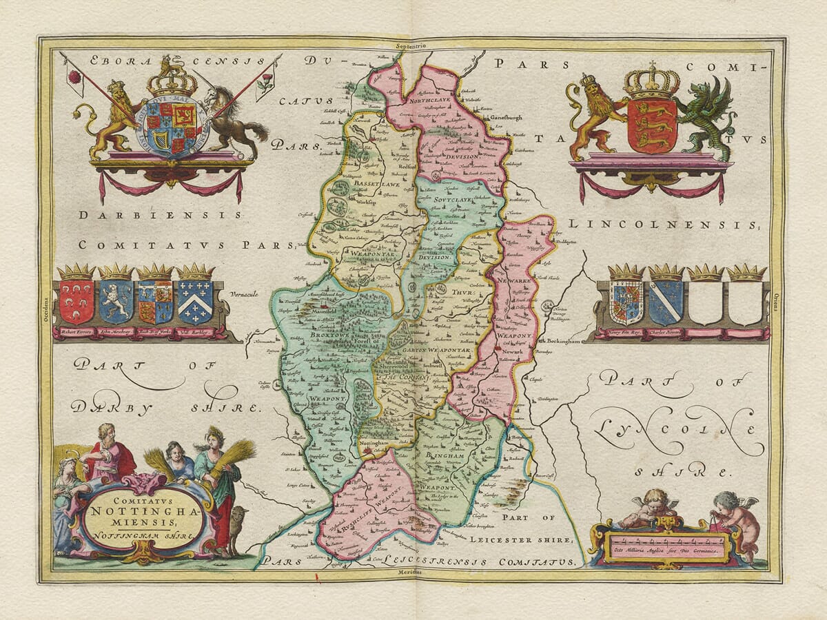
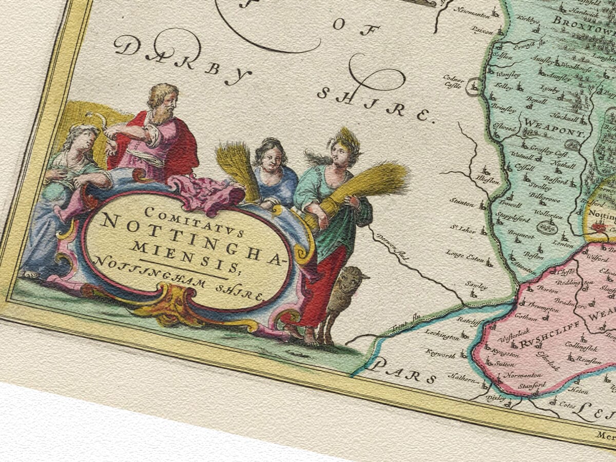
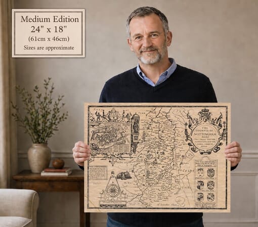
Joan Blaeu’s map of Nottinghamshire was first published in Amsterdam in 1645 as part of the fourth volume of his Theatrum Orbis Terrarum, sive Atlas Novus. Its engraved title, Comitatus Nottinghamiensis; Nottingham Shire, combines the county’s Latinised name with the English form familiar to contemporary readers.
The map belonged to Blaeu’s celebrated collection of English and Welsh county maps. These substantial copperplate engravings combined established geographical information with elaborate cartouches, heraldry and carefully arranged typography. Intended for wealthy collectors across Europe, Blaeu’s atlas was valued as both a geographical reference and a work of decorative art.
Joan Blaeu and the Amsterdam Workshop
Joan Blaeu inherited the family publishing house following the death of his father, Willem Blaeu, in 1638. Under Joan’s direction, the business expanded its atlas production and became one of the foremost cartographic establishments of the Dutch Golden Age.
The Nottinghamshire map belongs to the county volume published under Joan’s leadership and should therefore be attributed to him rather than to Willem. Blaeu did not undertake a new survey of the county. Its geography was based principally upon earlier English mapping, particularly the surveys of Christopher Saxton and the county map subsequently published by John Speed.
Blaeu’s engravers refined and re-presented this inherited material in the distinctive style of the Amsterdam workshop. The copperplate remained in use for later editions and was eventually incorporated into the monumental Atlas Maior. Surviving originals may consequently carry Latin, French, Dutch or German text on the reverse.
Nottinghamshire and the River Trent
The River Trent is the defining geographical feature of southern Nottinghamshire. It passes Nottingham and Newark before continuing northwards towards the Humber, connecting the county with a wider network of inland and maritime trade.
Nottingham occupies a prominent position beside the Trent. Its castle stood above the town and commanded an important river crossing and routes through the Midlands. The town was already an established centre of commerce and administration, although the enormous expansion associated with later textile manufacture and industrialisation still lay far in the future.
Newark-on-Trent appears farther northeast at another strategically important crossing. Its castle, bridge and position on the Great North Road gave the town considerable military and commercial significance.
Other recognisable settlements include Mansfield, Worksop, Retford, Southwell, Bingham and numerous smaller market towns and villages. Southwell Minster reflects the county’s long ecclesiastical history, while the northern estates and religious houses helped shape settlement across the region.
Blaeu represents towns through conventional building and church symbols. Hills are depicted pictorially, woodland appears as clusters of individual trees and roads are not systematically recorded. The engraving should therefore be understood as a seventeenth-century interpretation rather than a modern measured survey.
Sherwood Forest and the County Landscape
Sherwood Forest occupies an important place in Nottinghamshire’s historical identity. In the seventeenth century it was a royal forest governed by particular laws and rights. The term did not describe an unbroken mass of woodland: the forest included wooded areas, heath, grazing land, cultivated ground, villages and estates.
The forest had long been associated with royal hunting and with communities whose livelihoods depended upon timber, grazing and customary access to the land. Its extent and character changed considerably over time as areas were enclosed, cleared or converted to agriculture.
Sherwood’s enduring fame is inseparable from the legends of Robin Hood. The stories had already circulated for centuries when Blaeu’s map was published, but the engraving does not attempt to illustrate them. Instead, it records the genuine towns, villages and woodland landscape against which the legends became associated.
Elsewhere in the county, fertile land beside the Trent contrasted with the sandier soils and woodland farther north. Farming, livestock, woodland industries, local markets and estate management shaped the predominantly rural economy represented on the map.
Nottinghamshire During the Civil War
The publication date places the map within one of the most dramatic periods in the county’s history. On 22 August 1642, King Charles I raised his royal standard at Nottingham, traditionally marking the beginning of the First English Civil War.
Nottingham itself subsequently came under Parliamentarian control, but Newark became one of the strongest Royalist garrisons in the Midlands. Its position beside the Trent and the Great North Road allowed Royalist forces to influence movement and communication through the region.
Newark endured three sieges during the war. The final siege began in late 1645 and continued until May 1646, when the garrison surrendered on the instructions of Charles I. Blaeu’s map does not depict these campaigns, but it presents the county’s towns, rivers and routes during the very years in which they acquired exceptional military importance.
The apparently orderly landscape of the engraving therefore contrasts strongly with the political and military upheaval occurring in Nottinghamshire when the map first appeared.
Cartouches and Heraldic Decoration
The geographical detail is framed by decorative title and scale cartouches, Royal heraldry and an arrangement of eight family shield positions. Six display completed coats of arms, while two were deliberately left blank.
These heraldic devices associate the county with noble families, titles and traditions of landownership. They also give the composition the visual richness expected by the international audience for Blaeu’s atlases.
Today the map provides a compelling portrait of Nottinghamshire before canals, railways, industrial towns and modern roads transformed its landscape. It remains both an absorbing record of the historic county and an outstanding example of seventeenth-century decorative cartography.





 Verified owner