Joan Blaeu’s Seventeenth-Century Map of Liddesdale
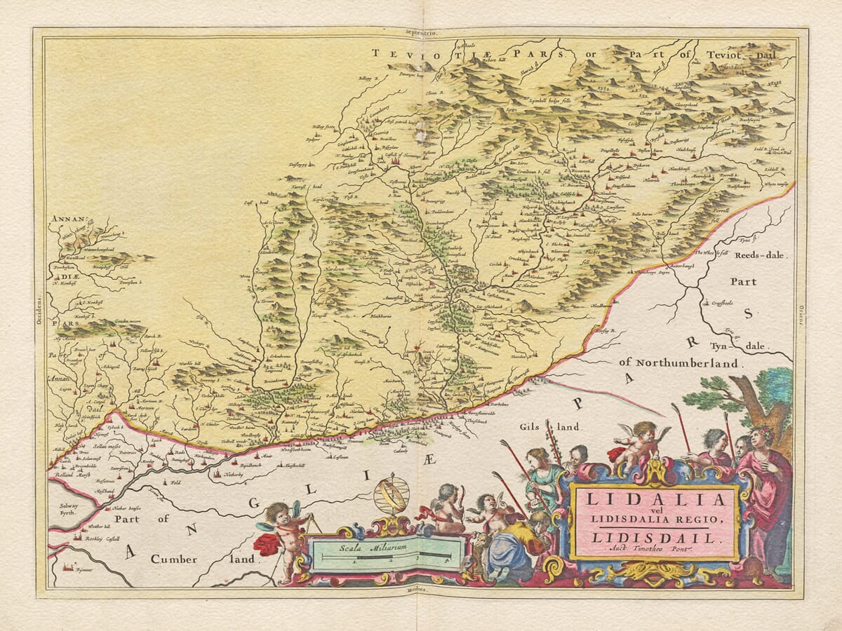
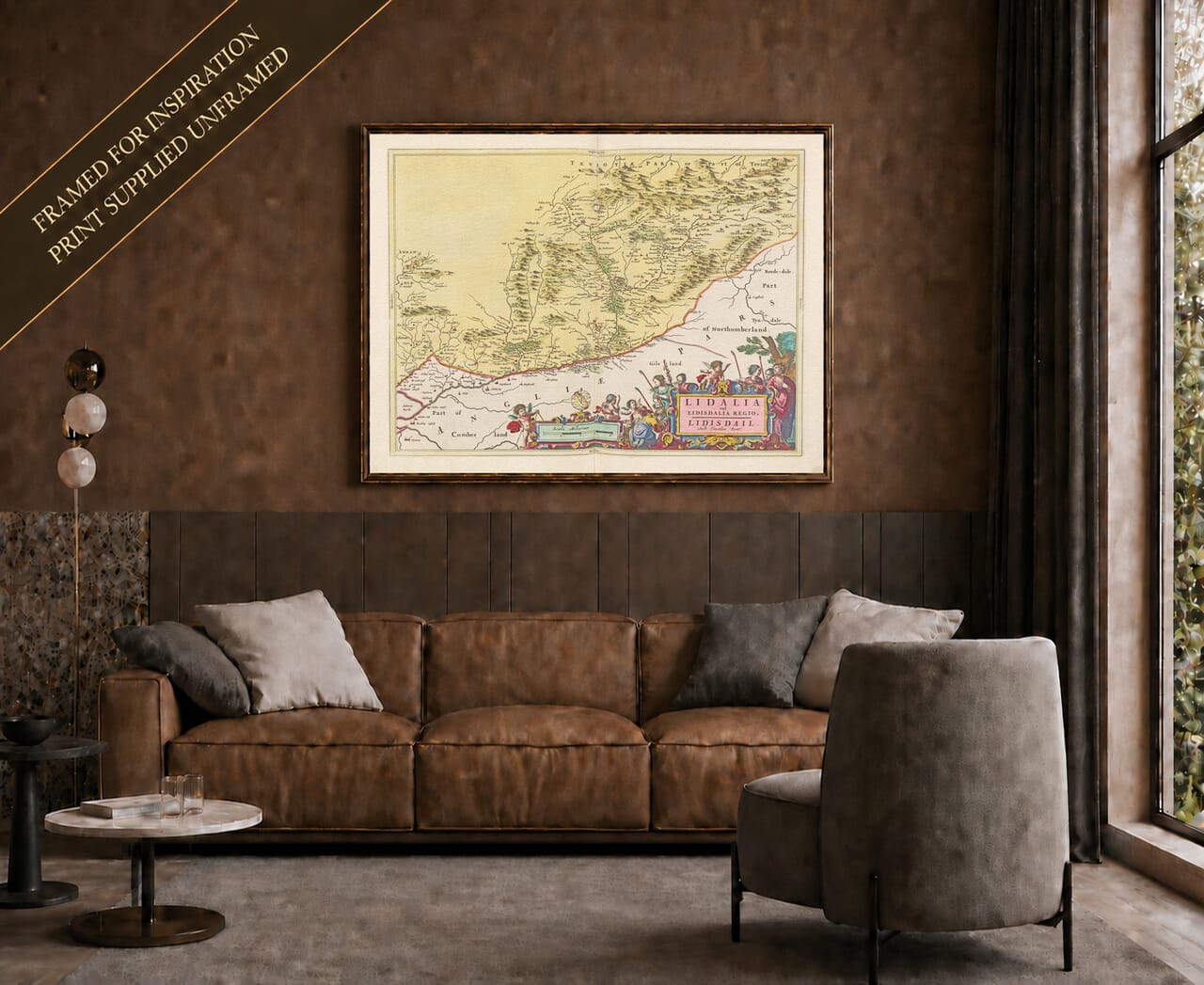
Published in Amsterdam in 1654, Blaeu’s map of Liddesdale preserves an extraordinarily detailed picture of one of the most fiercely contested districts of the Anglo-Scottish Border. Entitled Lidalia vel Lidisdalia Regio. Lidisdail, it was based upon the surveying work of Timothy Pont, whose late-sixteenth-century mapping formed the foundation for much of Joan Blaeu’s celebrated Atlas of Scotland. The National Library of Scotland records the printed Liddesdale map among the surviving Pont-derived sheets.
Map Details
Original title: Lidalia vel Lidisdalia Regio. Lidisdail. Auct. Timotheo Pont
Original cartographer / surveyor: Timothy Pont
Publisher: Joan Blaeu
First published: Amsterdam, 1654
Area shown: Liddesdale and the Liddel Water valley on the Scottish-English Border, with adjoining parts of Cumberland and Northumberland
Principal features: Liddel Water and its tributaries, settlements, castles and tower houses, Hermitage Castle and the March Dyke associated with the Debatable Lands
Source atlas: Theatrum Orbis Terrarum, sive Atlas Novus — Atlas of Scotland, 1654
Product type: Reproduction of a seventeenth-century copper-engraved map
Liddesdale takes its name from the Liddel Water, which runs southwards through the valley towards the English frontier. Its position made the district strategically important for centuries. To the north and east lay the other Border territories of Scotland, while immediately beyond the frontier were Cumberland and Northumberland. Blaeu’s map therefore depicts not simply a rural valley but a landscape whose castles, routes and settlements had been shaped by generations of conflict.
Pont’s survey was undertaken at the end of the sixteenth century, when the Border country was still experiencing the final decades of the world of the Border Reivers. Families on both sides of the frontier conducted raids, carried away livestock, pursued feuds and formed alliances that did not necessarily respect allegiance to either Crown. Liddesdale acquired an especially formidable reputation within this frontier society.
Dominating the map and the history of the district is Hermitage Castle. Standing beside Hermitage Water, the fortress controlled access through Liddesdale and was one of the most important strongholds of the Scottish Middle March. Historic Environment Scotland describes Hermitage as the “strength of Liddesdale” and emphasises its crucial role in controlling this volatile part of the Border.
The castle passed through the hands of some of medieval Scotland’s most powerful families, including the Soulises, Douglases and Hepburns. Its remoteness today can disguise how politically important it once was. During the sixteenth century it was closely associated with the Hepburn Earls of Bothwell, and Mary, Queen of Scots famously travelled to Hermitage in 1566 after James Hepburn, Earl of Bothwell, was wounded. The surviving fortress consequently provides a tangible connection between the local Border landscape shown by Pont and events of national Scottish history.
Another particularly significant feature on Blaeu’s map is the March Dyke, shown close to the frontier. This earthwork marked the division created in 1552 through the formerly disputed territory known as the Debatable Lands. For generations this area between Scotland and England had been difficult for either government to control. Blaeu’s engraving therefore captures the landscape only about a century after an attempt had finally been made to establish a more definite boundary. Specialist descriptions of the original map specifically identify the Scots’ Dike, labelled March Dyik, on the sheet.
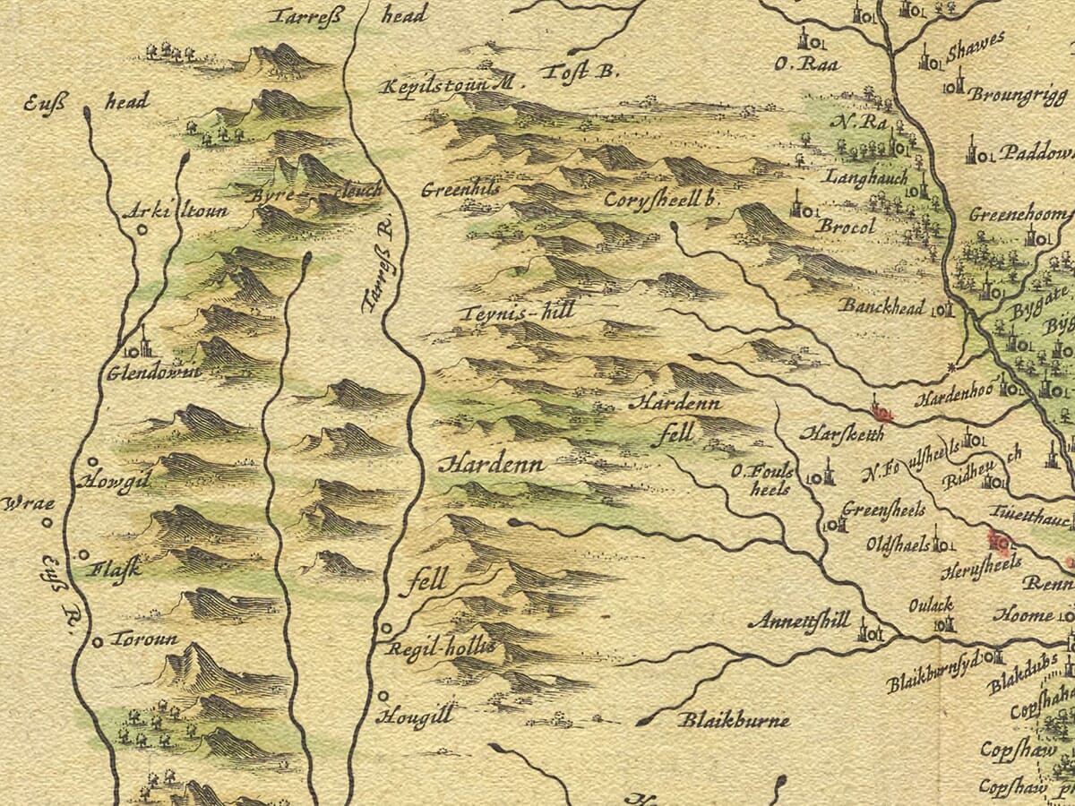
The density of castles and settlements is equally revealing. In a region vulnerable to raiding and counter-raiding, fortified houses and strongholds were fundamental elements of the landscape. Pont’s interest in recording such sites means the map is valuable not only for its geography but also as evidence of settlement patterns during the closing years of the Border reiving period.
The political world that Pont knew was already changing when Blaeu finally published the map. The Union of the Crowns in 1603, when James VI of Scotland also became James I of England, removed the international frontier which had given the Border Marches their military purpose. Royal government increasingly suppressed reiving and dismantled many of the institutions that had governed the frontier.
By the time the map appeared in 1654, therefore, Blaeu was publishing geographical information gathered from a landscape undergoing profound change. This gives the engraving a particular historical value: much of its underlying survey reflects Liddesdale at the very end of its centuries-old existence as a militarised Border district.
The publication itself was part of one of the great achievements of seventeenth-century Scottish cartography. Pont died without seeing his national mapping project printed. His manuscript surveys were preserved and developed, notably with assistance from Robert Gordon of Straloch, before eventually reaching the Blaeu publishing house in Amsterdam. Joan Blaeu transformed them into beautifully engraved maps for the Scottish volume of his Atlas Novus.
As with other Blaeu maps, practical geographical information was combined with decorative artistry. Rivers, hills, settlements and fortifications fill the landscape, while classical figures frame the title and scale. The National Records of Scotland describes its surviving example as a hand-coloured engraving measuring approximately 395 × 510 mm, with the title and scale framed by classical figures.
Today Blaeu’s old map of Liddesdale provides a compelling record of a landscape inseparable from the history of the Scottish Borders. Hermitage Castle, the Liddel valley, the March Dyke and the numerous small settlements recorded by Pont preserve a visual connection with the era of the Border Reivers and the centuries-old frontier between Scotland and England.
For anyone with family or historical connections to Liddesdale and the Scottish Borders, it is far more than an attractive antique map: it is a detailed record of one of Scotland’s most remarkable historic frontier landscapes.
Browse our collection of old maps of Scotland →






 Verified owner