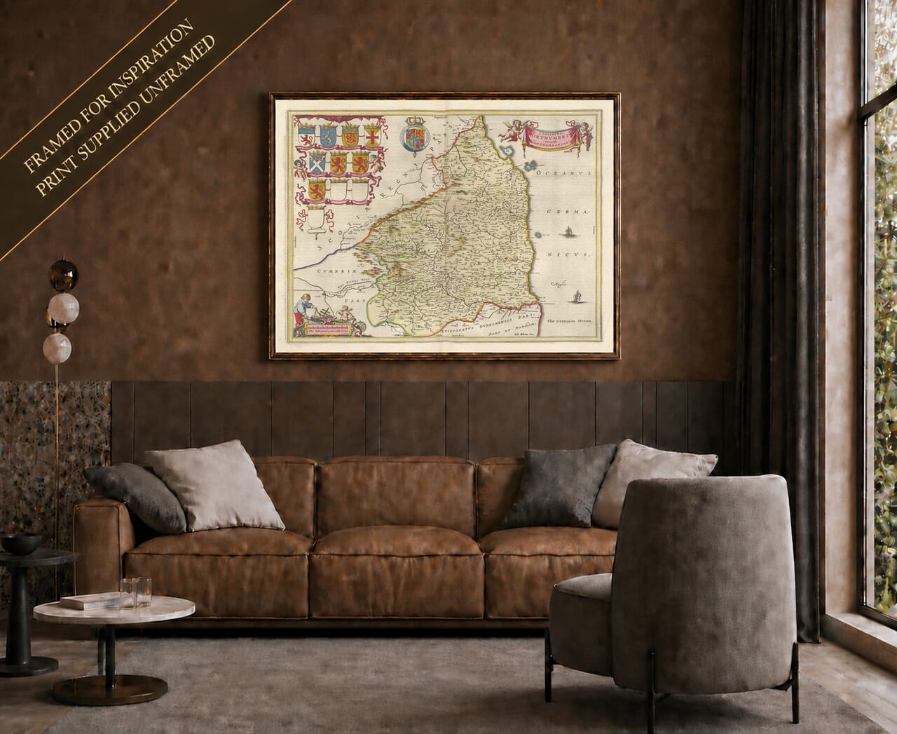
Joan Blaeu’s Map of Historic Northumberland
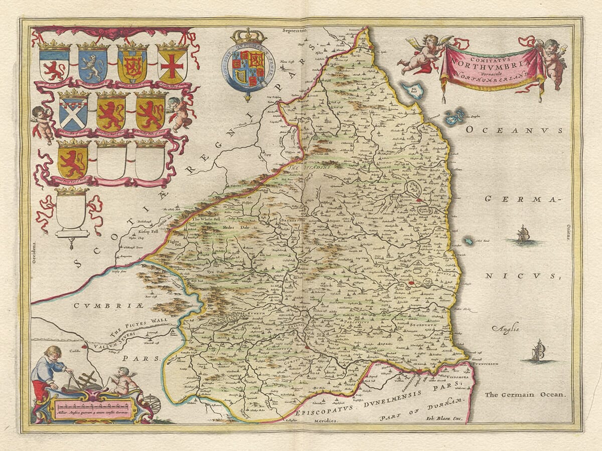
Joan Blaeu’s map of Northumberland was first published in Amsterdam in 1645 as part of the fourth volume of his Theatrum Orbis Terrarum, sive Atlas Novus. Its engraved title, Comitatus Northumbria, Vernacule Northumberland, may be understood as “The County of Northumbria, commonly called Northumberland.”
The map belonged to Blaeu’s celebrated collection of English and Welsh county maps. These substantial copperplate engravings combined inherited geographical knowledge with decorative cartouches, heraldry and carefully arranged typography. They were intended for an international market in which a prestigious atlas was valued as both a source of information and a work of art.
Joan Blaeu and the English County Atlas
Joan Blaeu inherited the family publishing house after the death of his father, Willem Blaeu, in 1638. Under Joan’s direction, the Amsterdam workshop greatly expanded its atlas production and became one of Europe’s foremost cartographic establishments.
The Northumberland map belongs to the county volume issued under Joan’s leadership and should therefore be attributed to him rather than to Willem. Blaeu did not personally survey Northumberland. Its geographical content was based principally upon earlier English county mapping, especially the work of Christopher Saxton and John Speed.
Blaeu’s engravers refined and re-presented this inherited information in the distinctive decorative style of the Amsterdam workshop. The copperplate was reused in later atlas editions and eventually incorporated into the monumental Atlas Maior. Surviving original examples may consequently carry Latin, French, Dutch or German text on the reverse.
England’s Northern Border County
Historic Northumberland extended from the River Tyne northwards to the River Tweed and the Scottish border. Its long North Sea coastline, upland interior and position between England and Scotland gave the county a distinctive character.
Newcastle upon Tyne dominates the southern part of the map. Its bridge, river crossing and access to the sea had helped establish it as the region’s principal commercial centre. Coal from the Tyne was already being shipped in considerable quantities to London and other markets, giving Newcastle an economic importance far beyond the county.
Morpeth and Alnwick appear along the principal routes leading north. Alnwick Castle was the great northern seat of the Percy family, whose history had long been closely connected with warfare, royal politics and defence of the border. Farther north, Bamburgh occupies its commanding position near the coast, while Berwick-upon-Tweed stands close to the Scottish frontier.
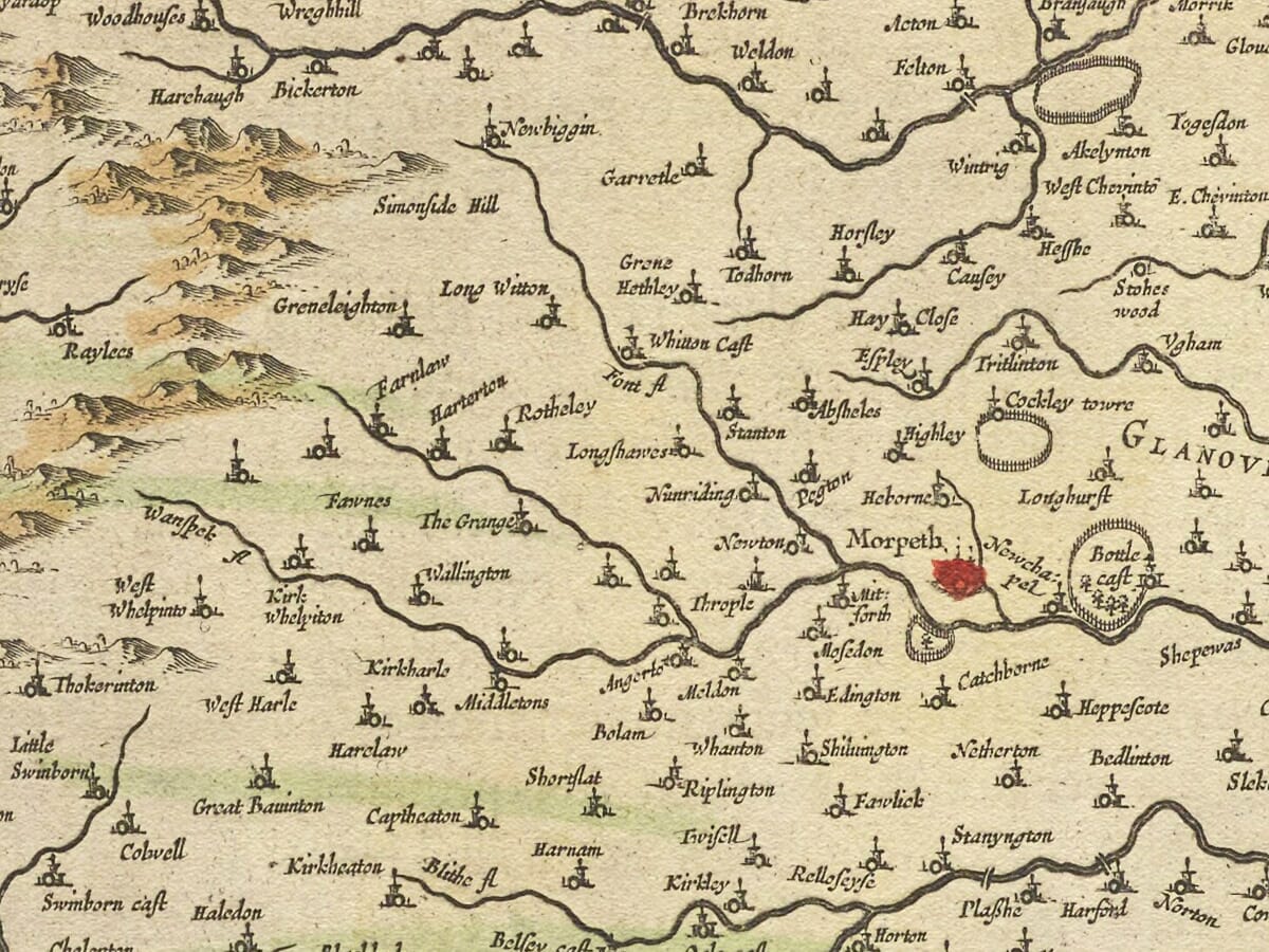
Hexham appears in the Tyne Valley to the west, surrounded by the more mountainous country of the county’s interior. Numerous villages, castles and smaller settlements are identified through conventional symbols, often accompanied by historic spellings that differ from those used today.
Rivers, Coast and Islands
Northumberland’s rivers provide much of the map’s geographical structure. The Tyne and its northern and southern branches cross the lower portion of the county, while the Wansbeck, Coquet, Aln and Tweed flow eastwards towards the North Sea.
The coastline includes Holy Island, or Lindisfarne, whose monastery had been one of the great centres of early Christianity in Anglo-Saxon England. The nearby Farne Islands are also associated with the religious history of St Cuthbert and with centuries of navigation along a demanding coastline.
Blaeu represents hills through pictorial profiles rather than measured contours. Woodland appears as groups of individual trees, while towns and villages are distinguished through conventional building and church symbols. Roads are not systematically shown, so the engraving should not be interpreted as a modern travelling map.
Two sailing ships animate the waters of the North Sea. Although principally decorative, they also acknowledge the importance of coastal trade, fishing and maritime communication to Northumberland’s economy.
Castles and the Border Country
For centuries Northumberland had been shaped by conflict between England and Scotland. Castles, fortified houses and defensive towers were prominent features of the landscape, protecting important routes, river crossings, estates and vulnerable communities.
The Union of the Crowns in 1603, when James VI of Scotland also became James I of England, brought the two kingdoms under one monarch. It reduced the likelihood of formal Anglo-Scottish warfare, although it did not immediately erase the legacy of raiding, family feuds and insecurity associated with the border.
Blaeu’s map therefore depicts a county whose geography had been influenced by defence and political rivalry. The numerous castles and historic strongholds shown or named across the region reflect Northumberland’s long position at the northern edge of England.
Northumberland During the Civil War
The map appeared during the First English Civil War. Newcastle’s coal trade and control of the Tyne made the town strategically and economically important. It supported the Royalist cause but was besieged and captured by Scottish Covenanter forces allied with Parliament in October 1644.
By the time Blaeu’s map was first published in 1645, Newcastle and much of the surrounding region had already experienced the effects of military occupation and disrupted trade. The engraving does not depict these events and was not intended as a military map. Instead, it presents an enduring image of the county’s settlements, rivers and border landscape.
Heraldry and Decorative Cartography
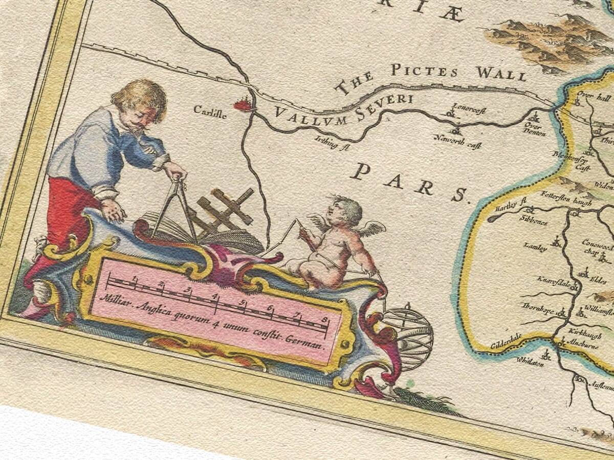
The title cartouche is supported by two cherubs, while a separate figure cartouche contains the map’s scale. Eleven heraldic shield positions appear within the composition, although three were deliberately left blank.
These arms connect the county with its noble families, titles and traditions of landownership. Together with the ships and figurative cartouches, they balance the detailed geographical engraving and give the map the decorative richness associated with Blaeu’s finest county maps.
Today the map offers a compelling portrait of Northumberland before railways, industrial expansion and modern roads altered the region. It remains both an absorbing record of England’s historic border county and an outstanding example of seventeenth-century Dutch cartography.





 Verified owner