Gerard and Leonard Valk’s Map of the Mediterranean
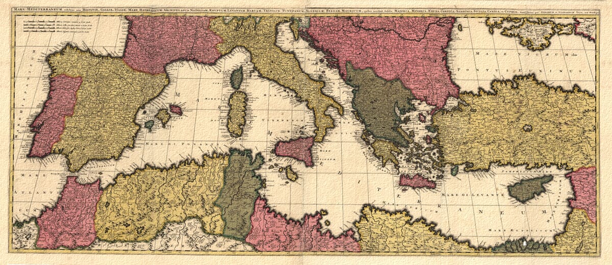
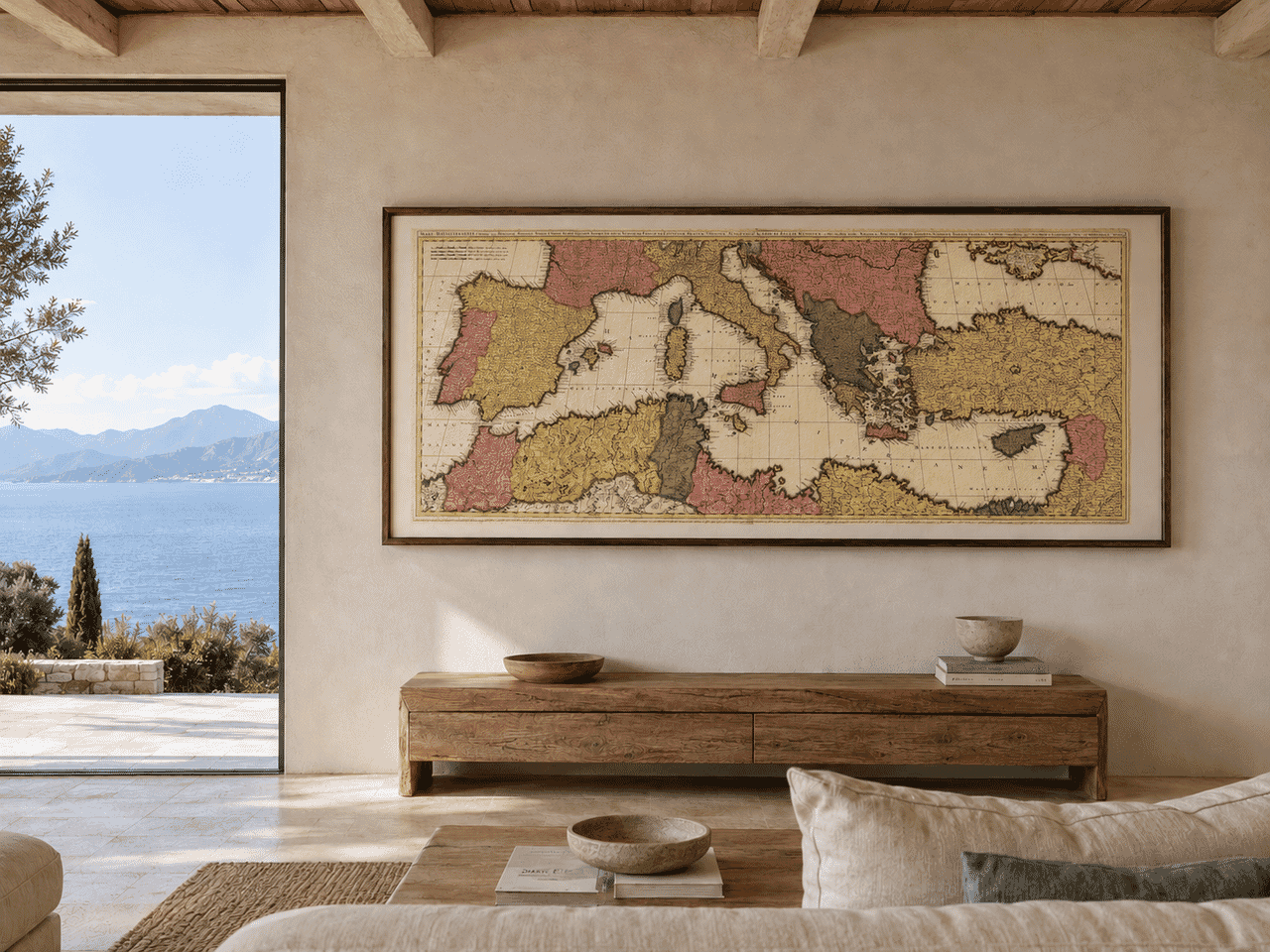
Gerard and Leonard Valk’s Mare Mediterraneum presents the Mediterranean as one vast, connected world. Published in Amsterdam after 1705, the map was printed from two copperplates and joined to form an unusually wide panorama extending from the Atlantic coast of Morocco and southern Spain to Anatolia, Egypt, Cyprus and the Levant.
The map’s elongated proportions follow the natural east-to-west form of the sea. This allowed the publishers to show its coastlines, islands and adjoining countries at a generous scale while retaining the visual unity of a single composition.
Map Details
- Original title: Mare Mediterraneum
- Full title: Mare Mediterraneum, exhibens oras Hispaniæ, Galliæ, Italiæ, Mare Hadriaticum, Archipelagus, Natoliam, Ægyptum, Levantam, Barcam, Tripolin, Tunetanum, Algeriam, Fezzam, Maurocum
- Publishers: Gerard and Leonard Valk
- Published: Amsterdam, after 1705
- Region shown: The Mediterranean Sea and its surrounding European, African and Asian coastlines
- Western extent: Atlantic approaches, southern Spain and Morocco
- Eastern extent: Anatolia, Cyprus, Egypt and the Levant
- Principal islands: Majorca, Minorca, Ibiza, Corsica, Sardinia, Sicily, Crete and Cyprus
- Original format: Copper engraving printed on two joined sheets
- Original dimensions: Approximately 47 × 116 cm
- Approximate scale: 1:3,700,000
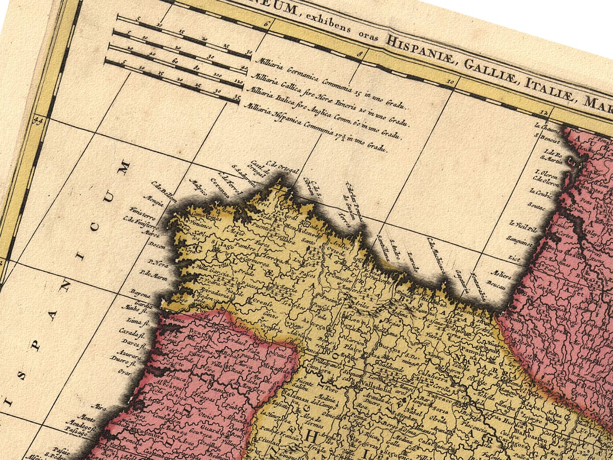
- Scale bars: German, French, Italian and Spanish miles
From Spain to the Levant
At the western end, the map enters the Mediterranean through the narrow Strait of Gibraltar. The coasts of southern Spain and Morocco frame the passage, beyond which the Balearic Islands occupy the western sea.
France, northern Italy and the Italian peninsula extend across the upper half of the engraving. Corsica and Sardinia lie prominently offshore, while Sicily sits at the centre of the Mediterranean between Europe and North Africa.
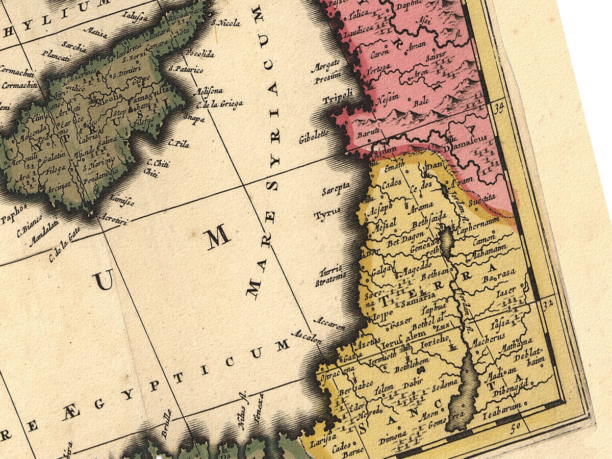
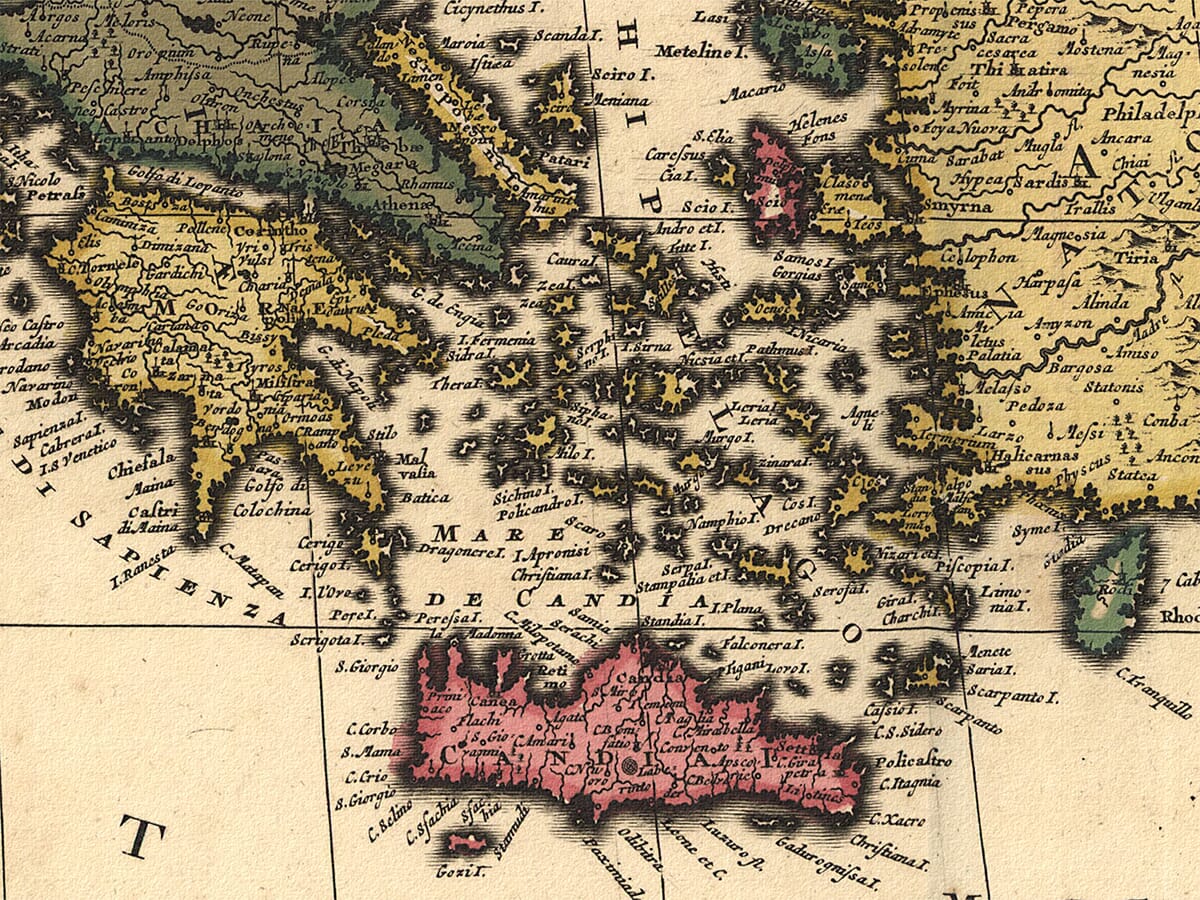
Farther east, the Adriatic reaches between Italy and the Balkan coast. Greece, the Aegean islands and the lands then commonly described by European mapmakers as Natolia lead towards Cyprus and the Levant.
Across the southern edge are Morocco, Algeria, Tunisia, Tripoli, Barca and Egypt. The Nile delta forms one of the most distinctive geographical features at the eastern end of the North African coast.
Islands at the Heart of the Sea
The Mediterranean islands receive particular attention. Majorca, Minorca and Ibiza mark important routes through the western basin, while Corsica and Sardinia stand between the coasts of France, Italy and North Africa.
Sicily dominates the central sea. Its position beside the Strait of Messina and close to the coast of Tunisia made it a natural landmark on routes linking the western and eastern Mediterranean.
Crete appears under its former European name of Candia. This reflected the long Venetian association with the island, even though Crete had passed into Ottoman control before the Valk map was published. Cyprus occupies an equally important position near the coast of Anatolia and the approaches to Syria and Egypt.
Taken together, these islands show why the Mediterranean could never be understood simply as an expanse of water. They were stopping points, trading centres, naval bases and meeting places between different cultures.
A Sea of Trade and Rival Powers
At the beginning of the eighteenth century, the Mediterranean remained one of the most politically and commercially complex regions in the world. Spanish, French, Italian, Ottoman and North African territories faced one another across comparatively narrow waters.
Merchant vessels carried grain, textiles, wine, oil, metals and luxury goods between its ports. Naval power was equally important, and control of islands, straits and sheltered harbours could influence trade across an entire region.
The map records this world through coastlines, towns, territorial colour and a dense network of historic names. It was designed as a geographical map rather than a working sea chart, but its broad coverage reveals the close relationship between the countries surrounding the Mediterranean.
Gerard and Leonard Valk
Gerard Valk established himself in Amsterdam as an engraver, publisher and map seller. His son Leonard joined the family business, and their names appear together in the map’s publishing inscription: Venundantur per Gerardum et Leonardum Valk cum Privilegio.
The Valk workshop became particularly renowned for its terrestrial and celestial globes, although it also published atlases, wall maps and individual engraved sheets. Some plates were acquired from earlier Amsterdam mapmakers and updated for a new generation of collectors.
Mare Mediterraneum demonstrates the firm’s ability to produce work on an imposing scale. The joined sheets, extensive title and broad geographical coverage were intended to make an impression when displayed.
Reading the Historic Landscape
Mountain ranges are represented pictorially rather than by measured contours. Forests appear as groups of individual trees, and coloured boundaries distinguish the territories around the sea.
Place names are given in the Latinised and historical forms familiar to European map buyers of the period. Some remain immediately recognisable, while others reflect older kingdoms, provinces or spellings that have since disappeared.
Four different measures of distance are provided: German, French, Italian and Spanish miles. Their inclusion acknowledged that the map would circulate among an international audience whose customary units were not identical.
More than three centuries after its publication, the map retains both its geographical interest and its decorative strength. Its sweeping composition brings the shores of southern Europe, North Africa and the eastern Mediterranean together in one remarkable view.





 Verified owner