Joan Blaeu’s Seventeenth-Century Map of Jura
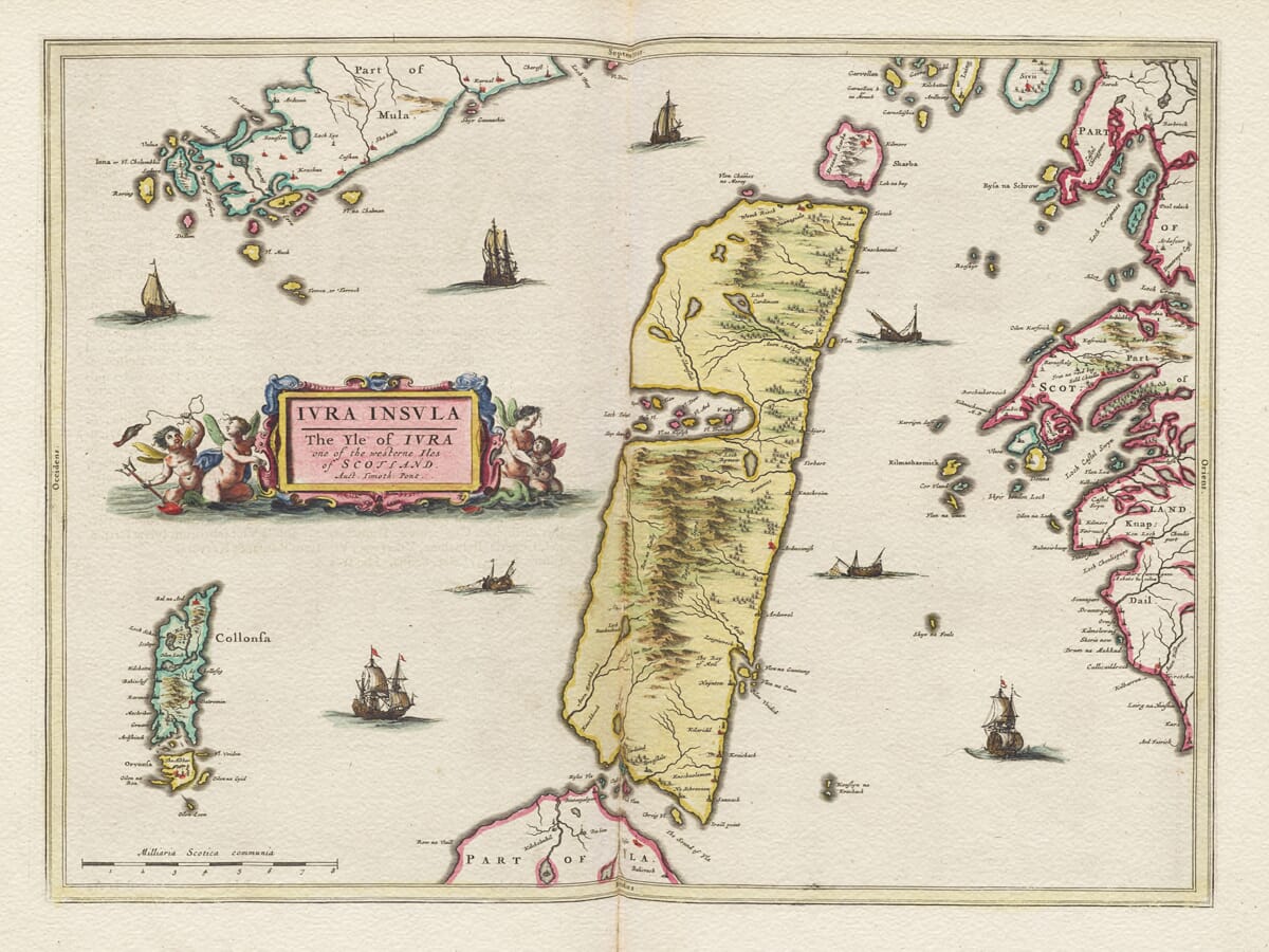
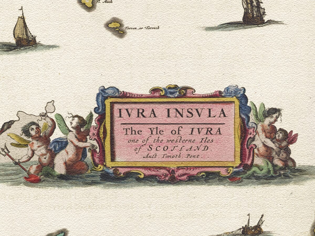
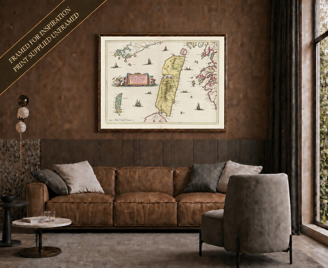
This remarkable old map of the Isle of Jura was published in Amsterdam by Joan Blaeu in 1654 as part of the Scottish volume of his celebrated Atlas Novus. Its original title reads Iura Insula. The Yle of Iura one of the Westerne Iles of Scotland, followed by the acknowledgement Auct. Timoth. Pont, identifying the pioneering Scottish cartographer Timothy Pont as the source of the geographical survey.
Original title: Iura Insula. The Yle of Iura one of the Westerne Iles of Scotland
Original cartographer and surveyor: Timothy Pont (c.1560–1614)
Publisher: Joan Blaeu
First published: Amsterdam, 1654
Area shown: The Isle of Jura, including its mountainous interior, coastline, settlements and neighbouring waters
Principal geographical features: The Paps of Jura, the Sound of Jura and the Sound of Islay
Source atlas: Theatrum Orbis Terrarum, sive Atlas Novus, Volume V — the 1654 Atlas of Scotland
Product type: Reproduction of a seventeenth-century engraved map
Pont travelled widely through Scotland during the closing decades of the sixteenth century, creating detailed manuscript maps of regions that had never previously been surveyed on such a scale. His work recorded coastlines, rivers, lochs, settlements, castles and the form of the landscape. Although Pont died before his proposed atlas could be published, much of his material survived and ultimately provided the foundation for Joan Blaeu’s great atlas of Scotland.
The National Library of Scotland records the Jura sheet among the printed maps derived from Pont’s work, while its surviving 1654 example identifies both Pont and Blaeu. The finished map therefore represents a fascinating collaboration across both time and geography: Scottish field survey undertaken around the end of the sixteenth century, transformed several decades later into a finely engraved map by one of Amsterdam’s foremost cartographic publishing houses.
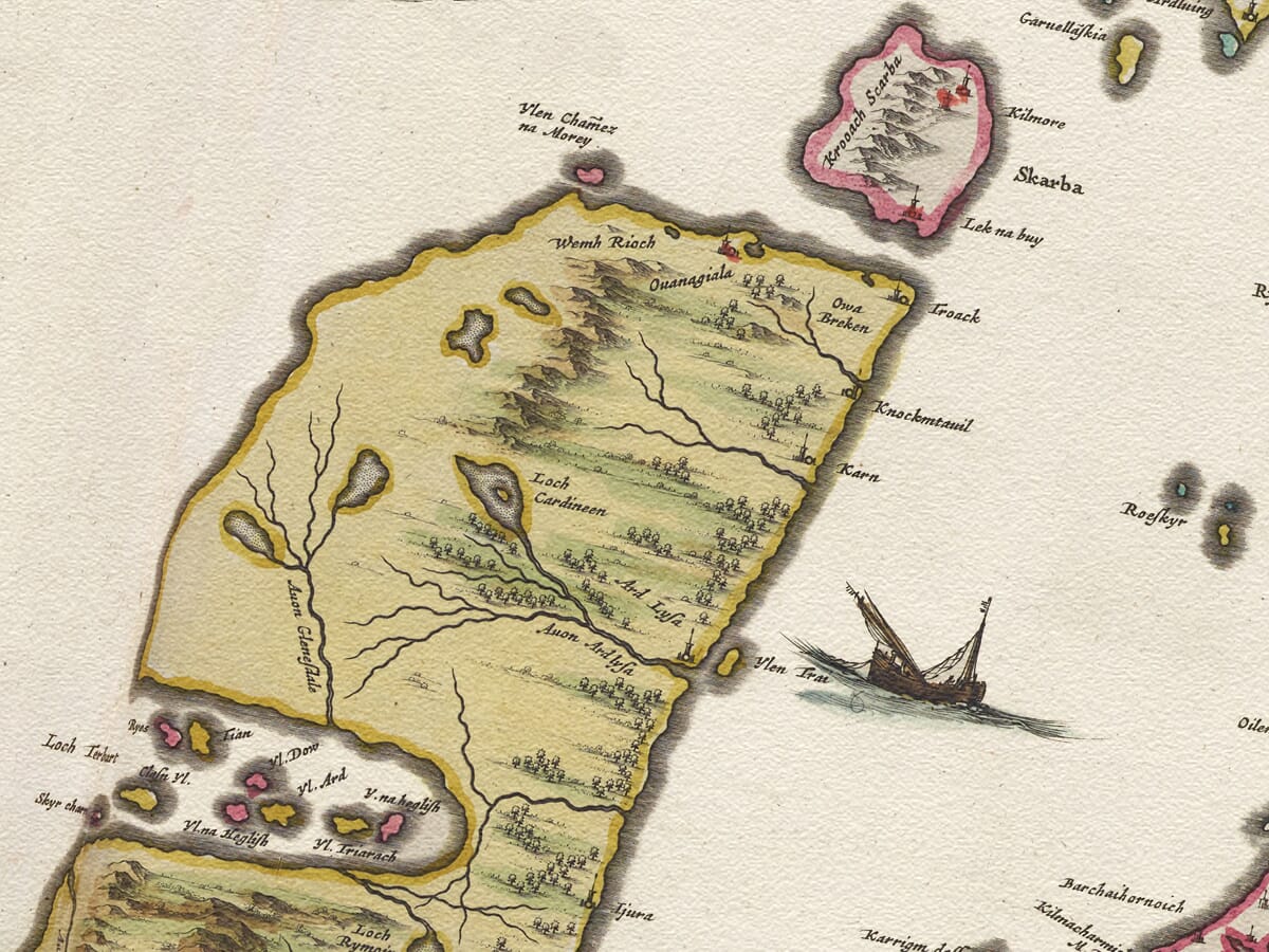
Jura itself occupies the centre of the composition. The island’s long, narrow shape runs across the engraved sheet, with mountains, rivers, lochs and settlements depicted in considerable detail. Its rugged interior is particularly prominent. The range now universally associated with the Paps of Jura is represented by repeated pictorial hills, an immediately recognisable feature of Blaeu’s treatment of the island.
The three principal Paps — Beinn an Òir, Beinn Shiantaidh and Beinn a’ Chaolais — remain Jura’s most distinctive landmarks. Even in the seventeenth-century engraving, the mountainous spine of the island provides a striking contrast with its narrow coastal fringes. The National Library of Scotland has specifically highlighted the Paps when describing Blaeu’s Jura map, noting how clearly the island’s rugged terrain is conveyed.
To a modern viewer, these hills should not be interpreted as measured contours. Seventeenth-century cartographers used pictorial mountain symbols to communicate the character of the countryside rather than precise elevation. Nevertheless, Pont’s underlying observations enabled Blaeu to portray the fundamental geography of Jura with remarkable clarity.
The map is also notable for its historic place-names. Familiar locations can often be identified beneath spellings very different from those used today. This reflects a period when written forms were not standardised and when names could be recorded from local pronunciation before passing through several stages of manuscript copying and engraving. For anyone researching family connections with Jura, these early names are one of the map’s most absorbing features.
Jura’s geographical isolation is also clearly apparent. The island lies immediately north-east of Islay, separated from it by the narrow Sound of Islay, while the wider Sound of Jura separates its eastern shore from mainland Argyll. In an age before modern roads, these waterways were not barriers in quite the way they might appear today. Sea travel was fundamental to communication throughout the western Highlands and islands, linking settlements and estates to neighbouring islands and the Scottish mainland.
A description of Jura written later in the seventeenth century by Martin Martin emphasised both its mountainous character and the prominence of the Paps to sailors approaching the island. Blaeu’s earlier map already captures this same powerful relationship between Jura’s mountains and the surrounding sea.
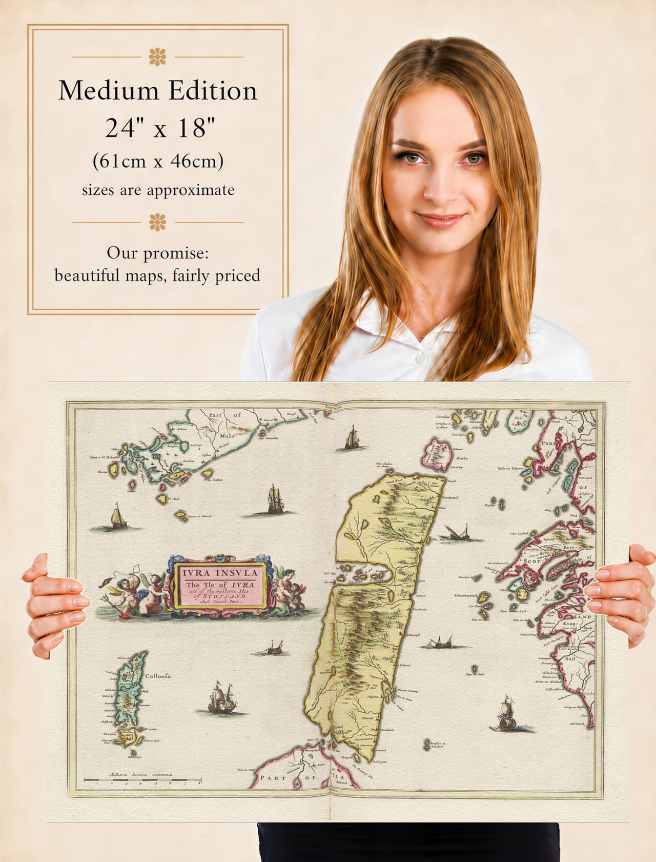
The decorative treatment is characteristic of the Blaeu workshop. The original copper engraving includes an elaborate figural title cartouche and a scale expressed in common Scottish miles. Surviving examples were issued with hand colouring, enhancing the coastline, geographical features and ornamental elements. Specialist catalogues record an engraved area of approximately 41 by 53 centimetres, demonstrating that this was a substantial atlas sheet rather than a small illustrative map.
Blaeu’s Atlas of Scotland was a landmark in the history of Scottish cartography. The 1654 volume gathered together detailed regional maps on an unprecedented scale and made geographical knowledge derived from Scottish surveyors available to an international audience. Jura formed part of a remarkable sequence devoted to Scotland’s western islands, alongside Islay, Bute, Arran, Skye and the Hebrides.
What makes the map particularly compelling today is the distance between the world it records and the modern island. Jura remains famously sparsely populated, and large areas of its mountainous interior still retain a sense of remoteness. Yet the map allows us to look beyond the modern landscape and examine how the island was understood more than four centuries ago.
For anyone with a connection to Jura, Blaeu’s
Iura Insula is therefore much more than an attractive old map. It preserves early settlements and place-names, records the island before modern scientific surveying, and links the pioneering work of Timothy Pont with one of the greatest achievements of seventeenth-century European mapmaking.





 Verified owner
















