





 Verified owner
Got there in time and loves it! Cheers David [Gift from US to UK]
 Verified owner
Thanks Lauren. We received it today - it's gorgeous! Thank you, Ellan
 Verified owner
Thank you for your prompt service. I have a gallery and framing business in South Wales. I'm so pleased it is printed in the UK
 Verified owner
My Isles of Scilly map arrived safely and I'm delighted with it!

The print arrived safely and we're delighted with it - a lovely reminder of our honeymoon 15 years ago.
 Verified owner
I have just received them! I'm sure our clients will be pleased with them and there could be more projects off the back of this one where we can use more. [Interior Designers]
 Verified owner
I just received my map of Ireland by Ewart today and, as usual, I am delighted by its quality. The crispness and fineness of detail is excellent and the colour reproduction surpasses my expectations. Please relay my thanks to Steve for another fine effort!
 Verified owner
Many thanks, Lauren. Very pleased with the map and the service: would recommend The Old Map Company to anyone interested in Old Maps.
 Verified owner
Many thanks, the map arrived safely this morning, and I’m really pleased with it. A stunning reproduction, just as I had hoped. I will keep browsing your website, and may yet be tempted by more of your items! Have a great weekend.
 Verified owner
Just arrived, wonderful map! Thanks very much!
 Verified owner
The map – beautiful – arrived safely, very many thanks.
 Verified owner
Thank you, I have already found the map. It’s wonderfull! Good luck! Rasa
 Verified owner
My apologies for the very late reply. I wanted to reach out to thank you so much for rushing my order. My partner absolutely loved it. I am amazed with the service so that is a five-star from me. I wish you all the best.
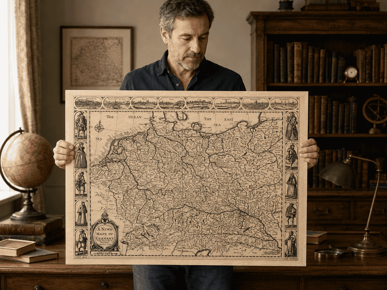
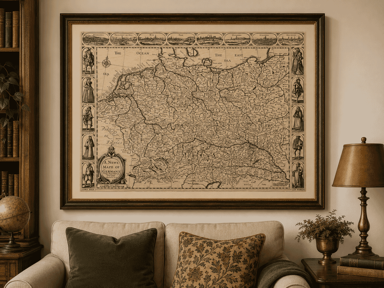
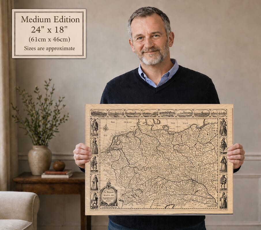
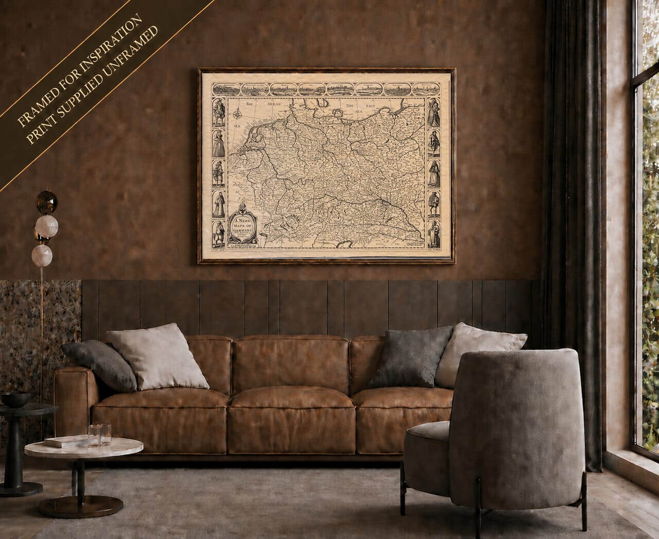
John Speed’s A Newe Mape of Germany is dated 1626 and was prepared for his great world atlas, A Prospect of the Most Famous Parts of the World, first published in London in 1627. Rather than showing the borders of modern Germany, the map depicts the much broader and politically fragmented German lands of the Holy Roman Empire, extending across territories that today lie within Germany and several neighbouring European countries. The plate was engraved by R. White and combines detailed geography with the decorative borders for which Speed’s continental maps became famous.
Original title: A Newe Mape of Germany
Cartographer: John Speed
Engraver: R. White
Date on the plate: 1626
First atlas publication: London, 1627
Atlas: A Prospect of the Most Famous Parts of the World
Area shown: The German lands of the Holy Roman Empire and adjoining territories
Decorative features: Eight European city views across the upper border and ten figures in regional dress along the sides
Technique: Copperplate engraving
The word “Germany” on Speed’s map does not describe the unified nation that emerged in the nineteenth century. In the early seventeenth century the region was a complicated collection of electorates, duchies, bishoprics, free imperial cities and other territories within the Holy Roman Empire.
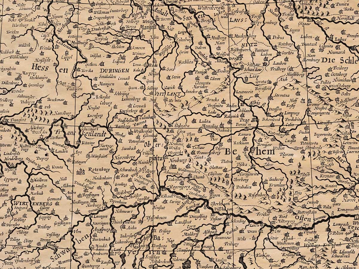
That political complexity is visible across the map. Among the regions and states are Bavaria, Saxony, Brandenburg, Bohemia, Silesia, Pomerania, Austria and the Palatinate, while major rivers including the Rhine, Danube, Elbe and Oder provide some of the clearest geographical structure.
Cities familiar today appear among much older political divisions. Frankfurt, Cologne, Prague, Vienna, Augsburg and Strasbourg can all be located, alongside numerous smaller towns and territories whose importance has changed considerably since Speed’s time.
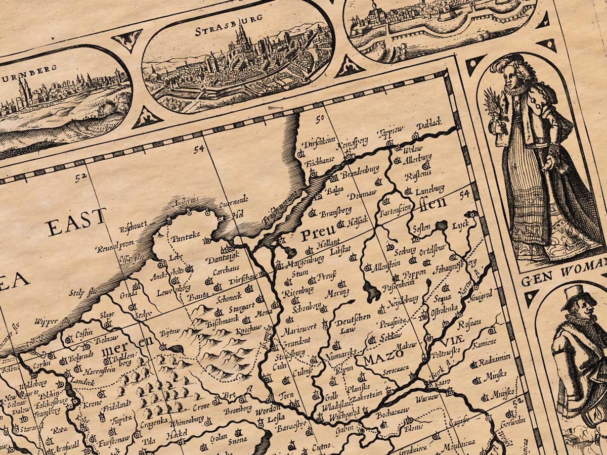
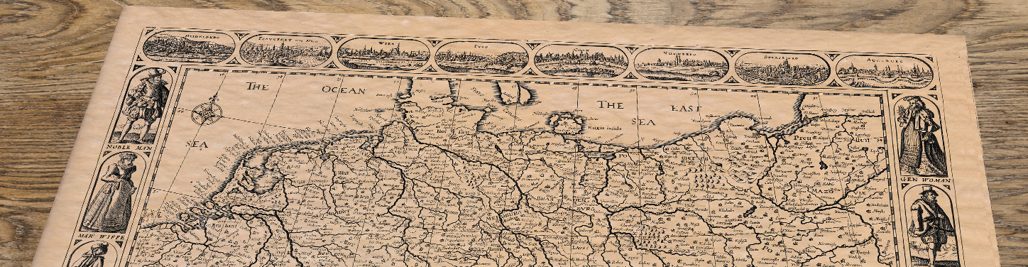
One of the most attractive features of the plate is the sequence of panoramic city views running across its upper border.
They represent Heidelberg, Frankfurt, Vienna, Prague, Cologne, Nuremberg, Strasbourg and Augsburg. These miniature prospects do more than decorate the map: they give the viewer a glimpse of some of the principal urban centres associated with the German-speaking and Imperial lands in Speed’s period.
Heidelberg and Prague were particularly important in the political and religious struggles that marked the opening decades of the seventeenth century, while Frankfurt, Cologne, Nuremberg, Strasbourg and Augsburg were major commercial, ecclesiastical or imperial centres.
Running down both sides are ten engraved figures representing men and women associated with different regions and social positions. These include a nobleman, merchant and figures identified with Bohemia and Switzerland, amongst others.
Like the costume figures on other Speed maps, they should not be regarded as documentary portraits of particular individuals. They belong to a seventeenth-century tradition of illustrating nations and regions through characteristic dress, helping Speed transform a geographical map into a broader picture of European society.
Speed accompanied his maps with substantial descriptive texts printed on the reverse of the sheets. His account of Germany ranges from geography and rivers to government, religion, historical tradition and the many principalities of the Empire.
The transcription retained below is therefore directly connected with the original atlas rather than being a modern general history of Germany. Its language and assumptions belong to Speed’s period, and it provides useful evidence of how an English writer of the early seventeenth century understood the German lands.
Speed added historical notes which we have transcribed here. We’ve edited archaic place-names and certain old spellings and missing letters, etc. for clarity.
Germany adjoins Belgium and stretches eastward toward Asia. It is often described as Higher and Lower, Greater and Lesser Germany. Indeed, it is the largest portion of the region known by that name, and the largest region of our quarter of the world known wholly by a single name.
(2) In antiquity Germany compares with the oldest parts of Europe and perhaps surpasses them, for some say she remained pure from Noah’s Flood or the Confusion of Tongues. Early chronologers trace her first inhabitants to Tuisto (or Tuisco), thought by some to be a son of Noah, who began his empire about thirty years after the fall of Babel.
(3) Ancient historians report that the early Germans worshipped Tuisto as a god who sprang from the earth. A street in Cologne (old “Cullen”) still bears a name reminiscent of him. The people were undoubtedly ancient, known long before the Romans gave the land the name Germania.
(4) Tuisto’s son Mannus was likewise revered. Some sources call the nation Teutonia from Tuisto. When the Romans conquered the Gauls they found the Germans so like the Gauls in stature and courage that they called them “brothers of the Gauls.” Other scholars derive the word German from ger (spear or man), meaning “all men” or “a mixed nation.”
(5) Geographers long believed that Germany’s population had remained since the first age of the world. Tacitus and Mela speak of a land once wild—“sylvis horrida, paludibus foeda”—but later greatly improved. By later ages the territory had grown populous and fertile, rivaling France, Spain, or Italy.
(6) Early geographers bounded Germany by the Rhine on the west, the Yssel on the east, and the Danube on the south. Later writers enlarged it far beyond: west across the Rhine into parts of modern France, east through Prussia and Sarmatia, south to the Alps, and north to the Baltic and North Seas. Its circuit is reckoned at about 2,600 English miles. The soil is naturally fertile and enriched by many navigable rivers.
(7) Principal rivers:
Danube (Donau), Europe’s greatest, fed by sixty navigable streams, emptying into the Black Sea.
Rhine (Rhein), rising in the Alps and running to the North Sea; source of famous Rhenish wines; cities such as Strasbourg stand on its banks.
Isar and Main (from Bohemia through Frankfurt).
Elbe, springing from eleven fountains in the Bohemian Forest (Sylva Hercinia).
Oder, joining the Elbe.
The Kingdom of Bohemia lies near the centre.
(8) Germany yields corn, wine, salt, metals, fruits, cattle, and strong timber. The air is wholesome; baths and gardens pleasant; cities fair; castles strong; villages many and well peopled.
(9) The inhabitants, once deemed rude and ignorant, are now industrious and learned—famous in Latin, Greek, and Hebrew. Beyond most of Europe (save perhaps the Low Countries) they excel in mechanical invention: firearms and gunpowder were first brought to notice here by Bertholdus Schwarz. The poorer sort are excellent craftsmen; the rest, scholars.
(10) Germany has bred many renowned minds: Albertus Magnus, Martin Luther, Ulrich Zwingli, Junius, Keckermann, and more. Religion is free: Roman Catholic, Lutheran, Calvinist, and Jewish communities all remain.
(11) Germany’s government is Imperial, successor to Rome’s. The Emperor is elected, not hereditary, by seven Electors established by Pope Gregory X:
Three Spiritual – the Archbishops of Mainz, Cologne, and Trier.
Four Temporal – the King of Bohemia, the Count Palatine of the Rhine, the Duke of Saxony, and the Margrave of Brandenburg.
Each performs ceremonial duties at the Emperor’s coronation: the King of Bohemia as chief cup-bearer, the Palatine as seneschal, the Duke of Saxony as marshal, Brandenburg as chamberlain, etc.
The Emperor’s title traces to the old Roman Empire, and he bears the style Caesar or Roman Emperor. Though elected, he wields wide power and usually secures succession within his house—lately the House of Habsburg (Austria).
(12) The first Emperor under this arrangement was Rudolph of Habsburg. Later came Henry of Luxembourg; Richard, Earl of Cornwall of England; and others. The Habsburg line has held the dignity almost without interruption.
(13) Many princes rule as near-sovereigns within the Empire. Sixty-four Free Cities owe only slight acknowledgment, together able to muster about 34,000 horse and over 100,000 foot soldiers.
(14) Chief regions noted by geographers (modern spellings first, historic in parentheses):
East Frisia (East-Friesland)
Westphalia
Cleves (Cleve)
Münster
Trier (Triers)
Cologne
Jülich (Juliers)
Hesse (Hassia)
Alsace (Alsatia)
Palatinate of the Rhine (Palatinat Rhen.)
Württemberg (Wirtenberg)
Bavaria
Franconia
Lorraine
Mainz (Mentz)
Würzburg (Wirceburg)
Baden
Nahe/Neitz (small territory)
Bamberg
Saxony
Anhalt
Mansfeld
Meissen (Misnia)
Austria
Brandenburg
Lusatia
Tyrol (Tirolis)
Bohemia
Silesia
Moravia
Pomerania
Mecklenburg
(15) East Frisia, on the North Sea; chief town Emden.
(16) Westphalia, south of East Frisia; famed for excellent bacon. Shared among the bishops of Cologne, Münster, and Liège. Cologne’s cathedral tradition claims the relics of the Three Magi. Münster was seized in 1533 by Anabaptists who called it “New Jerusalem.” Trier, of great antiquity, was founded (legend says) by Trebeta, son of Ninus.
(17) Duchy of Cleves, with cities Wesel, Emmerich, and Kleve.
Jülich, principal city Aachen (Aix-la-Chapelle), where emperors receive the Silver Crown.
Hesse, mountainous but fertile; capital Kassel, with the university town of Marburg.
Alsace, chief city Strasbourg, noted for its astronomical clock and lofty tower.
Lorraine and the Swiss Confederation, comprising the cantons Zürich, Bern, Schwyz, Uri, Glarus, Zug, Basel, Fribourg, Unterwalden, Solothurn, Schaffhausen, Appenzell, etc.
(18) Thuringia, small but rich; capital Erfurt.
(19) Franconia, west of Thuringia; converted by St. Boniface. Important towns include Würzburg, Bamberg, and Frankfurt am Main.
Württemberg, chief city Heidelberg, whose Elector governs large parts of Germany during imperial vacancies.
Baden, with famous baths at Baden-Baden.
Mainz, a spiritual Electorate.
(20) Saxony, birthplace of Martin Luther near Eisleben; includes Anhalt and Mansfeld.
(21) Swabia, south of Franconia; principal towns Ulm, Lindau, Augsburg, Nördlingen.
Bavaria, upper and lower, with Munich, Regensburg, Passau, Salzburg, and Ingolstadt.
Brandenburg, once held by the Vandals, with Berlin, Brandenburg an der Havel, and Frankfurt an der Oder.
Lusatia, chief city Görlitz.
Meissen, with Dresden, Leipzig, and Torgau.
(22) Bohemia, encircled by the Bohemian Forest; capital Prague.
Silesia, east of Bohemia; chief cities Wrocław (Breslau) and Nysa.
Moravia, capital Brno.
Pomerania, on the Baltic; chief city Szczecin (Stettin).
Mecklenburg, with Rostock and Schwerin.
Austria, extending to Hungary, rich and learned, capital Vienna, with the provinces of Styria, Carinthia, Carniola, and Tyrol.
Thus Germany, once deemed a land of forests and marshes, became a fertile and powerful realm, renowned for learning, invention, and strong principalities—an Empire elective in name, but long upheld by the House of Habsburg, and containing within its bounds a multitude of free cities and mighty rivers, the very heart of Europe.











