



£35.55 – £59.95Price range: £35.55 through £59.95
Willem Blaeu, Amsterdam, 1630
A richly detailed old map of the Seventeen Provinces of the Low Countries, encompassing present-day Netherlands, Belgium and Luxembourg. Willem Blaeu fills the North Sea with sailing ships, embellishing the map with an elaborate compass rose, decorative cartouches and finely engraved towns, rivers and provincial boundaries.A stunning certified FINE ART PRINT on heavy textured art paper — not a poster
Unlike most online offerings, our maps are produced entirely in-house, not outsourced to print-on-demand or drop-shipping services. This allows complete control over quality while offering better value. Each map begins with a high-resolution original, carefully enhanced and printed to order using archival papers and pigment inks for exceptional clarity, depth, and longevity. Every piece is personally overseen — no map leaves our workshop unless it is of a quality we would be proud to display ourselves.
Paper choice is essential to the authenticity of our maps. We use specially sourced 190gsm paper made in the UK from pure materials and traditionally pressed with natural woollen felts. This process creates a subtle, randomly textured surface that closely resembles an original antique document. Likewise the use of premium quality ink fully saturates the paper, producing remarkable clarity, depth, and historical character. Colour fastness and sharpness will remain good for in excess of 100 years!
The Old Map Company of Great Britain offers a vast and carefully curated collection of the very finest expertly reproduced vintage maps. Our range includes works by renowned cartographers such as John Speed and Willem Blaeu, covering Scotland, England, and beyond. Free UK courier delivery is included, with EU, USA, and worldwide shipping available at cost and calculated at checkout. If you need assistance, our team is always happy to help you choose the perfect map.
Speedy delivery A beautiful representation
Got there in time and loves it! Cheers David [Gift from US to UK]
Thanks Lauren. We received it today - it's gorgeous! Thank you, Ellan
Thank you for your prompt service. I have a gallery and framing business in South Wales. I'm so pleased it is printed in the UK
My Isles of Scilly map arrived safely and I'm delighted with it!
The print arrived safely and we're delighted with it - a lovely reminder of our honeymoon 15 years ago.
I have just received them! I'm sure our clients will be pleased with them and there could be more projects off the back of this one where we can use more. [Interior Designers]
I just received my map of Ireland by Ewart today and, as usual, I am delighted by its quality. The crispness and fineness of detail is excellent and the colour reproduction surpasses my expectations. Please relay my thanks to Steve for another fine effort!
Many thanks, Lauren. Very pleased with the map and the service: would recommend The Old Map Company to anyone interested in Old Maps.
Many thanks, the map arrived safely this morning, and I’m really pleased with it. A stunning reproduction, just as I had hoped. I will keep browsing your website, and may yet be tempted by more of your items! Have a great weekend.
Just arrived, wonderful map! Thanks very much!
The map – beautiful – arrived safely, very many thanks.
Thank you, I have already found the map. It’s wonderfull! Good luck! Rasa
My apologies for the very late reply. I wanted to reach out to thank you so much for rushing my order. My partner absolutely loved it. I am amazed with the service so that is a five-star from me. I wish you all the best.
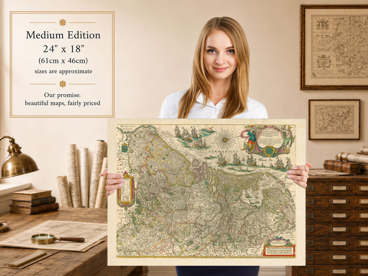
Willem Blaeu published this magnificent map of the Low Countries in Amsterdam in 1630. Its Latin title, Novus XVII Inferioris Germaniae Provinciarum Typus, describes the Seventeen Provinces that historically encompassed present-day Netherlands, Belgium and Luxembourg, together with adjoining areas of northern France and western Germany.
The words Inferioris Germaniae are a historical Latin description of the Low Countries and should not be interpreted as meaning modern Germany. This distinction is important because the map’s present product title identifies its subject incorrectly.
Blaeu’s map appeared during the Eighty Years’ War, when the political unity once represented by the Seventeen Provinces had already fractured. The northern provinces formed the emerging Dutch Republic, while much of the south remained under Spanish Habsburg rule.
Despite this division, the traditional concept of the Seventeen Provinces remained geographically and culturally meaningful. Blaeu therefore presents the Low Countries as a single recognisable region rather than separating the Dutch Republic from the Spanish Netherlands.
The map records a densely settled landscape of commercial towns, fortified cities, river systems and provincial territories. Amsterdam, Antwerp, Brussels, Ghent, Bruges, Utrecht, Rotterdam and numerous smaller settlements can be found among its exceptionally detailed place names.
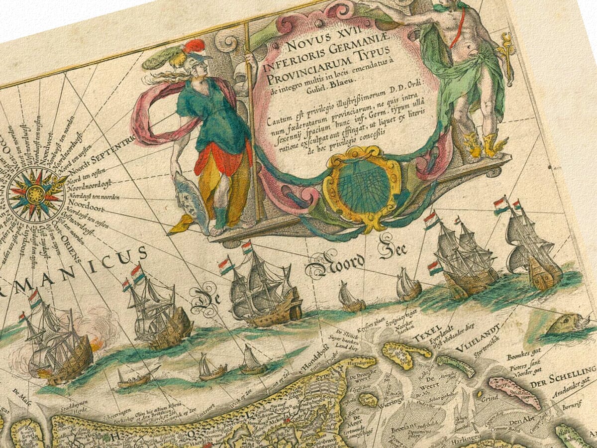
The North Sea, labelled Oceanus Germanicus, occupies the upper portion of the engraving. Numerous sailing vessels cross its waters, ranging from small coastal craft to imposing merchant ships.
These maritime decorations are more than ornamental. They reflect the importance of seaborne trade to the ports of the Netherlands and Flanders during the seventeenth century. A prominent compass rose reinforces the nautical character of this part of the map.
The unusual orientation places north towards the right. France consequently appears along the left side, the German lands towards the bottom and the North Sea across the top.
An elaborate title cartouche occupies the upper-right corner, accompanied by allegorical figures and heraldic decoration. On the opposite side, another ornamental panel lists the provinces and provides explanatory information.
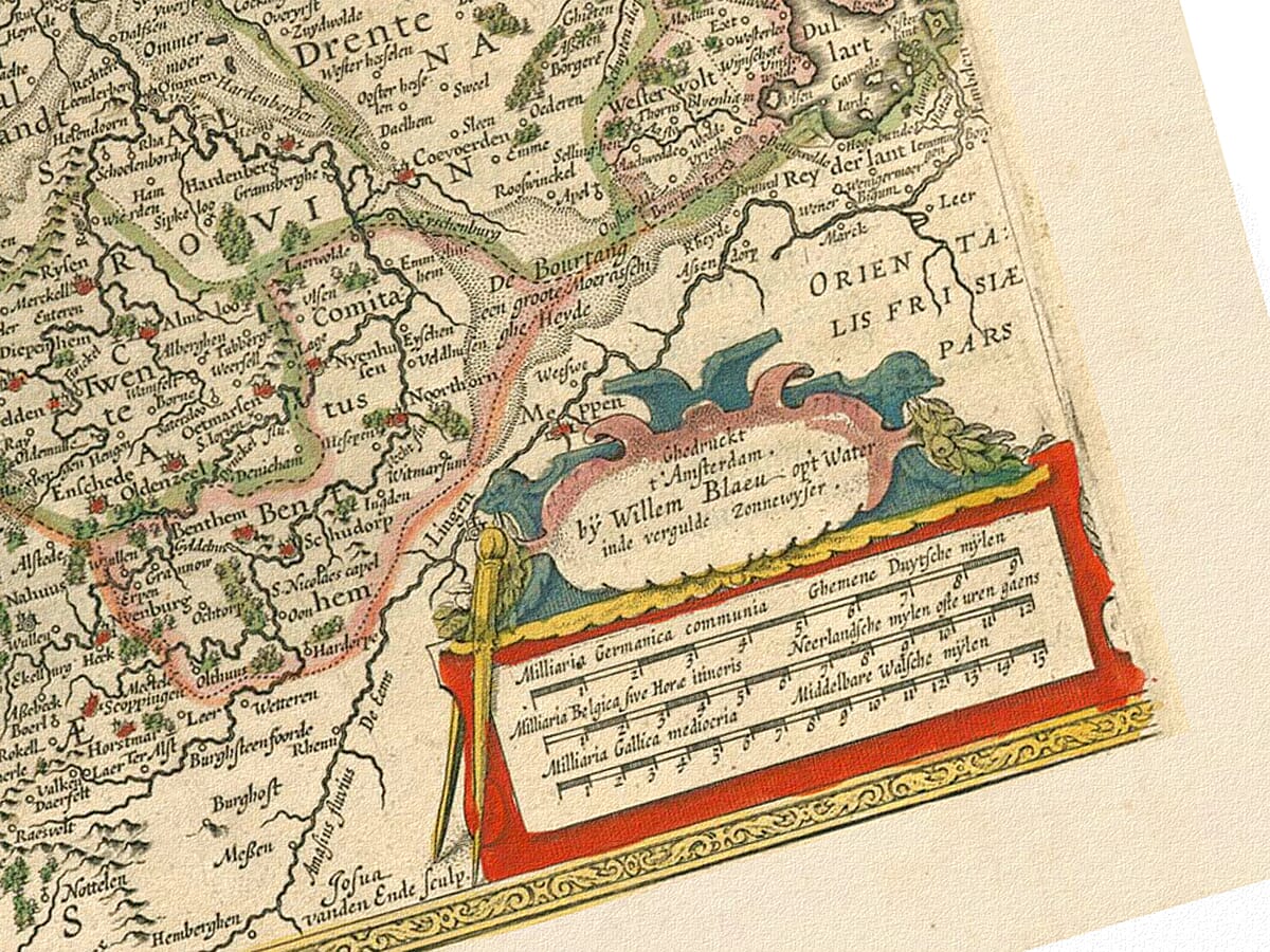
The French royal arms appear near the western edge, while several scale bars are positioned in the lower-right corner. Hand-applied colour distinguishes political boundaries and brings clarity to an exceptionally dense network of towns, rivers and roads.
Blaeu successfully combines geographical information with the decorative richness associated with the Dutch Golden Age of mapmaking. The result is both an important record of the historic Low Countries and a remarkably attractive seventeenth-century work of art.



