Joan Blaeu’s Map of the Historic County of Fife
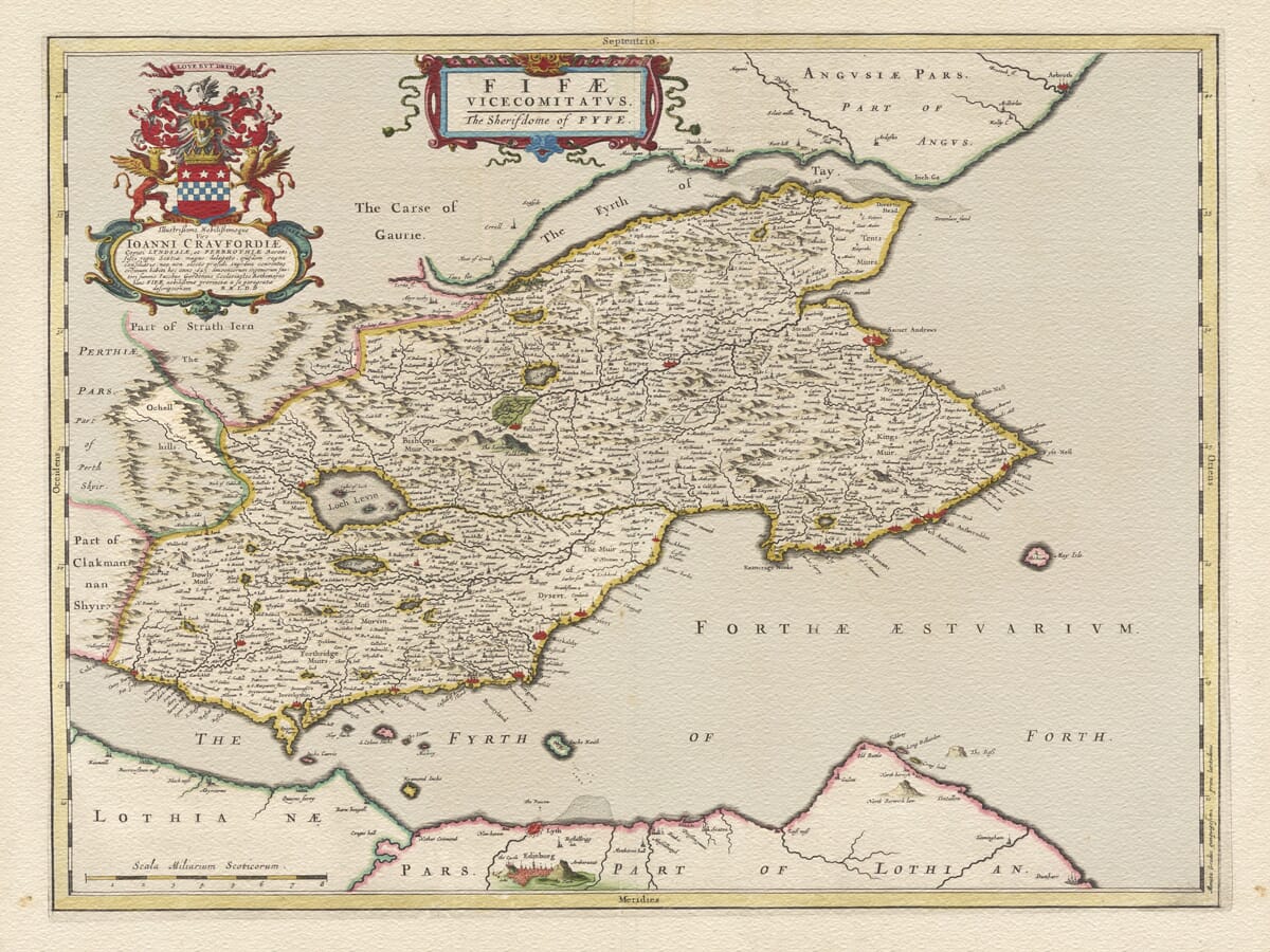
Joan Blaeu’s county-wide map of Fife was first published in Amsterdam in 1654 as part of the Scotland volume of his Theatrum Orbis Terrarum, sive Atlas Novus. Its engraved title, Fifae Vicecomitatus — The Sherifdome of Fyfe, identifies Fife through both its Latin and contemporary Scots names.
Map Details
- Original title: Fifae Vicecomitatus — The Sherifdome of Fyfe
- Original cartographer and surveyor: James Gordon of Rothiemay
- Publisher: Joan Blaeu, Amsterdam
- First published: 1654
- Area shown: Historic Fife, Kinross and adjoining shores of the Forth and Tay
- Principal places: St Andrews, Cupar, Dunfermline, Kirkcaldy, Falkland, Crail and the East Neuk burghs
- Surrounding waters: Firth of Forth, Firth of Tay and North Sea
- Source atlas: Theatrum Orbis Terrarum, sive Atlas Novus, Scotland volume
- Product type: Fine art reproduction print of the historic map
This is one of three maps of Fife contained in Blaeu’s atlas. The other two portray the eastern and western parts at a larger scale, while Fifae Vicecomitatus presents the historic county as a single, complete landscape between the Firth of Forth and the Firth of Tay.
James Gordon’s Survey of Fife
Most of Blaeu’s Scottish maps ultimately originated with Timothy Pont’s surveying of the late sixteenth century. This Fife map is an important exception. The engraving credits James Gordon, son of Robert Gordon of Straloch, who contributed new maps and revisions while Pont’s surviving work was being prepared for publication.
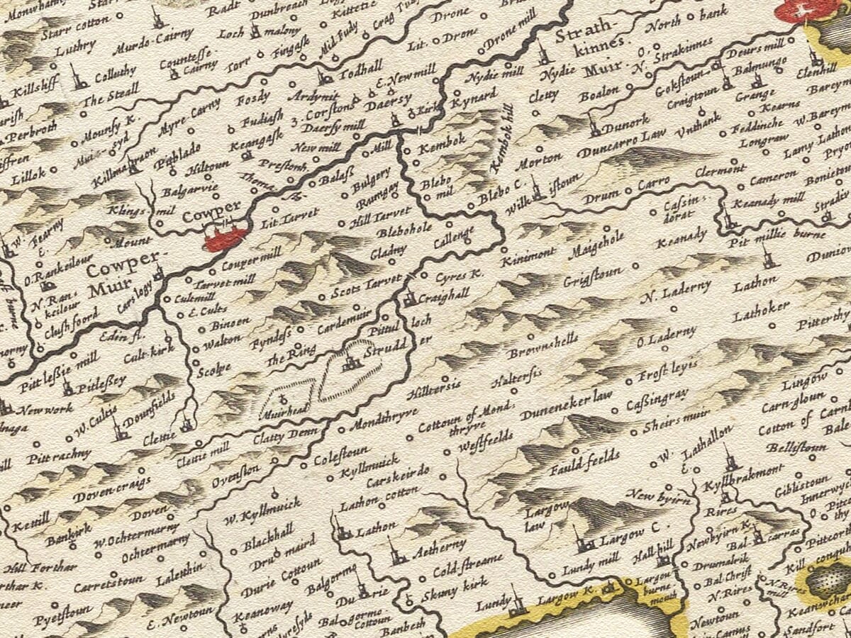
Evidence from the period records James Gordon working in Fife in 1642. His survey resulted in an unusually detailed representation of the county, with hundreds of settlements, estates, churches, waterways and landscape features compressed into a single engraving.
Modern scholarly comparison has identified Fifae Vicecomitatus as one of the most geographically accurate maps in Blaeu’s Scottish atlas. Its detail also distinguishes it from the separate East and West Fife plates, which appear to have developed from different source material.
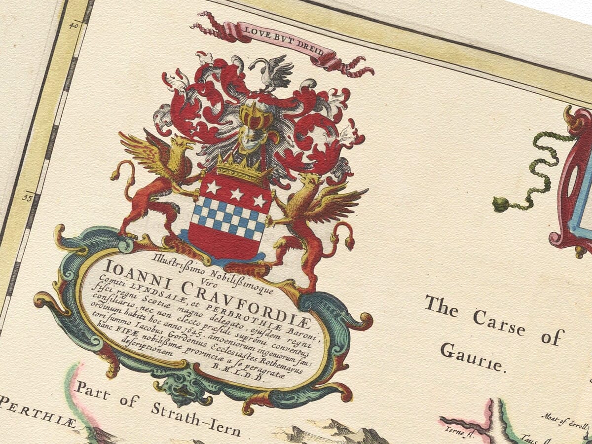
Although the surveying took place during the early 1640s, the map could not have been completed in its published form before 1645. Its heraldic dedication refers to a title and office connected with that year. The finished copperplate subsequently appeared in Blaeu’s atlas of 1654.
A County Between Two Firths
Fife’s identity is inseparable from the water surrounding it. The Firth of Tay defines the northern coast, while the broad Firth of Forth separates the county from Edinburgh and the Lothians to the south. The coastline then turns around the East Neuk towards the North Sea.
Blaeu gives these waters considerable space, allowing Fife’s unmistakable peninsular form to dominate the composition. Coastal headlands, islands, harbours and river mouths are recorded alongside neighbouring parts of Angus, Perthshire, Clackmannanshire and Lothian.
The map includes the Isle of May off the East Neuk and several islands within the Forth. Settlements on the opposite shores provide geographical context and emphasise Fife’s connections across the water rather than presenting it as an isolated county.
In the seventeenth century the firths were highways for travel, fishing and commerce. The coastal burghs maintained trading connections with Edinburgh, other Scottish ports and countries bordering the North Sea.
St Andrews, Dunfermline and the Royal Landscape
St Andrews occupies a prominent position on the eastern coast. For centuries it had been Scotland’s leading ecclesiastical centre, while its university—founded in the early fifteenth century—made the town an important place of learning.
Dunfermline, near the western end of the county, carried strong associations with the Scottish monarchy and its great medieval abbey. Falkland, shown farther inland, was another place closely connected with Scotland’s kings and queens through Falkland Palace.
Cupar appears near the heart of Fife as the county town, surrounded by a dense web of estates, farms and villages. Kirkcaldy and Dysart face the Firth of Forth, while Crail, Anstruther, Pittenweem, St Monans and neighbouring communities trace the coast of the East Neuk.
Together, these places reveal a county without a single dominant centre. Religious, royal, administrative and commercial importance was distributed among numerous towns and burghs, each connected with its surrounding farmland and access to the sea.
Harbours, Coal and Salt
The coastline supported generations of fishing communities, sailors and merchants. Fife’s ports exported local produce and maintained connections with the Low Countries, Scandinavia and ports elsewhere around the North Sea.
Coal and salt were particularly important to parts of the Forth coast. Seawater was evaporated in salt pans using locally mined coal, while both commodities entered coastal trade. Surviving evidence from the seventeenth century confirms Fife vessels carrying coal and salt overseas.
Blaeu’s map does not illustrate these industries directly, but its dense pattern of coastal settlements, havens and named estates records the landscape in which they developed. Inland, fertile farmland, market towns and country houses formed an equally important part of Fife’s economy.
Fife in a Time of Conflict
The map’s publication followed a deeply unsettled period in Scottish history. Fife had experienced the effects of the Wars of the Three Kingdoms, military recruitment and political division.
Inverkeithing became the site of a major battle in 1651 as Cromwell’s forces advanced through Scotland. Blaeu’s map appeared only three years later, during the period of Cromwellian rule, although the engraving itself was not designed as a military document.
Instead, it presents the county as an ordered and enduring landscape. Rivers, coastlines and settlements remain untouched by the temporary movements of armies, offering a composed image of Fife amid considerable political change.
Heraldry and Decorative Design
A colourful title cartouche crowns the map, while an elaborate heraldic dedication fills the upper-left corner. The arms, supporters and flowing ornament provide a ceremonial counterpoint to the closely engraved geographical detail.
Fife itself is picked out through coloured boundaries, with lochs, rivers, hills and coastal settlements carefully differentiated. Historic spellings and small building symbols reward close examination and make the map particularly appealing for local and family-history research.
This old map captures Fife before railways, modern roads and industrial towns changed the scale of its landscape. Yet its coastline, historic burghs and position between the two great firths remain instantly recognisable—a portrait of the Kingdom of Fife whose sense of place has endured for centuries.





 Verified owner

















