Joan Blaeu’s Map of Eskdale and Ewesdale
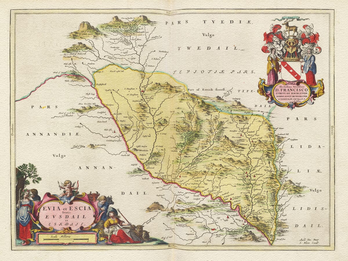
Joan Blaeu’s map of Eskdale and Ewesdale was first published in Amsterdam in 1654 as part of the Scotland volume of his Theatrum Orbis Terrarum, sive Atlas Novus. Its full title, Evia et Escia, Scotis Evsdail et Eskdail, identifies the two neighbouring valleys known to Scots as Ewesdale and Eskdale.
The engraving portrays a richly layered Border landscape of rivers, burns, hills, estates, churches, tower houses and scattered settlements. It extends beyond Eskdale itself, placing the valleys between Annandale to the west, Teviotdale to the north and Liddesdale to the east.
Map details
- Original title: Evia et Escia, Scotis Evsdail et Eskdail
- Original surveyor: Timothy Pont
- Publisher: Joan Blaeu, Amsterdam
- First published: 1654
- Area shown: Eskdale, Ewesdale and neighbouring parts of the Scottish Borders
- Principal places: Langholm, Canonbie, Westerkirk and settlements beside Ewes Water and the River Esk
- Neighbouring regions: Annandale, Teviotdale and Liddesdale
- Source atlas: Theatrum Orbis Terrarum, sive Atlas Novus, Scotland volume
- Product type: Fine art reproduction print of the historic map
Timothy Pont and the First Atlas of Scotland
The map’s geographical information originated with Timothy Pont, whose journeys during the late sixteenth and early seventeenth centuries produced the first comprehensive detailed survey of Scotland. Pont travelled through remote districts recording rivers, settlements, castles, churches and features of the landscape.
He did not live to see his intended atlas published. His surviving manuscripts were later collected and prepared with the assistance of Sir John Scot of Scotstarvet and Robert Gordon of Straloch before reaching Joan Blaeu’s celebrated publishing house in Amsterdam.
Blaeu transformed this Scottish material into a series of finely engraved maps. The resulting atlas appeared in 1654, combining the observations of Scottish surveyors with the typography, colour and ornamental design for which the Dutch Golden Age of cartography became renowned.
Two Valleys Shaped by Water
Blaeu’s title recognises that the map covers two distinct but closely connected valleys. Ewesdale follows Ewes Water southward between the hills until it reaches Langholm. There it joins the River Esk, which continues through Eskdale towards Canonbie and the Anglo-Scottish frontier.
The rivers form the map’s natural framework. Their tributaries spread into the surrounding hills, connecting farms, houses and small communities whose names crowd the engraving. Long before modern roads reshaped travel through the Borders, these valleys provided natural routes across a difficult landscape.
Langholm occupies a particularly important position where Ewes Water and the River Esk meet. The settlement lies among the hills at the meeting point of routes leading north towards Teviotdale, east towards Liddesdale and south towards England.
Further downstream, Canonbie stands beside the Esk in country that was intimately connected with the frontier. Westerkirk and the smaller settlements farther north reveal a more dispersed pattern of habitation, following the river valleys and sheltered ground between open moorland hills.
Life in the Border Country
The countryside recorded by Pont had been shaped by generations of tension along the Anglo-Scottish border. Eskdale and the neighbouring valleys were associated with riding families whose loyalties, feuds and alliances frequently crossed the frontier.
During the era of the Border Reivers, livestock raids and reprisals encouraged the construction of defensible tower houses and strongly built residences. Pont’s symbols for castles and substantial houses therefore carried particular meaning in this landscape. They identified centres of landownership and local authority but also places intended to provide a degree of security.
The Armstrongs were especially closely associated with Eskdale, Ewesdale and the adjoining country. Other Border families also held land throughout the region, creating a complex network of kinship and influence that did not always conform neatly to national or county boundaries.
By the time Blaeu published the map in 1654, more than half a century had passed since James VI of Scotland inherited the English throne in 1603. The Union of the Crowns reduced the military importance of the frontier, although memories of reiving, feuds and fortified living remained deeply embedded in the character of the district.
The engraving is not a record of raids or military campaigns. Instead, it preserves the enduring geography beneath that history: the waterways, hills, estates and settlements around which Border life had developed.
Hills, Settlements and Early Place Names
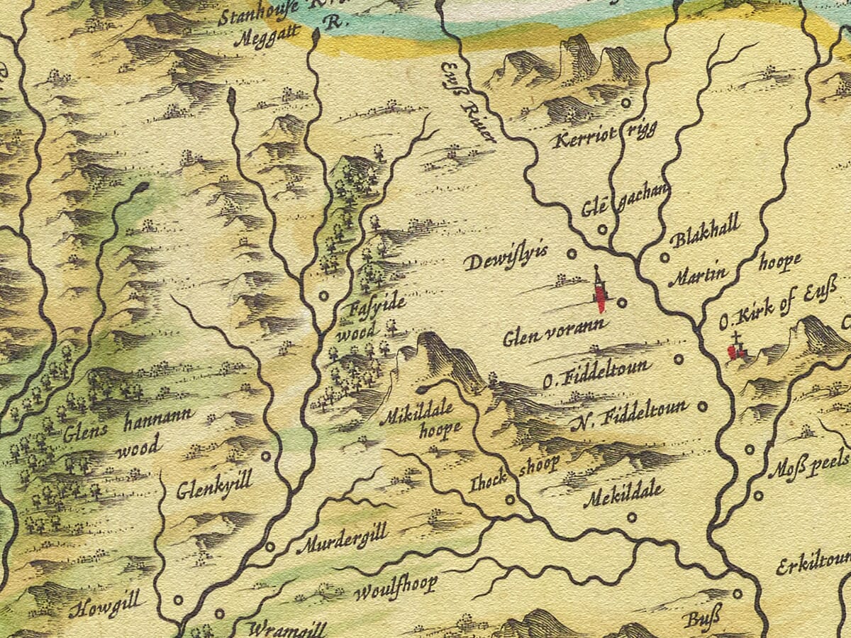
Relief is represented through rows of pictorial hills rather than scientifically measured contours. Groups of trees suggest wooded ground, while castles, churches and settlements are distinguished by different building symbols.
Roads are not shown systematically. Anyone accustomed to modern mapping must therefore read the rivers and valleys as the principal guides through the landscape. The map’s value lies partly in its abundance of early place names, many of which preserve older spellings or identify properties that have since changed or disappeared.
For family historians, the engraving offers a fascinating view of the country inhabited by generations of Border families. For those who know the district today, it reveals a familiar landscape before turnpike roads, railways, industrial development and the later expansion of Langholm.
Heraldry and Rural Decoration
Two decorative cartouches give the map much of its visual character. The upper-right cartouche displays the arms of the Scott family of Buccleuch, whose territorial influence extended across this part of the Borders.
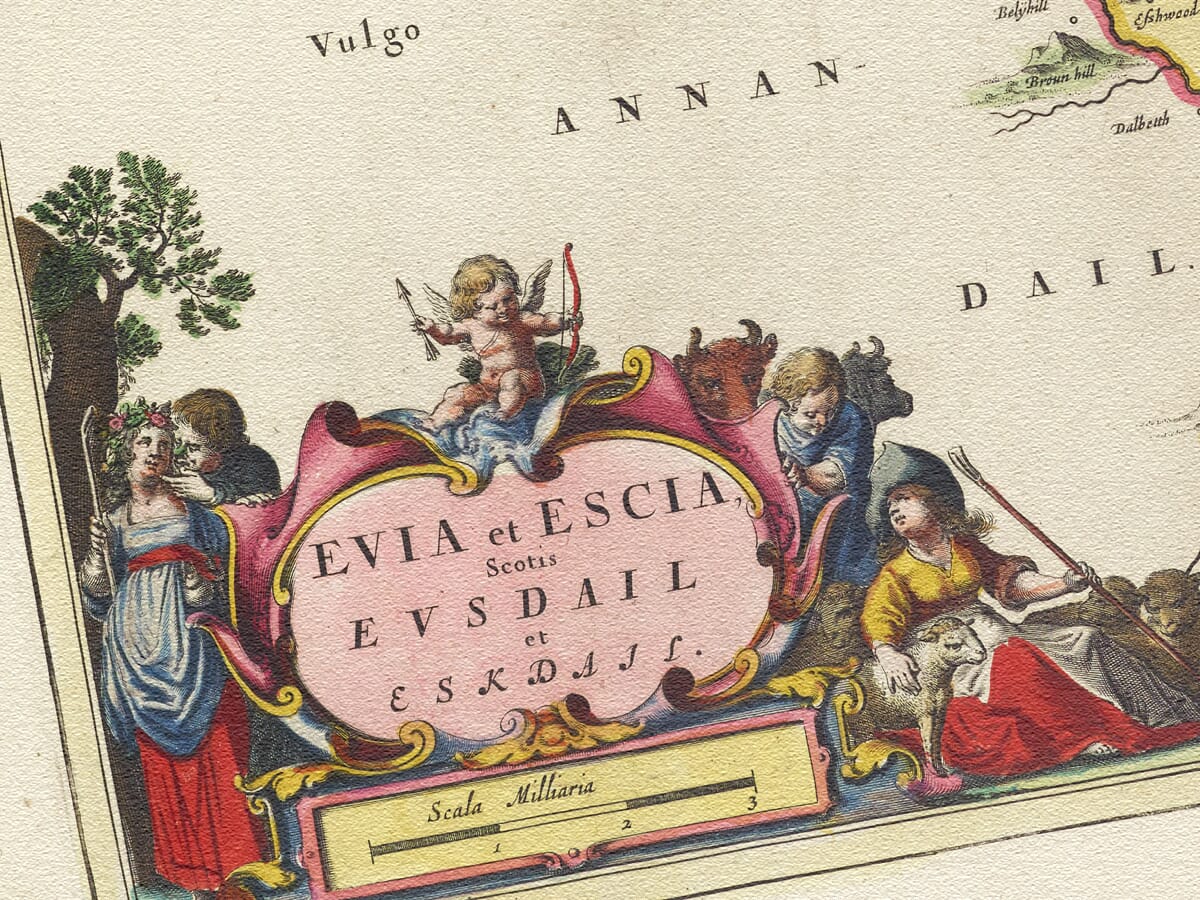
The title cartouche in the lower-left corner is more pastoral. Country figures gather around the inscription, accompanied by livestock and Cupid. Its gentler vision of courtship and rural abundance forms an appealing contrast with the austere hills and turbulent history of the Border country.
Blaeu’s map is therefore both a detailed historical document and an accomplished work of decorative art. It preserves Eskdale and Ewesdale as a landscape of flowing water, lonely hills, old strongholds and communities whose names have endured for centuries.





 Verified owner


















