Edinburgh in 1834: A Capital Transformed
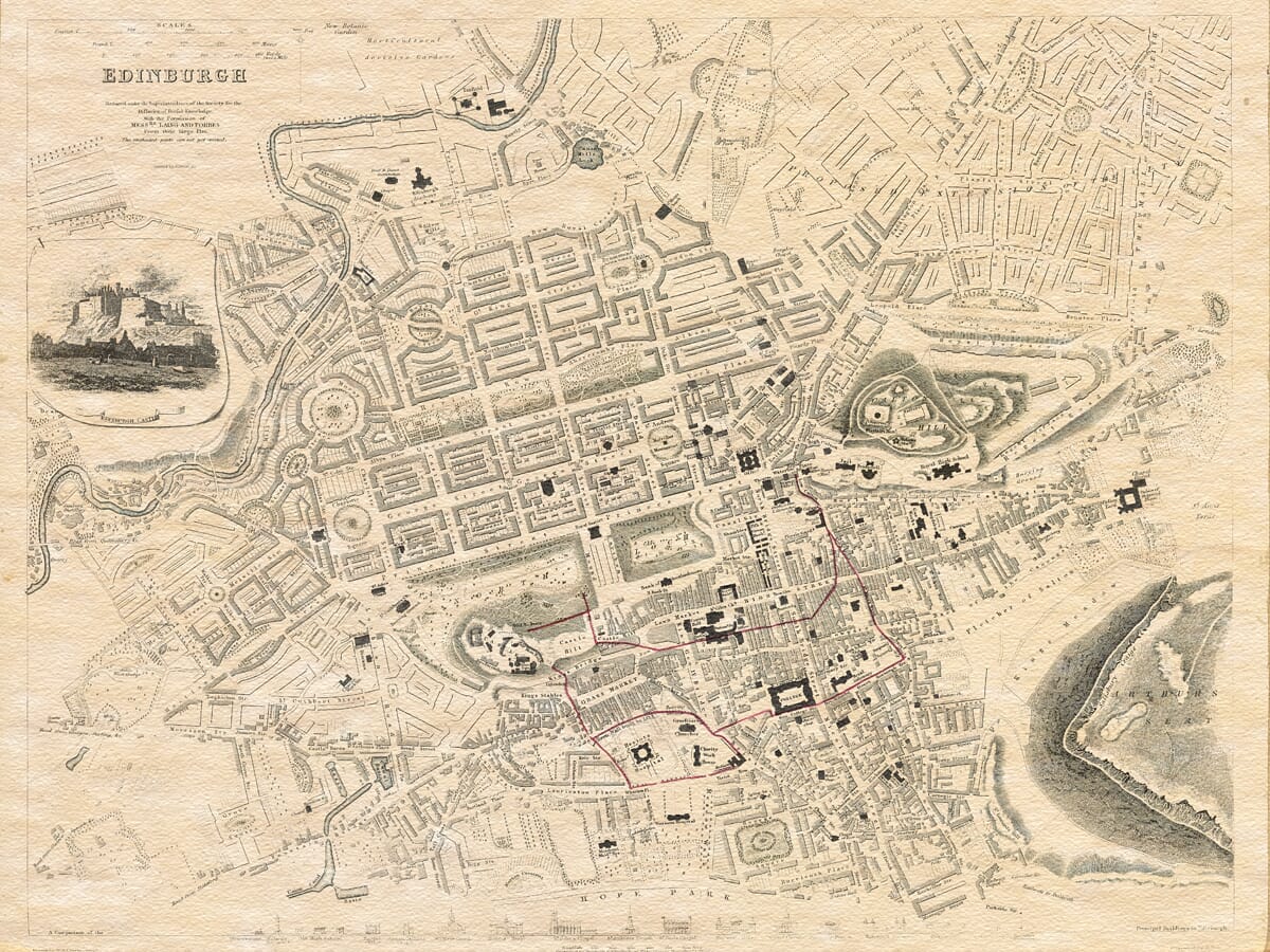
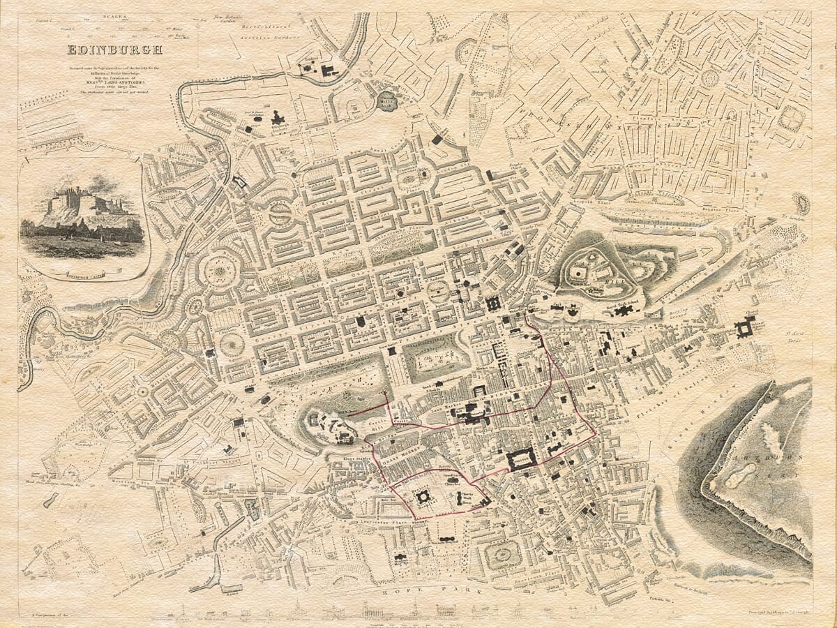
This remarkable plan of Edinburgh was published by Baldwin & Cradock on 1 January 1834 under the supervision of the Society for the Diffusion of Useful Knowledge. Its full inscription explains that it was reduced, with permission, from the large plan produced by Messrs Laing and Forbes. The finished map was drawn by the architect W. B. Clarke, engraved by Edmund Turrell and printed by J. Henshall. At a scale of approximately 1:8,500, it combines a precise street plan with engraved architectural views and carefully drawn topographical detail.
The Society for the Diffusion of Useful Knowledge had been founded in 1826 to make dependable educational material available at an affordable price. Its maps were intended for a growing audience interested in geography, travel, science and the rapidly changing modern world. Unlike expensive surveys made principally for officials or wealthy collectors, these plans brought accurate and attractively presented cartography into ordinary homes, schools and libraries. Edinburgh formed part of an ambitious series of plans depicting important cities in Britain, Europe and beyond.
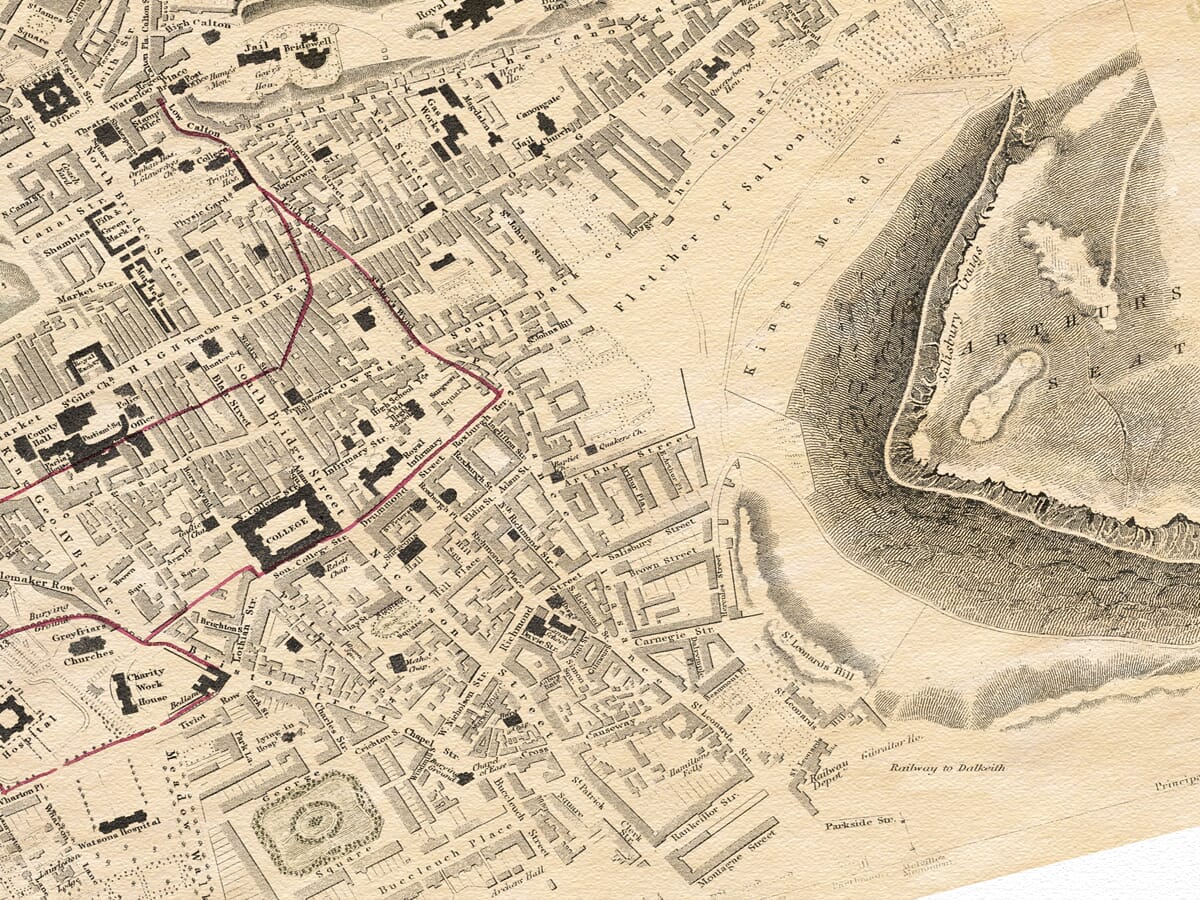
The map appeared at an especially interesting moment in Edinburgh’s development. The contrast between the medieval Old Town and the planned New Town is immediately apparent. South of the former Nor’ Loch, the Old Town follows the long volcanic ridge descending from Edinburgh Castle towards Holyrood. Its closes, wynds and tightly packed buildings gather around the High Street in a pattern created over many centuries.
To the north, the geometry of the New Town presents an entirely different urban ideal. James Craig’s original plan of 1767 had introduced the formal arrangement of Princes Street, George Street and Queen Street, linked by squares and cross streets. By 1834, Edinburgh had extended considerably beyond that first design. New terraces, crescents, gardens and residential districts were spreading north and west, reflecting the city’s growing prosperity and population. Edinburgh had grown from approximately 67,000 inhabitants in 1801 to around 136,000 by 1831.
This rapid expansion can be followed closely across the map. Charlotte Square marks the western end of the First New Town, while the curved streets of the Moray Estate demonstrate the more picturesque approach adopted by later planners. Queen Street Gardens, the Royal Botanic Garden and the open ground surrounding Calton Hill provide a striking contrast to the compact Old Town. The recently completed Dean Bridge, opened in 1832, carried the western road high above the Water of Leith and encouraged further development beyond the city centre.
Calton Hill forms another conspicuous feature. Its steep contours are represented by hachures, while the Observatory, Nelson’s Monument and the Royal High School illustrate Edinburgh’s enthusiasm for monumental classical architecture. Together with the buildings rising along Waterloo Place and Regent Terrace, they contributed to the city’s celebrated reputation as the “Athens of the North.”
The plan also predates the arrival of the railways that would soon transform the valley below the Old Town. Edinburgh’s first major railway connections opened during the following decade, and the area later occupied by Waverley Station had not yet acquired its familiar modern form. The map therefore preserves a particularly revealing view of the city immediately before railway engineering began reshaping its centre.
An engraved view of Edinburgh Castle enriches the composition, presenting the fortress dramatically above its rocky base. Along the lower border is an architectural comparison of seventeen principal buildings, all drawn to a common scale. These include the Observatory, Nelson’s Monument, the Royal High School, St Giles’ Church, Heriot’s Hospital, St John’s Chapel, the Register House, Assembly Rooms, Holyrood Palace, Calton Jail and the Melville Monument. This unusual feature allows the viewer to compare Edinburgh’s churches, civic institutions, monuments and public buildings as pieces of architecture rather than merely locating them on the plan.
Later impressions appeared in atlases published by Chapman & Hall, including an 1844 edition, demonstrating the continuing usefulness of the plate. Today the map provides much more than directions through an earlier city. It records Edinburgh at the meeting point of two distinct worlds: the densely layered medieval capital and the spacious, ordered city created during the Scottish Enlightenment and the great Georgian building campaigns.







 Verified owner














