Devon on Joan Blaeu’s 1645 Map
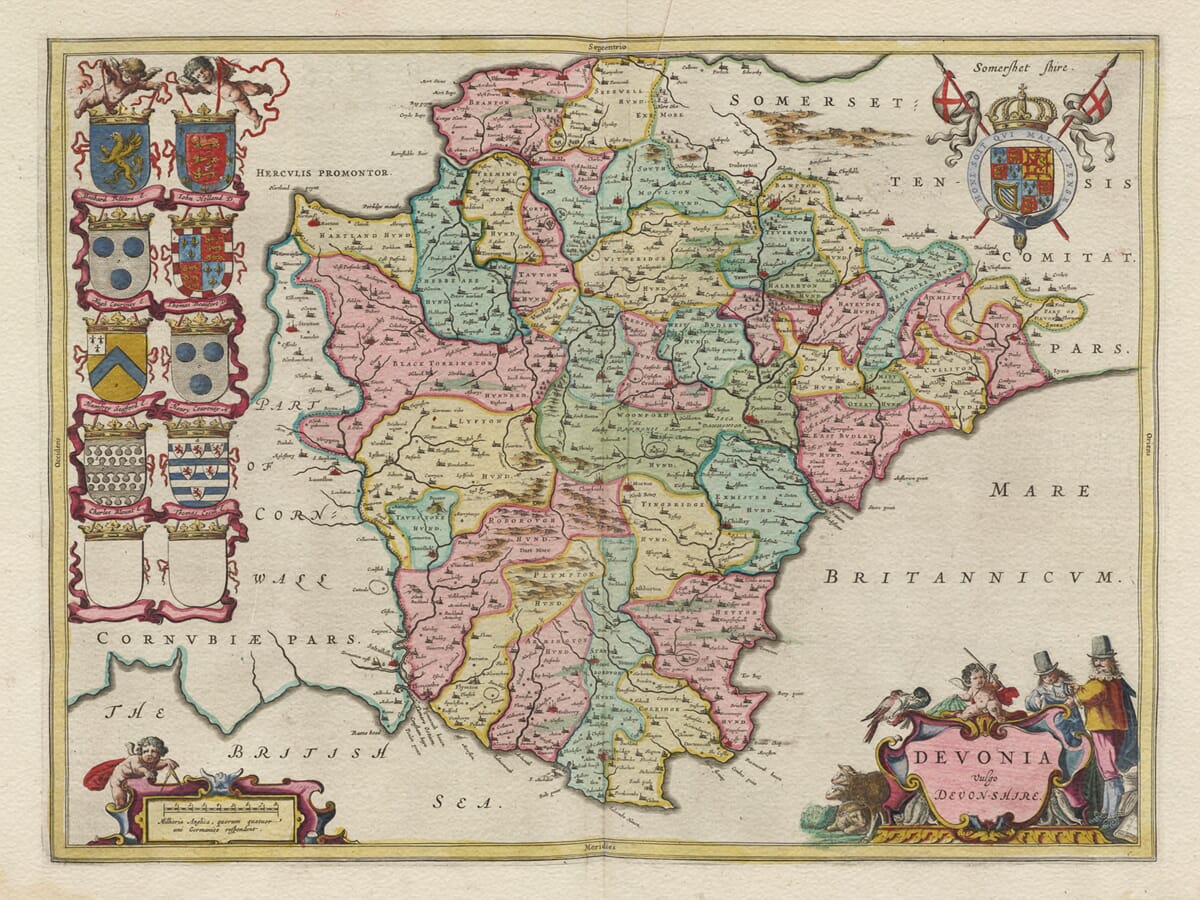
Joan Blaeu published this map in Amsterdam in 1645 under the title Devonia vulgo Devon-Shire. The Latin word vulgo indicates the name used commonly or in everyday language, giving the sense “Devonia, commonly called Devonshire.”
The first edition appeared in Le Théâtre du Monde ou Nouvel Atlas, Quatriesme Partie, the French-language fourth volume of Blaeu’s expanding atlas. Later impressions were printed for Dutch, Latin, German and Spanish editions, and the plate was subsequently included in Blaeu’s much larger Atlas Maior.
Blaeu did not conduct a new survey of Devon. Like the other English county maps in this atlas, its geography was based substantially upon earlier English cartography, particularly the work associated with Christopher Saxton and John Speed. Blaeu transformed this inherited information through new engraving, decorative lettering, heraldry and elaborate cartouches.
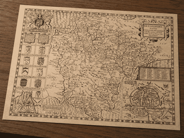
Devon’s two coastlines give the county a particularly recognisable outline. The map extends from the Bristol Channel in the north to the English Channel—labelled Mare Britannicum and “The British Sea”—in the south. Cornwall lies to the west, while Somerset and Dorset appear beyond Devon’s eastern boundary.
Exeter is prominently named, together with Plymouth, Barnstaple, Tiverton, Totnes, Tavistock, Honiton, Okehampton and many smaller communities. Rivers including the Exe, Dart, Tamar, Taw and Torridge help organise the landscape. These waterways and settlements are depicted geographically, but the engraving should not be interpreted as a detailed survey of ports, anchorages or commercial shipping routes.
The county’s higher ground is represented by conventional groups of pictorial hills. These suggest the upland character of the areas now known as Dartmoor and Exmoor but do not identify individual peaks or provide measured elevations. Blaeu’s engraving predates contour lines, modern triangulation and Ordnance Survey mapping.
Tin working had played an important role in Devon long before the map was published. Tavistock, Plympton, Ashburton and Chagford were established stannary towns around Dartmoor, where tin was weighed, assessed and taxed. Mining was regulated through distinctive stannary institutions. Although these towns can be found on the map, Blaeu does not identify individual mines, tin streams or underground workings.
The publication date also places the map during the English Civil War. Plymouth remained an important Parliamentarian stronghold despite repeated Royalist sieges and blockades. At Dartmouth, Gallants Bower was built between 1643 and 1645 as part of the town’s Royalist defences before Parliamentarian forces captured Dartmouth in 1646. These events provide historical context, but Blaeu’s map does not record military positions or troop movements.
Much of the engraving’s visual character comes from its decoration. Ten family shields are arranged along the left side, with two intentionally left blank. The royal arms appear in the upper-right corner. At lower left, a putto holds dividers beside the scale cartouche.
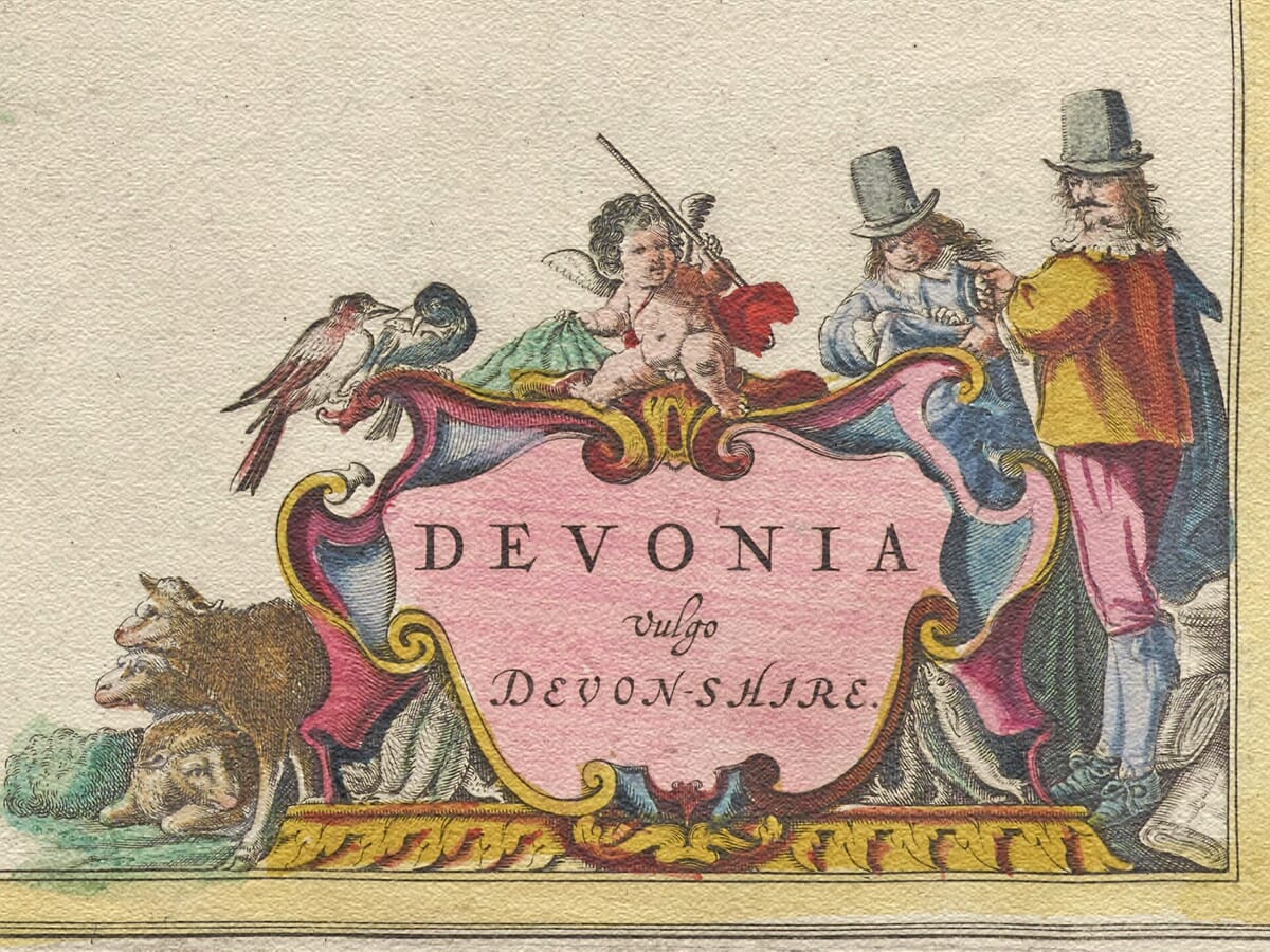
The title cartouche at lower right is surrounded by pastoral imagery. Sheep, rustic figures and birds accompany the ornamental framework, while fish support its lower sides. These details evoke rural and coastal associations, but they should be understood as decorative symbolism rather than a literal survey of Devon’s industries.
Devonia vulgo Devon-Shire therefore combines inherited seventeenth-century geography with the sophisticated presentation of Joan Blaeu’s Amsterdam workshop. It remains a rewarding historical map for exploring familiar Devon place names while appreciating the heraldry, colouring and decorative engraving of the Dutch Golden Age.





 Verified owner