


Got there in time and loves it! Cheers David [Gift from US to UK]

Thanks Lauren. We received it today - it's gorgeous! Thank you, Ellan

Thank you for your prompt service. I have a gallery and framing business in South Wales. I'm so pleased it is printed in the UK

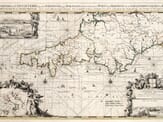
My Isles of Scilly map arrived safely and I'm delighted with it!

The print arrived safely and we're delighted with it - a lovely reminder of our honeymoon 15 years ago.

I have just received them! I'm sure our clients will be pleased with them and there could be more projects off the back of this one where we can use more. [Interior Designers]

I just received my map of Ireland by Ewart today and, as usual, I am delighted by its quality. The crispness and fineness of detail is excellent and the colour reproduction surpasses my expectations. Please relay my thanks to Steve for another fine effort!

Many thanks, Lauren. Very pleased with the map and the service: would recommend The Old Map Company to anyone interested in Old Maps.

Many thanks, the map arrived safely this morning, and I’m really pleased with it. A stunning reproduction, just as I had hoped. I will keep browsing your website, and may yet be tempted by more of your items! Have a great weekend.

Just arrived, wonderful map! Thanks very much!

The map – beautiful – arrived safely, very many thanks.

Thank you, I have already found the map. It’s wonderfull! Good luck! Rasa

My apologies for the very late reply. I wanted to reach out to thank you so much for rushing my order. My partner absolutely loved it. I am amazed with the service so that is a five-star from me. I wish you all the best.

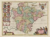
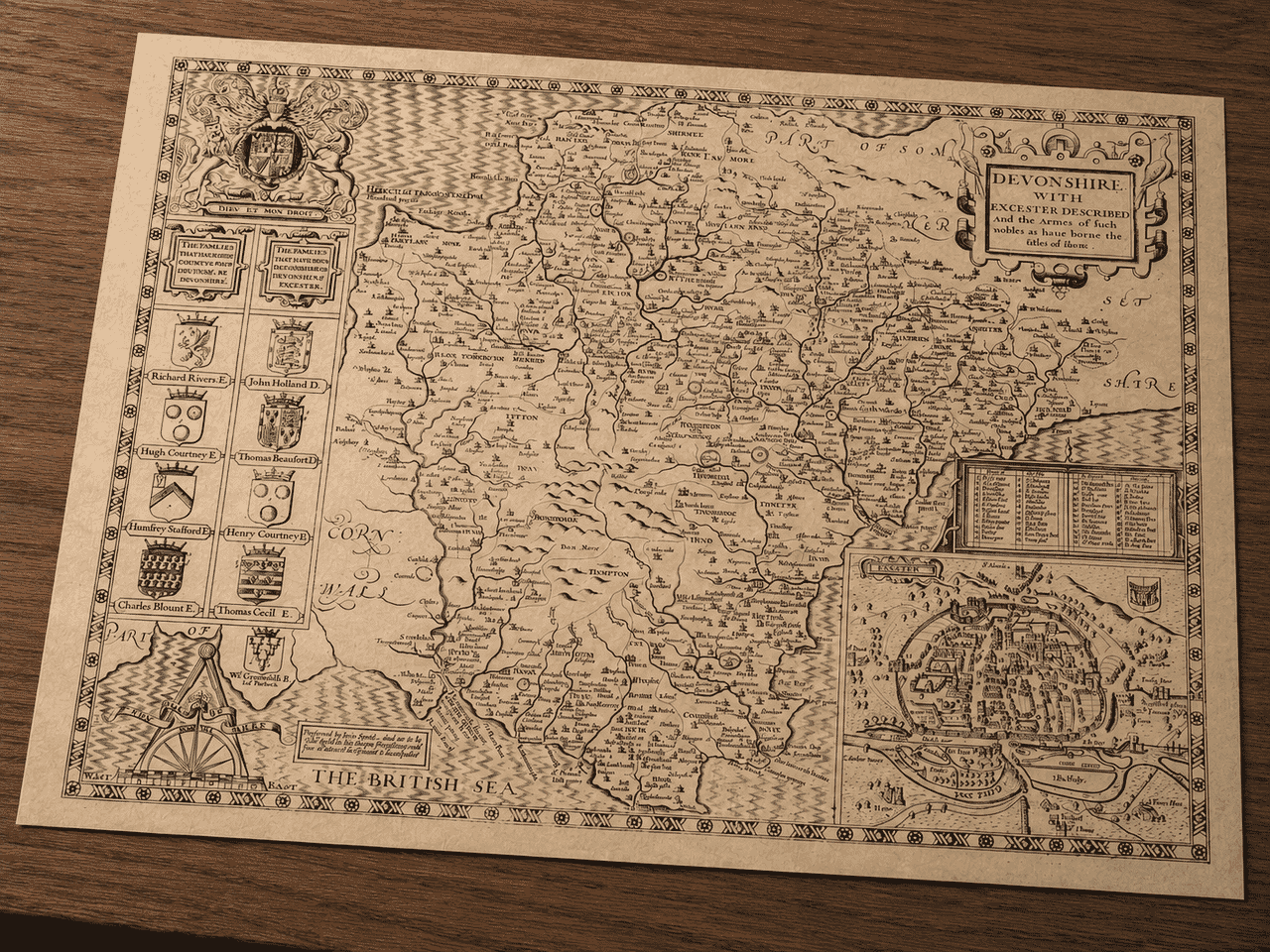
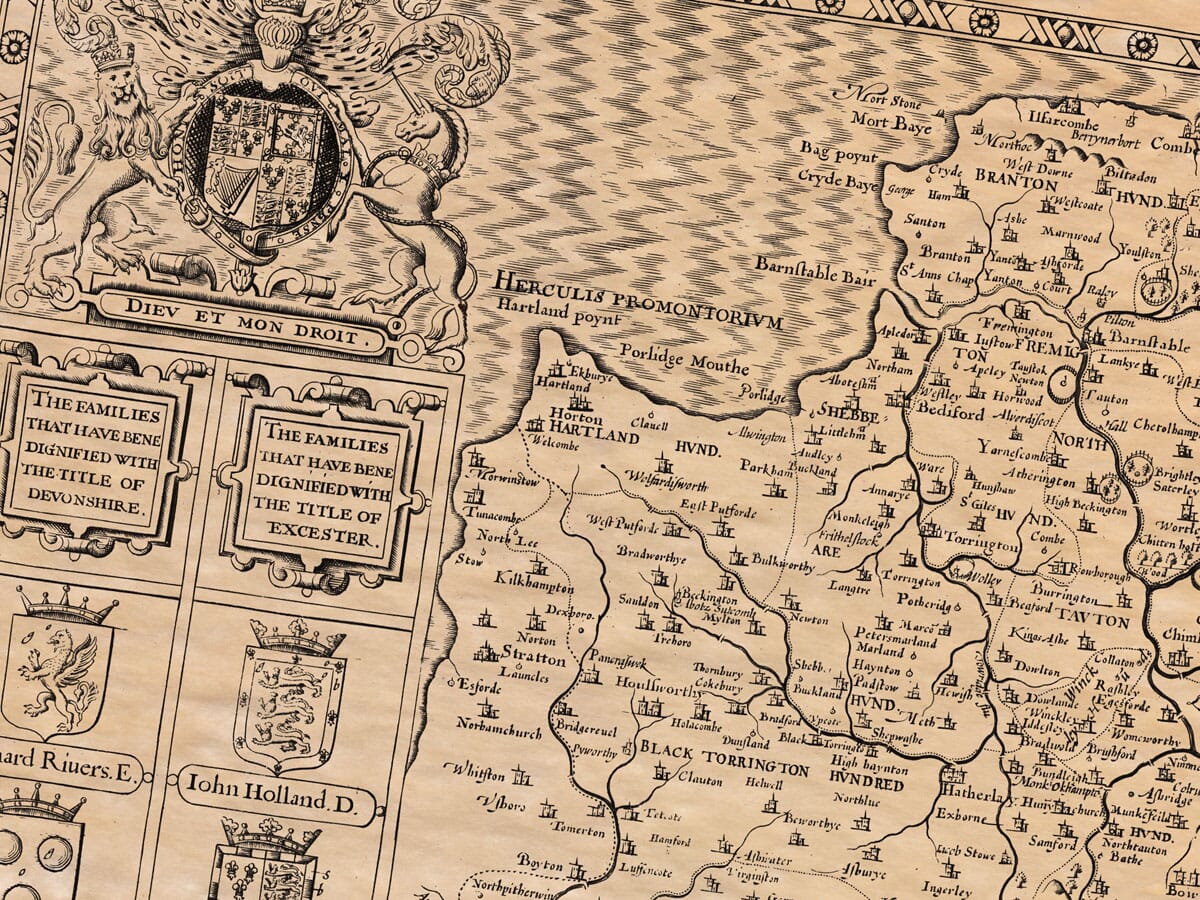
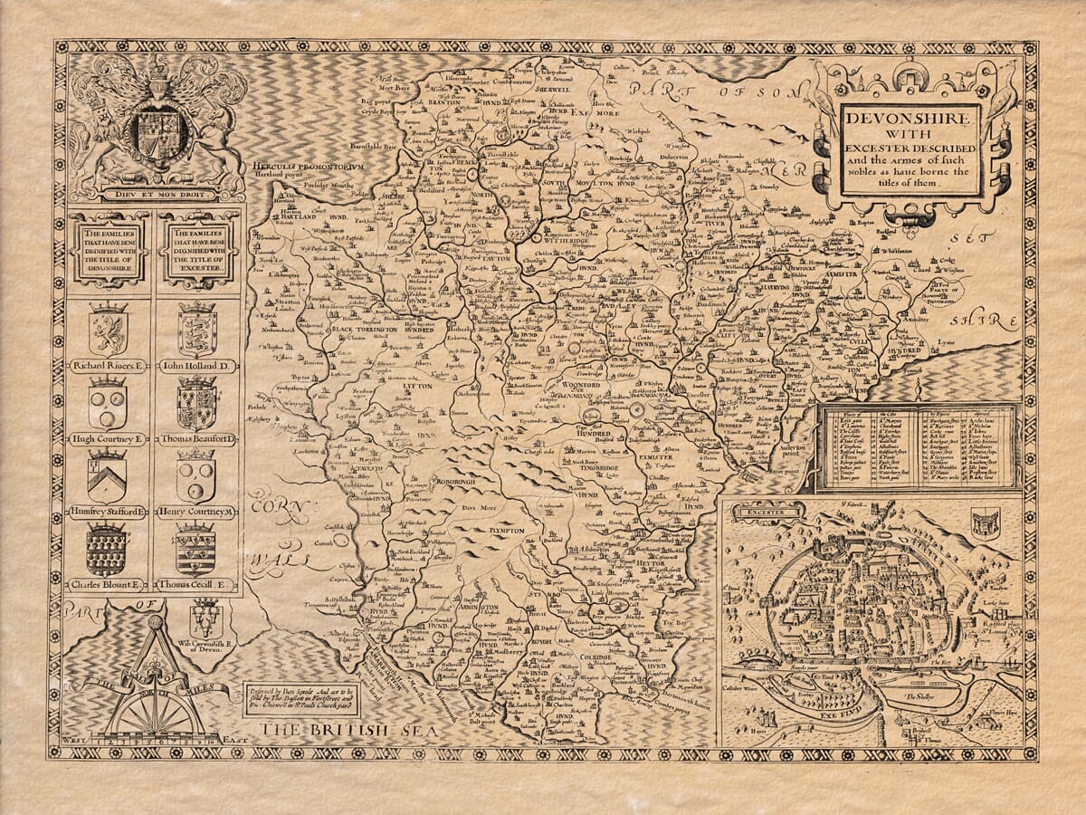
Devonshire, in Latin by the Cornish-Britains called Dewnania, by the English Saxon Deven-scyre, and by contraction of the vulgar Deyvne, is not derived from the river Dawes, as some would have it, but from the people Dannmonii. The same people we mentioned in Cornwall, and whom Ptolemy placed in the western borders.
The west of this county is bordered by Cornwall and washed by the River Tamar. The east borders Somerset and Dorset. The north and south sides are almost entirely on the Bristol Channel and Severn Sea. From Countesham in the north to Salcomb Haven in the south is about 45 miles. From Hartland Point in the west to Thornmouth East in the east is about 70 miles. So the full circuit of the county is around 200 miles.
About 70 miles by 45 miles at its widest points.
The air is sharp, healthful, and good.
The soil is productive and fertile, though stony in places. The land is so well-cultivated that no farmer ever sits idle, and the sea provides much wealth, especially on the north and south coasts. Fishermen journey long distances, risking life and limb for profit, and the soil yields grain and other crops well.
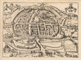
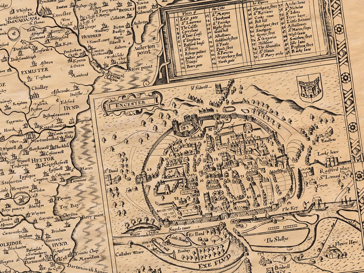
As for harbours, this county has many, with easy access to the sea. It’s ideal for shipping and trade. Among these, Exeter is famous for being one of Brute’s first settlements (though this may be more poetic than historical). Geoffrey of Monmouth mentions it in his writings.
“The Gods did guide his sail and course; the winds were at command,
And Totnes was the happy shore where first he came to land.”
With more credible and lamentable sources, the Danes first invaded in 787 A.D., when Brightkirk, a Saxon king’s steward, tried to question their intentions. The Danes killed him and returned to their ships, eager for further ventures.
Much later, Plymouth achieved great fame as the departure point for explorers and defenders of England. From here, Sir Francis Drake began his famous voyage in 1577, sailing around the globe in just over two years. Sir John Hawkins and Lord Charles Howard of Effingham also set sail from here against the Spanish Navy in 1588, defending England’s shores valiantly.
The county has excellent resources: wool, cloth, beef, and corn. Rich and fertile lands support plentiful livestock and agriculture. Deer, game, and fish are also abundant.
Exeter, the chief city of the county, lies by the River Exe. It is believed to have been founded by Antonius Emperour, for the Dannmonii tribe, and was later fortified by Vespasian. It stands beautifully on a hill, protected by walls with towers and gates. It once had a castle called Rougemont, from where the Earls of Cornwall ruled. Several notable churches and religious houses stand here, like St. Peter’s Cathedral and the Bishops’ See.
In 1003, the city was attacked by the Danish under Swanus, who burned much of it, but the people bravely rebuilt it. William the Conqueror laid siege to it again in 1067 when the citizens refused to open the gates, but he spared them after they submitted. The city flourished afterward and was governed by a mayor and many officials.
Latitude ranges from 50° to 52°. The city’s air is healthful. It is noted for learning, especially for having nurtured St. Boniface, apostle of Germany.
This county contains many remnants of battles and antiquities: stone circles, ancient tombs, and Roman inscriptions. There is also a burial place of Hubba the Dane, near Tawton. Letters of the Danes remain carved in stones there.
The title Duke of Devonshire has been granted to a few noble families, including the Holland and Courtenay families. The Courtenays were once Earls of Devon, with Philip Courtenay most notably.
Many religious houses existed here, including Exeter, Tavistock, Totnes, Hartland, and Barnstaple.
The county is divided into thirty-three hundreds (administrative regions) and many parishes, each with their own churches.

Description on the verso of John Speede’s Old Map of Devon