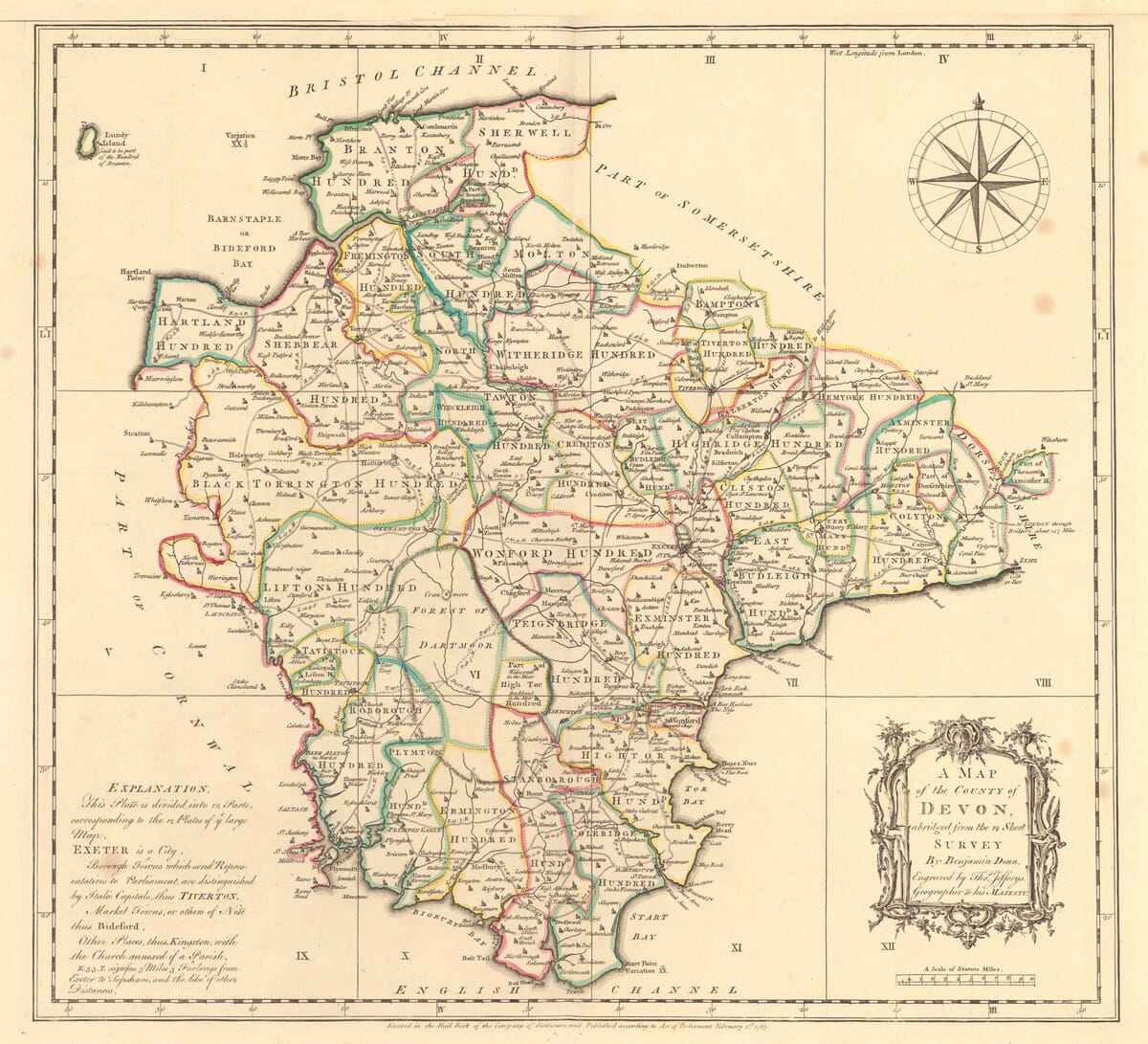
Benjamin Donn’s General Map of Devon
Benjamin Donn’s general map of Devon was published in London on 1 February 1765. Its decorative cartouche describes it as A Map of the County of Devon, contracted from the 12 Sheet Survey by Benjamin Donn and names Thomas Jefferys, Geographer to His Majesty, as its engraver.
This distinction matters. The engraving is not the enormous twelve-sheet map reproduced at a greatly reduced scale. It is the separate general view and index map supplied with bound copies of Donn’s survey, designed to present the entire county on one manageable sheet.
Map Details
- Original title: A Map of the County of Devon
- Description on map: Contracted from the 12 Sheet Survey by Benjamin Donn
- Surveyor: Benjamin Donn
- Engraver and publisher: Thomas Jefferys, Geographer to His Majesty
- Published: London, 1 February 1765
- Purpose: General view and index to Donn’s twelve-sheet survey of Devon
- Original dimensions: Approximately 485 × 535 mm
- Approximate scale: 1:264,000
- Coverage: Devon, Lundy and adjoining parts of Cornwall and Somerset
- Principal places: Exeter, Plymouth, Barnstaple, Bideford, Tiverton, Tavistock, Okehampton, Honiton, Dartmouth and Totnes
- Historic geography: Devon’s hundreds and the separate County of Exeter
- Other features: Roads, distances, rivers, settlements, churches, coloured boundaries, compass rose, numbered survey grid, title cartouche and scale bar
- Format: Hand-coloured copperplate engraving
A Guide to the Twelve-Sheet Survey
Strong horizontal and vertical lines divide the map into twelve numbered sections. Roman numerals I to IV run across the north, V to VIII through the centre and IX to XII along the south.
Each section corresponds to one sheet of Donn’s much larger survey. A reader consulting the bound volume could use this general map to identify the correct detailed sheet before turning to it.
The grid is therefore not an ordinary latitude and longitude system. It reveals the map’s original function and provides a direct visual connection with one of the most ambitious English county surveys of the eighteenth century.
Why 1765 Matters
In 1759, the Society for the Encouragement of Arts, Manufactures and Commerce offered a £100 award for an original county survey produced at one inch to the mile. Donn began surveying Devon at about this time and reportedly measured thousands of miles of roads and rivers during the following years.
His completed twelve-sheet map became the first successful entry for the Society’s county-mapping award. It was engraved by Thomas Jefferys and published on 1 January 1765, with this general index map following one month later.
This was several decades before the Ordnance Survey began publishing its own county mapping. Donn’s work consequently belongs to an important period when individual surveyors were applying measurement, trigonometry and astronomical observation to the production of increasingly accurate local maps.
The present engraving preserves the geographical structure of that pioneering survey while making the county legible as a whole.
Devon’s Historic Hundreds
Coloured lines divide Devon into its historic hundreds. Their names appear in large capital letters across the map, including Braunton, Tiverton, Halberton, Crediton, Exminster, Plympton and many others.
The boundaries create an intricate pattern that bears little resemblance to modern local government divisions. Several are irregularly shaped, and their names sometimes extend across roads, rivers and settlements.
These divisions were used for administration, taxation and justice. Their prominence makes them one of the map’s most recognisable historical features and allows the organisation of eighteenth-century Devon to be seen immediately.
Roads, Distances and Settlements
Roads form a dense network across the county. They converge upon Exeter and connect market towns including Tiverton, Crediton, Honiton, Okehampton, Tavistock and Totnes with the ports and coastal communities.
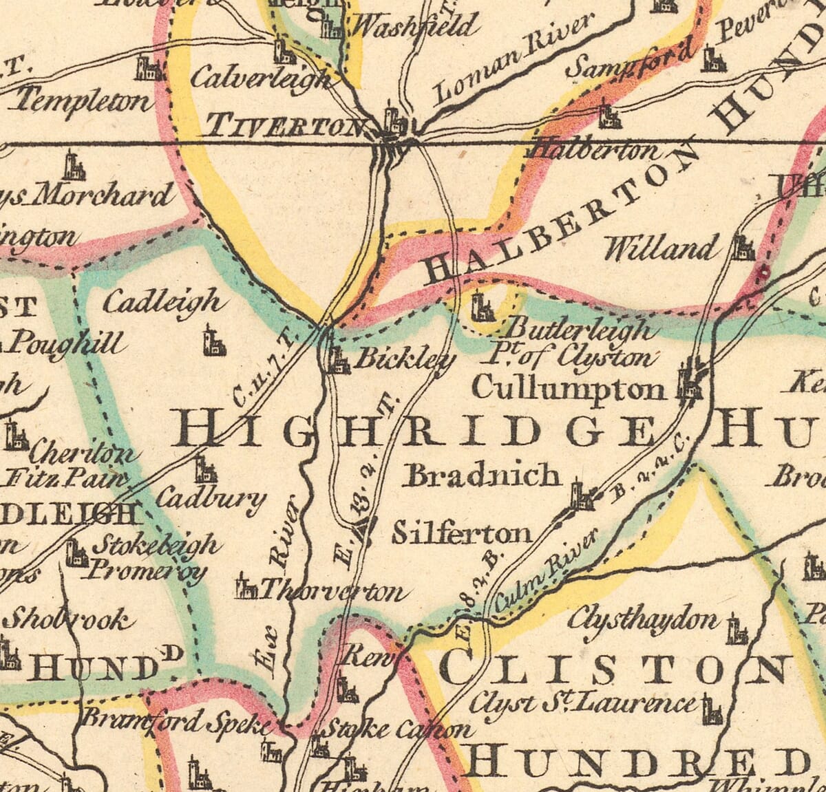
Figures placed along the routes record distances between settlements. The detailed gallery images show these measurements especially clearly around Tiverton, Bickleigh, Cullompton and Exeter.
Church symbols distinguish numerous villages, while larger lettering gives visual importance to the principal towns. This combination of roads, distances and settlement symbols reflects the practical origins of Donn’s survey: it was intended to describe how Devon was connected, not merely to outline its shape.
The Separate County of Exeter
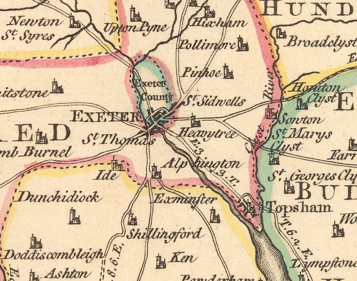
Exeter is enclosed within a small coloured boundary and explicitly labelled “Exeter County”. This is not a cartographic mistake.
Henry VIII granted Exeter county status in 1537, giving the city judicial and administrative independence from the surrounding county of Devon. Donn’s map records that arrangement by treating Exeter as a distinct territory within the wider county.
Roads radiate from the city towards Crediton, Tiverton, Honiton, Topsham, Exminster and the country farther west. The enlarged map detail also shows nearby places including Heavitree, Pinhoe, Alphington and St Thomas.
Lundy and the Two Coasts
Lundy appears in the Bristol Channel at the upper-left corner. A note beside the island associates it with Braunton Hundred, an unusual historical detail that would be easy to miss without examining the artwork closely.
Devon’s long coastline is framed by the Bristol Channel to the north and the English Channel to the south. Bideford Bay, Start Bay and Tor Bay are named, together with headlands, ports and coastal settlements.
The compass rose occupies the open sea northeast of Devon. Elsewhere, references to compass variation reflect the importance of accurate bearings to eighteenth-century surveyors and navigators.
Decoration with a Practical Purpose
The engraving balances three prominent elements around the county. An elaborate rococo title cartouche fills the lower-right corner, a large compass rose occupies the upper-right and an explanation of symbols appears at the lower-left.
The scale of statute miles is placed beneath the cartouche. Around the outer border, degree markings provide a further framework for the geography.
These details give the map visual character without overwhelming its practical information. The result is an unusually revealing portrait of Devon: a county divided into ancient hundreds, crossed by measured roads and presented as the key to a much larger pioneering survey.





 Verified owner