


£35.55 – £59.95Price range: £35.55 through £59.95
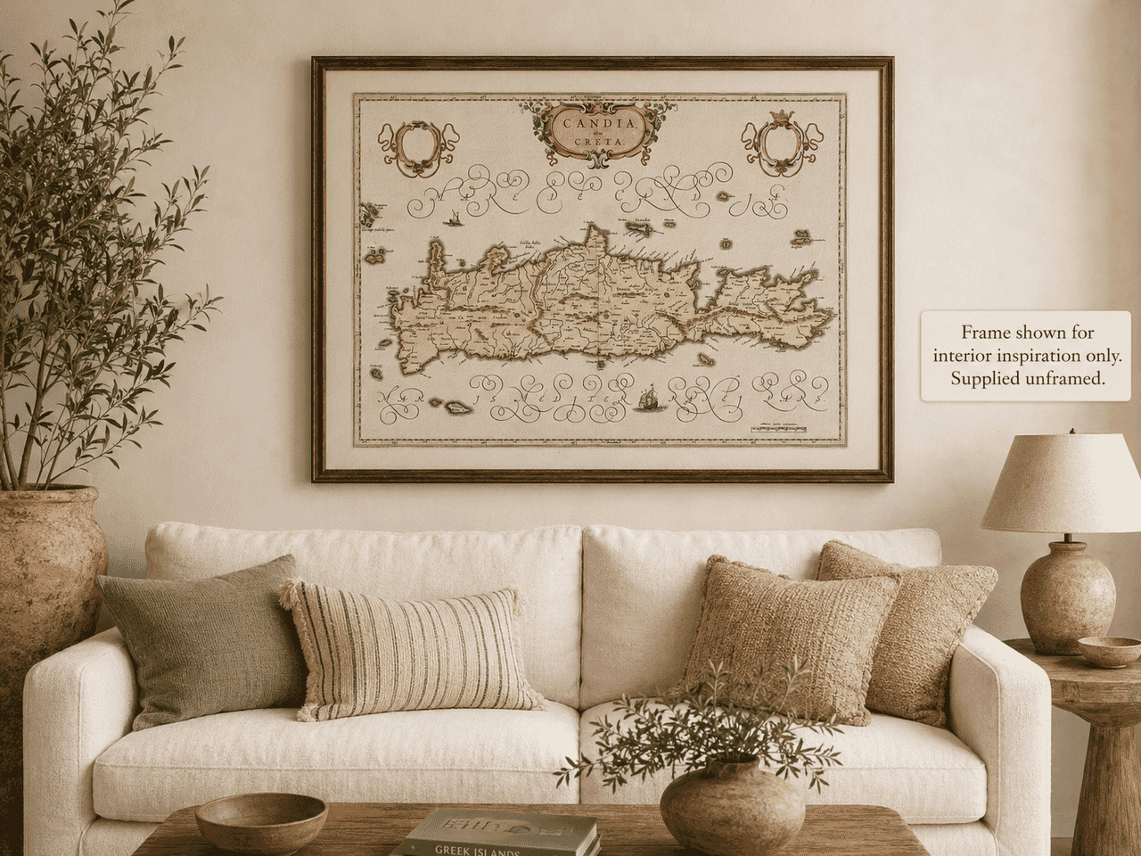
Old Map of Crete Engraved and published by William Blaeu Circa 1645
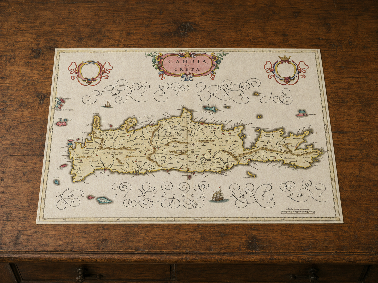
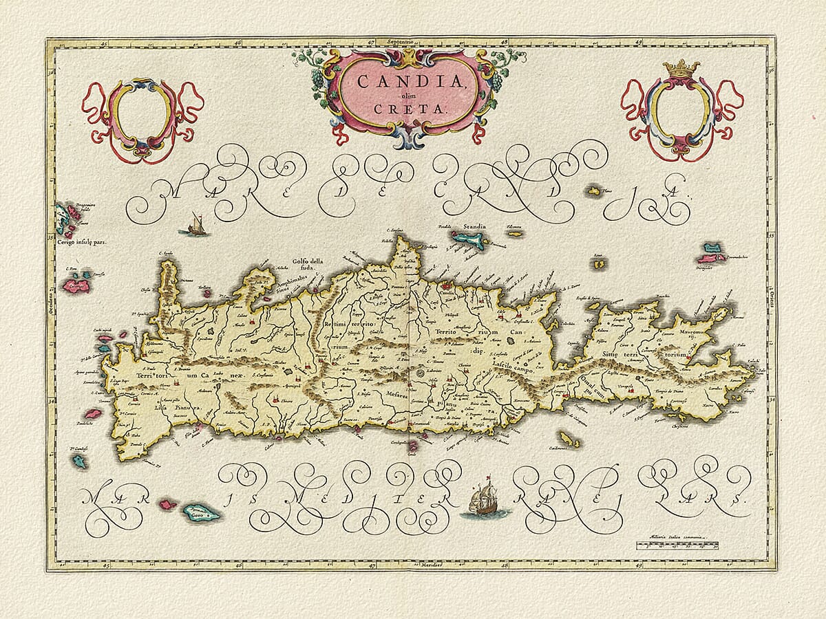
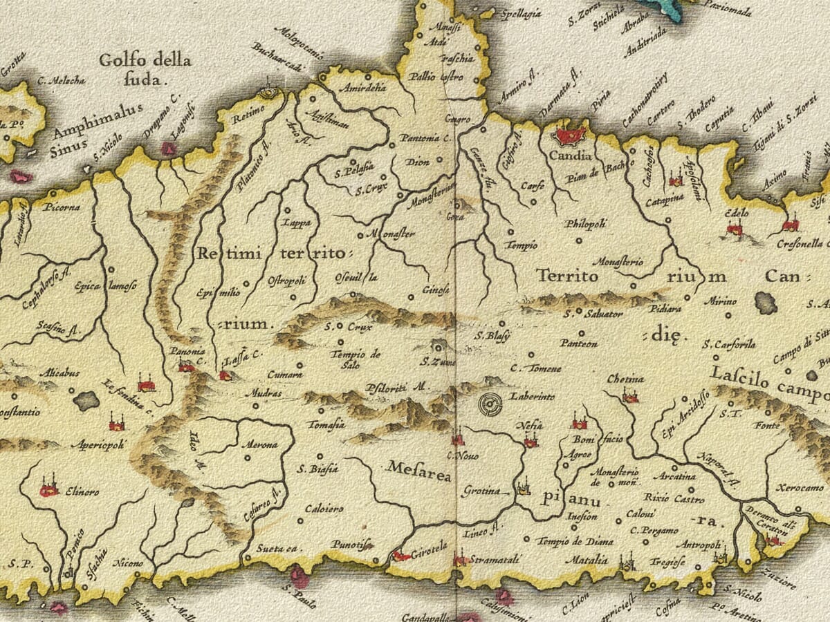
This richly detailed old map of Crete was engraved and published by the celebrated Blaeu mapmaking workshop in Amsterdam during the seventeenth century. The island appears under its historic name of Candia, with its long mountainous coastline, principal settlements, harbours and surrounding seas carefully recorded.
Decorative ships, sea creatures, an elaborate title cartouche and finely engraved topographical detail make this an especially attractive example of Golden Age Dutch cartography. Originally produced at a time when Crete was an important Venetian possession in the eastern Mediterranean, the map captures both the geography and political significance of the island shortly before the Ottoman conquest.
Reproduced from a high-resolution original and carefully prepared for printing, this historic map of Crete makes an impressive feature for a study, living room, holiday home or any interior with a connection to Greece and the Mediterranean.
A stunning certified FINE ART PRINT on heavy textured art paper — not a poster
Unlike most online offerings, our maps are produced entirely in-house, not outsourced to print-on-demand or drop-shipping services. This allows complete control over quality while offering better value. Each map begins with a high-resolution original, carefully enhanced and printed to order using archival papers and pigment inks for exceptional clarity, depth, and longevity. Every piece is personally overseen — no map leaves our workshop unless it is of a quality we would be proud to display ourselves.
Paper choice is essential to the authenticity of our maps. We use specially sourced 190gsm paper made in the UK from pure materials and traditionally pressed with natural woollen felts. This process creates a subtle, randomly textured surface that closely resembles an original antique document. Likewise the use of premium quality ink fully saturates the paper, producing remarkable clarity, depth, and historical character. Colour fastness and sharpness will remain good for in excess of 100 years!
The Old Map Company of Great Britain offers a vast and carefully curated collection of the very finest expertly reproduced vintage maps. Our range includes works by renowned cartographers such as John Speed and Willem Blaeu, covering Scotland, England, and beyond. Free UK courier delivery is included, with EU, USA, and worldwide shipping available at cost and calculated at checkout. If you need assistance, our team is always happy to help you choose the perfect map.
Speedy delivery A beautiful representation
Got there in time and loves it! Cheers David [Gift from US to UK]
Thanks Lauren. We received it today - it's gorgeous! Thank you, Ellan
Thank you for your prompt service. I have a gallery and framing business in South Wales. I'm so pleased it is printed in the UK
My Isles of Scilly map arrived safely and I'm delighted with it!
The print arrived safely and we're delighted with it - a lovely reminder of our honeymoon 15 years ago.
I have just received them! I'm sure our clients will be pleased with them and there could be more projects off the back of this one where we can use more. [Interior Designers]
I just received my map of Ireland by Ewart today and, as usual, I am delighted by its quality. The crispness and fineness of detail is excellent and the colour reproduction surpasses my expectations. Please relay my thanks to Steve for another fine effort!
Many thanks, Lauren. Very pleased with the map and the service: would recommend The Old Map Company to anyone interested in Old Maps.
Many thanks, the map arrived safely this morning, and I’m really pleased with it. A stunning reproduction, just as I had hoped. I will keep browsing your website, and may yet be tempted by more of your items! Have a great weekend.
Just arrived, wonderful map! Thanks very much!
The map – beautiful – arrived safely, very many thanks.
Thank you, I have already found the map. It’s wonderfull! Good luck! Rasa
My apologies for the very late reply. I wanted to reach out to thank you so much for rushing my order. My partner absolutely loved it. I am amazed with the service so that is a five-star from me. I wish you all the best.
Crete occupies a commanding position in the eastern Mediterranean, lying between mainland Greece, Asia Minor and the coast of North Africa. Its long, narrow form made it instantly recognisable to early cartographers, while its harbours and position on important sea routes gave the island considerable strategic and commercial importance.
On seventeenth-century European maps, Crete was frequently labelled Candia. The name originally referred particularly to the island’s principal city—today’s Heraklion—but during the long period of Venetian government it was also widely used for the island as a whole. Historical accounts note that Candia became the administrative capital under Venetian rule and that its name consequently passed into European mapmaking.
Venice acquired Crete following the division of the Byzantine Empire after the Fourth Crusade. The island then remained under Venetian control for more than four centuries. During this period, its ports linked the trade of Venice with the Aegean, the Levant and the wider Mediterranean world. Venetian influence could be seen in the island’s fortifications, civic buildings, harbours and architecture.
It was against this background that the Blaeu map was produced. Amsterdam had become one of Europe’s leading centres of map and atlas publishing, and the Blaeu family’s work was admired not only for its geographical information but also for its fine engraving, elegant lettering, ornamental cartouches and decorative colouring.
The map presents Crete stretched prominently across the sheet, with mountains suggested pictorially and towns distributed along the coastline and through the interior. The seas surrounding the island are enlivened with sailing vessels and ornamental details, turning a practical geographical image into a highly decorative work.
The title Candia olim Creta can be understood as “Candia, formerly Crete” or “Candia, once called Crete.” Surviving examples of this Blaeu design are generally associated with the mid-seventeenth century and later editions of the family’s atlases. Examples dated around 1650 and in the 1660s are held or recorded in map collections, which reflects the continued use of the plate through different editions.
The timing was historically significant. Ottoman forces began their major invasion of Crete in 1645. Chania fell first, followed by Rethymno, and the long siege of Candia began in 1648. The fortified capital resisted until 1669, when it finally surrendered and most of the island passed from Venetian to Ottoman rule.
The map therefore records Crete at the end of a remarkable era. It shows the island as it was understood by a leading Dutch map publisher while Venetian power in the eastern Mediterranean was being challenged. Its appeal today lies in this combination of history, geography and decorative artistry.
For anyone with family connections to Crete, memories of travelling there or simply an appreciation of historic Mediterranean cartography, this old map provides a fascinating link with the island’s past.
Those interested in this old map of Crete may also enjoy our Old map of Greece by John Speed, together with historic island maps of Corfu and Santorin. For a wider view of the region, see our Mediterranean Islands Map and explore our full collection of Old maps of the Greek Islands.