Joan Blaeu’s Map of Caithness: Cathenesia
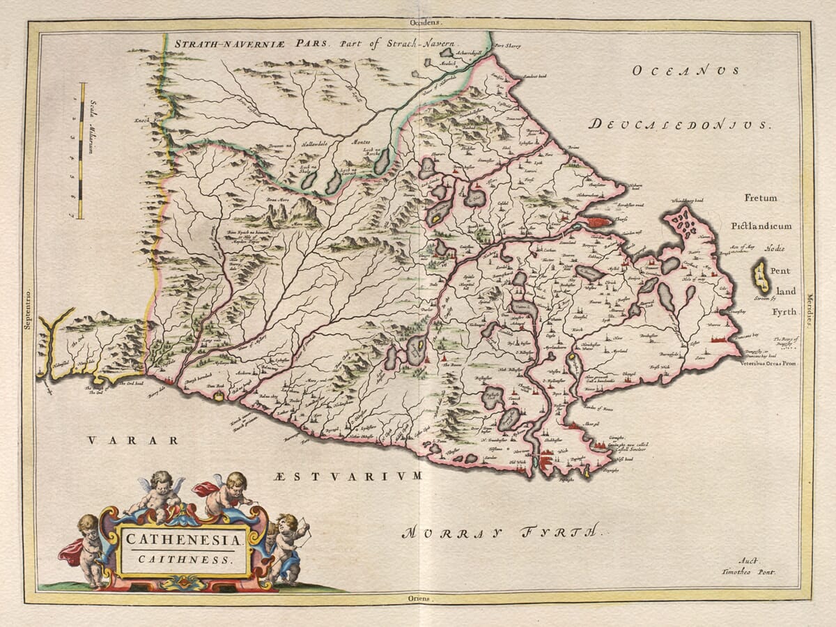
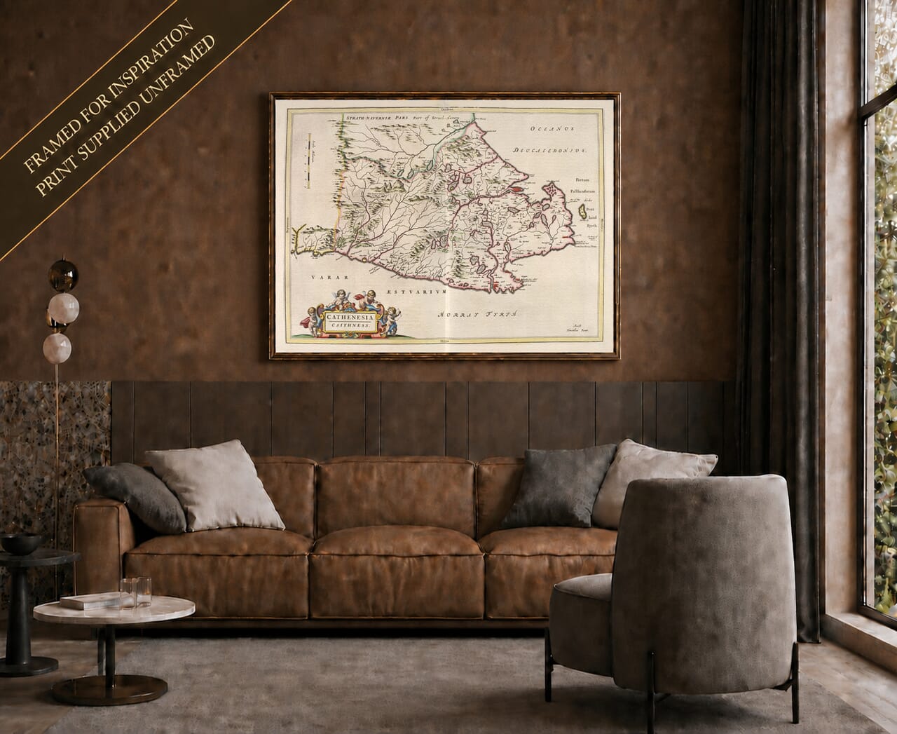
Joan Blaeu’s map of Caithness was first published in Amsterdam in 1654 as part of the fifth volume of his Theatrum Orbis Terrarum, sive Atlas Novus. Entitled Cathenesia. Caithness, the engraving depicts Scotland’s northeastern extremity between the Moray Firth, the Pentland Firth and the adjoining lands of Sutherland and Strathnaver.
The inscription Auct. Timotheo Pont identifies the source of its geography as Timothy Pont. His surveys provided the foundation for many of the regional maps in Blaeu’s landmark Scottish atlas.
Map details
Original title: Cathenesia. Caithness
Original cartographer: Timothy Pont
Publisher: Joan Blaeu
First published: Amsterdam, 1654
Area shown: Historic Caithness and part of neighbouring Strathnaver
Principal places: Wick, Thurso, Halkirk, Watten and Latheron
Source atlas: Theatrum Orbis Terrarum, sive Atlas Novus, Volume V
Product type: Fine art reproduction print of the historic map
Timothy Pont and Scotland’s Far North
Timothy Pont travelled through Scotland during the late sixteenth and early seventeenth centuries, recording places that had never previously appeared on a detailed printed map. His work was especially valuable in remote northern districts where difficult terrain, sparse settlement and long distances made systematic surveying unusually demanding.
Pont died before he could publish his proposed atlas. His manuscripts were preserved and eventually reached Joan Blaeu’s workshop in Amsterdam, assisted by Scottish scholars including Sir John Scot of Scotstarvit and Robert Gordon of Straloch.
Blaeu’s engravers converted this material into finely finished copperplates. The resulting Scottish volume, published in 1654, contained 49 maps and was the first printed atlas devoted to Scotland. Although Blaeu was responsible for publishing and presenting the finished map, the engraved attribution ensures that Pont’s role as its original cartographer remains clear.
Reading the Map’s Unusual Orientation
Modern viewers may initially find the map’s arrangement surprising. North is positioned to the left, south to the right, west at the top and east at the bottom. This rotated orientation allowed the long shape of Caithness to make effective use of the atlas page.
The Pentland Firth consequently appears along the right-hand edge, rather than across the top as it would on a conventional modern map. The Moray Firth and eastern coastline run along the lower portion, while part of Strathnaver lies towards the upper left.
The words “Pentland Firth” are divided around the northeastern coastline. They do not refer to an “Isle of Pentland”. The island shown in the strait is Stroma, lying between the Caithness mainland and Orkney.
Wick, Thurso and the Caithness Landscape
Wick appears prominently on the eastern coast beside the river and bay that gave the settlement its importance. It had become a royal burgh in the late sixteenth century, although its dramatic growth as a herring port still lay far in the future when Blaeu’s map appeared.
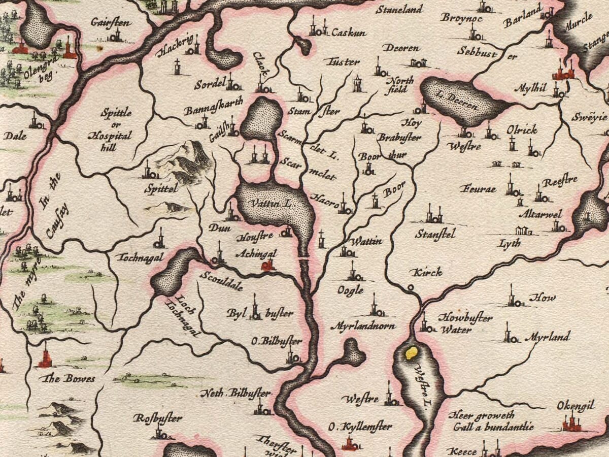
Thurso occupies the northern coast facing the Pentland Firth and Orkney. Its position made it a natural centre for communication and maritime activity. Inland settlements including Halkirk and Watten appear among rivers, lochs and estates, while Latheron stands along the route towards southern Caithness.
The map also records many smaller habitations whose names survive in farms, townships and estates. Examining these early spellings can be particularly rewarding for people researching family or local history.
Caithness differs markedly from the mountainous country farther west. Much of its interior consists of open moorland, low hills, wetlands and broad agricultural ground, although higher and rougher country rises towards Sutherland. Blaeu conveys these contrasts through clusters of pictorial hills, waterways and carefully distributed settlement symbols.
A County Shaped by the Sea
The sea dominates the map’s eastern and northern margins. The Pentland Firth connected Caithness with Orkney while also presenting sailors with powerful tides and difficult currents. Coastal settlements depended upon fishing, local trade and communication by water at a time when overland travel could be slow and uncertain.
Caithness also preserves a strong Norse inheritance, visible in many of its place names and in its historic connections with Orkney. Blaeu’s engraving does not attempt to explain these layers of history, but the density of coastal names and the prominence given to the surrounding waters reveal how closely life was tied to the sea.
The map was not designed as a modern measured survey. Roads are not shown systematically, relief is represented pictorially and the relative size of a settlement symbol should not be treated as an exact measure of its population. Its value lies in its remarkable record of the names, waterways and inhabited places known when Pont’s geographical information was assembled.
Decoration and Lasting Appeal
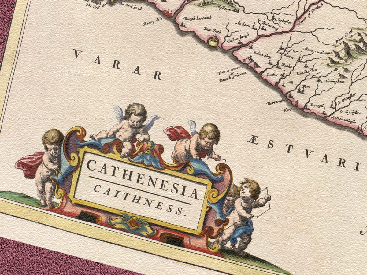
Four putti gather around the brightly coloured title cartouche, giving the map a warmth and playfulness that contrasts with the austere northern landscape. A scale of Scottish miles appears separately along the western side of the engraving.
The restrained colouring helps distinguish coastlines and regional boundaries without overwhelming Pont’s intricate geography. Rivers, lochs, hills and tiny buildings invite close inspection and allow familiar places to be rediscovered through seventeenth-century eyes.
For those connected to Caithness, this historic map brings together Wick, Thurso, the Pentland Firth and the open northern country in one compelling image. It remains both an important document from Scotland’s first printed atlas and a handsome celebration of a county shaped by distance, weather and sea.





 Verified owner