


£35.55 – £59.95Price range: £35.55 through £59.95
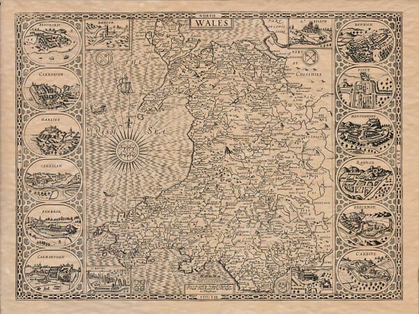
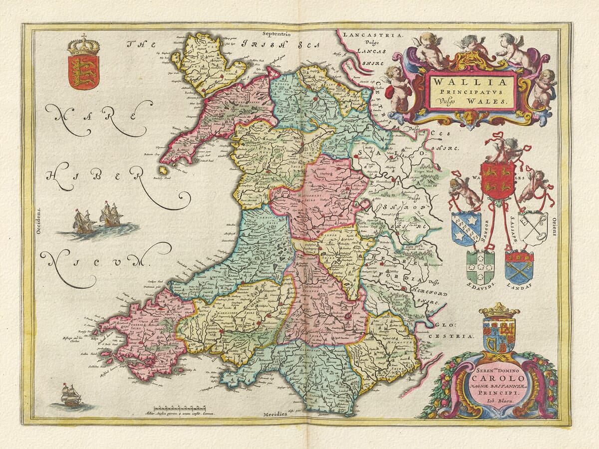
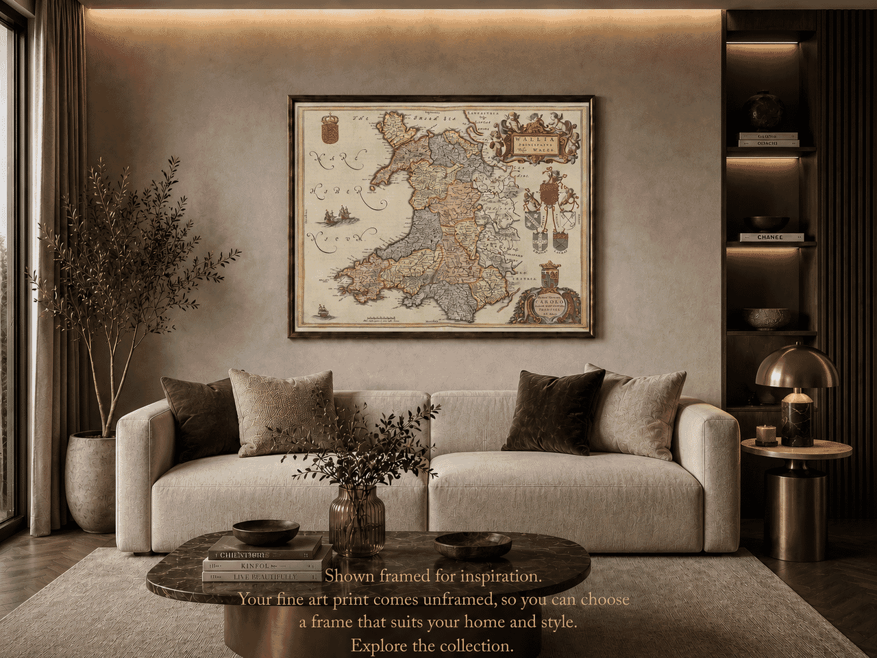
A beautifully detailed old map of Wales by Joan Blaeu, published circa 1645 and showing the historic counties, towns, rivers and coastlines of Wales in delicate original colouring.
This beautifully coloured seventeenth-century map shows Wales in remarkable detail, divided into its historic counties and surrounded by decorative heraldic features. Published by Joan Blaeu in the mid-seventeenth century, it records the towns, rivers, coastlines and regional divisions of Wales as they were understood during the great age of Dutch atlas-making.
From Anglesey and Caernarfon in the north to Pembroke, Carmarthen and Glamorgan in the south, the map is filled with place names that still resonate today. Its attractive colouring, ornate cartouches and historical importance make it an especially appealing choice for anyone with Welsh roots, an interest in Welsh history, or a love of decorative antique cartography.
A stunning certified FINE ART PRINT on heavy textured art paper — not a poster
Unlike most online offerings, our maps are produced entirely in-house, not outsourced to print-on-demand or drop-shipping services. This allows complete control over quality while offering better value. Each map begins with a high-resolution original, carefully enhanced and printed to order using archival papers and pigment inks for exceptional clarity, depth, and longevity. Every piece is personally overseen — no map leaves our workshop unless it is of a quality we would be proud to display ourselves.
Paper choice is essential to the authenticity of our maps. We use specially sourced 190gsm paper made in the UK from pure materials and traditionally pressed with natural woollen felts. This process creates a subtle, randomly textured surface that closely resembles an original antique document. Likewise the use of premium quality ink fully saturates the paper, producing remarkable clarity, depth, and historical character. Colour fastness and sharpness will remain good for in excess of 100 years!
The Old Map Company of Great Britain offers a vast and carefully curated collection of the very finest expertly reproduced vintage maps. Our range includes works by renowned cartographers such as John Speed and Willem Blaeu, covering Scotland, England, and beyond. Free UK courier delivery is included, with EU, USA, and worldwide shipping available at cost and calculated at checkout. If you need assistance, our team is always happy to help you choose the perfect map.
Speedy delivery A beautiful representation
Got there in time and loves it! Cheers David [Gift from US to UK]
Thanks Lauren. We received it today - it's gorgeous! Thank you, Ellan
Thank you for your prompt service. I have a gallery and framing business in South Wales. I'm so pleased it is printed in the UK
My Isles of Scilly map arrived safely and I'm delighted with it!
The print arrived safely and we're delighted with it - a lovely reminder of our honeymoon 15 years ago.
I have just received them! I'm sure our clients will be pleased with them and there could be more projects off the back of this one where we can use more. [Interior Designers]
I just received my map of Ireland by Ewart today and, as usual, I am delighted by its quality. The crispness and fineness of detail is excellent and the colour reproduction surpasses my expectations. Please relay my thanks to Steve for another fine effort!
Many thanks, Lauren. Very pleased with the map and the service: would recommend The Old Map Company to anyone interested in Old Maps.
Many thanks, the map arrived safely this morning, and I’m really pleased with it. A stunning reproduction, just as I had hoped. I will keep browsing your website, and may yet be tempted by more of your items! Have a great weekend.
Just arrived, wonderful map! Thanks very much!
The map – beautiful – arrived safely, very many thanks.
Thank you, I have already found the map. It’s wonderfull! Good luck! Rasa
My apologies for the very late reply. I wanted to reach out to thank you so much for rushing my order. My partner absolutely loved it. I am amazed with the service so that is a five-star from me. I wish you all the best.
Joan Blaeu’s map of Wales is one of those works that rewards a second look. From across a room, it is the colouring and the elaborate decoration that first attract attention. Seen more closely, it becomes a remarkably detailed record of seventeenth-century Wales, filled with counties, towns, rivers, coastlines and old place names that remain familiar today.
The map bears the Latin title Wallia Principatus vulgo Wales, meaning “The Principality of Wales, commonly called Wales”. It was published in Amsterdam during the 1640s, at a time when the Blaeu family workshop was producing some of the finest and most ambitious atlases in Europe.
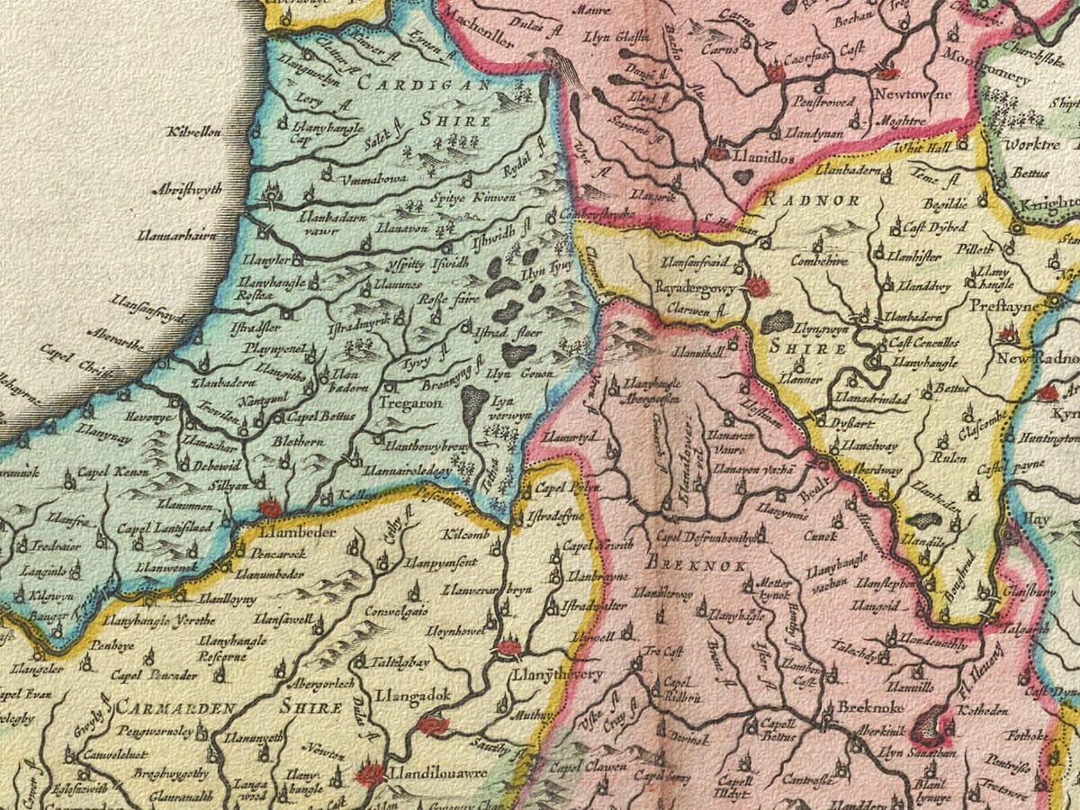
Wales is divided into its historic counties: Anglesey, Caernarvonshire, Merionethshire, Denbighshire, Flintshire, Montgomeryshire, Cardiganshire, Radnorshire, Breconshire, Carmarthenshire, Pembrokeshire and Glamorgan. The use of colour makes these old boundaries easy to follow, while also giving the map much of its decorative character.
In the north, Anglesey is shown clearly apart from the mainland, with Caernarfon, Bangor and Conwy marked nearby. Further east appear Denbigh, Flint and Wrexham. The mountains are represented in the old pictorial style, by rows of small engraved hills rather than modern contour lines, but the effect still gives a strong impression of the rougher landscape of north Wales.
Following the coast southwards, Harlech and Dolgellau can be found before the shoreline opens into Cardigan Bay. Aberystwyth and Cardigan are both marked, together with many smaller settlements. Some names appear almost exactly as they do today, while others use spellings that take a little time to recognise.
That is part of the pleasure of an old map. It does not reveal everything at once. A familiar town may suddenly appear after several minutes of looking, or an old spelling may gradually become clear. For anyone with Welsh family connections, the map can feel less like a distant historical document and more like a record of places tied to personal memory.
Central Wales is more lightly settled on the page, though it is far from empty. Montgomery, Newtown and Llanidloes appear among the river valleys, with Rhayader further south. Brecon is clearly marked within Breconshire, surrounded by the upland country of the middle border region. The rivers are especially important here, helping to explain where settlements developed and how different parts of the country were connected.
The south-west contains some of the most recognisable names on the map. Carmarthen appears as an important centre, while St Davids, Haverfordwest, Pembroke and Tenby are all shown around the Pembrokeshire coast. The outline of the peninsula, with its bays, inlets and projecting headlands, is immediately familiar even in this seventeenth-century engraved form.
Along the southern coast, Blaeu records Swansea, Neath, Llandaff, Cardiff and Cowbridge. Further east lie Abergavenny and Monmouth, both close to the historic border between Wales and England. The neighbouring English counties are included too, placing Wales within the wider landscape of the Marches and showing the close relationship between rivers, roads, border towns and markets.
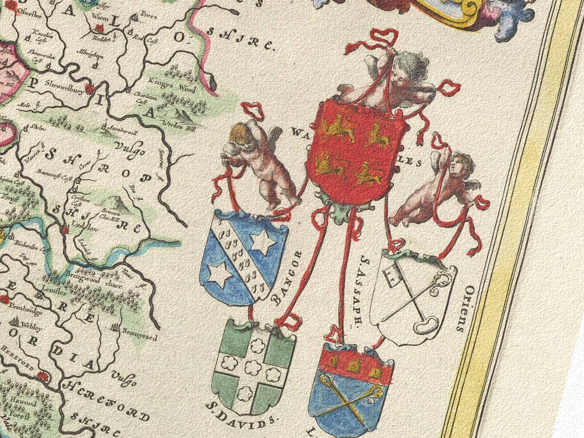
The decorative features are just as memorable as the geography. In the upper-right corner, the title is set within a richly ornamented cartouche surrounded by cherubs, scrollwork and colour. Beneath it are heraldic shields connected with the historic divisions and traditions of Wales. A royal coat of arms appears in the upper-left, while sailing ships occupy the Irish Sea and Bristol Channel.
At the lower-right is another elaborate cartouche carrying Blaeu’s dedication to Prince Charles. Such decoration was an important part of the great Dutch atlases. Maps were expected to inform, but they were also intended to impress. When an atlas was opened in a private library or study, the map had to work as both geography and art.
Joan Blaeu inherited one of Europe’s leading mapmaking businesses from his father, Willem Blaeu. Under Joan, the firm expanded its atlas publishing on a grand scale. The Blaeu atlases became admired for their engraved detail, careful composition and rich hand colouring, and this map of Wales is a fine example of that tradition.
What makes the map especially appealing today is the balance between beauty and detail. The coloured counties, ships, coats of arms and cartouches give it presence from a distance, while the dense network of names invites much closer inspection.
For anyone with an affection for Wales, the map offers more than decoration. It provides a link with the country as it was represented nearly four centuries ago, preserving familiar towns and landscapes within the visual language of the seventeenth century.