Willem Blaeu’s Old Map of Switzerland
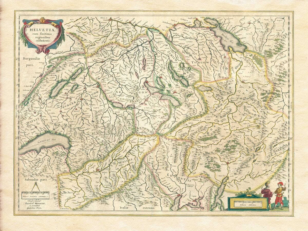
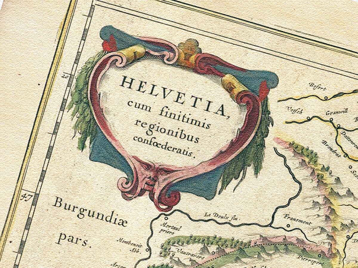
This richly detailed map of Switzerland was published in Amsterdam by Willem Blaeu around 1635. Its Latin title, Helvetia, cum finitimis regionibus confoederatis, identifies the country as Helvetia together with its neighbouring confederated regions.
The geography derives from a map first engraved for Gerard Mercator’s atlas in 1585. Willem Blaeu subsequently acquired and published the plate, adding his name while retaining Mercator’s original cartographic credit.
Map Details
- Original title: Helvetia, cum finitimis regionibus confoederatis
- Original cartographer: Gerard Mercator
- Publisher: Willem Janszoon Blaeu
- Published: Amsterdam, c.1635
- Original map first issued: 1585
- Region: Switzerland and neighbouring territories
- Principal places: Zurich, Bern, Basel, Lucerne, Geneva, Lausanne, Fribourg, St Gallen and Chur
- Principal lakes: Geneva, Constance, Zurich, Lucerne and Neuchâtel
- Format: Hand-coloured copperplate engraving
- Relief: Mountain ranges represented pictorially
- Other features: Rivers, forests, settlements, political boundaries, scale bars and decorative cartouches
Helvetia and the Swiss Confederacy
The name Helvetia derives from the Helvetii, a people associated with the region during the Roman period. It became a common Latin name for Switzerland and continues to appear on Swiss coins and postage stamps.
When this edition was published, Switzerland was not yet a single centralised state. It consisted of cantons, associated territories and allied communities linked through the Old Swiss Confederacy.
The map reflects this complicated political geography. Coloured boundaries distinguish territories within the Confederacy while also showing its relationship with Burgundy, Savoy, Swabia and the Italian lands beyond the Alps.
The Alps, Lakes and River Valleys
The Alpine landscape dominates the engraving. Closely arranged mountain symbols extend across southern and central Switzerland, emphasising the natural barriers separating valleys, cantons and neighbouring regions.
Switzerland’s major lakes provide recognisable geographical anchors. Lake Geneva occupies the southwest, Lake Constance marks the northeast and the lakes around Zurich and Lucerne define the country’s central districts.
Rivers connect these mountain and lake systems with the Rhine, Rhône and wider European waterways. Their careful representation reflects the importance of river valleys as settlement corridors and routes through otherwise difficult terrain.
Towns and Alpine Routes
Zurich, Bern, Basel, Lucerne and Geneva are among the most prominent settlements. Numerous smaller towns, villages and religious houses fill the surrounding countryside.
Switzerland occupied an important position between northern and southern Europe. Alpine passes carried travellers, merchants, soldiers and correspondence between Germany, France and the Italian states.
The map therefore presents the country as both a mountainous stronghold and an important European crossroads. Its inclusion of substantial neighbouring territory helps explain the Confederacy’s strategic position.
A Map Derived from Gerard Mercator
Gerard Mercator first issued this geographical composition in 1585. His name remains in the lower-left inscription, while Willem Blaeu’s imprint records its later publication in Amsterdam.
Reissuing and updating existing copperplates was common among seventeenth-century map publishers. Plates could remain in use for decades, passing between workshops and appearing in successive editions of important European atlases.
Blaeu’s publication introduced Mercator’s influential map to another generation of collectors and atlas readers during the great period of Dutch mapmaking.
Cartouches and Decoration
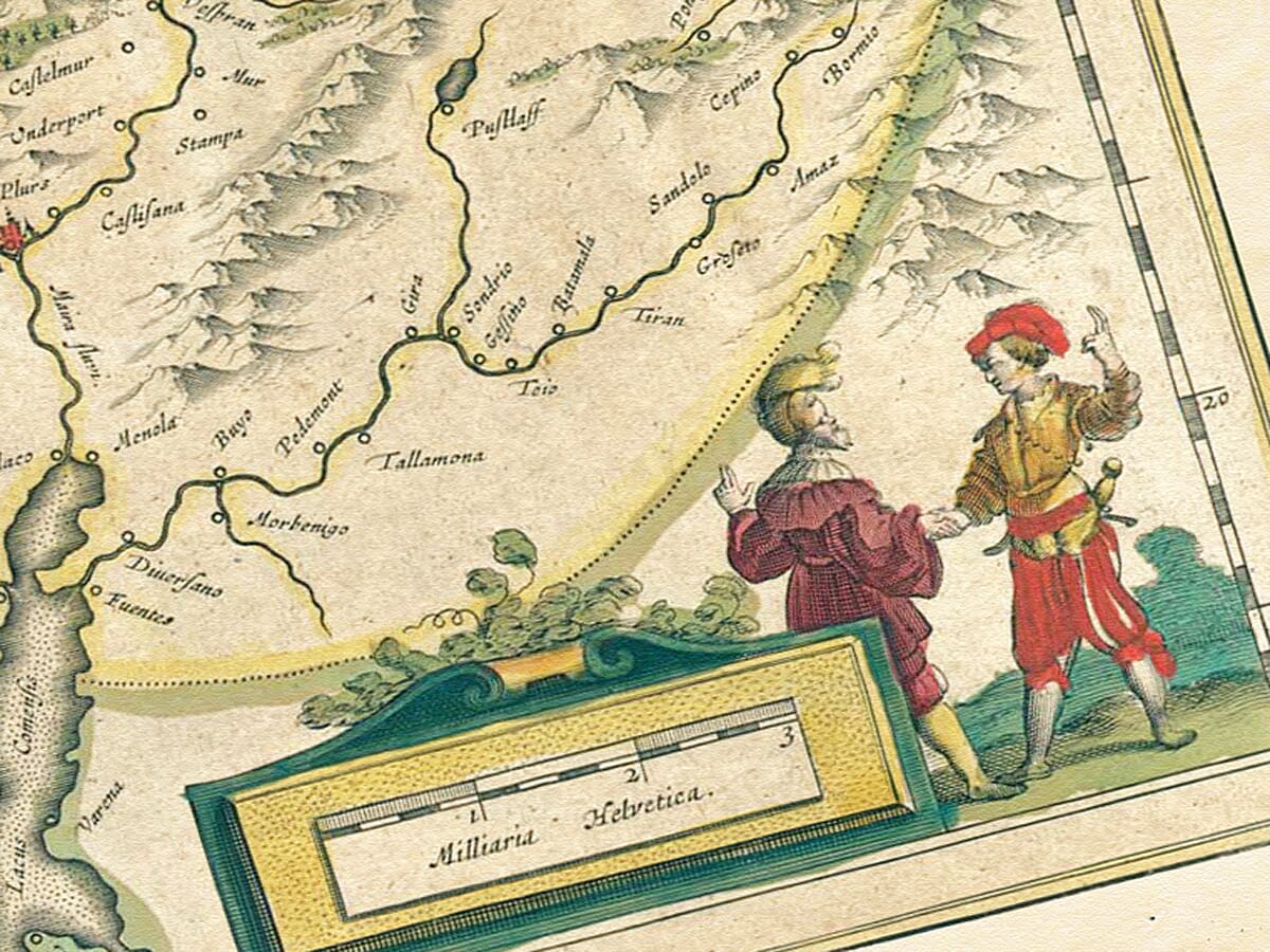
An elaborate cartouche in the upper-left corner contains the map’s Latin title. A second decorative composition at the lower right surrounds the scale and features two standing figures.
These ornaments balance the dense mountain engraving and extensive geographical information. Restrained hand colouring distinguishes territories, settlements and borders without overwhelming the original line work.
The result combines serious geographical content with the visual refinement associated with the Blaeu publishing house. It provides a striking record of Switzerland before modern national boundaries, railways and engineered Alpine roads transformed perceptions of the country.





 Verified owner












