Historical Background
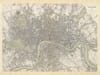
This 1938 map of Oslo was issued by the city’s municipal surveying office, Oslo Oppmålingsvesen. It records the Norwegian capital between the wars, with dense urban streets, railway approaches and working docks arranged around the inner Oslofjord. Unlike a decorative atlas map, its appeal comes from the amount of practical detail: individual buildings, transport lines, open ground and shorelines together preserve a city that was both a national capital and a busy industrial port.
Map Details
- Title on the map: Oslo
- Issuing authority: Oslo Oppmålingsvesen, the municipal surveying office
- Date: 1938
- Publication place: Oslo
- Original scale: 1:10,000
- Area shown: Central Oslo and surrounding districts, the inner harbour, Bygdøy and nearby islands
- Orientation: North at the top, indicated by the compass rose
- Format: Printed urban plan with coloured buildings, water and green spaces
- Visible features: Akerselva, Akershus, Frognerkilen, Pipervika, Bjørvika, Hovedøya and the Vi Kan exhibition site
A City Under Its Restored Name
The large heading Oslo is itself part of the map’s historical setting. The capital had been known as Kristiania before the name Oslo was restored in 1925. By 1938 the new name had become established, but the streets and buildings still embodied many earlier phases of the city’s development.
The plan brings these layers together without separating them into historical periods. A regular central street pattern gives way to districts with different alignments, while older roads continue into more open surroundings. Dense groups of buildings near the centre contrast with scattered houses and undeveloped plots towards the edges.
The Harbour Before Redevelopment
Three conspicuous labels identify the central waterfront: Pipervika, Bjørvika and Bispevika. Long quays extend into the blue water, and railway tracks approach the harbour from the east. This is a working waterfront whose shape reflects the movement of goods as much as the movement of people.
The peninsula containing Akershus separates parts of the harbour. Its position helps explain the close relationship between the historic fortress, the central city and access from the fjord. Nearby, tightly packed streets and buildings occupy the land immediately behind the docks.
For someone familiar with present-day Oslo, the waterfront is an especially rewarding area to compare. The map predates the contemporary cultural buildings and public promenades associated with Bjørvika, allowing the earlier port layout to be studied on its own terms.
Akerselva and the Eastern Districts
Akerselva winds southwards through the built-up city towards the harbour. Roads, blocks and larger buildings cluster around its course. The river provides a geographical thread through a landscape that can initially seem an intricate mass of streets.
Its historical importance reached beyond drainage. Water power supported the development of manufacturing along the river, particularly during the nineteenth century, and nearby neighbourhoods grew around industrial employment. The map shows the urban result of that development, although it should not be treated as a complete directory of factories.
Following the river through the sheet is a useful way to appreciate how waterways, industry and residential streets became interwoven. It also helps the reader orient the eastern and western portions of the capital.
The Vi Kan Exhibition
Near the western harbour, a red label marks Vi Kan Utstillingen 1938. This is one of the sheet’s most distinctive dated details. The exhibition presented a vision of modern Oslo and its achievements, making the map more specific than a street plan whose date appears only in a printer’s imprint.
The exhibition label sits within a city still visibly in transition. Transport routes, developed blocks and open land coexist across the sheet. It records not just an established capital, but a place actively presenting its modern identity to visitors and residents.
Islands, Green Spaces and the Map Key
Hovedøya occupies a prominent position in the fjord, with Lindøya partly visible along the lower edge. To the west, Bygdøy and the inlet of Frognerkilen provide a contrast with the crowded central waterfront. These quieter outlines help balance the composition and explain the capital’s wider setting.
The lower-right legend distinguishes building and transport information, while letters and numbers around the border provide a reference grid. A compass rose sits in the open harbour water. Together, these practical devices make the print rewarding for detailed study: tracing a familiar street, locating an island or comparing a district before later expansion altered its surroundings.





 Verified owner