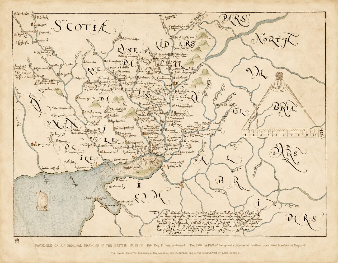
Colour-washed 1590 border map with pale blue waterways, muted green hills and aged-paper margins

Old Map of the Scottish Borders and Solway Firth, 1590

Price range: £39.95 through £59.95

The Scottish West March and Solway country, December 1590

This old map follows the rivers and fortified settlements of the western Anglo-Scottish border, from the Solway Sands into Annandale and Liddesdale. Small tower symbols stand beside handwritten place names, while larger drawings distinguish towns and castles. Dundronok appears near the Scottish shore; Carlisle anchors the English side, and a sailing vessel crosses the stippled waters of the firth.

Known as the Aglionby Platt, the manuscript was made for Lord Burghley during Elizabeth I’s reign. This colour-washed fine-art reproduction combines warm aged-paper tones with delicate blue waterways, muted green hills and small touches of colour on buildings. The colouring is a modern addition to the historical facsimile. A rewarding map for anyone interested in Border families, local place names and the country of the Border Reivers.

Supplied unframed. Medium and Large sizes retain the complete sheet’s proportions.

+ Read more

Size

Size

UK delivery just £4.95 per order · International delivery available.

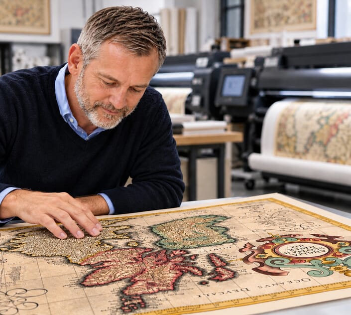
Inspecting Mercator's 1623 old map of Great Britain and Ireland

Fine Art Map Reproductions – Museum-Quality Printing

Unlike most online offerings, our maps are produced entirely in-house, not outsourced to print-on-demand or drop-shipping services. This allows complete control over quality while offering better value. Each map begins with a high-resolution original, carefully enhanced and printed to order using archival papers and pigment inks for exceptional clarity, depth, and longevity. Every piece is personally overseen — no map leaves our workshop unless it is of a quality we would be proud to display ourselves.

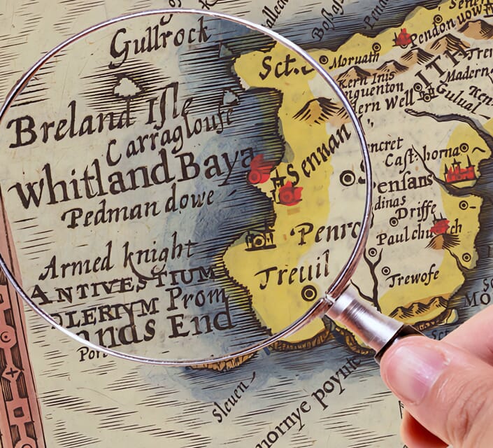
Hand hold a magnifying glass over West Cornwall Map

Authentic Old Map Paper & Accurate Colour Reproduction

Paper choice is essential to the authenticity of our maps. We use specially sourced 190gsm paper made in the UK from pure materials and traditionally pressed with natural woollen felts. This process creates a subtle, randomly textured surface that closely resembles an original antique document. Likewise the use of premium quality ink fully saturates the paper, producing remarkable clarity, depth, and historical character. Colour fastness and sharpness will remain good for in excess of 100 years!

Map in Postal Tube

Buy Old Maps Online in the UK Today Trading online since 1999

The Old Map Company of Great Britain offers a vast and carefully curated collection of the very finest expertly reproduced vintage maps. Our range includes works by renowned cartographers such as John Speed and Willem Blaeu, covering Scotland, England, and beyond. UK delivery is just £4.95 per order, with EU, USA, and worldwide shipping available at cost and calculated at checkout. If you need assistance, our team is always happy to help you choose the perfect map.

RECENT REVIEWS

Daz
DazGB
Verified ownerVerified owner
5/5

Speedy delivery A beautiful representation

4 months ago
David H
David H
Verified ownerVerified owner
5/5

Got there in time and loves it! Cheers David [Gift from US to UK]

6 months ago
Ellan C-S
Ellan C-S
Verified ownerVerified owner
5/5

Thanks Lauren. We received it today - it's gorgeous! Thank you, Ellan

6 months ago
Ivano Di Battista
Ivano Di Battista
Verified ownerVerified owner
5/5

Thank you for your prompt service. I have a gallery and framing business in South Wales. I'm so pleased it is printed in the UK

7 months ago
Robert B
Robert B
Verified ownerVerified owner
5/5

My Isles of Scilly map arrived safely and I'm delighted with it!

7 months ago
Andrew T
Andrew T
Reviewer
5/5

The print arrived safely and we're delighted with it - a lovely reminder of our honeymoon 15 years ago.

7 months ago
Hannah J
Hannah J
Verified ownerVerified owner
5/5

I have just received them! I'm sure our clients will be pleased with them and there could be more projects off the back of this one where we can use more. [Interior Designers]

7 months ago
Sean MacManus
Sean MacManus
Verified ownerVerified owner
5/5

I just received my map of Ireland by Ewart today and, as usual, I am delighted by its quality. The crispness and fineness of detail is excellent and the colour reproduction surpasses my expectations. Please relay my thanks to Steve for another fine effort!

8 months ago
John G
John G
Verified ownerVerified owner
5/5

Many thanks, Lauren. Very pleased with the map and the service: would recommend The Old Map Company to anyone interested in Old Maps.

9 months ago
Lois K
Lois K
Verified ownerVerified owner
5/5

Thrilled , Lauren! Thank You

10 months ago
Ed Simpson
Ed Simpson
Verified ownerVerified owner
5/5

Many thanks, the map arrived safely this morning, and I’m really pleased with it. A stunning reproduction, just as I had hoped. I will keep browsing your website, and may yet be tempted by more of your items! Have a great weekend.

10 months ago
Daniel McCade
Daniel McCade
Verified ownerVerified owner
5/5

Just arrived, wonderful map! Thanks very much!

11 months ago
Jonathon R
Jonathon R
Verified ownerVerified owner
5/5

The map – beautiful – arrived safely, very many thanks.

1 year ago
Rasa Terbetiene
Rasa Terbetiene
Verified ownerVerified owner
5/5

Thank you, I have already found the map. It’s wonderfull! Good luck! Rasa

4 years ago
Mina M.
Mina M.
Verified ownerVerified owner
5/5

My apologies for the very late reply. I wanted to reach out to thank you so much for rushing my order. My partner absolutely loved it. I am amazed with the service so that is a five-star from me. I wish you all the best.

4 years ago

Historical Background

Dated December 1590, this map records the Scottish border opposite England’s West March. It survives in the Burghley Atlas, now British Library Royal MS 18 D III, where county maps were gathered alongside manuscript plans and administrative information. Often called the Aglionby Platt, it is associated with Edward Aglionby and was prepared by him or someone working for him. Its interest lies in the detailed relationship between waterways, named households and places of strength.

Map Details

Original title: A Platt of the opposete Borders of Scotland to ye west marches of England
Original date: December 1590
Mapmaker: Associated with Edward Aglionby; the individual draughtsman is not securely identified
Prepared for: William Cecil, Lord Burghley
Original format: Manuscript map; this print reproduces a later historical facsimile
Original held by: British Library, Royal MS 18 D III, f.76
Area shown: Solway Firth, Annandale, Liddesdale and adjoining parts of Cumberland
Orientation: North towards the top
Finish: Fine-art giclée reproduction, supplied unframed

Towers, households and rivers

The Scottish side is filled with small building symbols linked by the river valleys. Some labels identify a settlement; others give the name of a resident. This makes the map particularly engaging for readers tracing Border places and families. The original explanatory note distinguishes substantial towers and stone houses from scattered dwellings that are omitted. The symbols should therefore be read as the mapmaker’s shorthand, rather than measured portraits of individual buildings.

The rivers provide the structure of the drawing, with Annandale to the west and Liddesdale further east. Hermitage appears among the densely marked places in the upper central part of the sheet. The English side is more sparsely populated with labels, making the different emphasis on the two sides of the frontier immediately apparent.

Dundronok and the Solway Sands

Near the Scottish shore, Dundronok is marked beside a small tower symbol, between Annan and the neighbouring coastal settlements. Below it, the estuary is labelled “Soulua Sands”. Wavy strokes and stippling describe the tidal water and sands, while the square-sailed vessel is one of the sheet’s most distinctive details. Across the firth, Bowness, Cardurnock and Skinburness appear in early spellings.

A manuscript preserved through a facsimile

The large regional lettering, hand-drawn hills and conspicuous pair of dividers above a numbered scale preserve the character of a working Elizabethan map. The supplied sheet also carries a later printed caption identifying the manuscript’s former British Museum location and its December 1590 endorsement. The date refers to the manuscript represented, rather than to the printing of this facsimile.

For a later view of the Scottish shore, see our Annandale map by Joan Blaeu, 1654.

Print sizes

Approximate reproduced sheet dimensions, including the captions shown in the image, are Medium: 23.1 × 18 inches (58.8 × 45.7 cm) and Large: 30.9 × 24 inches (78.4 × 61 cm). Dimensions retain the supplied image’s proportions. Any additional outer paper margin is excluded.