Historical Background
Fiji During the Age of Pacific Surveying
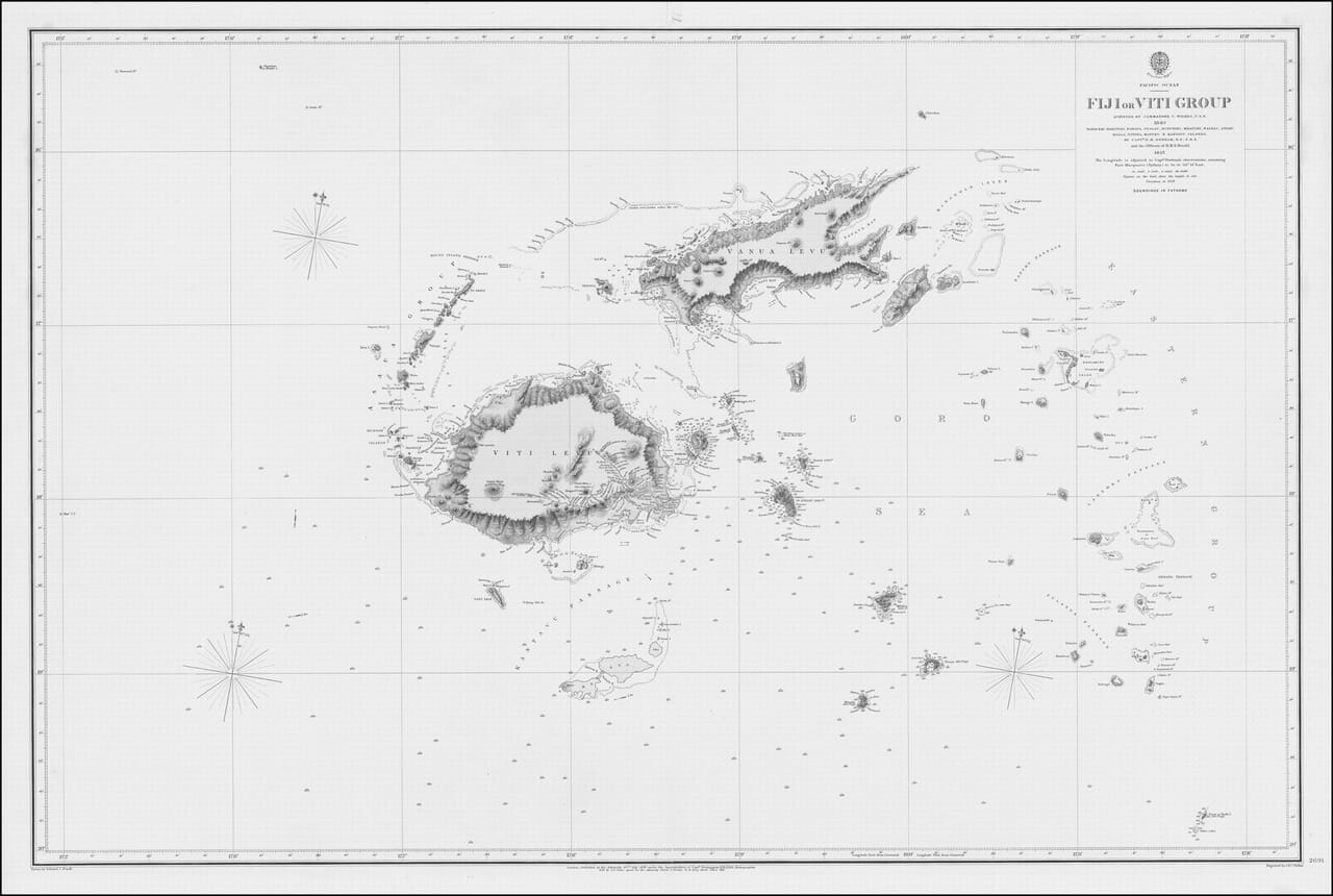
This chart was published in 1859, when European and American naval expeditions were systematically improving knowledge of the Pacific Ocean. Its title records two important stages of surveying: Commander Charles Wilkes’s American expedition of 1840 and the later work of Captain Henry Mangles Denham and the officers of HMS Herald in 1857.
Map Details
Original title: Fiji or Viti Group
Surveyors: Commander C. Wilkes, U.S.N.; Captain H. M. Denham, R.N., and the officers of HMS Herald
Survey dates: 1840 and 1857
Publisher: British Admiralty
Publication place: London
Published: 1859
Area shown: Fiji and the surrounding island groups of the South Pacific
Chart number: Admiralty Chart No. 2691
Type: Nautical chart
The map reflects the gradual replacement of uncertain coastal outlines with measured surveys, soundings and named anchorages. Its broad extent is also revealing: Fiji is not presented as a single isolated island, but as a dispersed maritime group whose navigation depended upon understanding passages, reefs and offshore approaches.
Viti Levu and Vanua Levu
The two largest islands, Viti Levu and Vanua Levu, occupy the centre of the chart. Their coastlines are drawn with considerably greater confidence than many of the smaller islands. Mountainous interiors are suggested through engraved relief, while coastal indentations, bays and offshore dangers receive particular attention.
The chart also records important neighbouring islands including Ovalau, Moturiki, Mbatiki and Kadavu. Numerous smaller islands are shown as isolated outlines across the surrounding sea, some accompanied by soundings, reefs or navigational notes.
A Chart of Routes and Anchorages
Unlike a purely decorative geographical map, this Admiralty chart was made for navigation. The wide network of latitude and longitude lines establishes the position of the islands, while compass roses and numerous soundings help mariners judge their approach.
The title specifically identifies Nandi Bay, Makongai, Ovalau, Moturiki, Mbatiki, Nairrai, Angau, Moala, Totoya, Matuku and Kantuva. These names give the chart a strong local character and preserve the geography of Fiji before modern roads, airports and national boundaries altered the way the islands were encountered.
Wilkes and the United States Exploring Expedition
Commander Charles Wilkes led the United States Exploring Expedition of 1838–1842, one of the most ambitious scientific voyages of the nineteenth century. The expedition surveyed coastlines, collected specimens and recorded islands across the Pacific. The Fiji information attributed to Wilkes in this chart therefore represents an important stage in the development of Western geographical knowledge of the region.
The later surveys associated with HMS Herald added further British naval observations. By combining the two survey traditions, the 1859 Admiralty chart represents a cumulative process of measurement rather than the work of a single mapmaker.
Fiji and the Wider Colonial Context
The chart was produced before Fiji became a British colony in 1874. Its appearance nevertheless belongs to the expanding maritime world through which European powers, traders, missionaries and naval forces increasingly entered the Pacific.
A historical chart such as this should therefore be read in two ways. It is an impressive record of hydrographic skill, but it also reflects the strategic and commercial pressures that made accurate Pacific surveying increasingly important. The islands are shown as navigable spaces, anchorages and routes at a moment when outside interest in Fiji was rapidly intensifying.
Its combination of open ocean, carefully measured coastlines and scattered island groups gives the map a distinctive sense of distance and discovery. It is an especially effective fine-art print for anyone interested in Fiji, Pacific exploration, naval history or the visual language of nineteenth-century charts.





 Verified owner