Verified owner
Got there in time and loves it! Cheers David [Gift from US to UK]
 Verified owner
Thanks Lauren. We received it today - it's gorgeous! Thank you, Ellan
 Verified owner
Thank you for your prompt service. I have a gallery and framing business in South Wales. I'm so pleased it is printed in the UK
 Verified owner
My Isles of Scilly map arrived safely and I'm delighted with it!

The print arrived safely and we're delighted with it - a lovely reminder of our honeymoon 15 years ago.
 Verified owner
I have just received them! I'm sure our clients will be pleased with them and there could be more projects off the back of this one where we can use more. [Interior Designers]
 Verified owner
I just received my map of Ireland by Ewart today and, as usual, I am delighted by its quality. The crispness and fineness of detail is excellent and the colour reproduction surpasses my expectations. Please relay my thanks to Steve for another fine effort!
 Verified owner
Many thanks, Lauren. Very pleased with the map and the service: would recommend The Old Map Company to anyone interested in Old Maps.
 Verified owner
Many thanks, the map arrived safely this morning, and I’m really pleased with it. A stunning reproduction, just as I had hoped. I will keep browsing your website, and may yet be tempted by more of your items! Have a great weekend.
 Verified owner
Just arrived, wonderful map! Thanks very much!
 Verified owner
The map – beautiful – arrived safely, very many thanks.
 Verified owner
Thank you, I have already found the map. It’s wonderfull! Good luck! Rasa
 Verified owner
My apologies for the very late reply. I wanted to reach out to thank you so much for rushing my order. My partner absolutely loved it. I am amazed with the service so that is a five-star from me. I wish you all the best.
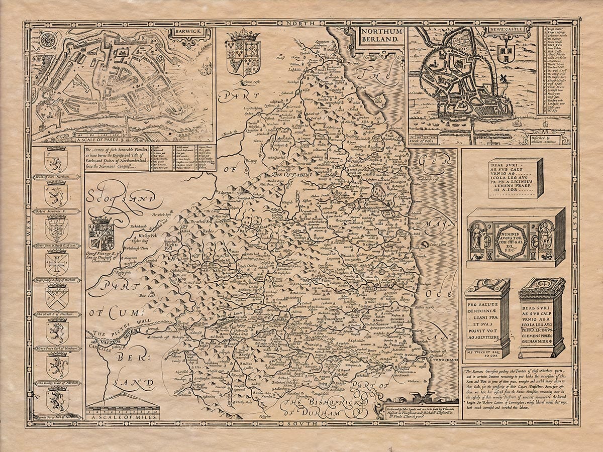
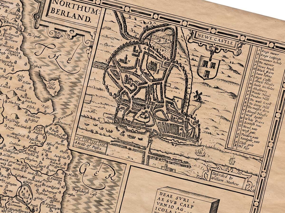
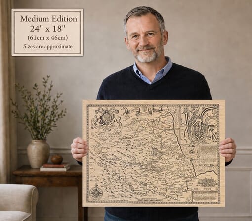
Speed’s Northumberland follows the border country through rivers and hills, with Alnwick, Bamburgh and Hexham among its recognisable settlements. The plans of Berwick and Newcastle show their defences and street patterns at a larger scale. Across the south, Hadrian’s Wall is labelled ‘Pictes Wall’; Roman altar illustrations and the heraldic border add further layers of history. The Newcastle inset explicitly credits William Mathew.
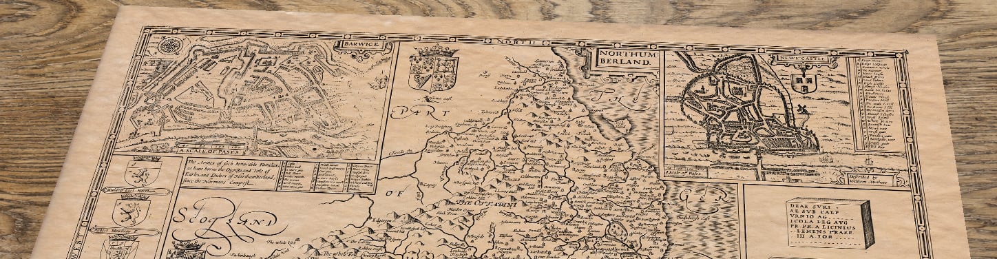
The Newcastle inset credits William Mathew’s survey. The later publisher’s imprint should be distinguished from the early dates of the town plans.
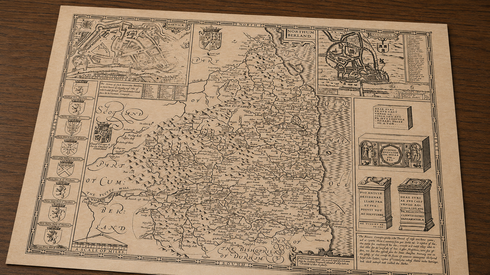
John Speed’s map of Northumberland was completed around 1610 and first published in his great atlas, The Theatre of the Empire of Great Britaine, in 1611–12. Speed drew heavily upon the earlier county survey of Christopher Saxton, but transformed the geographical information into something far more decorative and engaging. The copper plate was engraved in Amsterdam by Jodocus Hondius, whose fine linework helped give Speed’s county maps their distinctive appearance.
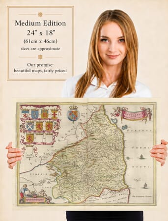
Northumberland occupies a special place within the atlas. England’s northernmost county had long been shaped by its frontier with Scotland, and Speed’s map reflects a landscape of castles, fortified towns, ancient remains and widely scattered settlements. The county stretches from the River Tyne and Newcastle in the south to Berwick-upon-Tweed and the Scottish border in the north, with the Pennines and Cheviot Hills rising across the western interior.
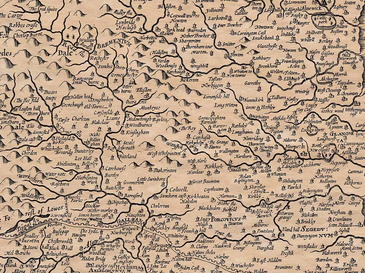
The engraved landscape is filled with familiar Northumbrian names. Alnwick, Morpeth, Hexham, Bamburgh, Warkworth, Rothbury, Wooler, Blyth, Alnmouth and Holy Island all appear, surrounded by numerous smaller villages and estates. As on many early maps, Speed used pictorial symbols rather than modern cartographic signs: villages are represented by small groups of buildings or a church, hills appear as repeated rounded mounds, and wooded areas are indicated by clusters of trees. The map’s scale is approximately one inch to four miles.
Rivers form some of the clearest natural features. The Tyne and its northern and southern branches cross the lower half of the county, while the Coquet, Aln, Wansbeck, Blyth and Tweed help define the position of settlements and routes. Along the coast, Speed records islands, river mouths and small ports that connected Northumberland with trade and travel along the North Sea.
One of the most intriguing details is Hadrian’s Wall, labelled on the map as the Picts Wall. By Speed’s time the Roman frontier had been abandoned for more than a thousand years, but its remains were still a prominent feature of the Northumbrian countryside. The wall crosses the southern part of the county, linking the map with the long Roman history of the region. A decorative panel of Roman antiquities adds further interest and reflects the seventeenth-century fascination with Britain’s ancient past.
The many castles shown across the map tell a different but equally important story. Northumberland’s position on the Anglo-Scottish frontier made defence a constant concern throughout the medieval period. Great strongholds such as Alnwick, Bamburgh and Warkworth stood alongside smaller castles, towers and fortified houses. These were not simply grand residences: they offered protection during raids, invasions and the long periods of unrest associated with border warfare.
Speed gives particular prominence to the county’s two most important urban centres by including inset town plans of Newcastle upon Tyne and Berwick-upon-Tweed. These detailed plans allow the viewer to move from the broad county landscape to the streets, buildings and fortifications of two early seventeenth-century towns.
The Newcastle inset is titled “Newe:castle” and was described by William Mathew. It covers the whole built-up town and records roads, important buildings, churches, windmills, quays, gates and defensive walls. Shipping appears on the River Tyne, emphasising Newcastle’s growing importance as a trading port. The town was already the principal commercial centre of the region, particularly through its river trade and access to the North Sea.
The second inset, titled “Barwick,” presents Berwick-upon-Tweed as a closely defended border town. Its walls, gates, batteries, public buildings and tightly grouped streets are clearly shown, together with ships on the river. Berwick had changed hands repeatedly between England and Scotland during the medieval period, and its powerful fortifications reveal how strategically important it remained when Speed’s map was made.
The contrast between the two insets is particularly effective. Newcastle appears as a prosperous river town and regional centre, while Berwick is presented as a fortified settlement guarding the northern frontier. Together they help explain the character of Northumberland at the beginning of the seventeenth century: a county looking both south towards English trade and government and north towards a border that had only recently become more peaceful following the union of the English and Scottish crowns under James VI and I.
The county map itself is enriched with heraldic shields, decorative cartouches, antiquarian details and finely engraved lettering. These elements were more than ornament. Speed intended his maps to combine geography with history, genealogy and civic identity. A reader could trace rivers and settlements, examine ancient remains, study town plans and recognise the arms of important local families—all on a single sheet.
For anyone with family roots or personal connections to Northumberland, the map offers countless details to discover. Familiar towns appear in early spellings, small villages occupy their historic settings, and the relationship between the uplands, river valleys, coast and border becomes immediately apparent.
More than four centuries after its first publication, John Speed’s old map of Northumberland remains both a valuable historical record and a striking work of decorative cartography. Its inset plans of Newcastle and Berwick, depiction of the Picts Wall, numerous castles and densely engraved settlements preserve a vivid picture of England’s great northern border county at the beginning of the Stuart age.